THE ONE, THE ONLY

I have always wanted a great sunrise shot of Shasta from this location. On our way up to Canada, it looked like the clouds were going to finally provide it, and the timing was right. So I stopped to take a photo. The rest of the family stayed sleeping in the car while I walked down to the lake. It is an easy walk, though I somehow managed to rip my pants, and get them all dirty, and got lost on the way back to the car afterwards (not really but I missed the path to the parking lot). The color just did not show up in the clouds as I hoped. There was just a tiny bit. It is still a lovely shot, but I still need to come back again.

No Comments

WHITNEY FALLS, SUNRISE

Blog story coming …

No Comments

THE CRAGGY CRAGS

It was not quite the shot I envisioned. But it was not too bad.

I was up at the speck of dawn, before 4 AM. It is a long drive up to the Castle Crags trailhead, and I arrived about an hour before sunrise. The weather report hinted of partly cloudy skies, but it was pretty iffy, about a 50% chance. There were some clouds around, but nothing, nada, at the trailhead. I sent up a little prayer, in fact I was pretty much praying for clouds the entire drive. I did not particularly want (actually had no desire whatsoever) to make a long hike in the dark with no prospect of a decent sunrise. So I started my hike in the dark anyway. Surely God would not let me down this morning.

The trail starts out with a bang, a 500 foot elevation gain up to the Pacific Crest Trail in a half mile. I made it up in no time at all, in fact it felt like I had only climbed 200 feet. I couldn’t believe I was already at the top of the ridge. The only explanation is that because it was so dark, and I was freaked out about lions hiding in every shadow, and I was so pumped on adrenaline that I did not notice the elevation in the hike. Well I did not see any lions, or tigers, or bears. Or anything at all. All I heard was the sound of fast rushing Castle Creek far below me, and the occasional sounds of little critters in the bushes (which also freaked me out).

So I arrived at Burstarse Creek on time, just before sunrise. I could not find the view that I wanted with the waterfall in the foreground and the Crags looming above. That’s because the view did not exist. I suppose I should have researched it a bit more beforehand but my writeup from the last time I was here said: “you will be able to see both the upper falls and lower falls from the trail (with the Castle Crags in the background providing an amazing backdrop)”. I did find that view but it was obscured and certainly not photo worthy. Nonetheless, I continued up the trail and found a decent shot to take with the Crags and a portion of the upper waterfall. And lo and behold there were a few clouds, and a little bit of color. Not much but thank you, Lord, for this. So it was not the shot I had envisioned, but it was not too bad.

I then proceeded up to the main waterfall, which as I said I have been to before.

So do you really think I came all the way out here again to Burstarse Falls just for a sunrise shot? Think again matey. But to find out what comes next, you will have to wait for my next post.

2 Comments

WAITING

Here’s some alpenglow of Mt Brokeoff in Lassen Volcanic National Park. The alpenglow only lasted a few seconds and then poof it was gone. I was really hoping those clouds over the mountain would color up a bit but they never did. C’est la vie, I guess.

Well this government shutdown has me annoyed to no end. I would not even care if the parks were closed if they still let us in there to hike the trails, but we cannot even do that. How dare the government take our land away from us. Now Utah is opening their national parks (paying the feds for it), but will California do the same? Of course not. Our governor doesn’t give a crap about our parks. He has proven that already. Oh how I would love to knock some sense into our politicians. This had all better be settled before waterfall season starts or else…

Speaking of which … when “will” it start? Who the heck knows but I sure am anxious about it. I just read one report saying that we could have an above average winter in California (about time, I say). I am hoping so, but then again I read another report we will be having a weak El Nino which is exactly what we had last year, and that makes me think it will be another below average season. How about we split the difference and have a NORMAL AVERAGEĀ  season? After two awful years in a row, that would make me happy enough.

No Comments

Rainbows

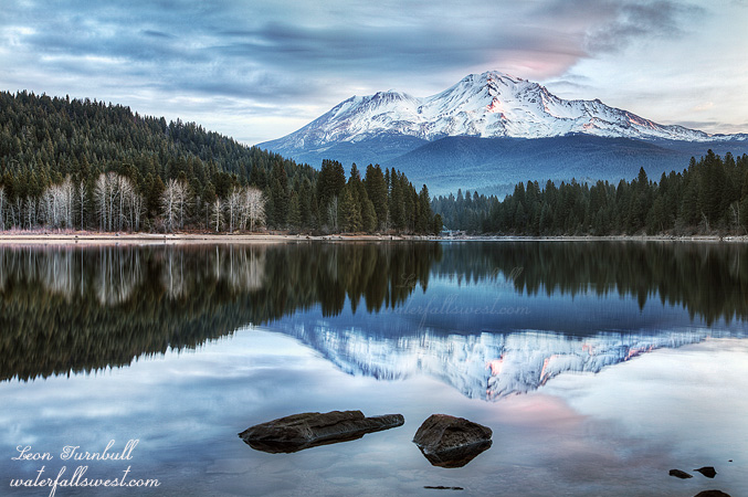
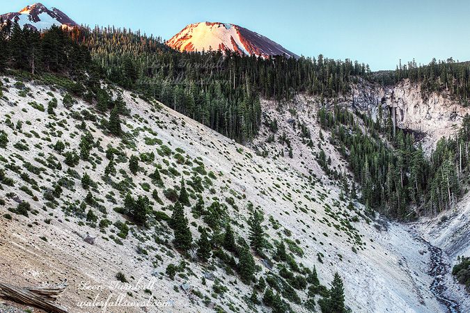
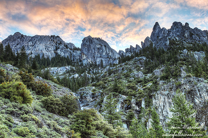
This photo was taken a bit after sunrise. There was not any great sunrise color on this day, but the rainbow over the canyon really made this shot I think (a double rainbow, even better). What you are looking at is the North Fork American River canyon. The mountain is majestic Snow Mountain rising 8074 ft. above sea level (on the right, poking up in the distance is Devils Peak). In the spring, the second highest waterfall in California (2200 ft. high) tumbles vigorously down the slope of Snow Mountain, and if you look closely you can see the path it takes in this image. Of course in late August, it is all dried up, but I think this spot would be a fantastic viewpoint of the waterfall in the spring, especially at sunrise or sunset (that is, if you could get to this spot in the spring, which is not likely, but that is a different story).

The story for this day was not to shoot sunrise from this location, but instead to find a new and quick way down to Heath Falls on the North Fork American River. It was going to be epic! But alas, it was not to be. It was not the cliffs that did me in here, it was the manzanita brush. On Google Earth, the brush did not look bad at all, and even from the cliffs here looking down, the brush did not look bad, but once I started going down, it eventually just became too thick and un-manageable. I was forced to turn back. I was bummed!

For a brief minute or two, I thought I was going to make it. There was actually an old trail here leading down to the bottom, something totally unexpected. It must have been an old miner’s trail, and from the look of it, it had not been traversed since the mining days. Nonetheless it was there and it started out very good, however once it hit the thick brush, it disappeared very quickly. With all the fires and lightning strikes happening in the Sierra this week, I kept thinking how nice it would be if one happened here to clear out all this brush, but it seems that is not going to happen this year either. I tried many different routes to try to get through the brush, and I just could not do it. In the end, I thought maybe from the other side of the ravine might be a possibility, which is down to the left of this view, and I want to return here again to give it another go, but that will not happen this year.

Some of you may know the “normal” way to get to Heath Falls is a long, difficult hike about 6.5 miles one way, impossible to get there in good lighting conditions on a day hike, and it also involves a sketchy crossing of private property to reach it. I was hoping to find a better and quicker route, and that involved driving from Soda Springs down through the Cedars and across the North Fork American River. The road from Soda Springs down to the river is absolutely awful. Indeed I would say it is almost as bad as the Bowman Lake road. If you are familiar with that road you know this one must be quite bad if I make this comparison. It is just extremely rocky and bumpy. Your jaw will be rattling for days afterward. For about 2 miles on each side of the river, and stretching apparently all the way down to Heath Falls, a group called the Cedars owns the land, and they do not want anyone else sniffing on the land either. You would think they would keep their road in better condition at least.

After trying Heath Falls, I was still in an exploring mood so I went further up Soda Springs Road in search of a trail down to Palisade Falls. I knew there was a trail down to it on this side of the river, but I did not know where it was, so I took a wild guess on my map. It was not exactly where I thought it might be, but I eventually did find it. I did not go down because I had already spent too much time trying to get down to Heath Falls and it was too late in the morning, but this is one I would really like to return to, perhaps even this year (though I am not anxious to brave driving this road again anytime soon). I think also that it will be of epic steepness comparable to the Wabena Falls trail. Sounds like fun. Maybe.

No Comments