No, your eyes are not deceiving you. This is *not* a waterfall. I can’t shoot waterfalls all the time, you know. Well, I could. In fact, I am not sure the last time I even posted a non-waterfall shot. Hmmm. Well there are, as you may know, three nice waterfalls within a mile of this location, and even more within a couple more miles. And yes I did see one of these waterfalls as I walked up the trail to this lake, but photograph it I did not. My primary mission, should I choose to accept it, was to photograph Eagle Lake at sunset, and photograph it I did.
I was not planning on going to any waterfalls this weekend or even to go hiking at all. I was just going to spend the weekend at home. Relax. Take it easy. Drink lots of beer. Then I heard from certain friends (thanks Karen) that Lake Tahoe was experiencing unusual amounts of smoke and clouds from the Rim Fire. It seemed to me there would be a strong possibility of a very nice, if not spectacular, sunset at Tahoe this weekend. So last minute plan change: drive up to Tahoe after work on Friday evening and find a spot to photograph the sunset. No waterfalls in this plan. Just beautiful Tahoe.
The Rim Fire … currently burning out of control just to the west of Yosemite National Park (far to the south of Lake Tahoe). It has actually now entered Yosemite and is heading rapidly towards Hetch Hetchy. By the time you read this, Hetch Hetchy may or may not in fact be burning. It is turning out to be one of the largest fires in California’s history. After two years of drought, everything is bone dry, and the fires are going nuts. It is certainly sad when people lose their home due to a forest fire, and also sad if beautiful scenic locations are burned (such as Hetch Hetchy if the fire reaches that far). On the other hand, there is much good to fires as well. One of these things is waterfalls. The Rim Fire has already burned quite a few waterfalls. How is that good? Am I nuts? Well it will be bad and ugly in some of the very scenic places (such as the Rainbow Pool area), but there are some other waterfalls that are now going to be suddenly accessible, which up until now have not been accessible due to the inordinate amount of brush surrounding them. If that brush has burned, it will possibly be much easier to reach these waterfalls. I can think of a few in this area that fall into this category, and I am already looking forward to trying to get to them (in the next two or three years).
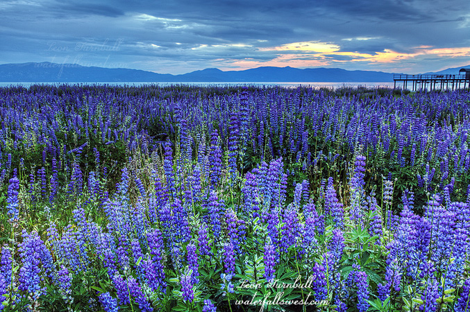
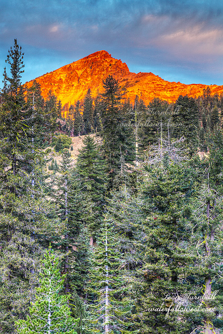
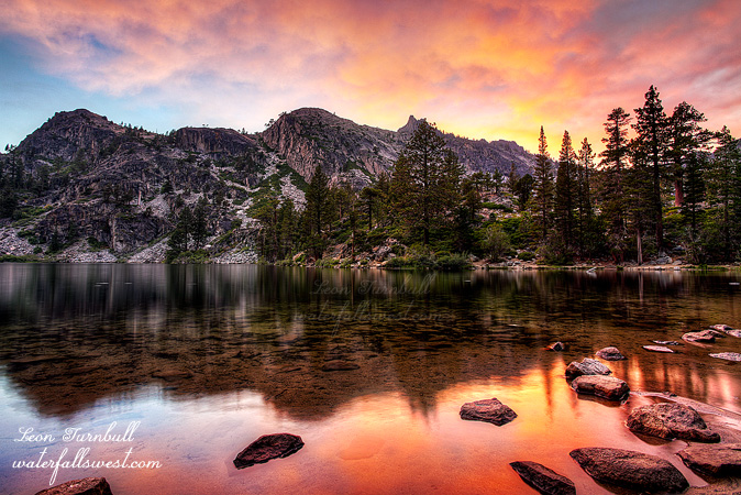
Anyway, back to Lake Tahoe. There are so many scenic spots in Lake Tahoe for a sunset or sunrise, and any of these can be spectacular or duds. It is a long drive up to Tahoe from Sacramento to see a dud sunset. When I go there for a sunrise or sunset, I never have a specific location in mind. I wait and see what the weather is doing when I arrive there. As I drive down into Tahoe from the summit, I can see where the clouds are lining up and where the best possibility for color is going to be. At first, it seemed to me that Emerald Bay was going to be the best spot. The haze was thick over the lake, but the edge of it seemed to be at the west end of the lake, meaning that it might really color up nicely at sunset over the Bay. When I got over there, however, I changed my mind. The haze was just too thick over the Bay, and it did not look like it was going to color much, if at all (and I was right – there was zero color over Emerald Bay at sunset). I changed my plan and decided instead to hike up to Eagle Lake for sunset. This was a much better idea anyway. I wanted to get a decent hike in, and I have wanted to photograph Eagle Lake at sunset for quite awhile now. This was my ticket. It is only a mile up to Eagle Lake, but it is a bit of a huffer with some elevation gain, and I arrived at the south side of Eagle Lake about 20 minutes before sunset, and there was no one else around. Perfect.
Well I was not the only one around. I could hear noise at the far north end of the lake, splashing in the water. Some big animal? I thought I heard faint voices. Campers, I suppose, though I saw nothing. I heard what appeared to be a duck whistle. I finally came to the conclusion that it must have been those weird Duck Dynasty people trying to scare up all the ducks and other wildlife in the area.
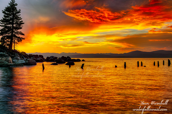
I would not say the sunset was epic by any means, and it was not precisely what I had envisioned, but actually it was pretty darn sweet. Thank you Lord. But it did not last very long. Only minutes after sunset, the color all disappeared. It left as quickly as it had come. Ok then, I packed up and headed back down the hill, thinking I might even get back to the car well before dark. Not so much. The sunset disappeared quickly and the darkness came just as quickly. No problem. I had my headlamp so I was not concerned, in fact, I was expecting to hike back down in the dark, just not quite so early as I did. It was a beautiful evening at Lake Tahoe and definitely worth the trip up there from the valley.