Diana

I had big plans all made this weekend, but sometimes plan do not work out as expected. I wanted to go to Hetch Hetchy and stay overnight in the backpacker’s parking area, then hike to Rancheria Falls first thing in the morning in order to get there with good lighting conditions for photography. It was a great plan. All I needed was a permit. But the bloody darn Yosemite rangers would not give me one. According to them, I was not a backpacker, I was just a day hiker. What? Sometimes it sucks to tell the truth, but I really had no idea this would be any sort of issue for them. It was a perfectly reasonable plan, and I am sure I read that people have done this sort of thing before at Hetch Hetchy. With the park not opening until well after sunrise and closing well before sunset it is absolutely impossible to do any good photography in this area of the park unless you stay overnight. Why would they not give me a permit? I don’t understand, and it really irked me.

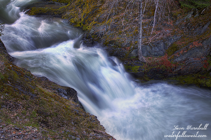
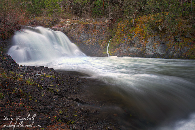
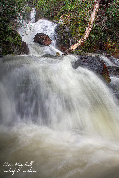
Anyway, this totally threw a wrench into my entire weekend plan, and it put a huge damper on an already bad  day. I did see four waterfalls on Saturday. The first one I saw was really nice but all the others were not so great, and the light was really bad for them, and some other waterfalls I was trying to see did not pan out either, and I got a tick bite, and my camera lens broke (for an unknown reason), and I got poison oak, and I lost my pack rain cover, and I almost lost my hat off a cliff. None of all those other things would have bothered me much, however, if the Hetch Hetchy plan had come to fruition.

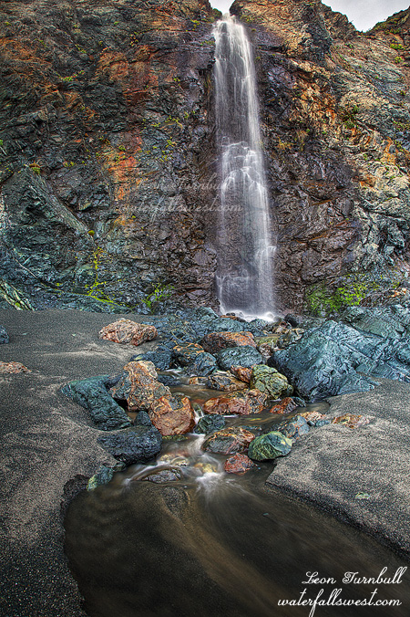
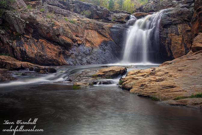
Friday was different though. Friday was a great day, and I saw four waterfalls on that day as well, and they were all great ones. The first one was Diana Falls, pictured here, just a small 21 ft. high falls, and very easy to get to, but I had never been to this one before. When you are going to Yosemite, you don’t stop off at small baby waterfalls along the way usually, and that is why I had never been here before. But this time, I was planning to spend a lot of time out of the park before going into it at the end of the day on Saturday, so Diana Falls was first on my list.

It is a long drive down there from Sacramento, and I left work early. Still traffic was bad leaving the city. When I finally arrived at the trailhead, I saw 3 other cars there. Not good, as I was hoping to have the falls all to myself, but all the others I met on the hike in, so I was alone once I got to the falls. It is a bit of a steep descent down to the waterfall, slippery, and laced with poison oak (but this is not where I picked up the oak, I am certain). Those rocks you see on the right side were incredibly slippery. I scrambled up there close to the falls, and I had to be extremely careful or I would have slipped right into the creek. That would have been quite bad. Anyway, it is a very pretty little area and waterfall. I took my time here taking photos, then afterwards, hurried back to the car, to get in one more location before dark, which was triple decker awesomeness. Stay tuned for that.

5 Comments

Yet Another Senseless Tragedy

A man was swept over 410 ft. high Feather Falls this past weekend. He slipped on the slick rocks above the falls and bye-bye. It is sad of course, but sometimes I just don’t understand why people do things like this. Why was he even close to the raging water?

Here are a couple links to the story:
http://www.redding.com/news/2012/apr/23/search-and-rescue-unable-find-body-chico-man-swept

http://www.therepublic.com/view/story/51f98261ce7a41de80d11be14366efa3/CA–Waterfall-Death/

It is interesting to note though that some of the news articles I read about this incident used the very often cited and very incorrect height of 640 ft. for Feather Falls, but other news sites used the correct figure of 410 ft., which was my measurement. Feather Falls has often been touted as the 6th highest waterfall in the U.S., and at a height of 640 ft. I do not know where this number came from but it is certainly very wrong. It was myself who first determined that the correct height of the waterfall was 410 ft. This height has been confirmed now by one other group as well. So it is nice to know that some news sites did the proper research and were using my measurement (and the correct one) for this tragic news story. This is one reason why measuring waterfall heights is important.

By the way, the photo here is obviously not Feather Falls. It is Federal Falls, which is a very precise and very small 11 ft. high.

2 Comments

Pauley

This weekend I took a trip up to Downieville to check out some new and old waterfalls. My first stop here was Pauley Falls. You may recognize this one, as it is the header waterfall I have in my blog. But as you can see, the flow was a lot more than when I was here previously in winter. Clearly, there was no way I could get right in the middle of the creek to take photos like I did when I was here the last time. I settled for just a quick shot from the side of the creek this time, as I did not want to spend much time here. I also did not feel like getting my feet into that cold snow melting creek. So what do you think? Should I change my header over to this new shot?

After stopping at Pauley Falls, I headed up to Federal Falls, which is another waterfall on this same creek but further upstream. It is a bit smaller than Pauley and not as nice a waterfall, but I will probably share that photo next.

My third destination ended up being a killer hike to try to find another new waterfall, but unfortunately I struck out. I scrambled up a mountain through poison oak to try to get to Humbug Creek Falls. I went further than I went last time, and came pretty close to the falls, but could not quite get there. I’m not sure if I could have gotten any further or not, but I was out of time and out of gas (literally). I needed to get home or my wife was going to be mad at me for being late (I was late anyway, and yes, she was not happy about it). The hike back took a lot longer as well, as the scramble back up the mountain was killer, and I was totally spent. When I got back to the car, my muscles were spasming, and I was incredibly hungry, but I had no food with me. I had to wait until I got to the small town of North San Juan, where I could pick up some food. I did get to a pretty interesting spot down in that canyon, with a good view up close of Little Humbug Creek Falls (which was roaring incredibly strong), but I am not sure about getting to that other waterfall down there, and I am just not sure if I will ever get back down there since the hike was so difficult.

No Comments

More Please

Winter is still trying to hang on. The end of last week saw a lovely April storm come our way and I headed up into the foothills after work on Friday evening. I liked this quote from a weather site I follow: “Ironically the Winter that never was may want to hang on here in Spring. Everyone loves a good comeback story.” (tahoeweatherdiscussion.com). It seems also that we might get more wet weather next week as another storm is in the long range scopes. Gotta like it.

My plan was to go out hiking Friday night as well as Sunday afternoon but I only got out on Friday. I’m always too tired on Sundays to do anything, I should know better than try to plan something for that day.

Anyway, even though I left work early, traffic was a mess. I drove through a crazy downpour before I got to Auburn and my map was telling me it would be getting to Colfax in less than an hour. I figured I might just have time to get to the first waterfall I had planned to see before it hit. It did not work out as planned however.

In fact it was already raining pretty good when I started the hike at Windy Point. I was looking to find a new waterfall there, but the directions given to me were rather lame, to put it mildly. I was thinking this would be a short easy hike but I soon realized it was going to be quite the opposite. By the time I reached Chamberlain Creek I figured out the directions and where the waterfall must be located. I would have to scramble up the creek to get to it. There was a path but it was very difficult, very overgrown, and there was a ton of poison oak. I persevered though and eventually came upon the waterfall. The creek was high and strong and the waterfall was magnificent, a 50 foot high fast rushing cascade, but it was determined not to give up its secrets to me. The path came out at the side of the cascade but offered no viewpoint. I could not dare get down close (or into) the creek as it was rushing much too fast. I tried going up to the top of the falls but that did not work either. One last try was to go further downstream. I was able to get down to creek level that way and get a shot. As you can see there are a lot of branches in the way and the view is rather obscured but this was the only option I had. If the creek was flowing less, I think I would have been able to get in the creek and a lot closer to the falls. I may definitely come back here in a few weeks to try again. This is obviously not a great shot but at least the rain had stopped, I never did see that huge storm cell that I drove through on the freeway.

There was a surprising and disturbingly large amount of trash near the falls. It was all very old, none recent, but why was it there? This is a remote and very difficult to reach location. It is not a camping spot so this was not left by any regular group of campers. Kids? Perhaps but I’m not sure why kids would come way out here to this remote spot. Miners? Pot growers? The latter one seems to be more of a possibility. Whoever it was, it sure makes me mad to see all this trash way out here in the wilderness. This should be a completely pristine area. I would love to come back and clean it up but it would be extremely difficult to haul it out of there.

I took an easier route back to my car, nonetheless I was very tired climbing out of the canyon. This is not the first tough hike I’ve done this year but man I must be out of shape again cuz I was really struggling. There were quite a few other waterfalls dropping down the hillside on the other side of the river on unnamed streams. I did stop to get a shot of Slaughter Ravine Falls but that was the only one. I booted it back home in time to get dinner and watch my Canucks lose again. Argh.

No Comments

Beach Waterfall and Announcement

This is Black Point Beach Falls near Stewart Point on the Sonoma Coast. This is one of three significant waterfalls I found on this beach, in addition to a couple other smaller ones. All of them just drop on unnamed streams onto the beach, 30 to 45 feet in height. This was the smallest of the three, 30 ft. high, but it was the easiest one to photograph. This location is off the beaten path, but it sure is nice. How could you not like waterfalls falling onto the beach?

In other news, I have a big announcement to make! My prints will be on permanent display at a brand new gallery and gift shop opening up in Weed CA, starting May 1. The address is: 248 Main Street, and the grand opening is set for Saturday, May 5. I am planning to be there for the grand opening in the morning. I know it is far north in California, but if you can make it up there for the grand opening (or at any other time in the near future), that would be awesome. This is a new and exciting adventure for myself, and you will be able to see (and purchase!) many of my prints as well as work from quite a few other artists. So next time you are in Weed, please make a point of stopping by!

5 Comments