
MOTIVATION
It was a rainy rainy weekend. It is tough to get motivated to go hike in the rain, but I figured I should get out hiking on the weekend anyway. Still, I could not decide where to go. Should I go up I-80 or Hwy 50? When I woke up in the morning, I still did not know. Even as I left the house, I figured I would go up Hwy 50, but I had not decided where. There were a number of possibilities but it was pouring rain. I kinda wanted to just go back to bed, but I could not turn the car around now. Finally, I decided on Ice House Rd. I thought this would be an easier hike than the other ones, and I definitely was not motivated enough to do a tough hike in the drenching rain.
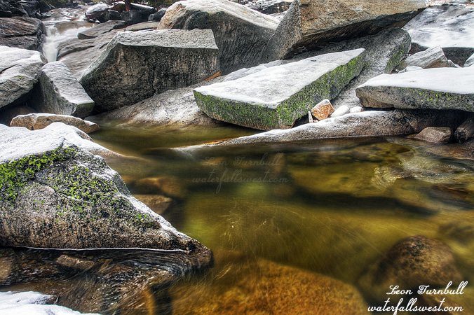
My plan was to go back to Middle Bassi Falls but via a different route. It should be easier. It should be less brushy. The flow should be good enough to get a better photo angle on it this time, too. I drove past the main Bassi Falls turnoff. No snow there. I was a bit surprised, but before too much longer, I hit the snow level. There was only 1-2 inches on the ground when I started the hike, and the conditions were about perfect here. I was high up enough that it was snowing, not raining, and that makes for a more pleasant hiking scenario, and with only a small amount of snow on the ground, it was very easy going as I hiked along the dirt road.
Well, that is until I came to a couple creek crossings. The first one was a surprise, and although not great flow, I could not find any way to rock hop across it, so that meant I had to take my boots off. It is not pleasant to have to take off your boots when it is snowing or raining and it is cold. Just saying. Then I came to Tells Creek crossing. This is a bigger creek, however I was actually able to rock hop across this one, but with a big cost. I had to scramble through some wet brush on the other side, and thus got my hiking pants thoroughly drenched. Ugh. I would regret that later. On the way back, I waded across that creek instead.
There was more brush to come also. Once I got off the main road, the rest of the route was cross country, and some of that involved going through more of that wet brush. More ugh. Should I go back? I could not go back now. I followed the Google Earth route that I mapped out precisely, and I was rewarded. The brush disappeared, and I continued on my way down to the waterfall. Thank God for Google Earth. If it was a sunny day, it would have been very pleasant hiking. If it was a sunny day, I would have been able to take a better photo.
The first time I was here, the flow was far too strong to get across onto the big rock in the middle of the creek. This time the flow was much reduced, as expected, and I would have no trouble getting over to the rock. However, getting up on the rock was extremely treacherous. It was wet with snow on it, and slick as all out. I tried to get up multiple times, but I could not. There were no footholds, and I literally would have slid right off the rock into the middle of the creek. I tried to get some other angles, but could not find any. I tried to cross the creek, but it was too deep. I finally decided on this one and only possible view of the falls. Next time I come here, I have to make sure that not only is the creek flow reduced, but it is dry as well.
Meanwhile, it started snowing. Hard. I had 5 miles or so back to the car, I was already very wet and soaked, and my tracks through the snow were already completely disappeared. It was a blizzard! I would not be able to follow my tracks back to my car. Good thing I had a GPS that was working. I would not want to get lost out in a blizzard. I made it back to the car, cold and wet and tired, but it was a good day hiking in the snow.