RAIN-OCALYPSE PART II
The rain-ocalypse returns for an encore. And a much needed one at that. After one and a half months of zero rain, we finally got our rain back. The forecast was for about 8 inches of rain in the Northern Sierra foothills over this weekend. We got four inches on Friday night, and there is another system coming in Sunday night. I am not sure if it will end up being quite 8 inches overall, nonetheless, it is a very welcome relief.
And it is a direct answer to all our prayers. It is interesting to note that the first blip of this storm on the radar came precisely on the day of our church’s fasting/prayer day. Co-incidence? At first I did not think very much of it because it was only about an inch of rain. Of course that is much better than zero the day before, but still, an inch is really nothing considering that we need so much. Then about four or five days afterwards, the forecast became clearer. It looked like we were going to get hit with a Pineapple Express big time. As the week progressed, the forecast kept getting better: 5 inches, 6 inches, 7 inches, 8 inches. Try not to get too excited, Leon. I know it has nothing to do specifically with our church, we are certainly not the only ones in California praying. Thousands of people have been praying in California, and we need to be, and I know it makes a difference. I suppose the atheist would say it is just a co-incidence, but the rest of us know better. Still though, this one storm is just a drop in the bucket of what we need in California, we are so deep in the hole, you might wonder if we will ever get out of it. I will do a more complete analysis of Rain-Ocalypse Part II when it is all over and have a post later in the week.
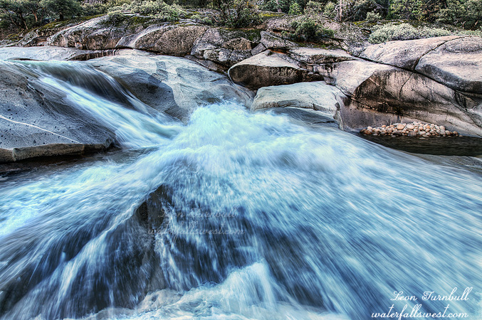
So where should I go hiking on Saturday, I pondered? It seemed that it would be a very rainy and wet day, and I did not feel like doing anything very hard or long, yet I also wanted to go somewhere new. Well that pretty much eliminates everything because I have already been to everything easy in the area. I thought about going back to Canyon Creek, thinking that it might be in monster mode but when I woke up on Saturday morning, the North Fork American was only at 500 cfs. It seemed that the rain had not picked up the river flow much at all. I should have gone however because only two or three hours later the river was at almost 6000 cfs. It would have been pretty awesome there. Hmmmm … I wonder …
Well I decided on an easy hike: Mile Hill Creek. I knew there was a waterfall on this creek because you can see it on Google Earth, but would it be flowing well enough? It did not seem so. The creek flows right beside the trailhead, and it looked pretty meager there. In fact, it was about the same flow when I was here a few weeks ago (on a different hike). This area did not get much rain, apparently. I was expecting the creek to have about twice this amount of water in it, and I was disappointed. Well, at least it was flowing. I figured since I was here, I would just do the hike anyway. Down at the bottom of the canyon, the creek would have a bit more water in it, and I still did not feel like driving up into the mountains today, though I am sure it would have been much better.
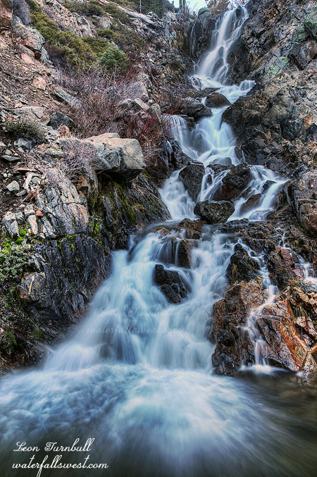
It is not a difficult hike down to Mile Hill Creek Falls. It is all on the road or trail, and the trail comes right to the base of the falls. It is really a beauty. I was expecting it to be more of a cascade and much smaller, but instead it is a gorgeous 91 ft. tiered vertical drop. How did I not ever come here before? Even though the trail comes right to the bottom of it, the angle is too severe there for taking photographs. I had to climb up on the side of the mountain. That was darn tricky. I may or may not have had one foot off the edge of a cliff and the other on a narrow crumbly ledge while I took this photo.
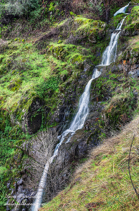
On the way back I came across a couple that were hiking along the trail. Actually, they were not hiking but examining my footprints in excruciating detail, apparently trying to determine from my prints if I was male or female. “Well, speak of the devil”, they said as I came up to them. “How far did you go?”, they asked. Just up to the waterfall, I said, thinking that they would have no idea in the world what waterfall I was talking about. But they surprised me: “Which waterfall? There is more than one”. For a couple seconds, my brain was going at 100 miles per hour, trying to determine if they knew of some waterfall that I did not know about. Then it dawned on me: No, I am talking about that big one, the 91 ft falls, not the piddly little 10 ft. cascade just up ahead. The other one I would not even consider to be a waterfall (which I definitely wouldn’t, though I admit it was somewhat interesting). “Ah, well did you see the bear poop just a bit back there?”, they said. Ummm, that is horse poop ma’am, not bear poop. I do know the difference between those two types of poopage. “Okay then, well enjoy your day”. Thank you, and you enjoy your little 10 ft. waterfall, and also try not to fall off the cliff while photographing that other one.
Well, that is sort of how the conversation went (in my head, at least).
I did see a bear coming down the road on the way back, however. Or it might have been a big dog. Whatever it was, it did not attack me and it seemed quite friendly.
And that was the beautiful morning I had in the midst of Rain-Ocalypse Part II.