THERE BE WATER, BATMAN!

What is this? Water flowing in California in October? In the midst of a 3 year drought? Impossible, you say? Not so Batman!

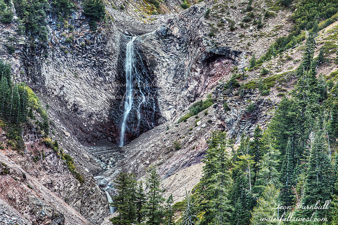
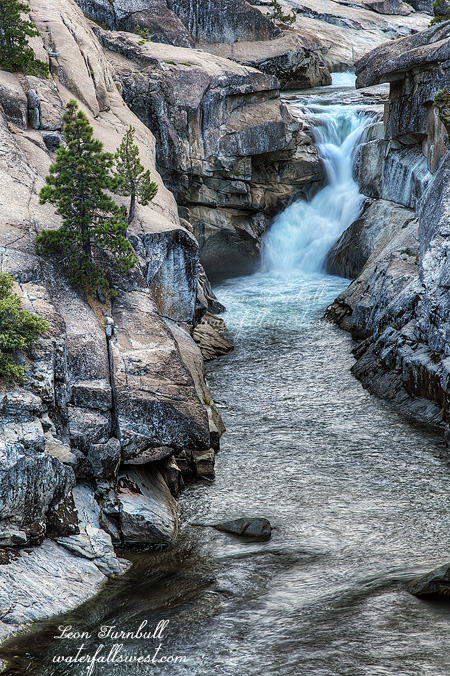
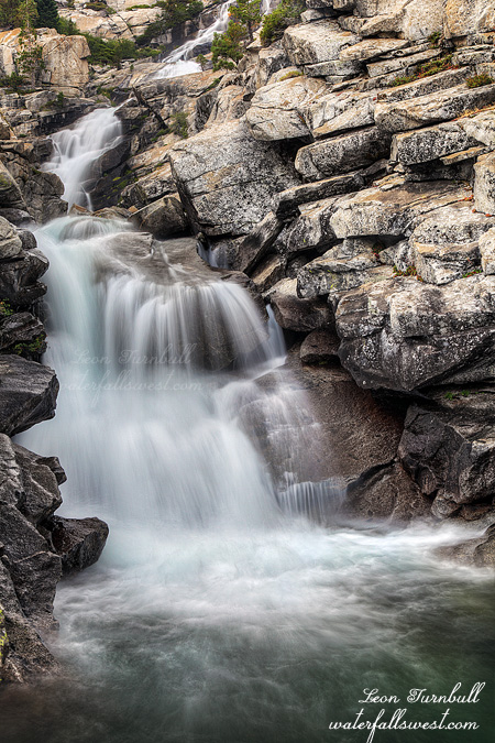
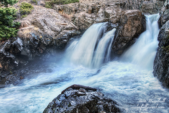
This is the South Fork Feather River with a flow of 400 cfs. Yes, it is a dam controlled river. And yes, for a short period of time in the summer, there is a recreational release of water from the dam, mostly for the kayakers I guess (but also for waterfall hunters!). Blink and you will miss it, especially in this drought year. I heard about this release from the kayaking community. This is a popular run for them, as there are quite a few rapids and small falls, and then there is this waterfall as well. I decided to make the long drive up here and see if I could get down to this waterfall, which I had never been to before.

It is a very long drive. I remember last year when I went to Deadwood Creek Falls at Clipper Mills, I thought that was a very long drive. Well this was even longer, another 25 miles or so past Clipper Mills, along a very winding road. Ugh, no wonder I had not been out to this waterfall before. But you gotta do everything once, right?

I arrived at the dam at 6:30am, right on schedule. There were already kayakers here, camping overnight, I guess so they can get going on the river bright and early, or something or other. I tried not to wake them, but I think I did wake at least one. According to my calculations, I did not have much time to make it down to the waterfall because it would be in the sun already by 7:30am. And I wasn’t sure exactly how or if I could get down to it. I almost did not make it. My planned route took me to the river a bit downstream from the waterfall. It was rather cliffy down there, however, and I was blocked out from being able to continue upstream to the falls. Hum buggers! I was screwed. It was already almost 7:30am. I would have to climb all the way back up to the top to get around the cliff, then try to work my way back down again right at the waterfall. I did not have much hope of doing that, because I figured it would be far too cliffy there (which is why I did not try that way first!), and by the time I got back down, it would surely be well in the sun. Nonetheless, this is what I attempted to do. When I got to the top and at a location right above the falls, I followed a ridge back down. Surprisingly, very surprisingly, there was a possible route down which would not end up being certain death for me. In other words, it was not as cliffy as I anticipated. I was able to make my way all the way back down to the river, right to the base of the waterfall. And lo and behold, thank the good Lord, it was still in shade. I did not have a lot of time to take photos before the sun arrived on the scene, but it was enough. Awesomeness.

Now about the waterfall itself, I admit I was disappointed in its height. I was expecting it to be bigger. The kayakers claim this waterfall is 30 ft. high. Umm, yeah, not even close, guys. Why is it that kayakers always seem to grossly exaggerate waterfall heights? I wonder. Anyway, this waterfall is not 30 ft. high. I measured it a few different ways, and the most accurate measurement I came up with was 19 ft. That is the best I can do, guys. I cannot even give it another foot to make it an even 20. It might not even quite be 19 ft, but I think I got it right. Certainly, it is not any more than that.

Well I waited around to see if any kayakers were going to grace me with their presence, by dropping over this waterfall. I waited quite a while, but they never showed. Sleeping in? The sun was well up, so I finally headed back up the mountain. When I got back to my car, the sleeping kayakers were all gone, and so were their cars. I guess they were probably on the river yesterday, and not going back down today. I would have been waiting a long time had I stayed down at the falls. There were others that looked to be getting ready but had not started yet. Anyway, I had enough, and I still had that long long long drive back home. It was a fun day on the South Fork Feather River.

2 Comments

MY PRETTY

Clear Creek Falls is a very pretty 144 ft. high falls on Mt. Shasta. It would be spectacular in the spring, but it was not too bad on this day especially considering that the creek was certainly dry just a week before. It’s a beauty, and I will be happy to return here again, even though it was a tough one to get down to.

No Comments

MUD

Mud Creek lived up to its name this past week. A large section of the Konwakiton Glacier on Mt. Shasta broke off sending huge muddy flows into the Mud Creek drainage, and flooding over a road miles below. The event only lasted a few hours, but it got me thinking about visiting Mt Shasta again. I figured that with melting glaciers, plus the recent rain and snow we had in California, that the waterfalls on Shasta might be actually flowing quite nicely, and perhaps even quite strongly.

So after work on Friday, I packed all my weekend gear into the Gator (that would be our pet name for our SUV), braving the crazy busy traffic, and headed up I-5 all the way to Mt Shasta, finally arriving there well after dark. Mud Creek was not the only waterfall on Mt Shasta that I wanted to visit this weekend. I had high hopes of finally seeing Whitney and Coquette Falls. Surely these creeks would also be experiencing good decent flow from the melting glaciers and recent rain. The area got 2.5 inches of rain at the end of this past week. But alas, as I stopped to examine Whitney Creek with my head lamp that night, I found it bone dry. Huge disappointment. Whenever I have ever driven by here, no matter what time of year, Whitney Creek has always been dry. I am certainly beginning to wonder if this waterfall ever flows at all.

I drove on back to the McCloud campground and set up shop there for the night. And promptly froze half to death that night. My weather app told me it would be in the mid forties that night, and it said the same thing in the morning. Wrong! It was 34 degrees when I woke up in the morning. Even though I was in my (supposedly warm) sleeping bag and wearing layers of clothing, I was freezing the entire night, and slept very little.

The next afternoon I drove up to the Clear Creek trailhead. Before the hike I tried to get a little nap in the car. That did not last long before a couple drove up to the trailhead and parked right next to me. I could hear them talking as they prepared to start out on their backpacking trip. So much for sleeping. The girl was having a major ordeal getting ready. Apparently, there was a huge spider living in her hiking boot, and she was freaking out, and trying to get her husband/boyfriend to get rid of it for her. I am guessing you do not get out hiking much if you have spiders living in your hiking boots. After much time and consternation, they finally left. I am not sure where they were backpacking to, but it was certainly at a much higher elevation, and it would be well below freezing that night. Good luck to them in surviving. Well, I definitely was well past being able to nap, so I ate my lunch and started off on my own hike. No spiders in my boots, guaranteed.

At the viewpoint, you are 1 mile away from the 100 ft. high Mud Creek Falls. It is a magnificent waterfall, with an even more magnificent backdrop, 14,179 ft. high Mt. Shasta. The only way to photograph it is with a long lens, and that is why I lugged my very heavy 100-400mm lens up the mountain with me, which is not something I would normally do. One of these days, I will get up closer to this beauty. I think I now have an idea how to do it, so that will certainly be in my future plans. The waterfall was flowing fairly decently, and I think most of it was from snow that was melting from this past storm. No major glacier events today. It certainly would have been amazing to be up here during the event last week. Of course, it happened during the night so it would have been tough to see it then. Ha ha. From the viewpoint, I could also see that Clear Creek had some water flowing as well. There is a waterfall on this creek as well, and I wanted to try to get to it if possible.

I continued hiking up the trail and caught up to the spider couple, resting ahead, and no doubt clearing out more unruly creatures from their hiking boots. Just before I got to them, however, I cut off the trail and headed down down down. I found a bear path traversing along the mountain side, but eventually I had to leave it because I guess these bears do not like waterfalls. I went straight down the mountain. It was steep, but not cliffy or dangerous. In a surprisingly short amount of time and without too much difficulty, I found myself at the Clear Creek drainage with a glorious view of the 144 ft. high waterfall on Clear Creek. It was not flowing too well, but considering this creek was no doubt dry as a bone a week ago, it was not bad. It would be an awesome waterfall to visit in the spring, and I am sure I will be back here. I will be sharing that photo next, but in the meantime enjoy spectacular Mud Creek Canyon Falls.

No Comments

GO TO THE FLOW, JOE

I bet you thought there were no waterfalls left flowing in California due to this nasty drought. Right? Well, besides a very select few such as Burney, Mossbrae, and McWay Falls that flow year round, most everything else is pretty much dry no doubt. But not this one.

The North Fork Stanislaus River is a controlled river flow, so I knew that it would be flowing well. The keepers of the water usually have this river flowing all summer long. So when the drought leaves everything else dry as a bone, coming here in the summer is a good option.

I had never been here before, however, and I had been putting it off for three years now. There were a multitude of reasons why I had not tried it before. Number one reason is the very long drive and the fact that I would have to get up at 3AM in order to be able to get down to the river in good lighting conditions. It is SOOOOOO DIFFICULT getting up that early in the summer time and I did not think I would make it this time either. In fact, I had turned off my alarm in the middle of the night, thinking I would skip it yet again. But at around 2:50AM, I was wakened due to my wife snoring. She is not a loud snorer (and she will tell you she does NOT snore – yeah right) but I need perfect quiet in order to fall to sleep. Well, I may as well get up and go, I thought.

I had known about the waterfalls on the North Fork Stanislaus River from the kayakers. The Devils Kitchen run is a popular one for them, so I am certainly not the first to document/discover these waterfalls. I had thought, though, that I might be the first to hike down to them. I certainly have never heard of anyone hiking down there before. So in a way this was another drawback for me. I was not sure if it would even be possible to hike down to the waterfall due to very steep terrain or thick brush. Even if I could get down to the river, would I be able to get any view of the waterfall? Also, I did not know exactly where the waterfall was on the river, though I had a good idea, and I also thought it might not even be 20 ft. high. A huge long drive and a big difficult hike for a 15 ft. waterfall? Not exactly something at the top of my list of things to do. But alas the stupid drought does not leave many other good options, so this one still seemed like a good plan to me.

There actually was a trail down to the river, so I suspect I am not the first to hike down there. Well, it is an extremely old trail, and very faint, too faint to even follow in a lot of places. It has certainly fallen into disrepute and probably not been used in a great many years. Except it IS still used … by bears. There was a very large amount of bear poop along the trail, and some of it was HUGE. Like so huge I think there must be grizzly bears down there or something. I cannot confirm that though. I did not see any. I did not see any black bears either. Just a heckuva lot of poopage.

Even though the trail was too faint to follow, the terrain was not too steep and not too brushy, so I was able to make it down to the river. From there I worked my way upstream and found this waterfall. The kayakers call it Portage 24, and I measured it to be 34 ft. high. I was very pleasantly surprised to find this beauty and to be able to get down to it without too much difficulty, and especially that it was bigger than 20 ft. high. There is another 25 footer shortly above this one, though not as nice, but I will share that photo later. The lighting was not very good for photos, however. Even though everything was in shade, the sun was getting ready to come up over the ridge in the distance, making everything a bit too bright. In another month or so, the sun would be at a much better orientation for morning photography, however, I am not sure it will be flowing in a month, as the water gurus will likely turn the tap off by then. It is a beautiful place, and I would like to go back someday, but the hike back up the mountain was killer, climbing 1500 ft. elevation back to the car. And then that long drive home. Whew!

2 Comments

ONE LEFT

Horsetail Falls is THE waterfall I love to visit in the summer. This 790 ft. monster waterfall always has good strong flow in the summer, and this year, it is pretty much the only waterfall left around here that is still flowing at all.

As I drove up Hwy 50 on Friday evening after work, I saw that the South Fork American River looked pretty pitiful. It seemed much lower than just a week ago when we drove up to Tahoe. This was bad news. Since Horsetail Falls flows into this river, I had no doubt the waterfall would be pitiful also. Well, not so, actually. In fact, it seemed that Horsetail Falls had quite a strong flow still. I don’t really understand how it could be that Pyramid Creek had a bigger flow than the American River. Makes no sense, but perhaps it was just my imagination. Anyhow, I paid my parking fee and marched up to the falls.

When I arrived, I found a couple different people enjoying the view at the base of the falls. This is not allowed. I am the only one that is allowed to be here on a Friday evening. Just kidding folks. But it is surprising because usually I am always alone when I come here in the evenings. Well, I explored a bit further up the mountain this time, but did not find any interesting photo spots, then came back down, and by that time, the others had left, so I had my favorite spot to myself (actually, I have a few favorite spots at Horsetail Falls). This is definitely not a new composition for me but it is all I got this time around. It seems that I stupidly left my image stabilization ON, and I did not realize this until I got home. When you do this combined with using a tripod, your images are ALL blurry. Well, I managed to scavenge this one photo which is not too horrible, but it would have been much sharper had I not been so stupid. Anyway, at least I only did it at this easy to reach waterfall, which I have already been to a hundred times, and will return again many more times. The only other time I left the I.S. on was at a waterfall in which I will likely never return to again because it was so difficult, and I did not get any good pictures of that one.

I will probably be back to Horsetail Falls again very soon. I have one more idea for a new composition of this waterfall (IF I can get to this one particular spot which I was eyeing on Friday – and not kill myself in the process). The flow is definitely on its way out. In another couple weeks, you will be able to cross the creek easily at the base of the falls; I could have almost done it this time, but decided to play it safe. That’s a good thing.

No Comments