GOLD DIGGIN

After last weekend’s tick disaster, I said I would only be hiking at higher elevations for the rest of the year. I figured I should go between 4000 and 5000 ft. in elevation this weekend. I found one possible hike I could do, so I set out in search of gold (and a new waterfall).

Starting at 5400 ft., I was surprised there was still so much snow on the ground. CNRFC said there was no snow here, but indeed there was snow, and I found up to two feet, even more in some places as I hiked down the forest road. There was snow all the way down to the waterfall, which was 1000 ft. in elevation lower than I started. I did not use my snow shoes, but I probably could have used them, as I was sinking in some spots. But overall, it was pretty solid snow. The hike was good.

It was also mostly easy, though I took a wrong turn which made it a bit harder than it should have been. I finally arrived at the creek, where I was expecting to find a waterfall about 100 ft. high. That is what I was hoping for. Actually, I did not even know if there would be any waterfall here at all. However, instead of a 100 ft. high waterfall, I found a 20 ft. high waterfall. I measured it precisely 20 ft.  (though it did seem a bit bigger than this as I stood in front of it). There was just the one decent drop on this creek, and below this there was a bit of a cascade, but nothing very interesting. It was tricky and steep to get up to it, but you can stand right in front of the falls and enjoy the spray. Speaking of spray there was a lot of it, so taking photos from in front was impossible; I climbed up the bank to get a side angle shot of the falls.

You may think it was just a big waste of time to drive and hike all the way out here for a 20 ft. waterfall. I suppose if I had known it was only 20 ft. high, I would have gone somewhere else. Nonetheless, I had a very enjoyable hike. The weather was perfect. The hike was not too difficult. There was still snow on the ground. The creeks were flowing well. I found a pretty little waterfall. I had an absolutely awesome day in Eldorado National Forest.

However, if you want big waterfalls, stay tuned to this channel. The next one I plan to see will be over 400 ft. high, and I know that for certain. And you will not be able to guess which one it is…

No Comments

NIGHTMARE ON NFAR STREET

As of Apr 1, here are the final season numbers: Rain is at 132% of average for Northern CA, 127% (central Sierra), and 129% (southern Sierra). Snow pack is at 164% of average for Northern CA, 164% (central), and 155% (southern). This is terrific news for California! The final numbers are probably most similar to 2011, and not as big as 2017. Now that spring is here, I am definitely OK with people wanting the rain to end and spring to start. In fact, I would like to see that as well (are you surprised?). However, the rain is continuing to fall as we go into April. We are not seeing any more big storms, but nonetheless, we are still seeing very unsettled weather with many showers and rain and it looks like that will continue through mid month.

This past weekend, I tried to go on an early season backpacking trip down to my favorite river, the North Fork American. It was a nightmare on NFAR St.

My plan was to hike down the Mumford Bar trail to the river and along the American River Trail to New York Canyon. It would have been glorious. I tried this a couple years ago, and the trail was so horribly overgrown, I could not make it even anywhere close to Beacroft Falls. However, I heard that the forest service has now cleared this trail, and I wanted to try it again. So ..

This time around, it was much earlier in the year, so I had to start hiking from China Wall. This added 3 miles (one way) to the hike. There was 3-4 feet of snow on the ground. The first 3 miles is on the road, and it was packed down because it is popular for snowmobile riding in the winter. I did not need my snowshoes for this section, however, once I got to Mumford Bar trail head, snow shoes were required. The snow was deep, and not hard packed. I would not have made it more than a hundred feet down that trail without them.

This trail is a huge descent, 2700 ft. elevation loss in about 3.5 miles. The first 1100 feet were in the snow, so this made the hike extra difficult, and it took a long time. There were a couple very sketchy spots as well, where I had to cross a couple seasonal creek drainages. It was quite steep with big drop-offs from the snow bank down to the creek, and very unstable snow at the edge of the creek. If the snow bank collapsed on me, I would have a very big fall. I looked for a different way down to find a more stable option without any big drop-offs. It was difficult, but I found ways around these sections, and continued on. At 4300 ft. elevation, the snow was finally gone, and I ditched my snowshoes beside the trail, hoping they would still be there the next day when I came back up.

For this hike, I did something a bit different, wearing trail runners instead of hiking boots. This is the first major hike I have worn trail runners. (actually, it is the first hike, period). The reason I did this is because I knew there would be a number of creek crossings plus hiking in the snow, and I did not want to have to carry water shoes because I am trying to cut down on my backpack weight. Overall, wearing trail runners worked out fine, except for one thing: I kept rolling my ankles. In hiking boots, I am sure this would not have happened at all. I did not hurt my ankle on this trip, but it worries me for the future, because I was out of commission for 6 months a few years ago when I severely twisted my ankle on a hike.

By the time I got to Mumford Bar, it was much later than I wanted. I still had a long way to go to New York Canyon. I did not think I had enough time now, but I would re-evaluate once I got to Beacroft. The trail to Beacroft Falls is now cleared, and easy to follow. There were still a lot of downed trees to climb over. These could have been from the last winter or two, after the trail was cleared by the forest service. HOWEVER … I had a bigger problem …

THE TICKS ….

WERE ABSOLUTELY HORRENDOUS ….

The section from Mumford Bar (a little before that) to Beacroft was unbearably tick infested. It was the WORST TICK EXPERIENCE I have ever had in my life. I was initially going to say it was the second worst experience (after Canyon Creek), but I changed my mind. It was the worst experience, and the reason I say worst is because once I got home I found out that I had about 4 or 5 small tick bites on my body. I had thought I escaped with no bites. Nopity nope. Nope nope nope. I had to pluck over 100 little buggers off my body on this section to Beacroft, stopping every few minutes to check my legs and body. It seems they were all over the ground, also, which is very unusual. They must have been hanging on very low brushes, because they seemed to get on my shoes as I walked along, and then climb up my legs from there.

By the time I got to Beacroft I was completely done with this hike. There is no way I could continue another 5 miles to New York in this infested terrain (and the trail was much more overgrown after Beacroft, so it would be even worse). I decided to camp at Beacroft instead, but one problem: there is no camping area here at all! Any flat ground I saw was not cleared of brush, and hence was infested with ticks! There is absolutely no way I was camping here amongst so many ticks. That would be very stupid indeed. I needed an open area, and there was none. I thought about going back to Mumford Bar. I did not want to, but it seemed I had no choice. Finally, I found one very small spot by the river. It was quite rocky, but there was one small place I could set up my tent. It was not too great, but there were no ticks there, and it would have to do.

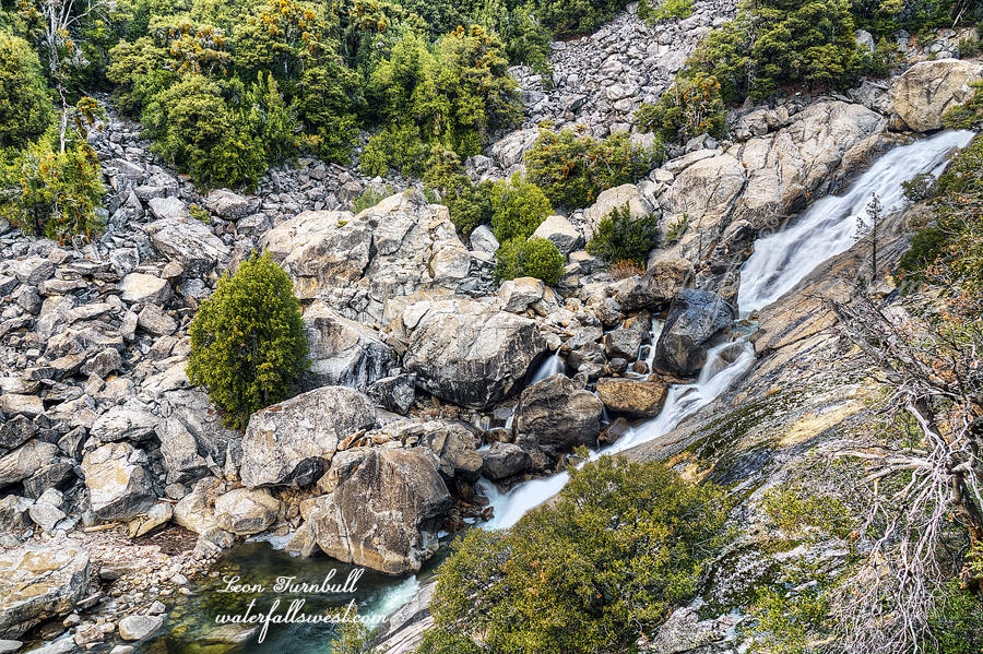
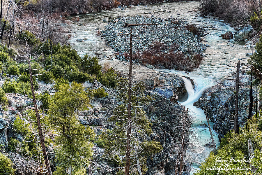
After setting up and eating dinner, I wanted to go down to see Beacroft Falls. I was here in 2003, and I did not get a very good photo of it at that time, so it would be a nice consolation being able to get a good photo of Beacroft Falls. When I was here 16 years ago, it was very easy to get down to the waterfall. Now it is IMPOSSIBLE! Believe me, I tried. I gave it my very best effort. Even though the Forest Service cleared the trail to Beacroft, they did not clear any brush off trail (ie. down to the river or falls). Never mind the ticks, the area along the river around Beacroft Falls is completely overgrown and access to the river is literally impossible. Think of the worst brush you have ever encountered in your life. Multiply that by 1000. The brush at Beacroft is even worse than that. You think I am exaggerating but I assure you I am not. I could not get down to the waterfall. More disappointment. The photo here is taken from just off the trail from quite a distance away. It was the only view I could find. As you can see it is not a big waterfall, only about 15 ft. or so high. It is not a bad view, but would have been much better from close up.

I slept pretty well down by the river in my tiny little spot. I got up fairly early and packed up. I wanted to get back to Mumford Bar before the ticks woke up. Maybe they would be sleeping in. Well, that did not really work out too well. I still got plenty of ticks on me on the way back to Mumford, but I suppose they were not nearly as active as they were the previous afternoon.

I rested at Mumford Bar trying to prepare myself for the big climb ahead of me. I found my snow shoes right where I left them. The last 1100 feet climbing up in the snow was very tough. In particular, the difficult section where I had to cross the seasonal creeks was a lot more sketchy on this day because the snow was a lot softer. I had to be really careful on each step. It could have been disastrous if I slid down the soft snow. The last 3 miles on the road back to the car was also a lot tougher because the snow was so much softer. I was so tired when I got back to the car. It was time to drive home, eat pizza (thanks Tara), and sleep.

2 Comments

DAY 2. THE SLOG HOME

It did not get down to freezing in the night, but it was cold, so I was actually glad I had both sleeping bags. I was very warm in my tent. I got up at sunrise, and went out into the cold. It was not really very cold, though. As I said, it was much colder at Llewellyn Falls in September. It was a very pleasant morning, I made breakfast and had some coffee, then packed up.

Instead of going back up the mountain the same way, I headed up the creek. There are two more waterfalls upstream from the big drop on Eleanor Creek, both of them are pretty nice, and access is much easier, so I was very glad to see them.

It took 3 hours to get back to Frog Creek in only 2 miles. The climb back up the mountain was killer. It was after 12PM when I got there. I had lunch and filtered water. I still had 9 miles to hike back to the car. At least it was all on trail now, but it was a long slog back. The last couple miles of road walking back to the dam at Cherry Lake is particularly painful (because you just want the hike to be over!). I finally got back to the car at 4PM. It was another 7 hour hiking day. I lost 3 pounds of weight on this trip, and that is after the huge pizza dinner I ate at Pizza Factory in Groveland. It was a fantastic trip into the Yosemite Wilderness just before Christmas.

No Comments

DAY 1. SHUTDOWN!

Twas the night before the night before the night before Christmas, when all through the national park, not a creature was stirring, not even a park ranger. The waterfalls were flowing by the lake with care, in hopes that the madman soon would be there.

And he was!

Yes, I was off to Yosemite National Park on the morning of the government shutdown for a one night winter backpacking adventure. I had my permit, and I was allowed to enter into the park. It was only a partial shutdown, and I would be walking into the national park from Cherry Lake. I would be hiking to Lake Eleanor, but not just anywhere at Lake Eleanor, I would be hiking to the very far end of the lake. It was going to be extremely difficult, and I was expecting snow and winter conditions, so my pack was much heavier than normal.

When I picked up my permit in the morning, I find it interesting to see who else is backpacking at the same time. There was one other permit there for someone hiking in the next day for 2 nights. Here’s the thing: there was a big winter storm coming in! Did he not know this? Even more interesting than this, however, is that I saw him! He was just starting out at the trailhead when I was finishing. This was 4PM on Sunday, only 45 minutes before sunset. He only had 3 miles to hike, but he would be arriving at his destination after dark for certain. I asked him if he knew there was a winter storm coming? He replied “there is? Well, I do have a rain fly”. He seemed a bit clueless and unprepared for a winter storm. I mean, if you are going backpacking, how do you not know what the weather conditions are going to be? In 2018, I went on 9 backpacking trips, and had zero days of rain. In 2017, I only had one day with an afternoon thunderstorm, no other rain on any of my trips. Is this just good luck? Or good planning? I think it is both, actually. I watch the weather very closely, and pick the best days to go backpacking. I may change my planned dates if the weather is not looking good. I just think backpacking is a lot more fun if you do not have to deal with a lot of rain. For this trip, I knew there was only a 10 percent chance of rain for the weekend. In fact, I was expecting a bit of a shower for the hike back out on Sunday, but that did not even happen.

I was expecting cold weather, though, and snow on the ground. That did not happen either, but I wanted it. You see, I have an idea for a winter backpacking trip in the near future, but it is a very hardcore trip, and I have not backpacked in the winter before. I wanted a first trip to ease into something that would be incredibly difficult. According to CNRFC, there was snow at Lake Eleanor, and the temperature would be about freezing at night. Well there was no snow, and although it was cold at night, it was not even close to freezing. It was colder at Llewellyn Falls in September. Thus, I did not really get the winter experience I was hoping for. I had brought my new Thermarest Neo Air X Therm winter sleeping pad, and I brought both my sleeping bags, tucked inside each other at night. That was a bit overkill I think, and added an extra 2 pounds, but if it was as cold as expected, I think it would have been needed.

It was a great trip nonetheless, and also extremely difficult. There is an easy trail from Cherry Lake to Frog Creek at Lake Eleanor. It is a long hike, about 9 miles. I started hiking at 9AM, arriving at Frog Creek about 1PM. From there, no more trails. I crossed the creek, and went up to Frog Creek Falls, a very lovely 30 ft. cascade. After this, I wanted to hike to the end of Lake Eleanor where there is a very large waterfall (in fact, you can see it from the trail along Lake Eleanor). I planned to camp somewhere along the creek above the falls. Getting down to the waterfall, though, was going to be a challenge. The cliffs are huge at the end of the lake, and I did not think I would even get to see the waterfall at all from up close. It was very tiring just getting to the end of the lake. You need to climb way high up above the cliffs, then back down to the creek. It is only 1.5 miles, but it took almost 3 hours. I finally arrived at my camp, a nice spot along the creek, at 3:45PM, just one hour before sunset.

I dropped my pack and headed straight down to the waterfall. It is not easy getting down to it. At the brink of the falls, it is extremely steep and cliffy, but amazingly I found a view of the waterfall from the side. It is not a great one, but I was pretty happy to get even this view. I was not expecting anything. However, I could not get any further down. It was just too cliffy. It was now very late, and I just had time to take some photos and get back up to camp.

I was almost back to camp when I realized that I forgot my Inreach device back at the waterfall viewpoint. Ugh! So stupid, madman! I had to go all the way back down to retrieve it. By the time I got back to camp, it was after sunset. I set up my tent in the dark. I was extremely tired. I had been hiking basically non stop for 8 hours. It was now dark and cold, and I did not feel like cooking my dinner, so I had a snack and hopped into bed. It was early, but I was so tired. I tried to watch a movie on my phone, but I was too tired even for that. Time to sleep!

No Comments

GIMME THE FACTS

It felt like a long time coming but winter has finally arrived in Northern California. It WAS a long time coming. However, as of Dec 1, we are almost back to average for precipitation this winter in Northern CA, and we ARE above average in Central and Southern Sierra. You heard that right: Not “below average”, but “above average”, thanks to a couple big late November storms, praise be to God who provides. In Northern CA, we are at 83% of average. In Central Sierra: 118% of average, and Southern Sierra: 147% of average. The snow pack is very similar: 82% North, 117% Central, and 128% for Southern Sierra as of Dec 1. This is fantastic news! I am not sure if the rain and snow will continue strong into December; there look to be a few storms in the next week or two but nothing really big.

So …. What’s the deal, man?

We always have dry periods throughout the winter. This is why I only tally the totals at the end of each month, not during the middle of the month. This year, our “first” dry period (and it won’t be the last one) began right at the beginning of the year, and in mid November we were at only 20% average for the year. But in two storms, we are now above average overall. Why bust your hearts looking at daily stats?

Sadly, the slow start was a major contributor to the Camp Fire, which was an awful and devastating catastrophe. But it did not cause the fire, nor did global warming cause it. The fire was caused by humans, (as are the vast majority of fires, by the way). Frankly, it makes me mad because the fire was (most likely) caused by PG&E negligence, and it should never have happened in the first place, and they did the exact same thing last year in Napa. Global warming should not be used as an excuse for accepting that devastating fires will occur. Do not say fires are the “new normal”. Let’s prevent fires from starting in the first place by being responsible.

I hear a lot that global warming is causing the drought in California. That is what everyone says, but is it true? What are the facts? Gimme the facts, man. If it is true, then shouldn’t we see an increasing pattern of dry winters in California? Yet:

2009 – avg
2010 – above avg
2011 – above avg
2012 – below avg
2013 – below avg
2014 – below avg
2015 – below avg
2016 – above avg (everyone seems to conveniently forget that 2016 was an above avg year, yet this was the year we started to climb out of the drought)
2017 – above avg
2018 – below avg
2019 – ???

I do not see any pattern of increasing dry winters here. Do you? I see an awful drought period, but even with that we have a 50/50 split of good/bad winters over the past 10 years. Going back further in years does not make any difference. Indeed, I checked back 50 years, and for every decade there was pretty much an exact 50/50 split of good vs. bad winters. 50 years! I also checked back 20 years for slow starts to the winter. I only found one other year (2014) that was as bad as this year to start (through mid November). Even so, we still ended up above average by the end of November 2018, and as I said that is why I only tally totals at the end of the month. So again, I do not see any pattern of increasing slow starts to the winter. Do you?

Are we even in a drought in California? What are the facts, man? Southern CA is still in a more serious drought, but Northern CA is not in a drought (or officially I guess you can say it is in a low drought status – which is normal after summer). I think it will all depend on if we have a good winter or a bad winter this year, as to whether we go back into a drought in California. Don’t say we are in a drought before winter has hardly even started. Let’s wait to see what happens by the end of the season. So pray for rain and snow! God is the only one that can seriously help and make a difference.

Anyhow … this photo is the upper waterfall of Bear River Reservoir Falls. It is 21 ft. high in total, including the upper 4 ft. tier. It is a pretty little one, but just a little one.

No Comments