ALL FIRED UP
Ain’t nobody livin’ in a perfect world
And everybody’s out there, cryin’ to be heard
And now I got a new fire, burnin’ in my eyes
Lightin’ up the darkness, movin’ like a meteorite
All fired up
Now I believe there comes a time
When everything just falls in line
We live an’ learn from our mistakes
The deepest cuts are healed by Faith – Pat Benatar
Shootings of police in Dallas, School shootings, Intolerance against Christians and saying hateful words to each other on Facebook/social media, False teachers claiming to be Christian yet promoting hatred against homosexuals and saying it is good that they are killed (make no mistake, anyone who hates is *not* a Christian – Jesus loves *everyone*), breaking laws, stealing, hurting others, even littering. I don’t know about you, but I am All Fired Up and completely sick of all this hate and hurting of one another. It is easy to say let’s all just love each other, but it is not so simple. That will never work, because the real (root) problem is that more and more people in the U.S. (and more every day) have abandoned and turned away from God. They cannot truly love because God is Love. As this trend continues, the situation will only get worse, and not ever better. If more people loved God, then more people would love each other, and there would be less hate and killing in the world and in this country. This is what I believe. Jesus is the only one that can save us.
Well onto better things …
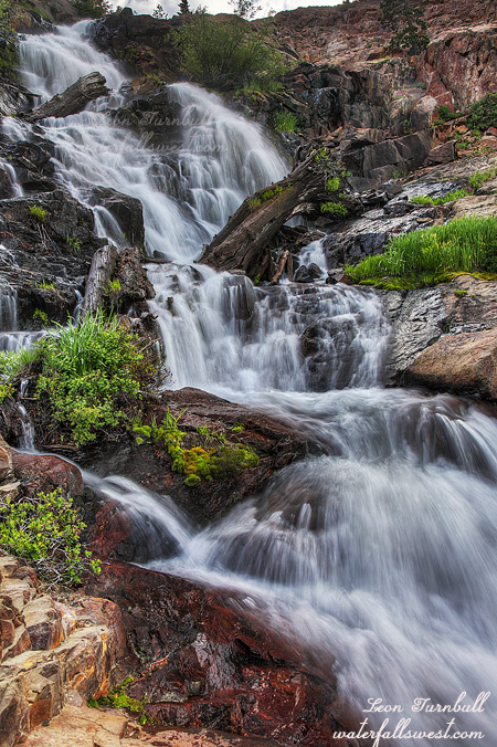
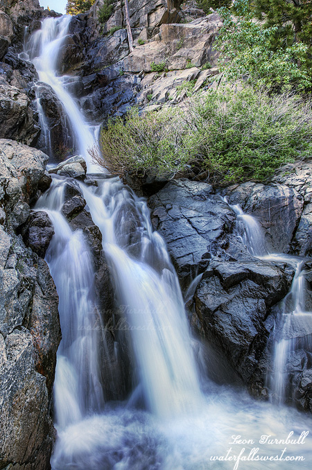
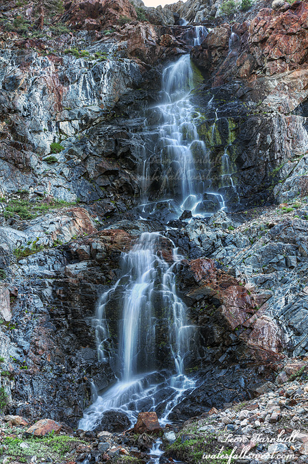
I was definitely All Fired Up about this waterfall. All week long I was anxious to get here. When Jadon and I were here last weekend, I glimpsed this falls from a distance, it was a big one, and still flowing quite well, but we had no time to go up to it. I knew I would be back here this week. I absolutely had to come back. And so I did, and brought Jadon again as well.
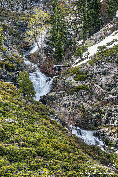
This weekend we saw no one up at the lake. We had it all to ourselves. No over friendly dogs. No crazy OHVs driving through the middle of the lake. We did see one family walking down from the lake as we went up. They parked their car down the hill where we did. Smart people. That road gets crazy rough, and I would not want to drive my SUV up there any further than we did. It makes for a longer walk of course. Jadon would prefer the easy hikes, but he did not complain (much). The weather was slightly, but only slightly cooler than the previous week, and I think it was actually a few degrees warmer than it was supposed to be. And the mosquitoes were still biting. There was a nice breeze up at the lake, and no mosquitoes there, but down the road there was no breeze and that means prime flesh eating conditions for the little buggers.
It is actually a pretty easy hike to this waterfall, and there was even a well worn path to it, which means many people have been up here before. I thought this quite surprising because I have never heard of this waterfall being here. I knew about the lower falls, of course, but no one has ever mentioned the upper falls. It is 93 ft. high, and for a completely unmarked stream, it seems to have very good flow in the early summer, though I think it would have been much better a couple weeks earlier. Next year, I am sure I will be back. This area is spectacular.