FLOOD
Rain rain on my face. It hasn’t stopped raining for days. My world is a flood. Slowly I become one with the mud. (Jars of Clay)
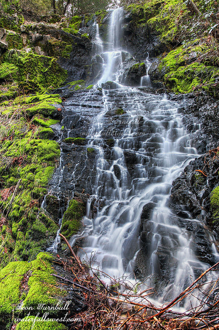
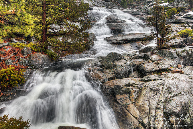
What a crazy, difficult, and fun adventure! It was well worth it to find this gem. I will have to say this is my find of the year thus far, a magnificent 100 ft. high waterfall. Yet another new discovery from waterfallswest.com. You are welcome. You gotta come see this beauty.
It was the beginning of the end in northern California this weekend. Well, more to say, the beginning of a huge storm to get March rolling on the right foot. We picked up 6 inches of rain in the foothills so far this weekend, with another big storm today. Certain areas of the state had up to 10 inches already. We could get up to 20 inches of rain by the end of next weekend. That would be incredible if it comes to pass, but at least we should have a good chunk over 10 inches.
The snow levels were high to start with on Saturday, so that means the creeks are overflowing with rain and snow melt. I headed up to higher elevations on Ice House Rd, hoping to find some amazing waterfalls. I found one.
I woke up to a bit of a break in the weather Saturday morning, which made hiking a lot more pleasant. The rain would be starting up again though, by 10am or so, and in the afternoon, there was supposed to be crazy big winds, and the snow would be starting. I wanted to be off the mountain before that happened. I thought I should have lots of time, this should be an easy hike. Have you heard that one before?
I was able to drive up the road a bit further than I expected, but finally hit a snow wall. Walk from here. I did not need my snowshoes at first, but figured I would need them later, so I carried them along the way. They are heavy for my aching back, so essentially I carried them in my hand the entire distance. So my back was ok, but my arms were sore by the end of it! I did use them though, so it’s a good thing I did that.
After about a mile, I had to get off the main road and follow another road through a campground area and continue following the road up stream. This is when things got difficult. As I said, it should have been an easy hike. However … the snow was all melting from the warm weather and rain, there had been a couple inches of rain so far, and all the unnamed side creeks were going nuts. There was literally a river running down the middle of the road. Not kidding. I had to cross numerous side streams, and some of them were quite difficult to cross without getting wet feet. In other words, I got wet feet. (trying to cross a stream on a slippery, flimsy log is not a good idea). And if that was not enough, the whole area was a swamp fest! Trying to negotiate around all the flooded area was a nightmare. It took a lot longer to get up to the falls than I expected.
By the time I finally got up there, the rain was just starting up again. I just barely had time to take some photos. Unfortunately, I could not measure this beast because the battery died in my laser range finder, but it is about 100 ft. high. There is an upper section and a lower section as well. Absolutely magnificent. The hike back was wet, needless to say, and by the time I got back to the car I was soaked through and through, and cold, and hungry.
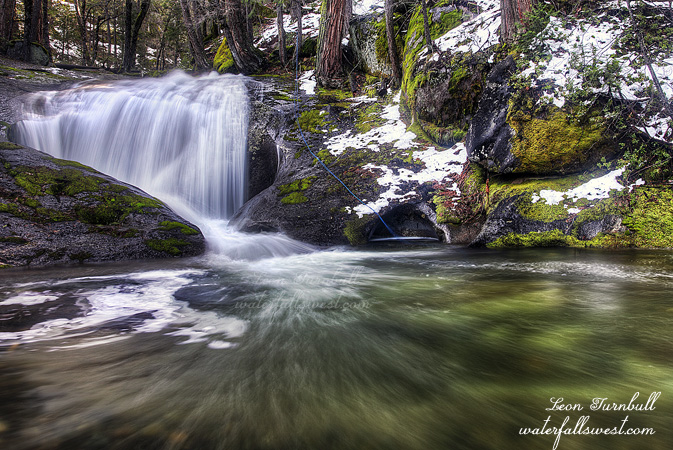
I had initially entertained the idea of going to Bassi Falls after this hike. That creek was very very full when I passed by it. It would be awesome, but it is much harder to hike Bassi Falls in the winter than the summer, and I was just dead tired after the first hike. Plus, I did not have any dry jacket and it was raining pretty good by the time I got back down there. Ah well. I had a fabulous day on Ice House.
http://waterfallswest.com/waterfall.php?id=rocky-basin-creek-falls-658
No Comments