HAPPY HAPPY
Well I was definitely pleased and surprised to find this waterfall, but it wasn’t my plan. Let me please explain my dear readers. Why, of course, you say…
There is, I believe, a bigger waterfall on this river, above this one. It is the East Fork of the North Fork of the North Fork of the American River. Say that three times fast. Or try EFNFNFAR for short. I first learned about these waterfalls from the late Russell Towle. I did not see any photos from him, but he indicated this lower falls was 10-15 ft. high. Later on, a friend of waterfallswest also got down to the lower falls, and not the upper one, and he also is crazier than I am (you can take that as a complement, Joey). However, his photo and description also made it seem that the lower falls was only 15 ft. high at the very most. So in a nutshell, I figured I could either try to get to the upper falls in which there was a 95 percent chance that I would fail miserably, or I could go to the very small lower falls. Neither of which appealed to me, and so I just did not even bother.
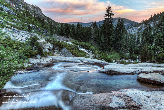
Well so this weekend rolls around and I have nothing better to do, so I determined to give this one a go, but my plan was to try to make that 5 percent happen and get to the upper falls. To be sure, years ago I have tried this waterfall before, but my route at that time was faulty. This time, the route was golden. I was very pleasantly surprised when I got down to the river to find it flowing halfway decent. There was about an inch of rain a week ago, but that is not much considering the drought, and I expected the river to be all but a trickle. How awesome that I might actually get to see some water flowing over a waterfall today. Well as it turned out, my routed put me too far to the left, it was too cliffy further to the right, and thus I ended up coming all the way down to the river below the lower falls. I figured I would at least try to get up to that small one, if nothing else. I had to cross the river (which fortunately was easy to do so, and then waded up the river towards the falls). Then I saw it ahead of me.
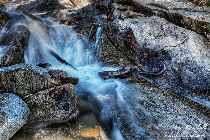
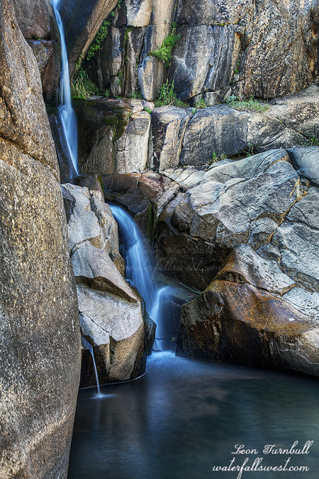
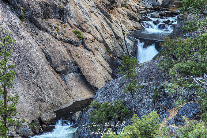
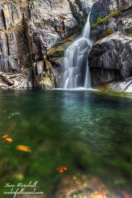
Wow! What a surprise, what a beauty! It is not a piddly little 10-15 footer, but a very gorgeous 32 ft. high gem. Magnificent! The cliffs on both sides of the river were completely massive, in fact it was just a teensy bit scary standing in the pool below the falls with the massive cliff looming above me. What if a big old bear above decided to knock a nice big old rock onto my head. That would not be very fun. Anyway, it certainly is a surprisingly nice waterfall, and the emerald green water was amazing. Will I try that upper falls again someday? Absolutely, and if we don’t get rain anytime soon, maybe it won’t be too long in the future.