A Sign of Good Things To Come
On Good Friday our church was having an all night prayer vigil. They wanted people to sign up throughout the night to come to the church for 30 minutes to pray. I signed up for 4AM. I know what you are thinking. I am nuts! But I had a plan, and it was that afterwards, I would drive on up to Lake Tahoe to catch the sunrise at Eagle Falls. It was a great plan! But as usual, God had a different plan in mind for me. His plan started out with heavy overcast clouds in the forecast over Tahoe and snow/rain showers. I could see during the day on Friday that my great sunrise plan was not going to work out too well, so I nixed that idea, and decided that instead I would just go on a hike after the prayer vigil up on Ice House Rd. And since it was overcast, I would not need to worry about hurrying up there to get there before sunrise. And in doing so, I would be able to spend more time in prayer at church. Exactly what God wanted! Funny that.
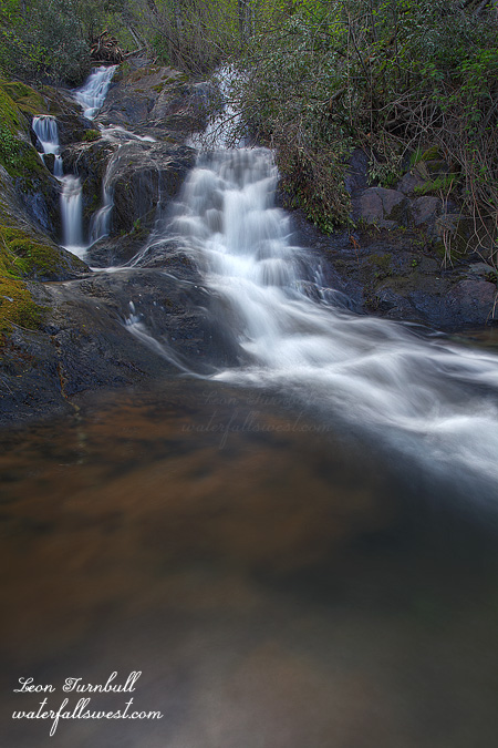
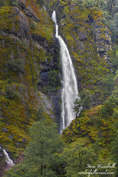
Anyway, Jay Bird Canyon Falls was my first destination of the day, and I ended up arriving not too long after sunrise. It had crazy flow! Although it is a very tall waterfall (173 ft. high), the creek is small, and usually the waterfall is just a nice, pretty, dainty, thin flowing waterfall. Today it was a 173 ft. high monster! The entire amphitheatre where it drops into was full of mist from the falls. There was not a dry spot to be had to take a photo. I got completely drenched as I approached closer to the waterfall, and the mist was freezing cold from snow melt as well. I could not find any place to take a photo (even up on the ridge opposite the falls was full of mist). Well, it was certainly an awesome experience, and I take it as a very good sign for things to come this spring. If this small waterfall (in terms of creek size) had such a powerful flow, what are other waterfalls (such as Yosemite) going to be like this spring? They will certainly be amazingly awesome for sure. I suppose you are wondering where I did take this photo. Perhaps especially if you have been here before and do not know where this spot is. Obviously it was taken from further back. Not from the road. It is kind of a secret, so I’ll leave it to you to figure out.
More info on Jay Bird Canyon Falls:
http://www.waterfallswest.com/waterfall.php?id=218