FLOOD
Rain rain on my face. It hasn’t stopped raining for days. My world is a flood. Slowly I become one with the mud. (Jars of Clay)
I had really hoped to go hiking in the Bay Area, however the route I normally take over there was closed due to flooding. Switch to backup plan. I considered going up to Canyon Creek Falls with the high water flows, but in the end I decided to go back to the Oroville area. It was a good choice! If I had gone to Canyon Creek, I would have been trapped! A huge mud slide came down during the morning, and closed the freeway. I would have been on the wrong side of that for who knows how long. Perhaps forever. Highway 50 going to South Lake Tahoe was also closed later that morning because of another slide (and was still closed indefinitely, days later, as I write this – though it is now finally open again). I think God was looking out for me. I had no troubles at all on the road to Oroville.
And yet, if I had gone to Oroville just two days later, I might easily have been stuck in a huge mess driving home afterwards. The entire area of almost 200,000 people was evacuated due to a serious issue with the emergency/auxiliary spillway at the Oroville Dam. They said that the spillway would have an “imminent” failure within 60 minutes when I first heard the news and when they issued the evacuation order. When they use the word “imminent”, to me, that indicates that the failure “will” happen. If the failure did happen, then there likely would have been a huge disaster. The failure did not happen. They increased flows on the main (already damaged) spillway, and this eventually stopped the flows over the emergency spillway. Two days later, the evacuation order was lifted and everyone could go back home. Clearly, they had to be safe in case something did happen, but why say failure was “imminent” when it was not “imminent”? Nonetheless, I am not confident the Oroville Dam is out of the danger yet, with much more rain in the forecast over the next 10 days. We still have 1.5 months of winter left at least, and the reservoir is very full. They are going to need to keep using the damaged spillway and not risk using the emergency spillway again. We pray there is no disaster in Oroville.
Northern CA has now received 225% of average rainfall thus far. 20 more inches and we will surpass the wettest year on record. I think it will happen. I have a lot more to say about the weather we have had this winter, but I am waiting until April to give my final analysis and update. Who knows what will happen between now and then.
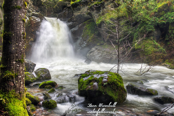
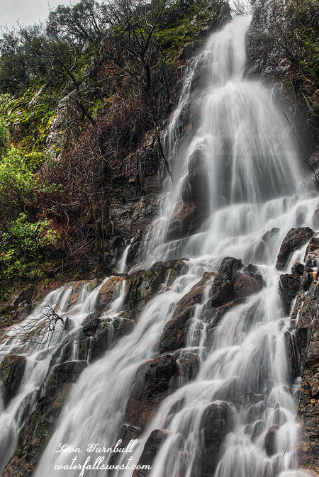
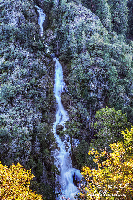
But for now, we have the floods. My hike on this day was magnificent. Waterfalls everywhere. Big streams, little streams, unnamed streams, you name it streams. The water in Butte Creek was raging. This is supposed to be a normal little creek, not a raging river.
Once again, I was hiking along one of those canals, on little narrow metal grates over top of the canal. It was a different canal than last time, and this canyon is not nearly so crazy, ridiculous, and deathly steep as the Miocene Canal in the West Branch Feather River canyon. Still though, there are some spots that are unnerving if you are afraid of heights.
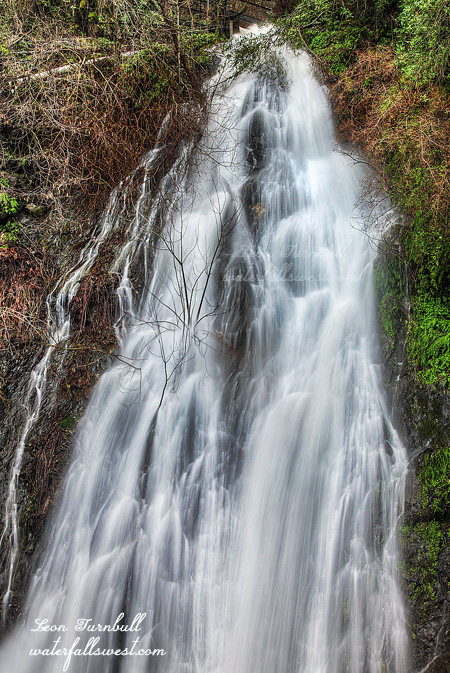
Also, most of the waterfalls throughout this canyon (and there were plenty), were not photograph-able at all, due to being completely obscured by trees and bushes, and I did not take any photographs of them. Only two I felt were worthy, this being one of them, 84 ft. high, and had the largest flow of the creeks in this canyon. Once again, similar to Alder Creek Falls, I had to photograph from the canal on the narrow metal grate, ruining my knees as I knelt on the rough surface, and trying to be very still as I took the photos because any movement would shake my tripod all over the place with the vibration. It was a beautiful day after all the rains, and I saw no one else in the canyon the entire morning.