Last time I tried to go to Curtain Falls on the Middle Fork Feather River was four years ago. The flow in the river was 230 cubic feet per second and I could not cross the river, the flow was too strong and too deep. But my memory told me it was just slightly too strong at that time and I almost made it. This year I decided to try it again. The flow was at 200 cfs so I thought that since it was this much lower, I could manage to cross it easily. Humph. I was skunked again.
It is a long hike down to the Middle Fork Feather River, losing 1600 feet in elevation in 2 miles. That means it is a pretty tough hike back out of the canyon, and when you have nothin to show for it, tis not such a good thing.
This time around, however, I was more concerned about different things. I thought crossing the river would be easy. But some people had reported to me that the trail was in serious disarray. Deadly serious. Impassable. The last section of the trail involves climbing down the side of a cliff on wooden stairs. Since the last time I was down here, the stairs and railings had apparently disintegrated, rotting wood, making the climb down impossible and deathly if you attempt it. One of the persons who told me this is someone I consider a hardcore hiker, so I figured if he could not make it down, then it must be really bad indeed. I have not heard of anyone else going to Curtain Falls in the last four years except one other person, and he reported much the same thing. Could the trail really disintegrate in such a short time? I wanted to go find out, but I was worried about those stairs. Not to mention that I really did not want to walk all the way down there and then not even be able to get to the river. But I figured if I could get past those stairs safely, then I could definitely get all the way to Curtain Falls.
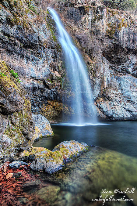
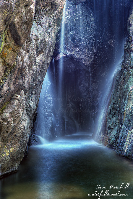
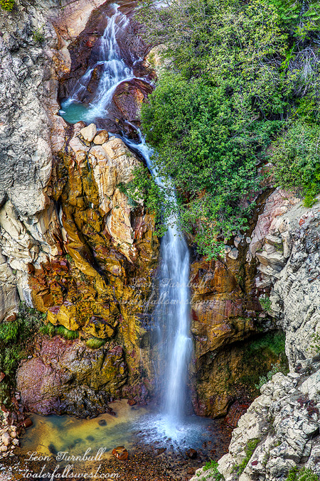
Well I hiked down to those stairs and … they were actually ok. Yes they are rotting and falling apart, and they certainly need repairs, but it was not a dangerous thing to go down them by any means. Ok then, down to the river, go upstream, cross and get up to the waterfall. Easy. Right? Not! Firstly, it was much crazier scrambling upstream and I almost didn’t even make it up to this little pool where you need to cross. I think the reason is because the normal passageway is now plugged with logs so I could not get through it. I had to go a different route, which involved doing a mad scramble up through a crack in the rocks, using my rope to haul me up and praying that the log I was standing on with my full weight did not give way. Holy crackers that was nuts. But I made it up (and back down that crack afterwards, which also was an adventure). When I got to the pool I could see that there was not going to be any river crossing. It was once again flowing too swift and deep. It did not seem to be any better than four years ago either. So I had to take a picture of this baby waterfall and call it a day. If I ever try this again (and I will, count on it), I will not be coming here unless the flow in the river is down to 150 cfs. This is a controlled river, and I have not seen it under 180 in the past year or two, so I don’t even know if they ever let it get so low, but I will have to pay more attention to the flow over the next year and wait for the right opportunity.
The hike back up was outlandish. Not because of the elevation gain, I did quite well on the climb. But the bugs were horrendous, hounding me each step of the way, and driving me bananas. Isn’t it supposed to be winter yet? And there were ticks! Lots of them, oozing off the grasses overhanging the trail. I could not believe it. Ticks in November? I have not heard of such a thing before. There should not be any of these buggers around until the rains start well into December and January at the earliest. It was unbelievable, but at least I did not get any of them biting into my tender and precious skin. It was a gorgeous, but crazy and frustrating day in the Middle Fork Feather River canyon.