MADMAN ADVENTURES
Wake up 3:30am. Drive to Feather Falls trailhead. Arrive in dark. Start heading out to the waterfall.
Sound crazy? Nuts? Insane? Wait til you hear the rest of the story.
First off, this may be TMI but when I arrived at the trailhead I had to use the outhouse facilities there. I noticed a rat crawling around down in the hole. I’m not kidding you. Needless to say I went very quickly.
That was the freakiest thing I saw this day. Which is probably good because I was biking in the dark. Not hiking. I was hoping to be at the falls by sunrise and since it is about 5 miles one way, biking is the quickest option. It is actually a very nice trail to bike, going out is mostly downhill, but fairly gentle, so coming back afterwards is tough but not killer. It is easier to hike out and back but much quicker to bike.
I was also trying out the new camera I just bought. A GoPro Hero head cam. Why would I get such a thing? Well, I have a grand idea of documenting my hikes for the public to view and follow me along. This one is going to be really good I think and definitely not boring, so be watching for it soon.
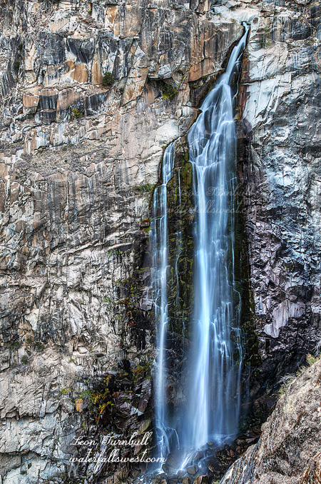
I arrived at Feather Falls a bit later than I wanted. I first went down to the viewpoint. The falls was flowing really quite well, much better than I expected. This late in the year and after two years of drought I thought it would be as low as I have ever seen it. Not so. It was exquisite.
After photographing from the viewpoint it was time for part two of my adventure: crossing the river above the waterfall and try to find a spot on the other side to photograph it. I have never seen a photo of Feather Falls from the other side. Now I know why. (actually I lied – I have seen one very very old photo, but that is it).
I figured the worst part by far would be crossing the river and with the falls flowing higher than I expected, I thought it might be impossible. People have died here including one last year. It is kinda freaky crossing a river above a 410 ft high waterfall but actually it was very easy (don’t try it in the spring though).
Next up was to climb the ridge on the other side and make my way down to a point where I could see the falls. After studying Google Earth I really expected this to be a piece of cake. It looked so open and non brushy. Not quite. It was extremely brushy. I found a trail going in the right direction and thought I would be in luck. At first I thought it was a human trail but after awhile (and after passing a number of bear droppings) I realized it must be a bear trail. Eventually I was stopped by the brush. I could go no farther but I did get to a point where I could see the waterfall. It was too obscured to take a picture but you will see it in the video. So it was not a huge success but at least I got a view of the waterfall (albeit somewhat obscured).
The bike ride back to my car was quite tiring (it didn’t help that I did all that scrambling on the other side of the river). All uphill and 5 miles, but I made it all the way. It is a good thing I am in shape right now from biking to work every day. Otherwise I might still be out there on the trail somewhere.