Johnson Creek Falls

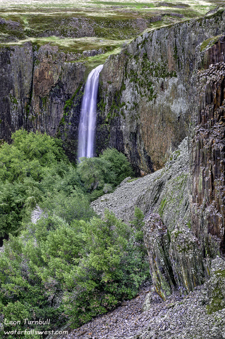
This is Johnson Creek Falls near Etna. My friend Brian was initially the person who told me about this one. You will not find this one mentioned in any of the CA waterfall books. Yet it is certainly a well traveled waterfall among the locals. The Etnans (or Etnanites? Etnatonians?) have done a pretty good job of keeping this one a secret from me until now.

The waterfall is technically on private property. But there is a sign indicating that the trail is open to the public for hikers. That is definitely the kind of sign I love to see. It has been this way for a long time, and obviously the locals come here rather frequently, and are no doubt respectful of the landowners’ property. Thank you, people of Etna, and especially to the owners of this property.

It is not a very easy waterfall to get to. It is only a 1 mile hike, but it is a very strenuous 1 mile. The trail climbs up and up and up to the top of the waterfall. It is a very steep hike, and once at the top of the falls, you are treated to an obscured view of the waterfall across the canyon. I measured the falls to be 118 ft. high, though it really could be higher than that (but if there is more above, then it is not viewable). From this viewpoint, it is necessary to scramble down to the bottom if you want to get a better up close and personal view. It is a very steep and difficult descent. It is also slippery and dangerous if the ground is wet (which it certainly was with the snow around). I managed to get down to the bottom, then cross to the other side of the creek to take my photos. From this low point, you can only see part of the entire waterfall (actually, about 71 ft. of the total 118 ft. height can be seen from the bottom). I imagine that in the spring it would be extremely wet down there from the spray of the falls. This time of year though presented another difficulty: falling ice. While I was down there standing in the middle of the creek taking photos, ice was falling down the waterfall. I was a safe distance away, but it was something that made me a bit wary. I did not stay down there too long.

No Comments

Snow Hiking

On Black Friday, I was excited about trying to hike to Maple Falls in the Marble Mountains Wilderness. At 4200 ft. elevation though, I wasn’t sure if I would be able to due to snow. As I drove up I-5 towards Yreka, I found that there was quite a bit of snow around Dunsmuir (about 2500 ft. elevation). At that point I was about resigned to abandon my idea. If there was this much snow at Dunsmuir, how much more would be at Maple Falls? Yet in Yreka (a higher elevation), there was no snow at all. Hmmm, maybe I could do this after all. So I drove out to the Maple Falls trailhead. At 2400 ft. elevation, there was no snow at the trailhead. It was a 4 mile hike to the falls, and I would be climbing all the way to 4200 ft. That makes for a tough hike, even with no snow.

As I climbed the trail, I began to wonder if this was such a great idea after all. At about 3000 ft., I started to see some snow on the trail. Nothing too much yet. At 3200 ft., there was a lot more snow on the trail, but it was still off and on, and only a couple inches, so nothing to be concerned about. Then at 3400 ft., I was trudging completely through the snow. I was about halfway to the falls at this point, and it was still only a few inches deep. I came this far, surely I could make it the rest of the way. It would be dumb to turn back now. Or would it? At 3800 ft. elevation, I was now walking through 6 inches deep snow. I was following deer tracks up the trail. Surely if the deer could do this, then so could I. Right? I was almost there. I was not turning back now. That would be really dumb. Then I saw the hill for the last half mile of the hike. It went straight up the side of the mountain. By 4000 ft. elevation, I was clambering through a foot of snow on the trail. But then a new problem presented itself. The waterfall was not in the right spot as it was labeled on the USGS topo maps. It turned out that it was actually another half mile further than it was supposed to be. That is another half mile of very difficult trekking up a mountain through deep snow. I had intentionally left my snow shoes back in the car because I knew I would have been carrying them for most of the hike, and I did not want to carry them for most of a 8 mile hike (or as it turned out, 9 miles). By 4200 ft. elevation, I was hiking through 2 feet of snow now. Finally, I could see the waterfall across the canyon. But there is not a good view of the falls from the trail. So now what? I climbed all the way up here, and I cannot even get a picture of the falls? The only thing I could do was scramble down the very steep and treacherous slope to try to find a viewpoint of the falls lower down. So that is what I did, very carefully, checking my footing with each step. I at last managed to get down to a point where I could take a photo of the falls. It is not a great one, no doubt. In the summer, I think you could get a lot closer to the falls, but this is the best I could do, under the circumstances. It also is not nearly so big as I had been informed. It was supposed to be a 60 ft. high waterfall, but I measured it as 33 ft. high. It was not very impressive, and I wasn’t too happy about coming out here all this way in the snow. But at least I made it, and although I was very tired at the end, it was still a great Black Friday hike out in the wilderness.

ONE MORE IMPORTANT NOTE:

Effective Dec. 1, 2010, my website (waterfallswest.com) is changing over to be a subscription based site. The extensive waterfall information I provide on the site is no longer free (for California, Hawaii, BC, and Oregon only). Why am I doing this now? The reason is simple: it takes a lot of time and effort and money for me to maintain the website as a free service to everyone, and I provide a lot of information on the site, and am continually adding new waterfalls to the site. I now have visited over 500 waterfalls in the western U.S. and Canada. I need some compensation to offset these costs in order to keep the web site up and running. I am only asking for $15/year for a basic subscription, which is not very much at all. I hope you will agree and contribute a small fee to help maintain this website and help keep it going into the future. Please see the following page for more info:

http://www.waterfallswest.com/page.php?id=faq

It is worth noting that I have more than 530 waterfalls on my site now that I have visited, and this includes over 300 California waterfalls. All these will be included in the Basic subscription (for now, states other than California, Hawaii, BC, and Oregon will remain free). In addition to this, I have added over 170 select California waterfalls that I have not yet visited, and these also will be included in the Basic subscription (these are mostly from southern California, and other areas in CA that I have not yet visited). So that is about 470 California waterfalls that will be part of the Basic subscription. But I have catalogued over 1200 waterfalls in my database throughout all of California, and all these remaining 700+ waterfalls will be included in a Premium subscription to my site ($35/year). So you will have access to over 1200 waterfalls throughout the state of California, and all information that I have about them (including GPS co-ordinates). That is far and away a much more extensive listing of CA waterfalls than you will find anywhere else, either on-line or in print.

2 Comments

The Cool One

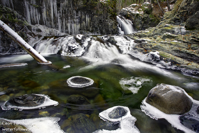
This must be the coolest 14 ft. high waterfall I have ever seen. It is Shackleford Falls in northern California, near Fort Jones. It is super easy to get to, there is a lot of flow in the creek throughout the year, and the photo possibilities are practically endless. I was running around here like a giddy schoolboy, and could have spent a lot more time here than I did.

I came here on Black Friday, one of three waterfalls I visited that day. I was hoping to at least get to one more, but I ran out of time and energy. My first hike of the day was a grueling 9 mile jaunt, half of it through deep snow, and that really played me out. I will post a photo from that hike later, but I really wanted to post this cool little waterfall first.

Black Friday is my favorite day of the year to go hiking. Everyone else is either sleeping in, or else they are out standing in line in the cold, waiting to go shopping. No one is out hiking. That was certainly the case on my first hike, but I did see a couple people here at Shackleford Falls, and also I saw a bunch of people at the third waterfall I visited. What the hey? You people are not allowed to go hiking on Black Friday, did no one tell you! Only I am allowed to go hiking on Black Friday! I have dominion over Black Friday hiking in northern California. Ah well I guess I can’t stop people from getting out and enjoying an awesome day in the outdoors, nor would I want to. They perhaps even got the great idea from me, anyway.

After my killer 9 mile hike, I stopped here at Shackleford. The sun was forecast to disappear behind cloudy skies, and although it tried valiantly to do otherwise, by the time I got to the waterfall, it was bye bye sun, right on schedule. That meant I was free for the rest of the day to photograph waterfalls to my heart’s content, without having to deal with harsh sunlight. Leon was a happy camper (thank you, God!).

I was even happier when I saw this little waterfall (especially since the first waterfall I saw that day was nothing very exciting). It is only 14 feet high, but it is so amazing. There was snow and ice all around it, icicles hanging off the side cliff wall, icy rocks submerged in the water, great flow for late in the year, easy to get to and climb around (just don’t fall in the icy water), and the coolest part was the ice wall directly in front of the waterfall (which you can see in the above photo). The water from the falls just sprays against that wall, and it freezes up so coolly. To get a good view of it, I had to climb up on the icy and very slippery rocks close to the waterfall. There is a lower cascade you can’t see here (I will probably post that photo showing it as well, later). If I were to slip on the ice and fall in the drink, it would have been a very cold slide down that cascade. I imagine in the summer that people do slide down it. The waterfall may not be as amazingly cool in the summer without the ice, but I still think it would be a pretty nice one to visit.

7 Comments

Metlako

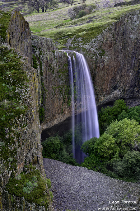
This is beautiful Metlako Falls along Eagle Creek in the Columbia River Gorge. It is about 100 ft. high.

No Comments

Finally!

Fifth time’s a charm, I guess.

Friday seemed like a perfect day to once again try getting to the Lower Traverse Creek Falls. This time I was ready and determined to get down there. I’ve tried four separate times over the past few years, in various ways, and did not make it. Mostly because I was looking for an easier way to get down there. This time, I was going to get down there. The hard way. No turning back this time.

I arrived at the trailhead at 6:30AM, and started trekking down to the upper falls. I noticed that the overgrown brush on the trail seemed to have been cut. Indeed, it was most certainly not nearly so overgrown as when I was here a week ago. Apparently, someone had been down here in the past week with clippers. I guess that is a good thing. As I approached the upper falls, though, I became a bit perturbed. More trash. Beer cans. I was just here a week ago and cleaned up all the trash, and now in less than a week, it is trashed again! Could it be the mysterious person with the clippers? Perhaps. Whoever it was, certainly irked me.

Anyway, I climbed down to the base of the falls, and noticed that Traverse Creek Falls was in single segment mode now. I was expecting that, after a week of no rain. It was still flowing decent though, and I felt a trip down to the lower falls was still in order for this day. So off I went.

The going was not too bad at first. I started off following the creek bed. The toughest thing is watching your footing on the slippery rocks. I eventually picked up a trail. I remembered this trail from when I went down to Bear Creek Falls a couple years ago. It seems pretty very well defined now, but it is a lot tougher going, because it is still overgrown and there are a lot of up and downs. But clearly, quite a few people had been on it. The trail eventually goes quite high above the creek, and I remembered that it just kind of ended once you get down to Bear Creek. The same was true on this day. As I approached Bear Creek, the trail petered out. I decided to head back down to the creek level and came out at the Bear Creek confluence. From there, I continued down the creek bed. From Bear Creek, the going was fairly easy. Until you come to the dead end. Which happens to be just before the waterfall.

At this certain point, the cliffs on each side of the creek converge into a narrow channel. There is no way to continue at the creek level. Unless you want to swim. I didn’t realize the waterfall was just down from here. I thought it was actually a lot further downstream. Nonetheless, I found a path heading up the cliff. Straight up. Well, I didn’t come all the way down here for nothing. So up the cliff I went. And up. And up. I eventually got up to a point and found the “trail” again, traversing across the cliff. As I traversed downstream, I saw the waterfall far below me. As I said, I was surprised to find it here. I was sure it was much further downstream. But I was certainly happy to have it here. Now I just needed to get down to it.

I approached the top of the waterfall, and found it to be very cliffy. Far too cliffy for my liking. There was a rope going down from near the top of the falls to the bottom. I looked at it closely, but it just seemed a bit too crazy. There were not very many footholds down the cliff. I’m sure the young and daring would go down here with no difficulty, but that is not me. So how could I get down, then? It seemed to me the best option was back up to the “trail” and try to come around the cliff section downstream. That plan worked great. Along the way, I managed to lose my hiking pole. One minute I had it, scrambling through brush, and the next I didn’t. But I didn’t know what happened. Did I leave it back at the top of the falls? I was almost at the bottom, so I continued on without my pole, planning to look for it on my way back (and fortunately, I did find it on my way back – I had somehow just dropped it in the brush).

I worked my way down to the stream and then back up to the falls. Yes! After all these years, I finally made it to Lower Traverse Creek Falls. It is a pretty one, though much smaller than I thought. I had been told it was 40 ft. high. Not even close. I measured it to be 22 ft. high. Smaller than the upper falls. Nonetheless, it is a beauty. And in such a remote, hard to get to location. And yet, obviously many people had been here before. There were even ropes hanging off some trees, that kids had set up for swinging off into the pool below the falls  in the summer. It took me a full 2 hours to hike down here from the upper falls. It was a very tough hike.  I can’t really imagine that kids would come all the way here to swim in the summer. But there it is.

Eventually, I made my way back up the cliff, and worked my way back up the creek bed. I stopped at the Bear Creek confluence to rest. I thought about going up to see Bear Creek Falls while I was down here. The light was still good, being an overcast day. But I was really quite tired from my hike, and I still was only half way back. I decided to skip Bear Creek for another day. And that was a good decision. By the time I got back to the car, my legs were really cramping, and I was totally exhausted. But I did manage to pick up those beer cans and some other trash I found along the way. Perhaps it will stay clean now for more than a week, this time.

2 Comments