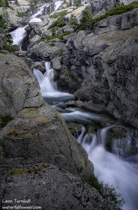
Well I really hadn’t been out hiking in a long while and I was anxious to get out and see something. It’s been awfully hot, it is mosquito season, and the waterfalls are well past their peak by now.
I knew 790 ft. high Horsetail Falls would be flowing well, however. And since it was 100+ degrees in Folsom, I figured it was time to escape the heat and head into the mountains for a breath of cooler air. I watched the temperature gage in my car decline from 100 as I drove up the hill. When I arrived at the trailhead, it was at 83. Well that is not too bad. Any higher and it would have been a bit too warm for hiking, so I was pleased, and it would get cooler as the evening went on.
There were lots of people and cars parked at the trailhead on this Sunday evening. It is a very popular trail, but when I have been here before, the people are usually all exiting by sunset time. This was what I expected again. I would see a lot of people on the trail while I was hiking up to the falls, but once I got there I would be all alone. That was almost but not quite the way it worked out. I did see a lot of people exiting as I hiked up to the falls. When I arrived at the waterfall, there was no one else in the vicinity where I was photographing the falls, so I did have it to myself mostly. But there were still quite a lot of people descending from the top of the falls surprisingly, so I was not the only one in the area, and I was not the last one to leave the area either (when I went back down). The best thing though was that there were ZERO mosquitoes! I’ve never really encountered a lot of mosquitoes here before, but when I was here at the same time a couple years ago, there were a lot more. But zero is very good! I wonder if mosquito season is about over now. Perhaps it is time to head out more into the high country.
Anyway, Horsetail Falls was flowing quite well, but not quite what I was expecting. Considering the large snow pack we had this year, I was expecting this waterfall to be amazing, but it was clearly past its peak. It had about the same flow as it did when I visited here in July two years ago (and that was a drought year). Nonetheless, it is still an awesome waterfall. I think though that I arrived a bit too late in the evening for best light. The waterfall was all in shadow and the nice warm light on the rocks was all gone. I probably should have been there an hour earlier in the day.
As I was photographing the falls, I was approached by a family coming down from the top. The very friendly guy asked me if I could photograph them by the waterfall, and he would pay me. I said sure, and that he didn’t have to pay me. But he insisted on giving me $10. Well that was enough to pay for my parking and a hamburger later. Sweet. Anyway, I photographed them by the falls. We talked for awhile and then they went on back down while I took a couple more shots of the falls before I headed back down myself. It was a lovely evening.
Please sign up for one of the new Waterfall Photography workshops I am offering this Fall. Sign up by July 31, and receive a free 20-30 print of your choice.
Posted in Uncategorized by leapin26: July 21, 2010
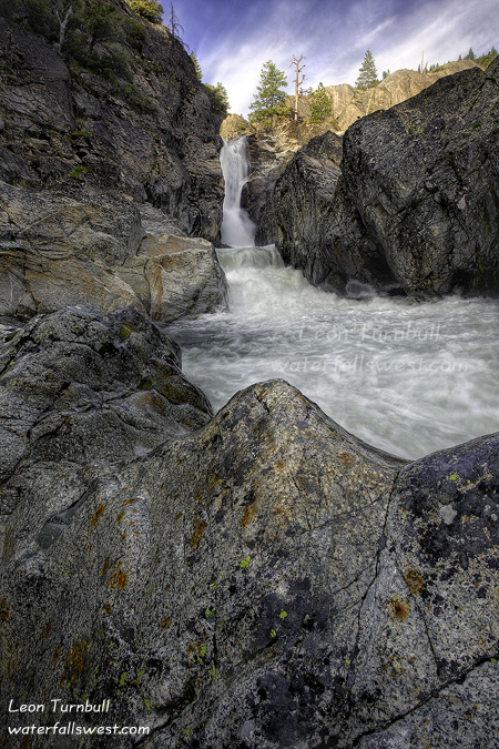
On Father’s Day, I drove up to Bowman Lake in the evening. The Tahoe Natl. Forest website said the road was still closed due to snow. But they are always behind and never keep their site up to date. I thought I would try it anyway. And I was right in trying it. The road was free of snow and open all the way up to Bowman Lake. There were quite a few other people out making the drive up there as well. But no one was going where I was planning to go. Because no one even knows about it.
The outlet from Bowman Lake is Canyon Creek. It flows down down down into the South Yuba River. And it makes a few waterfalls along the way. Not too many people know about these waterfalls below Bowman Lake. But this one here, which I am calling Upper Canyon Creek Falls, is not too hard to get to. If you stop at Windy Point on the road up to Bowman Lake, you can get a grand vista of this canyon, and see the creek rushing hard down from Bowman Lake, zigging and zagging, and winding its way down the canyon. If you look straight across from this point, you will see the creek disappear into the trees, then turn back away from you. This is where the waterfall is. If the trees were not there, you could likely see the falls. But you can’t get down there from Windy Point. There is a huge cliff in the way. You need to hike down from the other side, starting nearer to Bowman Lake.
The hike begins on a logging road. It was hot and muggy. The mosquitoes were out in force. I had to put on bug juice for the first time this year. I hate that stuff! But I got some from REI that was deet free, and it seemed to work very well once I put it on. The bugs were staying away from me. It is a pretty easy hike down the logging road until you get near the waterfall. I could hear and see the falls from the road, but how to get down to it? I found an open area from the road and started going cross country. As I got closer to the creek, I could get a pretty good look at the falls. It was a nice one. But once down at the creek, I was still far away from it. I had to work my way up the creek to the falls. Things got a bit more difficult and brushy, but I managed to do it. Now I was close to the falls, but there was a big cliff in the way, as the creek drops into a narrow gorge, and you can not see the waterfall. The only way to see it would be from the middle of the creek. The creek was rushing much too fast to consider wading or crossing. But fortunately, there were some big rocks that protruded right out into the middle of the creek. I could hop out on these rocks into the middle to see the waterfall, and take my photos. If the creek was flowing any harder, these rocks would have been submerged and this would not have been possible. As it was, things were a bit dicey. I was getting splashed by the water, and every once in a while, more of the creek would splash over onto the rocks, and all the while the creek was raging past me. The really bad thing though is that I was downstream from the dam at Bowman Lake, and if they decided to let out more water from the dam, I would have been in serious trouble. But I knew that the outflow from the dam is very consistent and this scenario was highly unlikely. Anyway, it is definitely a very cool spot. And the waterfall is a very cool one. I measured it to be 44 ft. high. I was extremely happy to have found this on Father’s Day. A great day indeed.
Posted in Uncategorized by leapin26: July 19, 2010

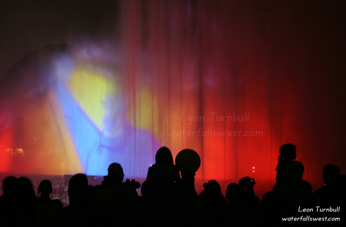
On one evening at Disneyland we went to see the new World of Color show. It was an incredibly spectacular display of water, lights, and fire. It was also a madhouse.
This show was not organized very well in terms of traffic control. The best place (and really the only good place) to view it is from the front row. But they don’t open “the gates” until a couple hours before the event. Then it is a mad rush of people down to the viewing area. We had kids so we couldn’t just run down there like everyone else. Thus we couldn’t get a front row spot, so we settled on the second viewing area back from the front. The good thing about this spot is that we wouldn’t get wet by the water works from the show, and this allowed me to take pictures. But the bad thing is that we didn’t have a clear view of the show, and there were many people in front of us (and thus, in my pictures). If I were to go back for this show, I would definitely want to experience it from the front row. However, I don’t think it would be possible to take pictures from the front because you get completely drenched from there by the water.
The World of Color show is a very challenging thing to photograph. These shots were all hand held, in low light, with the light changing constantly from dark to bright to very bright. It was impossible to focus, or get any kind of consistent exposure. Nonetheless, I did have a few shots that turned out not too bad. These were my favorites.
On another note, please sign up for one of the new Waterfall Photography workshops I am offering this Fall. Sign up by July 31, and receive a free 20×30 print of your choice.
Posted in Uncategorized by leapin26: July 16, 2010

We just returned from a nice family vacation to Disneyland. It was an adventurous trip.
It started out the first day with a trip to the ER. For my daughter and myself at the same time. Nekoda just had a bad fever but my wife was worried about ear infection. She did not have that but did have a virus that needed antiobiotics to get rid of. As for me, well let’s just say it was nothing serious and I was able to walk around Disneyland for 4 days without too much pain. But it does mean that my backpacking trip to Yosemite next weekend will be canceled, and I will need to return to the doctor to get the problem taken care of. Bummer.
As for Disneyland, the kids (my wife included) had way too much fun. The weather was very nice (not too hot), and the crowds were quite manageable (surprisingly). We rode Pirates of the Caribbean about 7 times (well, my wife rode it 7 times). That is now Jadon and Nekoda’s favorite ride as well. We saw the fireworks show and the new World of Color shows (both very impressive). The best show I thought was the Abraham Lincoln show, which was incredibly inspiring (yet sad that so few people go to see that). My daughter was ecstatic because she got to meet a lot of the princesses. We stood in long lineups for her to do that, but seeing her face light up when she met them was incredibly priceless. I’m not sure who her favorite was (she loved ALL of them). Jadon even got to dance with Ariel in a show and that was too cool (that’s my boy!).
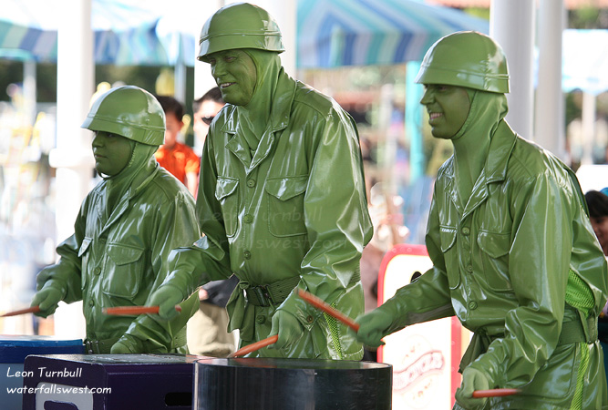
I took a lot of family pictures of course. I also tried to get some shots of some of the characters around Disneyland, and I am posting here a few of my favorites.



Posted in Uncategorized by leapin26: July 14, 2010
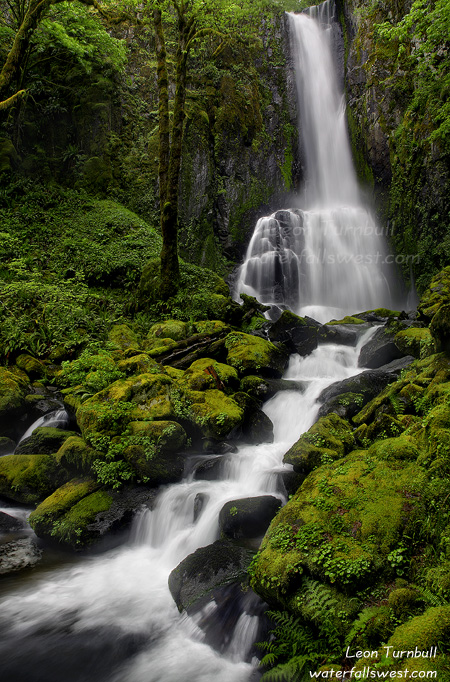
Back to Oregon again. This is 119 ft. high Kentucky Falls, which is found out in the middle of nowhere in Siuslaw National Forest, at the end of a 2 mile hike down the beautiful Kentucky Creek trail. Right beside this is North Fork Falls, which I posted earlier. Both waterfalls are very spectacular. Kentucky Falls was particularly difficult to photograph due to all the mist from the falls. But somehow this shot turned out not too bad.
Posted in Uncategorized by leapin26: July 7, 2010