With all the forest fires burning in California this summer, be sure to check conditions before you head out hiking into the wilderness. As of now, there are 96 active fires burning in the state, but that is down from over 1000 fires burning just about a month ago. And I suspect we’ll be having fires throughout the summer since it will continue to be hot with no rain.
There are currently many trail and road closures throughout the state, and this affects quite a few waterfalls in California. These are the closures in northern California that I currently know about. This list is subject to change at any time. As I become aware of any changes, I will post it in the comments to this blog entry. (and feel free to add any comments yourself that you know about).
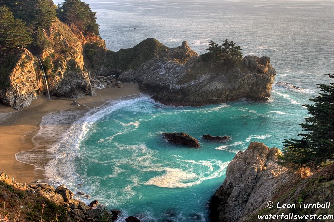
McWay Falls, Canyon Falls (Julia Pfeiffer Burns SP)
Pfeiffer Falls (Pfeiffer Big Sur SP)
Limekiln Falls (Limekiln SP)
Feather Falls
Pacific Crest Trail (Plumas Natl Forest)
Foresthill Rd from China Wall to Sailor Flat – Euchre Bar, Italian Bar, Mumford, Beacroft and American River trails are closed (affecting waterfalls in the NF American River area)
North Fork Falls (Emigrant Gap)
Bowman Lake Falls, Faucherie Lake Falls
Killer Fang Falls (Washington)
Canyon Creek Falls (Trinity Alps)
Whiskeytown Falls, Crystal Creek Falls, Boulder Creek Falls, Brandy Creek Falls (Whiskeytown NRA)
Mill Creek Falls (Lassen NP, due to construction, not fire)
Hidden Falls (Auburn, due to construction, not fire)
Posted in Uncategorized by leapin26: July 16, 2008
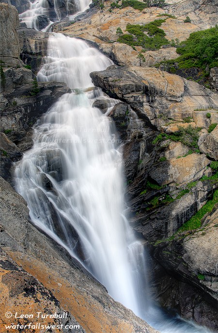
This photo shows the middle section of Horsetail Falls. It is an incredibly spectacular 500 ft. waterfall along Pyramid Creek, coming down from huge Lake Aloha in the Desolation Wilderness. The waterfall flows fairly well year-round, but it really is spectacular in the spring when the snow is melting. It is not even close to being at full force here, though there lots of water in the falls. It is pretty much impossible to photograph or view the entire waterfall in one setting. Little sections is the only way to photograph it. This little section is probably 100 ft. high or more.
Once again, I was on very dicey granite rock close to the edge, trying to photograph this section of the falls. Don’t worry. I was safe enough. I am always very careful around waterfalls. Nonetheless, I wouldn’t have wanted to get any closer to the edge.
I came up here after work last Friday, trying to escape the smoke and heat from the city. It is about an hour drive from Folsom. My idea was to arrive at the trailhead about 5:30pm. It is about an hour hike into the falls, photograph there for about an hour, hike back to the car by about 8:30pm (still light out), and be home by 9:30pm. All that worked out pretty much according to plan. There was still a lot of smoke and haze in their air, but the smoke didn’t bother me hiking. I met only a few people on the trail, coming back from the falls. There was no one around once I arrived at the waterfall. It was just really nice to spend time at Horsetail Falls all by myself. Just sit back, relax, and enjoy the beauty of the Creation. This is usually a very popular location on weekends. But on a Friday evening, there was no one else up at the falls and I had it all to myself. Sweet.
Posted in Uncategorized by leapin26: July 15, 2008
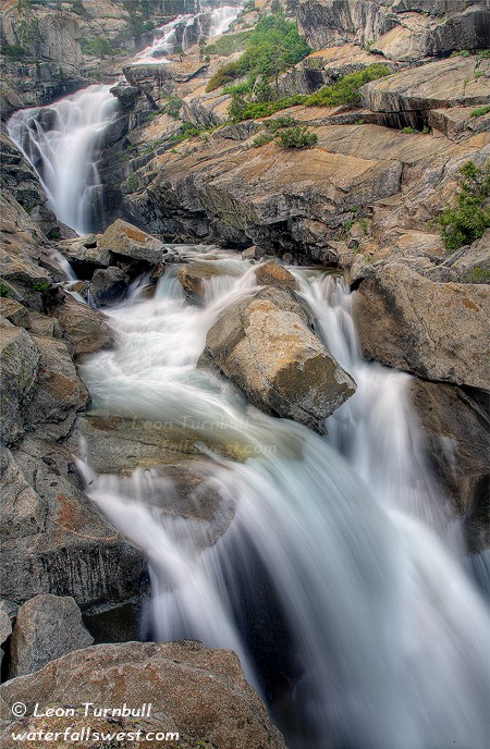
Photographically speaking, Horsetail Falls near Lake Tahoe has been my long-time nemesis. I had been here to this waterfall plenty of times before, but had yet to come away with any decent photo of it. Does every photographer have a similar nemesis, or is it just me? I’ve been here in spring, summer, fall, sunrise, sunset, you name it. It is a difficult waterfall to photograph, and I think it has a lot to do with all the non-colorful granite rock that the falls tumble over as well as the lighting.
I wanted to try coming back to Horsetail Falls again, at sunset. I thought the light would be better on the falls at that time of day. But with all the fires in California this year, there is just a huge band of smoke and haze, which makes for a light overcastness over the entire sky. So although the light wasn’t what I was looking for on this day, overcastness is indeed good for photographing waterfalls. I thought I came away (finally) with some very decent photos of Horsetail Falls. But even so, I’ll probably be back again next year to try to do better.
I especially liked my composition of this shot. I was as close to the edge as I dared possibly go, trying to get that lower waterfall section in my photo. The granite rocks in this area are extremely smooth and slippery, even if not wet. And it is a big drop-off into a raging creek if you slip and fall. That would not be too fun.
Posted in Uncategorized by leapin26: July 13, 2008
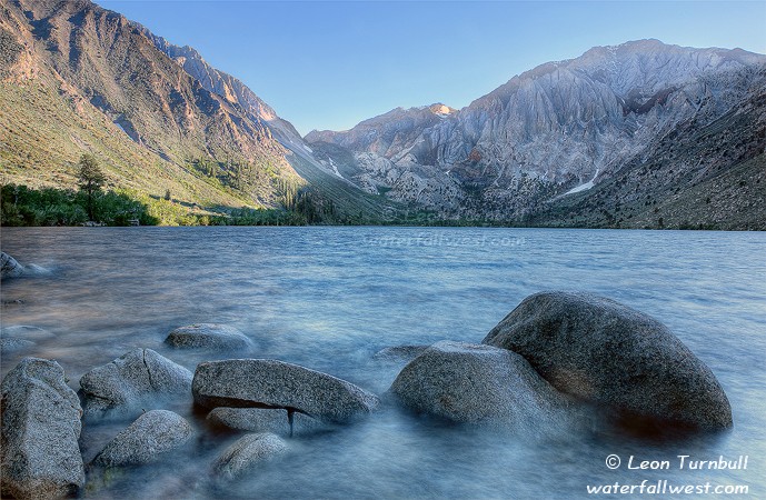
Convict Lake, is as pretty a little lake as you ever will see so close to the highway. And yet, it doesn’t feel like you are close to any highway. But it can be a rather popular lake for fishing and such, however when we were here it was terribly windy and there were no boats out in the water, and not many people around either. The idea was to be here for sunset, but we were a few hours early for that. And I didn’t want to wait around so late when everyone was so tired. This lake is actually much better to photograph at sunrise anyway.
I did wait around until closer to sunset. Because the lake was so choppy, I used a long exposure to try to smooth out the water a bit. The kids were throwing rocks in the water right beside me, and trying to splash myself and my camera. I had to keep telling them to get off those rocks in front of me until I was finished taking my photo. Ah kids, what can you do.
Posted in Uncategorized by leapin26: July 10, 2008
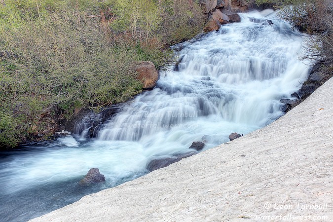
The outlet stream to the Triplet, er I mean Twin Lakes is called Mammoth Creek. It drops through a scenic little canyon on its descent to Mammoth Lakes village, and it creates some waterfalls along the way. Right below the bridge at the outlet to the lake, you can find this splendid little 33 ft. high cascade. There is a little trail leading down to it, and it is not too difficult. When the snow has melted more, I think you could get right down to the base and get in the creek if you so desired (which I would, of course). But this day, that snow on the bank was complete ice, and had I attempted to get down there, I would have taken a nasty tumble into the creek, and been washed downstream. So, I took this photo instead from a rather safe, but still scenic, vantage point.
Now if you have Chris Shaffer’s Waterfalls book you may know he mentions Mammoth Creek Falls in it as well. But it is not this waterfall. There is, apparently, another nice little waterfall on Mammoth Creek further downstream from here. I did try to find this other waterfall. But I could not find the “trail” he referred to in this book, and despite annoying some deer having breakfast, I could not see any way through the thick manzanita brush down to the lower falls. I initially concluded that Shaffer was actually referring to this waterfall I have pictured here, and his directions in the book were just really out of whack. However, upon further thought, I realize he is indeed referring to another waterfall further downstream. I do not understand, however, why he made no mention at all of this nice cascade on Mammoth Creek, which is quite easy to reach, and is certainly no slouch in terms waterfallity (is that a word? well, it is now).
Posted in Uncategorized by leapin26: July 8, 2008