BOOM BOOM BOLAM
It was a stressful week, and I was so very much looking forward to getting out for an overnight backpack trip on Mount Shasta on Labor Day weekend. But where would I go? Could I even do it? The smoke from fires has been particularly bad up north. Would it be too unhealthy to hike? Would the creeks on Shasta even be flowing? I had no idea. I called the Ranger station in Mt Shasta. They had no idea. Isn’t it their job to know these things?
It has not been hot enough recently. Yes, you heard me correctly. July was hot. The first part of August was hot. But the last couple weeks have been very cool. Too cool in fact. The glaciers on Shasta would not be melting very much right now. Thus I was concerned that the waterfalls would not be flowing any more for this year.
As I drove north and passed Redding, all of a sudden the smoke in the sky became horrendous. This was from the Hirz Fire. The sky was ominous. I could see the orange glow from the fire above the mountains to the east. If it was this bad at Shasta, I could forget about hiking. However, as I got closer to Shasta, the smoke dissipated and the sky became much clearer. Things were looking up. But what about the creeks? I stopped at the Whitney Creek crossing along the highway to check it out. The creek was flowing. Not super great mind you, but it was flowing. It was early morning, so it would be much better in the afternoon also. But if there is water at the Whitney Creek crossing, does that mean Bolam Creek will be flowing also? Or just Whitney? (the two creeks join together before the highway) I have seen Bolam completely dry when Whitney flows. And I have seen Bolam flowing well when Whitney is just a trickle. So what would it be like today? The only way to find this out is to hike all the way up to Bolam Creek as I had originally planned.
I have hiked up to Bolam Creek Falls before, but did not get to the upper or middle falls. It was a killer hike just to the lower falls, and I had no energy or time to continue up the mountain. This time around, I planned a different route. A much easier route, and I would be camping at Bolam Creek as well. I would have plenty of time. It was going to be glorious.
It was a beautiful day. I was feeling so refreshed as I started this hike, but my pack was very heavy. I was carrying 3 1/2 L of water, which should be enough (hopefully) to get me up there and back. I was not certain what the water situation would be up at Bolam Creek or if it would even be flowing, or if it was flowing could I even get down to it? If you look at Google Earth it does not look possible to get down to creek level. The canyon is seriously steep. So that meant I had better take enough water with me to be safe and not sorry.
The trail starts out well for the first 3 1/2 miles. It is well-traveled and a gentle grade, climbing up 1500 feet of elevation. 99% of the people using this trail are summiting Mount Shasta or trying to anyway. But not me. I am looking for waterfalls. So when the trail ends at the point where the climbers go upwards and onwards, I needed to go cross country over to Bolam creek. It was fairly easy going.
The geology on this side of Mount Shasta is fascinating. I crossed over a number of very old and very dry drainages. These are not marked on any maps. They looked to be volcanic, or glacial, or both. At least a couple for certain were obviously glacial. Glaciers that have long since disappeared, probably hundreds of years before USGS made its topographic maps. It seems to me that some people forget that glaciers have been melting pretty much continually since the last ice age, thousands of years ago. If they are continually melting, then they will eventually all disappear, right? Are they melting faster now? Perhaps they are, but it should not be a surprise to anyone that glaciers are melting. On Mount Shasta, the Coquette Creek drainage is dead (very sadly). I declared it dead two years ago after I came up to visit Bolam Falls. I do not think this waterfall has flowed significantly or at all in over 10 years. What a shame. However, it is not surprising. There is not enough glacier above to melt into this drainage anymore. I would pay a lot of money to travel back in time and see Coquette Falls flowing as it once did. But the Bolam Creek drainage still flows.
I descended down into the Coquette drainage, the first real steep section of my hike (which I would have to come back up the next day), crossed it at the dry waterfall and made my way over to Upper Bolam Creek Falls. There was a perfect campsite right beside the waterfall viewpoint, with a view of Mount Shasta and the waterfall in one shot. What a perfect place. I was so happy. I set up camp, had my dinner, then decided what to do next. I had thoughts of crossing over Bolam Creek to Whitney Creek, but I could see no way across. The canyon was crazy steep on both sides. I decided to just stay at Bolam and I’m glad I did.
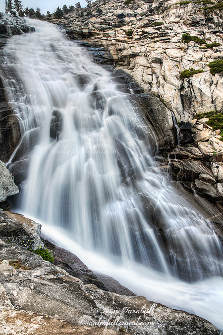
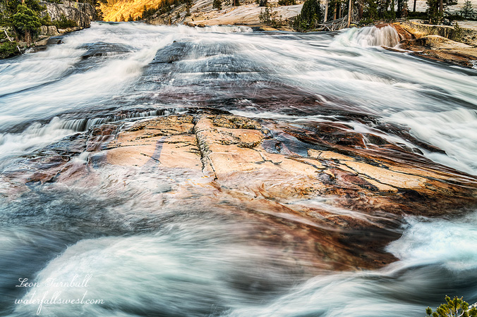
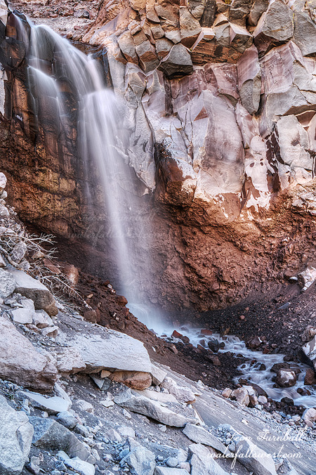
In the evening I went down or tried to get down the Coquette drainage to get to the base of Bolam Falls, but it was too steep, the ground was very unstable and crumbly. Nonetheless, I did find a path over to it, after I had almost given up. It was awesome to be up close to this marvelous 80 ft. high waterfall (pictured here above). After this I climbed back up, got down to the middle falls (which was crazy steep and dangerous- but I managed), and then photographed the upper Falls from top of the ridge.
I was now down to a half liter of water. I still had found no way to get down to the creek level at any place. The creek was also flowing incredibly dirty and it was not really drinkable. So what would I do? A half liter would not get me back to my car. I went to sleep, very dirty, and very tired. In the morning I decided I’d have to get down to the creek. I found a way, and filtered some water. The creek flow was much lower in the morning, and also a lot cleaner as well. Now I had plenty, and even enough to enjoy a cup of coffee with my breakfast. It was a beautiful morning, and I was feeling terrific. After breakfast, I packed up the gear and headed back up the hill (and then entirely downhill after that initial tough ascent from Coquette). It was a fantastic couple of days in the Shasta Wilderness.
No Comments