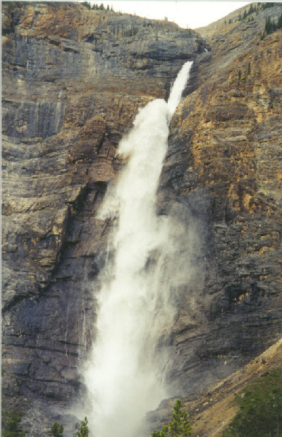
Takakkaw Falls Easy


Image 1 of 1;
Click arrow to scroll or click image to enlarge
Location: Yoho National Park, near Field, Field region
Stream: Takakkaw Creek
Alternate Names:

Height: 1250 ft. (381.1 m)
Access:   car   wheelchair   dog  
Distance: n/a
Elevation:
Season: Jun-Oct
Form:   tiered
Lat/Long:51.500301, -116.473618
Directions:Along Hwy #1, just a few minutes east of Field (40 km west of Lake Louise). Turn on Yoho Valley Road and follow it to the end (14 km). It is a narrow, winding road not made for campers/trailers.

Takakkaw Falls is the second highest waterfall in Canada. Takakkaw means "magnificent" in Cree. And it is. We love how the top of it "blasts" off a ledge and down over a thousand feet to finally hit the bottom. Very powerful. Obviously, this is popular with the tourists, so you will not be alone. But it did not seem really "too" busy when we were there, and you can essentially walk right up the embankment to the base of the falls (getting a bit wet in the process).

Other Falls. From Takakkaw Falls, take the Yoho Valley Trail to see 4 more waterfalls: Point Lace Falls, Angels Staircase, Laughing Falls, and the very impressive 260 ft. (79.3 m) Twin Falls. The moderate trail is 5.2 miles (8.3 km) one way.

Get Google Maps directions to trailhead

Zoom out on map to see all nearby waterfalls:

Other waterfalls nearby:

Whisky Jack Falls 1.44 miles
Point Lace Falls 1.63 miles
Laughing Falls 2.83 miles
Twin Falls 4.45 miles
Hamilton Falls 5.98 miles

Rockies Waterfalls Home Page