LOST !

I got up super early for this one: one last hike on the Memorial Day long weekend. Way too early indeed. 3AM early.

The trouble with this hike is, and it’s why I have not done it before, is that the sun gets on the waterfalls very early and it is a very long hike to get to them, which makes it almost impossible to get to them in good light. However, I found a better way. I just was not sure if I could do it this early in the season, but good news: there was no snow on the road and I could drive all the way to the new trailhead. This might actually work after all.

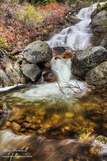
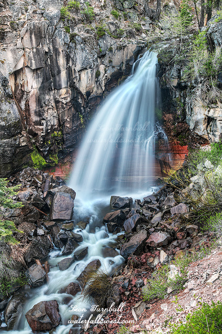
Indeed, it turned out to be a very easy hike to the waterfall. Only 1.5 miles instead of 5.5 miles. That’s a darn good shaving. Very little elevation gain, and only a little bit of cross country hiking was involved, nothing too difficult. I got to the falls in good time and it was flowing great. It is 41 feet high and it is a beauty.

In case you are wondering, I purposely made a longer exposure of this waterfall than usual. Some people do not like the silky waterfall look with longer exposures, and that is perfectly fine, and I agree that in some cases it is better to use a shorter exposure. Mostly, though, only with powerful waterfalls, not with smaller waterfalls. I am adamant about this. A short exposure with smaller waterfalls like this one will make the falls look choppy and uninteresting. Be a better photographer. A longer exposure will give the image a very artistic feel, and that is what I was trying for with this shot. I think I succeeded.

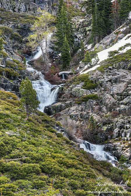
I decided not to go down to the bottom of the falls, as the view from up above is stellar anyway, but also I wanted to try to get to the upper Falls in good light. I figured I could go to the bottom afterwards if it was still in shade when I got back down to it. However, finding the upper Falls was troublesome to say the least. It is not in the place where it is supposed to be, in fact there is no waterfall at all where it is marked on all the maps. Did it even exist? No wonder I’ve never seen any photos of it. I had to do some serious off-trail exploring through the snow, but eventually I found the upper falls and it’s a nice one as well. Photo is coming later.

By the time I found it, I figured the lower Falls would be in the sun so I decided to go back a different route thinking it would be much much easier. Big mistake. It was not only harder, but I got lost. Not really, but I definitely would’ve been seriously lost and likely still out there if I did not have a GPS.

The first trouble was that snow, which covered most of the trail. The second trouble was that the actual trail did not precisely follow the USGS topo maps. Despite the snow cover, I was able to follow the trail fairly closely and even if I missed part of it I always found it again quickly. Until …. I came to a big Meadow and swamp, where I lost the trail completely and there was no finding it again. The trail supposedly went right through the middle of the swamp, but who knows if it really did or not. Not wanting to go back, I just hiked along the Meadow to the end. It was not so easy to do but I made it to the end of the meadow, where I found the trail again. And just in time. The trail proper took off in a different direction down a gully on the other side of the ridge. Well all right, it will be a cakewalk from here, right? Nope. At the bottom of this little gully there was another swampy area. And I lost the trail again! This time was much worse. I got completely turned around from where I was supposed to be heading. However, all I had to do was just follow my trusty GPS and it led me in the right direction and back onto the trail proper. No problem. The rest of the hike was indeed a cakewalk.

I have been thinking a lot lately about that guy and his dog who got lost hiking in the Sierra Nevada. In addition, there was some other person who got lost out east on the Appalachian trail and died, within a mile of the trail. But I don’t really get it. There is no excuse for getting lost in the wilderness if you are properly prepared. These people did not have a GPS. Why would you not have a GPS? Or at least a Compass and know how to use it? If you do not have a GPS, you can download maps onto your phone (even if there is no cell coverage), and you can buy solar powered chargers for your cell phone, right? So there is no reason at all for getting lost. I always take my GPS, with extra charged batteries, plus I have downloaded Maps onto my phone for emergency backup situations, and a SPOT device for real emergencies. So there you have it. Be prepared, don’t die. That’s a good philosophy. Am I right?

http://waterfallswest.com/waterfall.php?id=lower-canyon-creek-falls-926

2 Comments

ONE WITH THE BEARS

I arrived at Shasta in the afternoon and ready to start my hike. Soon after I started, I encountered snow. Snow patches at first but then solid steady snow at 6300 feet. I would be gaining 1500 feet in elevation, which is hard enough as it is, but with most of that through snow it would be more difficult. I was not expecting much snow at all until about 7000 ft, so this was a big surprise, and at some spots I was hiking through 7-8 ft of snow under my feet! No joke.

But it was fun! The snow was very solid and I was not sinking through, and even though it was very warm out, the snow was not melting much, if at all. I was not a little worried the waterfall would still be snow covered, and not flowing at all. I followed many bear tracks up through the snow. I was one with the Bears. It is funny that I have seen so many bear tracks this year, but I’ve never seen the bear that goes along with them. Just as well, I suppose. The snow is what made the hiking fun and it was easy enough to get all the way up to the creek on logging roads (easy is relative when you have to gain 1500 ft. however). Once at the creek I just had to climb up the steep snowbank for a little, and I would be at the waterfall. Easier said than done. This last part was definitely a bit treacherous, but I made it up close enough for a decent view of the 45 foot high falls. No one has previously documented this waterfall before, and it is quite a pretty one. I had to wait, as expected, for the sun to go behind the ridge. It took quite a while, so I ate my dinner, sat in the cold snow, froze my bum off, and waited and waited and waited. I still did not get all the sun out of my frame but I think this shot is quite decent.

It was easier to hike down the mountain of course, but it was still tiring. It is not so fun when you are tired. I think I saw some new bear tracks that were not there on the way up, I am pretty sure, but the bear was not anywhere to be seen as usual.

After this, my plan was to camp out somewhere around Mount Shasta, deep in the woods, all by myself. This was in order to do an early morning hike somewhere else. However, the hike I wanted to do was not going to work. That creek was completely dry. This was mind-boggling to me. All the other creeks on Shasta are running with decent snow melt, why is this one dry? I had to come up with a plan B and that was to hike to Ash Creek Falls next morning, which is not something I wanted to do again, but I had no better options. I did do the hike to Ash Creek Falls in the morning, but I did not take any photos because it took longer than expected and it was in the sun when I got there. It was still a good hike. It involved a lot more snow hiking too. By the end of it all, I was doggone tired.

http://waterfallswest.com/waterfall.php?id=upper-squaw-valley-creek-falls-shasta-2037

No Comments

ROCKY ROAD

Well I did have a big big hike planned this past weekend. It was going to be glorious. However, on Friday, we got over a foot of new snow along the I-80 summit precisely where I was planning to go. That is fantastic, especially in May, but I did not think I would be able to drive through all that new snow on roads that had not been plowed. I could not think of anywhere else I would want to go. So I gave up and slept in. (it was easier to give up than you might think – haha).

The next day I felt that I needed to do “something”, “anything”, nothing too hard, but at least “something”. I came up with the idea of going back to Rocky Canyon. I was pretty sure there was another waterfall on this creek, and with it getting some good spring flow now, I knew it was time to go back to it.

It is a steep climb up the mountain. If you don’t know where you are going, you get to go through brush as well. I went through brush. (on the way back down, I found the proper route – no brush- much better, but you do have to walk  a bit more along the crazy highway). I took photos of the lower falls. The last time I was here, my camera broke when I got to the falls. All I could take was a crappy iPhone photo. This time I got a better photo, but it is still a tough one to shoot. The terrain is very steep.

I continued up the mountain. One thousand feet up. Straight up. It is not a hike for pussy foots. I finally came to the upper falls, which I could see, but I screwed up. I tried to get down to the bottom but it is very steep, and very brushy, and even using my rope to help me get down, I could find no decent view of the cascade. What a wasted effort. Then it started to hail, and hail a lot. I packed up and got back up to the trail, where I put on my rain jacket. I was good now, and ready to go back down to the car with no decent shots. But the hail stopped, and I thought maybe I should try going further up the trail and see if there might be any more waterfalls up there. I am glad I did!

I found a very easy path over to the top of the falls, no steep terrain, and a clear view and shot right in front of this magnificent 49 ft. high drop. It was pretty much perfect. It was well worth the quick trip up from the valley, and the short but steep hike up to the falls. By the time I got back down to the car, it was snowing, and snowing  hard. I love that kind of weather!

No Comments

BACK TO NORMAL PROGRAMMING

For last weekend’s hike, I decided to camp out the prior night at the trailhead. That way I would not have to get up at such a bloody awful hour to get there by sunrise. It is a very long drive from my house.

When I arrived at the trailhead and campground, I saw that the creek I would have to cross in the morning was extremely high, with peak snowmelt happening. The very first thing I did was make sure I could cross it. The water came up to above my knees, it was flowing swift, and it was darn freezing cold, but I was able to cross it safely. Ok good, so long as it does not rise any more overnight. I knew it would be rising more overnight, though.

It was quite cold sleeping in the car, getting down to 38 degrees. Again, I survived. I had a weird dream that our company transferred all of us to a fake company in order to save money and not have to lay us all off. We did not know how that would save money. Anyway, sometime during the night I decided to take a different route to the waterfall. The new route still required crossing the creek but at a different place, above where two forks split. So I figured two creek crossings at smaller flows would be much easier. Right? Sure, why not, you say.

Once again I forgot something. This time it was my hiking pants. Oh come on, madman! What is it with you, lately? I also forgot my hat. Ugh. But the pants is what I was worried about. It was 38 degrees in the morning! Then I got a brilliant idea. I would put my long underwear on underneath my hiking shorts. Who is going to see? There is not going to be anyone out on this trail! I probably would not have even thought of this, except I saw a couple backpackers at Yosemite doing this very thing, or what looked like it. I guess if you wear your long underwear hiking, you do not have to bring hiking pants along and that saves weight backpacking. Is that it? Anyway, it worked perfectly, and no one saw me. Except the birds and squirrels, and I am sure I heard them laughing at me. C’est la vie.

There was snow. I was surprised about this. When I was at Yosemite there was no snow at all below 7000 ft., but here there was snow at 6000 ft. I guess that makes sense because the northern Sierra received more precipitation this winter, but I still thought it was odd and there should not be so much snow. At least I was not sinking in at all. The snow was hard packed. I was following some footprints of a couple that had clearly been here in the past couple days. Did they go to this waterfall? How would they even know about this waterfall? Before long, however, they turned off on a different road and I was alone again. Briefly. I soon realized I was now following a big old bear’s tracks through the snow. Even the big old bear was not sinking in the hard packed snow. But the bear also turned off before reaching the creek crossing. He was a wise old bear. Unlike the waterfall madman. I came to the creek crossing. The creek did not split. There was only one crossing, and the flow was just as substantial as at the other location. Again, I waded across the knee deep, cold, fast rushing creek. Again, I made it across without taking a header into said cold, fast rushing creek.

On the other side, I continued climbing up the road through the snow. No more bear tracks. Now I found deer, coyote, and what I think was a big cat’s tracks. It was fascinating all the animal tracks I saw. But no animals to go along with them. And then all of a sudden there were the two human prints again. What? Where did they come from? They obviously took a different route up here, instead of staying on the main road. I wondered if their route was better than mine, but they still would have had to cross that darn cold creek as well.

When I got to the waterfall however, they stayed on the road. I got off the road and headed cross country. I found this spectacular cascade, and a stupendous overlook of the waterfall. It is 135 ft. in total height, and is a real beauty. I was able to get right down to the bottom, then decided I would try to get to the upper drop as well because that part was obscured from below, so I climbed the rest of the way up the mountain, and was able to get down to the upper drop. From there I decided to keep climbing up the mountain where I eventually found the road again, and the human prints again. I don’t know where they were going, but they did not go down to the falls. They just bypassed the falls and probably had no idea the waterfall was even there since it is not right beside the road. Down the road I went, crossing that cold creek again, and finally getting back to the car. It was an incredibly fun hike, and I think it may have even come close to making up for my shortened backpack trip.

http://waterfallswest.com/waterfall.php?id=talbot-creek-falls-1970

2 Comments

EPISODE II. THE MIDDLE FORK MENACE

Don’t you love my clever blog titles from my Yosemite trip? I thought they were clever, anyway. Maybe I’m the only one. Sigh.

In the morning, I thought I would try to find this new waterfall on the Middle Fork Tuolumne River. It was not my first choice but my first choice was X’ed out due to a big snow patch I encountered on the road. I was thus late getting started down to the MF Tuolumne. There were clouds, though, so perhaps it would be ok. Then there were no clouds. Then a few minutes later there were clouds again. And on and on it goes.  Crazy weather. For photography, it was touch and go all morning long.

The first part of the hike was easy enough, hiking along a road. Then I had to get off the road and head down the mountain. The wildflowers were abundant through here, and it was pretty much unavoidable stepping on them. It was like hiking on Table Mountain in Oroville, but minus the killer cows. I suppose there were killer bears around but I did not see any.  As I got down closer to the waterfall, I found it was far too cliffy to continue any further. It is a fantastic 60 ft. waterfall but I could see no way to get any clear view of it. Perhaps I will try again another day, but I think the only way is to repel down to the bottom. Not my cup of tea. I like living.

Speaking of living, it was really nice to hear that the missing hiker (Cody Michael) and his dog were found today. They were backpacking in the Sierra and were missing for a few days. The area is very close to where I am planning to hike next weekend. But I don’t really understand what happened. He was not injured. So it seems he just got lost. Well, I don’t get it. Why did he not have GPS? And why no rescue device? It does not seem like he was very well prepared for backpacking in the Sierra Nevada backcountry. I always bring GPS with extra charged batteries, as well as my SPOT device on every hike I do, backpacking or not, easy hike or not. And not to mention, bear spray as well. You never know what will happen. Anyway, he seems like a nice guy, so I am very happy he is safe home now.

Back to the MF Tuolumne, here is one weird thing: While I was down there, I saw a backpack down by the brink of the falls. There was no one around. It seemed to be hanging on the cliff edge (I was a distance away, but I saw it clearly). Did someone accidentally drop it off the cliff, and then could not get down to get it? After this, I moved away to a different spot and when I looked again, I could no longer see the backpack. What happened to it? I know I did not imagine seeing it! I looked and looked but could not see it. I just have no clue.

By the time I got back up the mountain to the car, I was quite tired. My big backpack trip was starting the next day, and I was already tired. Perhaps I should not have done this pre-trip hike. But it was certainly fun.

No Comments