EPISODE I. RETURN OF THE MADMAN

I woke up excited about starting my vacation to Yosemite. But I was in no hurry or rush to get going early, I just wanted to be over there by sunset. So I took it easy, did some small tasks, then watched an episode of TV on Netflix. Well all of a sudden after that, I had lost my motivation for going on the trip. I just felt like lounging around the house all week on my vacation. It is strange how TV can do that to you! Anyway, I forced myself out of the house and drove to Yosemite as planned. If you are wondering why I went on vacation by myself this year, it is a bit of a hodge podge year in the Turnbull household. My son Jadon went on his vacation to Washington DC with his school mates, and he also gets to go to New Orleans later this summer with his youth group. My wife and daughter are going to Alaska for their vacation in the summer. Well I could not be left out on vacation this year, so I chose a week in Yosemite. Where else?

I had my lunch in Groveland at a new place. I ordered a burger well done as I always do. It came well done all right, but also included a well done bun and well done bacon. I did not think it was necessary to say only the patty well done, please. Otherwise, it was good.

I drove first to Cherry Lake and Eleanor Lake. Eleanor was almost full, but Cherry was very low. I was surprised by that. It is not like they have been releasing any water yet from the lake. How could it be so low, still? Last year I saw Kibbie Falls from across the other side of Lake Eleanor. This year I wanted to get up close to it on the north side of the lake. It was not difficult to follow the shoreline to Kibbie Creek. From there, however, things got very messy. It was an extremely difficult climb up the mountain to the falls, through thick awful brush. I was literally crawling on my hands and knees through the stuff. I got very wet and very dirty, and despite it all, I could not get any decent view of the falls from closeup. Is this a good start to my trip?

On the way back down the mountain, I slipped on a wet rock, and came down hard, landing on my arm. I almost broke it. No joke. Now that would have been a really good start to my trip. Not! I was initially planning to continue past Kibbie Creek along the lake to see how far I could get, but I decided not to go any further since the hike was already way more difficult than I anticipated, my arm was dangling on its limb (or at least hurting very much), and besides that I heard thunder rolling in.

In case you are wondering, I saw zero bears on this trip to Yosemite and area. Even though I was camping in Bear City (Rancheria). I have seen many bears before, but I have never ever seen any in any national park. It is a weird thing with me. Anyhow, I did see many things that “looked like” bears. Every piece of burnt wood I saw looked like a bear in the distance, and I was hiking through the Rim Fire area. I saw many pieces of burnt wood.

After getting back to the car I continued driving to Jawbone Falls, where I have been to before, and I decided to camp here, sleeping in my car. It is a great spot to camp, it is so out in the middle of nowhere, and there was no one else around. It was very cold that night (38 degrees), but I managed. It was supposed to get much warmer by Monday. I hoped.

No Comments

EPISODE IV. THE RIVER STRIKES BACK

Well I think God was trying to tell me something on this backpacking trip. I mentioned that my belt buckle broke five minutes into the trip. In addition to this, my sunglasses broke, my tent mesh got a big hole in it (to let in all the mosquitoes), my hiking pole broke, my tripod broke (it was still workable but not very well), and my phone battery was almost dead (faster than it should have), but that is not the end of it.

I woke up early with the intention of continuing my hike up the canyon, even though my foot was extremely sore and I could barely walk on the big blisters. I looked at the river and saw that it was much higher than the night before, and this had me even more concerned, which I will explain in a bit. Nonetheless, the idea was to hike up to the upper Rancheria Falls, take photos, then come back and pack up, and continue the hike up to Tiltill Valley and Vernon Lake.

There is not a good angle of the upper falls from this side of the river, so I figured I would cross above the falls on the bridge and try to get down to the bottom on the other side. I only got halfway down. In order to continue, I would have to trounce through a huge swath of poison oak. Ummm, no thank you. I did not want to get to the bottom that badly. It was a pretty good view from this halfway point beside the creek, which was absolutely roaring and incredible, so I took some photos, then decided to go back up and try going down on the other side. That was actually quite do-able and I made it all the way to the bottom, and found a ledge right in front of the falls which was amazing. You cannot see the entire waterfall from there but it is still a spectacular viewpoint. And that is when it happened: I realized I had left my extra memory cards for the camera back at the car. Doh! Major stupidity strikes again! The sun was coming out, so I frantically deleted some photos that I did not need in order to take some shots of the upper falls from this location, but that was the final straw. I could not continue my hike now, no matter what. I would not be able to take any more photos if I continued on, so what would be the point? With my foot being so sore and the river rising I was already trying to really justify in my mind how wise it would be to continue, but now I knew I had to go back. I enjoyed eating my breakfast at the bottom of the falls as the sun came out, then walked back to my campsite to pack up.

It was a long and hot hike back to the Hetch Hetchy trailhead. When I finally got back to the Wapama Falls bridge, I found quite a big difference in the river. I got very wet crossing the bridge (remember, I was completely dry crossing it the day before). It was extremely misty, and water was starting to splash onto the bridge. It was cold (but felt great on the hot day). I found out later that the Tuolumne River had risen from 900 cfs to 1400 cfs overnight (Falls Creek is proportionally similar to the Tuolumne, so it is a good measure). That is a huge increase in one day, and it is much more substantial than I had expected. If it increased at this rate, then in a couple days Falls Creek would be in the danger zone, and it could be potentially deadly to cross the bridge, especially considering that I was planning to cross at Vernon Lake, which is more dangerous to cross than at Wapama. I could be stuck on the wrong side of the creek with no food and no way to get home for days! Could this be why God wanted me to go back early? I suspect so. As it turned out, the river did keep rising during the week but not quite at that initial rate. Had I continued to Vernon Lake, the creek may have still been crossable, but it would definitely be on the edge of the safe level.

When I got to the car, my foot was very sore, and I was extremely tired. There is no way I could do any more hiking anytime soon. Thankfully, I had cold soda in the cooler. I downed three of them promptly, then went to eat a whole pizza at my favorite place back in Groveland. Nice.

No Comments

EPISODE III. THE MADMAN AWAKENS

Episode 3? What happened to episodes 1-2? Well, it is like Star Wars when you see episodes 4-6 before 1-3. But were 4-6 better than 1-3? And what about 7? I will not get into that debate with you, but I will say this: I still remember the day in 1977 when we went to see Star Wars in the theater (I was 9 years old). Anyhow, in this case, episodes 3-4 *are* better than 1-2 and that is why I am posting them first. It also fits because this is my third attempt at hiking to these waterfalls on Rancheria Creek. Don’t you just love all the subtle nuances?

Today the big hike begins. The waterfall madman awakens from sleeping in the car at the campground. I got almost 11 hours of sleep the previous night. How sweet is that. I needed it, and I was in no big hurry to get started. I got up, made my breakfast, drank my coffee, and drove out to Hetch Hetchy to pick up my wilderness permit.

Five minutes into the hike, my belt buckle broke. I had not even gotten to the dam yet. I had Krazy glued it before I left, and I did not expect it to last through the entire backpacking trip, but five minutes??? It was still workable, but if the rest of it broke off, I would be in dear trouble. I prayed it would hold up for the trip. I guess I will need to buy a new backpack for next time, but they are kinda expensive, and I do like the one I have. I have had it since the year 1977 (or something).

The reservoir was not full, and yet they were releasing a lot of water from the dam. It made for a nice rainbow, but why are they letting out so much water? Are those SF’ers really that thirsty?

The flow in Wapama Falls was ok. It was pretty much the same flow as when I was here last year. This is exactly what I expected. I did not get wet at all crossing the bridge. (remember that statement)

Then I remembered something critical: I forgot my first aid kit back in the car. Doh! How stupid is that?? It is obviously much too far to go back to get it now. Would I need it? It is a long trip. Can I take a chance that I will not need it? What was in there that I am going to need? Well I swear that almost immediately after remembering this stupid mistake, my toe started hurting and I was starting to get a blister. Would you call that a psychological blister? I never get blisters in these hiking boots. And now I am on a long hike, and getting a blister on the first day, and nothing to treat it with? How am I going to manage this?

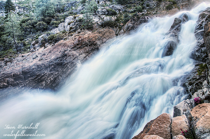
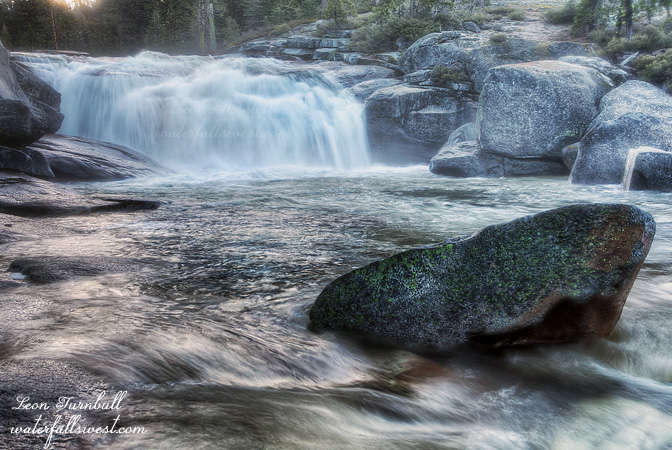
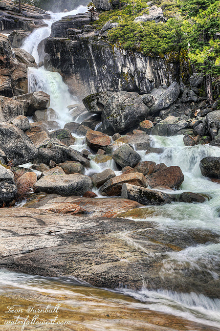
I finally arrived at Rancheria Falls. My wife pronounces it ranch-er-EE-a, but I have never heard it pronounced that before. I have only heard it pronounced ranch-EER-i-a. That must be correct, then. Sorry, Tara. There are two absolutely fantastic waterfalls here, and they are both much much more impressive in person than in photos. I was not expecting either of them to be as big and majestic as they are. Wow. There is also a third one as well (I will get to that later – in Episode 3.5).

Rancheria Falls is an extremely popular backpacking destination, and there is a large area for camping, and most of the sites are all shaded. There was no one else here when I arrived, and I had the place to myself. I was surprised at this. I picked out what I thought would be the best spot, but the problem is that there were mosquitoes everywhere here, and obviously they were going to be a lot worse in the evening. I had hoped that by going in early May, I would not have to deal with stupid mosquitoes. Apparently, they get a much earlier start in Yosemite than elsewhere, much to my chagrin. I dropped my bag and made a search for a better spot. I went to the top of the main falls. There were no camping sites up there. I went down to the bottom of the upper falls. Nothing there that did not have mosquitoes. I continued on down to the lower falls, going to the bottom of that waterfall. Still no good spots. Then finally back to the top of the lower falls, and there it was. It took about a full hour to find this spot, but I found it. It was breezy, there were no mosquitoes, it had a little bit of shade, access to water at the top of the falls, and it was secluded (not that it mattered with no one else around anyway). It was the perfect camping spot. I went back to retrieve my pack, and dragged it back down to my new spot, set up camp, relaxed for a bit, nursed my very painful toe with nothing to nurse it with, and watched as the thunderstorm clouds started rolling in. I was a bit exposed in this spot. There weren’t supposed to be any thunderstorms today, but it was nothing to worry about, the clouds hovered over the reservoir and stalled there. They did not look very menacing anyway (famous last words?)

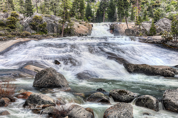
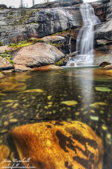
Anyhow, around 4pm, I went over to the top of the falls to get some water to make my dinner, had a wonderful baked lasagna meal (well – freeze dried – is that wonderful?), and set off with my daypack back down to Tiltill Creek. Huh? Well there is a nice 40 ft. falls at the bridge over Tiltill Creek you know, and of course I wanted to get a good photo of it in good light. What I did not realize is that it is quite a walk from Tiltill Creek to Rancheria, and a big ascent. For some reason, I thought it would be much easier to get back and forth between the two. I had planned to shoot Tiltill, then the three waterfalls on Rancheria all on that same evening. But they are all much further apart then I thought. Tiltill Creek is not very easy to photograph. In fact, it is impossible to get a clear view of it. That seems to be the norm with all these waterfalls (except Lower Rancheria – pictured here). After Tiltill, I went cross country over to Rancheria Creek. I hiked up the mountain off-trail to get back to Lower Rancheria Falls. It was actually quite fun. Way over back on the trail, I noticed a large (noisy) group coming in to Rancheria for the night, the only other group that came this day to Rancheria. They went right to the spot I had initially chosen to camp (with the mosquitoes). I’m sure glad I did not setup camp there. I took many photos of Lower Rancheria. It is a fascinating waterfall with a 40 ft. drop then fanning out in an amazingly wide 60 ft. slide. I think it would make for an amazing water slide, and you might actually survive it, as long as you are certain you can get out of the water at the bottom of it, before you get to the big waterfalls below it (episode 3.5 spoiler alert). I’m not certain you actually could get out with the way Rancheria Creek was raging this day. When I got back to my campsite at the top of the falls, I went back over to the creek to my water spot, and I found it was completely flooded. The creek had risen this much in just a few hours. The next morning, it was flooded even more. I knew it would rise during the day with the warm weather, and I could not tell how much it had risen exactly, but it seemed a lot more than I would have thought, and it had me a bit concerned. But more on this in Episode 4. I fell asleep listening to the soothing roar of the creek.

2 Comments

SURPRISE

And so we return once more to Bassi Falls and Ice House Rd. This is my fourth time up Ice House this spring. Will it be my last? I think not.

I mentioned a surprise we found last week while hiking the new Bassi Falls trail. Here it is: Lower Bassi Falls. A surprise little 18 ft. high falls, but quite impressive. I had not known this was here before, but I had never hiked this trail to Bassi Falls before. The light was bad last week when we went by it, and I didn’t think my friends wanted to stick around 3 hours for sunset, so back again this week by myself, at sunrise. The light is not very good here in the morning, and it was quite misty at the base of the falls, but I made do the best I could. Compared to 109 ft. high Bassi Falls, it is not very amazing, but it is still quite a nice little falls.

Did you know this waterfall was here? Well how about yet another one on Bassi Creek? Last year I discovered Upper Bassi Falls. This year it is Middle Bassi Falls, a very sweet 28 ft. cascade.

After shooting this lower falls, I went straight to the big waterfall, not even stopping, except for a glance (it was still flowing strong in case you wondered), and I went straight to the top of the falls. It is not horribly difficult to go up, but it is much trickier to go back down. The key word: carefully. You do not want to go the wrong way either, or you will find yourself either over a cliff or in the midst of un-navigable thick brush. Brush was the word of the day today because it does not stop at Bassi Falls. It was easy and fun going upstream from Bassi Falls, during the times I could follow right along beside the creek. However, with the high flow on the creek, there were certain spots you could not go along the creek. That meant you had to go through the brush. It was crazy thick and horrendous. I almost died and no one would have ever found me. But I persevered through that awful stuff, and was able to get back along the creek for the remainder of the journey.

I found the Middle Falls, but it was horribly in the sun. I took some pictures but they are not good. My calculations told me it would be in the shade til 9am. That was quite wrong. Also the creek was just a little too high. Getting to a good viewpoint of the falls was impossible, but with a little less flow I think it would be do-able. The flow of the SF American at Kyburz was about 730cfs. Maybe 150-200cfs less, and I think it will be good. I will definitely return.

On the hike back down, I kept thinking I should have a raft and just float down the creek. It would be amazing and fun, and I could avoid all that horrendous brush. I would just need to make sure to get out before I hit that 109 ft. waterfall. Am I right?

No Comments

OLD AND NEW

Not much happening with me this past weekend. On Sunday afternoon, after church, I took some friends to see how good old Bassi Falls was behaving these days. This was the Pastor of another church with his wife and daughter and one of their friends. I dragged my son Jadon along for the ride as well (kicking and screaming?).

So what is the deal with the Bassi Falls trail now? I’m sure you are all wondering about it, just like myself. The USFS website indicates the road should be open now, but it is still gated at Ice House Rd. What I really am wondering about is now there is a new “permanent” sign saying no motor vehicles are allowed on the road. This leads me to think it may be gated permanently. I guess we will find out in another month or so. There is also a new trail to Bassi Falls now, which has been just opened in the last year or so. I had never taken this trail before, but we took it this time. It is 2 miles and is quite an easy trail. It is well signed and easy to follow for the most part. However, the old trail was only a half mile long, so compared to that, it is not so easy. Everything is relative, right?

I have mixed feelings about all this. On the one hand, you would think that if the trail is harder then less people will go to see Bassi Falls. This would be a good thing because Bassi Falls is a complete madhouse on the weekends in the spring and early summer. Less people would mean the Bassi Falls experience will be much more pleasant. However, the reality is that an easy 2 mile trail is not going to keep anyone away. Even this weekend, on a stormy Sunday afternoon in April, and in very early season, there were a lot of people at Bassi Falls, despite the extended walking required. Half of the people did not even know about the new trail, so they had to walk up the old road to the old trailhead. That is much tougher, but they still did it. Also, hiking 2 miles vs. a half mile makes it much more difficult to see Bassi Falls at sunrise or sunset, when the light is at the best. But I did find one interesting surprise on hiking this new trail. I will talk more about that later.

I felt very tired on the hike. As I said, it is an easy 4 mile (round trip) hike. Elevation gain is minimal. I hope it was just because it was a warm, sunny, Sunday afternoon. Normally I just relax on Sunday afternoons, and thus I was not mentally prepared to do any hiking. I have a big trip coming up in a couple weeks, and I will be hiking 7-10 miles per day for about a week. How am I going to do a 10 mile hike every day with 3000 ft. elevation gain when I cannot do a 4 mile hike with 200 ft. elevation gain? Oh boy. Can’t wait to find out.

I have already said the weather was stormy and also that it was warm and sunny. Did you catch that? So what was it man? Make up your mind. It was both! I swear the weather literally was changing every two minutes. It was raining, then two minutes later it was sunny, then it was cloudy, then it was sunny, then raining. It was crazy weather. All in all though, the light was not too great, and I’m not excited about the photos I got this time. But it did not matter much, I was not there to take photos.

The falls were flowing quite well and strong with snow melt. Everyone was happy. One fun thing about Bassi Falls is trying to get up closer to it, which requires you to walk through the extremely cold creek. This is easy enough to do, and Jadon and I worked our way onto a big rock up close to the falls. But the daughter of my friend and their other friend went a lot further, jumping across into the very middle of the creek onto some more big rocks. The problem is that this was extremely dangerous. The creek is raging. If you slipped and fell into the creek, you would be swept downstream. It may be fun to jump over to the middle in front of the falls, but it’s not worth it! I told the girl to be extremely careful, it is dangerous, but that was all I could really say. Her parents were off somewhere else and not watching. I couldn’t make her not do it, but I could make my son not do it, and I told him he would not be following her, but he said “don’t worry daddy, I have no intention whatsoever of going over there”. Ok whew, he is definitely a smart kid. Anyhow, the two of them made it ok. They just gave me a little heart attack, that is all.

2 Comments