BACK TO DRY

So you think we had a lot of precipitation in December, do you? I know the media was saying this before Christmas. Well, the official December tally from the NOAA indicates the truth: we are only at 45% of normal for our snowpack in the Southern/Central Sierra, and 55% for the northern Sierra. That is WAY BELOW average. We did have warmer precipitation earlier in December which did not add to the snow pack, but the overall precipitation was also below average and the rain did not do much of anything for our reservoirs. Folsom is currently at about 45% capacity, and Shasta/Oroville are 40% capacity, and this is also way below average. The worst part of all this is that we have been mostly dry for a couple weeks now and from what I have read the long range forecast for the rest of January is looking extremely bleak, barring a miracle (which I’m still hoping for). This will make it 8 out of the last 9 Januarys being dry months, and now we are seriously looking at the possibility of a fourth year in a row of far below average snow pack. But we still have February and March. Don’t give up hope yet.

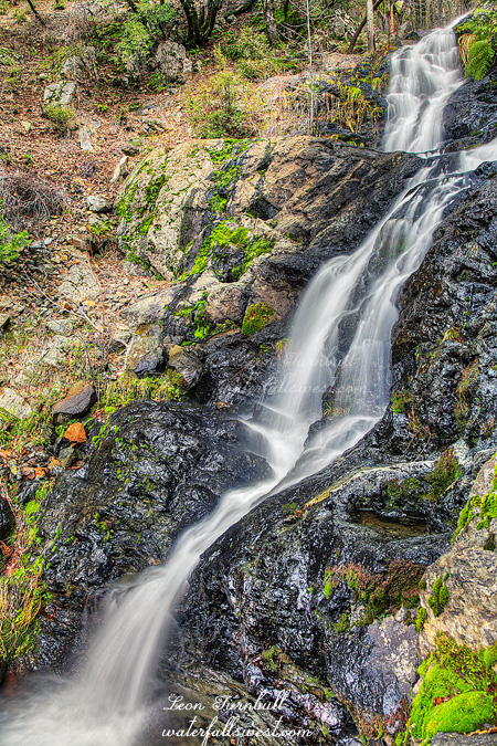
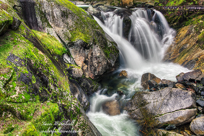
This is 18 ft. high Fiddle Creek Falls, and it was still flowing quite strongly when I was here. A nice little falls right alongside the road. I would not have gone out of my way to stop here since I have been here before, but it was not out of my way, so thus I stopped! The flume at the top is interesting. When I was first here years ago, I thought it was just an ugly thing that needed to go away. Now I am torn. On the one hand, I wish it was not here, but the more I see of this waterfall, the more I think the flume is very much part of its character. It’s like the log across Lion Slide Falls or the ones at Russian Gulch Falls. Fiddle Creek Falls would just be naked without the flume there.

Comments Off on BACK TO DRY

SURPRISE

So here is my tally for the Christmas holidays of 2014: 5 hikes, 8 waterfalls (6 new ones, 1 old one, 1 sort-of-new one), 30 miles of hiking, 4000 ft. elevation of climbing (at least), one very bad case of poison oak, one injured rib cartilage. Not too shabby. The worst thing was the oak (ugh!). The best thing was Cherokee Creek Falls (see my last post).

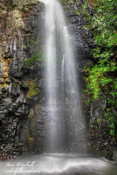
This one, however, was a very pleasant surprise: Wet Ravine Falls, 33 ft. high. I found it right alongside the road as I was driving back down the hill from Cherokee Creek. I had no idea there was a waterfall here beforehand, but there it was, and for such a small creek, it was flowing quite nicely. Easy to get up close to, but a bit difficult to photograph.

I found it quite strange that some creeks in the Downieville area were flowing very strong, and others nearby had hardly any water in them at all. That was disappointing in some respects because I had hoped to get to see some more falls in the area that day. Wet Ravine was a nice surprise though, as I wouldn’t have thought this would be flowing at all. Sweet.

2 Comments

FOGGY CHRISTMAS EVE

On Christmas Eve I headed up to Downieville. My goal: Attempt to get down to the monster waterfall on Cherokee Creek.

I had little hope for success. On Google Earth, it looked incredibly steep, cliffy, brushy, and it did not look like there were any open views to the waterfall. It was worth a shot though, of course. 😉

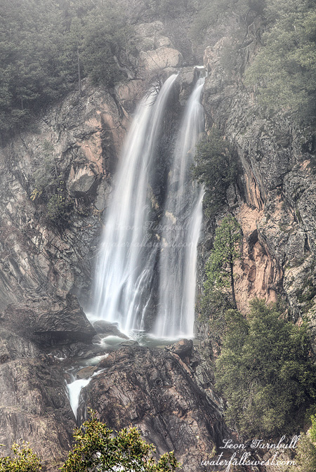
I arrived at first light. It was steep but not cliffy or brushy (yet). There was a lot of poison oak on the descent, however. Once again though, I seemed to have managed to avoid getting the big itch. I’ve been doing well at that lately (knock on wood). I continued the descent, deftly avoiding touching anything of the oak variety. I came to the spot where I hoped I could get a view of the thing, on top of a cliff overlook. Oh, but there were just too many trees in the way. It was so close. It would have been a magnificent view point if it were completely open. If I hung my body out over the cliff, whilst holding onto a flimsy tree branch, then I could get a pretty clear view (but uh, no thank you on that one). I thought I was done for, and there would be no further entry down the mountain. But then I saw that I could continue down further without any death defying maneuvers necessary. Just a little further down and I came to this spot with a clear view of Cherokee Creek Falls. This plunge shown here is 79 ft. high. Just as I got here the fog rolled in, completely obscuring my view of the waterfall. But I absolutely could not leave here without a good decent photo. So I waited. And I waited. And I waited. Finally, the fog cleared slightly. Just enough to take a decent photo.

There is a lower tier of this waterfall, about the same height as the upper tier. I was able to continue further down the mountain, but I could not find any clear spots to photograph the lower tier. The terrain got too cliffy to go much further, so I headed back up the mountain. I still had more waterfalls I wanted to visit this morning and I had already taken much longer than I wanted at Cherokee Creek, but it was worth it. What a magnificent waterfall.

7 Comments

LITTLE ONE

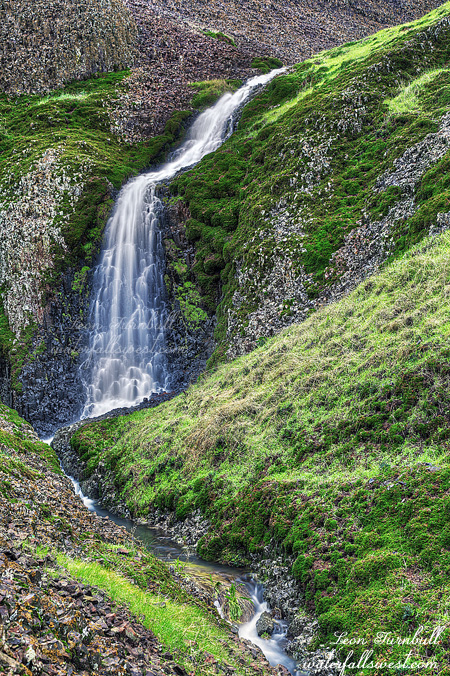
This is Little Hollow Falls, 30 ft. high. It doesn’t really compare to all the big waterfalls on Table Mountain, but it is a nice little thing, and easy to get to.

4 Comments

OF COWS AND OAK

This weekend took me back to Table Mountain in Oroville. With two inches of rain this week, and four+ inches last week, it was time to think all these waterfalls on Table Mountain would be flowing again. Well … they were all flowing, but not nearly as well as I expected them to be.

My initial plan was to go to Ranch, Crevice, and Lower Beatson. However, I saw new “no trespassing” signs at the trailhead. What? Isn’t North Table Mountain supposed to be public accessible land? Why are there signs here now? I wasn’t sure what to do. If I parked here, it would be obvious I was “trespassing”. Probably not a good thing. I decided to go up to the main parking area, which I wanted to do anyway. My second hike was going to be to go to Little Hollow Falls, which I had not been to before. It was an easy hike to that little waterfall, and I will post that photo soon. After that I decided to continue down towards Beatson. THE LONG WAY.

I met some cows along the way. The cows on Table Mountain are killer cows. I may have said that before. I’m not kidding. They have been known to attack people. Well … I did hear of one instance before where a cow charged at someone. That is the truth, at least. The cows today were stalking me big time and were highly intolerable. They would not mooooove out of my way as I came up to them. Normally, they will move away as I approach, but not today. There was a large group of about 20 and they just stood there, blocking my way, and determined to not let me pass. I really did not want to walk right through the midst of them, so I decided to drop off the top of the hill and go down to Beatson Creek. I wanted to do this anyway, just not at this exact spot. It would have been perfectly fine, except that the entire hill was covered with poison oak. There was no avoiding the stuff. What to do, what to do. Do I go back and do battle with the cows? Or continue on and do battle with the oak? I chose the oak, and I am entirely uncertain that was the right choice. Well, I got to the bottom and now had to cross Beatson Creek which was wide and full. It was raining and I did not want to take off my boots and wade across. Fortunately, I found a log crossing the creek and managed to keep my feet and the rest of my body dry. In other words, I did not take a header of the very slippery and wet log, knock myself unconscious on a rock and drown (in case you were wondering).

I continued up the other side and headed in the direction of Lower Beatson Hollow Falls. Again, I came across another large group of cows that would NOT let me pass around them. They kept running along parallel to me, blocking me from going around. I swear one of them was about to charge me. I ended up going all the way to Crevice Falls before I could cut back to Lower Beatson. Just a bit of extra hiking there. Darn cows. What is up with them today? When I was last at Lower Beatson Hollow Falls, I was not happy with my photos or the view I found. The waterfall is quite hidden and it cannot be seen very well from the top of the cliff. And since it is on the top of a cliff, getting down is quite out of the question. Well, I really wanted to return here and try to get down to the bottom of it. I anticipated that it would be a huge effort that involved rappelling down the cliff and then wading up the creek through heavy brush and poison oak. Not something I looked forward to, but as I said I just was not happy with my photos from the first time. As it turned out, it was actually quite easy to get down to the bottom, and once down, I found a path leading right up to the waterfall. Was it a cow path? No, I am pretty sure it was a human path. I have never heard of anyone being down here at the base of this falls before, but it was obvious that people had been. This was especially clear as I got up to the waterfall. There is one large rock you have to climb up on, which would have been quite challenging, but there was a ladder! Not just any ladder, it was a good solid iron ladder. Quite fascinating. The waterfall is quite fascinating as well, dropping 38 ft. off the cliff into this very cool little grotto, with huge basalt chunks scattered about that had broken off the cliffs, and a second little waterfall beside it as well. Very cool. From here, I hiked back up and made the long trek back to my car at the main trailhead. All in all, about 10 miles of hiking for these two little waterfalls. Whew!

3 Comments