Difficult

This morning I went on a hike back up on Ice House Rd. This is my third time already up there on Ice House this spring, and I plan to be going up there many more times. It is one of my favorite hiking areas in the greater Sacramento area. There are so many areas to explore, and many waterfalls to find. This is what I was doing this morning: exploring to find new waterfalls. And I found one indeed. But it was certainly a difficult one.

When I was up at Jay Bird a couple weeks ago, I had initially planned to explore into Round Tent Canyon. But there was still too much snow at the top of the canyon. I could have snowshoed in, but it would have been a difficult 9 mile snowshoe hike, and I did not want to do that at the time. I returned here this morning, two weeks later, and most of the snow was gone! I was able to drive in on the road a half mile, but then got stopped by a snow mound. I would have to hike the rest of the way, but that was fine. I would not need snowshoes, so it would not be too difficult. At least the first part of the hike was not difficult, anyway. It was certainly a pleasant hike along the road paralleling Round Tent Canyon. The creek, starting out as a small little stream, picked up speed as it continued on, getting more water along the way from side streams and melting snow. The steepness of the canyon also picked up steam along the way, getting steeper and steeper, and much steeper. I was definitely wondering if I would be able to get anywhere near a waterfall, if indeed there was even one.

I had no idea, really, if there was a waterfall in Round Tent Canyon. After examining my topo maps, it looked like there “might be” a 50 foot high waterfall in there somewhere, at a certain spot. As I got down to that certain spot, though, it required getting off the nice mellow road, and getting down and dirty in the midst of the forest. The terrain was now very brushy, very steep, and very difficult. I had really hoped that the terrain would not be so brushy, as I had quite a ways to go still, down to the waterfall. No such luck on that one. I persevered however, and came down to a spot which was close to where I anticipated a waterfall to be, and found just a small 20 foot waterfall. I looked downstream, and saw the terrain seemingly flatten out, so this must be the only waterfall down here after all.

I made my way down the steep mountain to try to get to the bottom of this 20 footer. It was as messy as anything I have ever seen. Huge trees fallen all over the place at the base of the waterfall. There was no way I could get up to it to take a photo. It looked though, that I might be able to get up to it if I crossed the creek. I did not bring my water shoes, and I really did not want to do this, so I debated amongst myself, and finally decided that I should cross since I came all this way and this was the only waterfall down here. After crossing, I found that I was able to get up to the falls, but I was too low! I could only see the bottom 10 ft. section, and could not see the top of the falls from this spot. There was no other viewpoint. I crawled under the huge logs spanning across the creek, which is something that kinda freaks me out. What if the logs all of a sudden collapse on top of me? I have the same issue when driving and I get stopped under an overpass or something. What if there is an earthquake when I am under there? Anyway, I buckled up my courage and crawled under there to take a photo anyway. The logs did not collapse, and there was no earthquake.

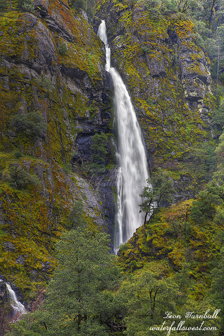
So after all that shenanigans, I crossed back over the creek and started my climb up the mountain. But fortunately, I took a closer look at my map, and I realized that I was not really even close to where I had thought the waterfall should be. I had better continue on downstream to see if there might be yet another waterfall down there. When would I ever be back in this canyon? Never. So more difficult cross country and bushwhacking brought me down to yes, the 50 ft. high waterfall that I anticipated getting to in the first place. Indeed I measured it to be exactly 50 ft. high, though it looked to my eye that it was actually quite higher than that. It was another steep descent down the mountain, and I could not get all the way down to the bottom due to a sheer dropoff, but I crawled up on a rock on the side of the cliff, and was able to take this photo of it. Getting any closer or a better angle would have been far too dangerous.

After that it was just a matter of climbing back out of the canyon and back to the road. It was difficult and it took awhile, but I finally made it back to the road. Thanks to my GPS that works so well under tree cover, it would have been almost impossible to find my way back otherwise. Maybe. Once back on the road, I made the long, slow, (and easy) journey back to my vehicle parked near Ice House Rd. It was a crazy day, but I was so pleased that I found this new waterfall deep within Eldorado National Forest.

More info on Round Tent Canyon Falls:
http://www.waterfallswest.com/waterfall.php?id=1663

No Comments

Foggy Falls

As I drove up Hwy 50 in the early morning I encountered some very intense fog. I literally could not see 10 feet and I had to slow down to under 10mph. Seriously is it April or January? The only other time I remember fog so thick was driving up the Malahat out of Victoria BC. As I approached Pollock Pines I stopped at the Shell station there. Making friendly chit chat, the lady there put me in my place. “You think this is bad? This is nothing. Sometimes you cannot even see the tulips just outside the window there.”. Well what she said may be true but in my defense it was not quite so foggy right there in Pollock Pines as it was on the highway around Camino which is where I had to slow right down.

Regardless, my primary concern at the moment was that I might not even be able to SEE the waterfall I was planning to go to. My plan was to shoot Mill Creek Falls from across the canyon, not go right up to it. It would be pointless to go on a six mile hike and then not even be able to see the waterfall. Did I get up out of bed for nothing? Should I turn around now and go home?

I decided to just drive up to Ice House Rd and make my decision once I got there. When I arrived at the trailhead the fog had dissipated enough that I thought it would be good to proceed on the hike. But as I got ready to start hiking, within five minutes the fog rolled in again. Oh and it started raining too. Nonetheless I continued on.

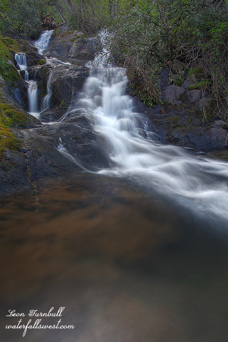
As I hiked down the road I also had a pleasant surprise. I found a bonus waterfall which I could see from the road on White Hall Creek. It was off the main road though so I decided to try to get down to it on my way back (which I did – I LOVE finding new waterfalls).

Mill Creek Falls is not a new waterfall. I have known about it for a long time. You can see it in the spring from Ice House Rd off in the distance. You can sort of see it from Hwy 50 at White Hall. But getting to it is a problem. My friend (no names mentioned, Rob) got up to it by trespassing. I have not figured out how to get up to it without trespassing, though I think it may be possible … somehow.

Quite by accident I found a way to get fairly close to it from across the canyon. I was initially looking for a way to shoot it from a distance from Ice House Rd. From my vantage point I noticed a road leading down the canyon to a point directly across from the falls. I decided to follow it down. That is how my present journey unfolded. When I got down there I found a wide open field with excellent views across the canyon and of the waterfall. Indeed it was possible to descend the hill practically all the way down to Hwy 50 and White Hall. I descended to a good spot but not all the way down. Although Mill Creek Falls is not a spectacular or a photogenic waterfall by any means, the fog layers above and below the falls certainly added an interesting and marvelous dynamic to the falls. I did carry my big lens on this hike and did take some shots with it but I liked this one taken with my 24-105 lens the best.

More info on Mill Creek Falls:
http://waterfallswest.com/waterfall.php?id=699

No Comments

A Sign of Good Things To Come

On Good Friday our church was having an all night prayer vigil. They wanted people to sign up throughout the night to come to the church for 30 minutes to pray. I signed up for 4AM. I know what you are thinking. I am nuts! But I had a plan, and it was that afterwards, I would drive on up to Lake Tahoe to catch the sunrise at Eagle Falls. It was a great plan! But as usual, God had a different plan in mind for me. His plan started out with heavy overcast clouds in the forecast over Tahoe and snow/rain showers. I could see during the day on Friday that my great sunrise plan was not going to work out too well, so I nixed that idea, and decided that instead I would just go on a hike after the prayer vigil up on Ice House Rd. And since it was overcast, I would not need to worry about hurrying up there to get there before sunrise. And in doing so, I would be able to spend more time in prayer at church. Exactly what God wanted! Funny that.

Anyway, Jay Bird Canyon Falls was my first destination of the day, and I ended up arriving not too long after sunrise. It had crazy flow! Although it is a very tall waterfall (173 ft. high), the creek is small, and usually the waterfall is just a nice, pretty, dainty, thin flowing waterfall. Today it was a 173 ft. high monster! The entire amphitheatre where it drops into was full of mist from the falls. There was not a dry spot to be had to take a photo. I got completely drenched as I approached closer to the waterfall, and the mist was freezing cold from snow melt as well. I could not find any place to take a photo (even up on the ridge opposite the falls was full of mist). Well, it was certainly an awesome experience, and I take it as a very good sign for things to come this spring. If this small waterfall (in terms of creek size) had such a powerful flow, what are other waterfalls (such as Yosemite) going to be like this spring? They will certainly be amazingly awesome for sure. I suppose you are wondering where I did take this photo. Perhaps especially if you have been here before and do not know where this spot is. Obviously it was taken from further back. Not from the road. It is kind of a secret, so I’ll leave it to you to figure out.

More info on Jay Bird Canyon Falls:
http://www.waterfallswest.com/waterfall.php?id=218

4 Comments

Pennyweight Falls

This is Lower Pennyweight Falls in Colfax, 22 ft. high. I went here after work last week. With the flow in the creek so much reduced, it was pretty easy to rock hop across the creek and up to the falls. It certainly would be nicer with a bit more flow. However, it was still very nice, and I enjoyed my time and solitude at these falls on this particular evening.

No Comments

ACTION ALERT: Help Save the North Fork

The following was sent to me, and I would like to pass it along to all my readers. If any of you wish to send a letter, please do so before May 10.

ACTION ALERT

CDFG Suction Dredge Mining Regulations

Threaten the North Fork American River

Regulations Threaten Fish, Frogs, Water Quality,

and People In The Sierra Nevada!

The California Department of Fish and Game (CDFG) has released new proposed suction dredge mining regulations for California rivers and streams and is seeking public comments. Here’s a link to the DFG website:   http://www.dfg.ca.gov/suctiondredge/

You have the opportunity to speak out for the protection of our river, fish and wildlife, water quality, and public health! May 10 is the deadline for submitting comments.

Please write a letter TODAY. See sample below.

Background

Up until recently, suction dredge mining for gold has been pervasive on many California rivers and streams, particularly in the Sierra Nevada. This form of mining uses a powerful motor and pump, attached to a hose that is used to suction up gravel from the stream bottom. Gold is then sorted out from the gravel and the remaining sediment-ladened water is flushed back into the stream. The adverse impacts of this mining are well documented by scientists. Suction dredging can harm habitat for sensitive, threatened, and endangered fish and frogs, as well as release toxic mercury left over from the Gold Rush into the stream.

Previous state regulations failed to recognize these impacts and a lawsuit filed by Indian Tribes and other organizations forced the agency to develop new regulations. In the meantime, the California Legislature approved a moratorium on suction dredging that has been in effect since 2009. But if the new proposed regulations are adopted, destructive suction dredging will return to many of the Sierra Nevada’s most sensitive rivers and streams.

The new regulations are a hodge-podge of some good but mostly weak and non-existent restrictions that fail to fully protect endangered steelhead, salmon, frogs, and other species. The new regulations fail to ensure that mining does not harm water quality and human health with sediment and mercury. Special areas like Wild & Scenic Rivers and Wild Trout Streams are not protected in the regulations either. The regulations even permit suction dredge mining in Yosemite Valley, in violation of federal law! In addition, the regulations will depend on active enforcement from CDFG, which like other state agencies, is suffering from severe budget cuts.

North Fork American River: This truly wild river was formerly off limits to suction dredging. The new regulations allow year round suction dredging upstream of Big Valley Canyon and seasonally (September) from Big Valley downstream to Iowa Hill Bridge. Opening this river to suction dredge mining would be harmful to sensitive foothill yellow-legged frog and wild trout.  Adding insult to injury, the proposed regulations will allow the use of larger suction nozzles on the North Fork. This stream is both a state and federally-designated Wild River and a state-designated Wild Trout Stream. Neither of these facts seem to have been considered by CDFG in the development of the new regulations. Mining will harm the rivers exceptional water quality and clarity, as well as its extraordinary scenic, recreation, fishery values. Also, experience shows that the miners bring lots of equipment and supplies down to the river but leave their trash behind (including batteries and fuel containers). Even with a 14 day limit on camping, many stay much longer. Due to the narrow canyon, disposal of human waste is a problem; it accumulates in few spots and leaches into the river.

~~~~~~~~~~~~~~~~~~

Jim Ricker

President, North Fork American River Alliance

P.O. Box 536

Alta, CA 95701

530-389-8344

http://www.nfara.org

SAMPLE LETTER (please personalize, paraphrase or plagiarize)

Mark Stopher

California Department of Fish and Game

601 Locust Street

Redding, CA 96001

Regarding: Suction Dredge Program Draft SEIR Comments

Dear Mr. Stopher:

Please consider this letter an official comment letter on the draft SEIR prepared for the draft amended regulations that have been circulated.

The North Fork American River, like other California rivers and streams, must be protected from the adverse impacts of suction dredge mining. The proposed regulations do not provide sufficient protection for the fish, wildlife, and water quality of our rivers. DFG must analyze each individual river, and its tributaries, for adverse impacts from proposed regulations. A statewide basis for evaluation is inadequate and will lead to major adverse impacts on some streams.

Please revise the regulations to prohibit suction dredge mining in all rivers and streams that provide critical habitat and future recovery areas for threatened and endangered fish and wildlife. Please close all mercury-impaired rivers and streams to suction dredge mining to protect water quality, human health, fish, and wildlife.

Please ensure that the extraordinary and outstanding values of the North Fork American, a state and federal Wild & Scenic River and a Wild Trout Stream, are fully protected. Suction Dredge mining is incompatible with such designations and was prohibited in the W&S North Fork American under previous regulations. Mechanized or motorized equipment does not belong in a W & S River. In addition, portions of the North Fork and Middle Fork are proposed Wilderness and their wilderness qualities must not be compromised. You cannot put obstacles in the way of the land managers (Forest Service, BLM) nor add to their enforcement load as a result of your regulations. Rivers and streams should be closed to mining if budget cuts result in insufficient wardens in the field to enforce the new regulations.

Suction dredge mining will harm the North Fork American River’s exceptional water quality and clarity, as well as its extraordinary scenic, recreation, and fishery values. In addition, experience shows that the miners bring lots of equipment and supplies down to the river but leave behind piles of trash (including batteries and fuel containers) that leach into the river. Even with a 14 day limit on camping, many miners stay much longer. Due to the narrow canyon, disposal of human waste is a problem; it accumulates in a few spots and leaches into the river. Trash and human waste does impact water quality, the fisheries, and human health.

Recreational and commercial mining is not a legitimate activity in California if it is done at the expense of the state’s fish, wildlife, water quality, human health, and state-protected beneficial uses of our rivers and streams. Suction dredge mining is completely inappropriate in the North Fork American River.

Thank you for your consideration.

Sincerely,

(your name, address)

No Comments