CLOSED

Just so you know, if you are wanting to come to California anytime soon, it is closed. A couple summers ago, I think, we were saying the same thing, but that was because of fires. Now it is floods. California does not know how to do any weather that is not extreme. Roads are currently closed all over the place due to flooding, in northern California, the Central Coast, and the Bay Area is a mess. Places in Southern California received over 8 inches of rain in ONE DAY! Mud and rock slides are closing highways frequently in the Sierra Nevada. Dams in northern California are on the brink of failure. Just stay away, if you know what is good for you. I do not. I love all this rain. I will admit though (a big admission for me), it seems that it has become a bit too much for California to handle.

Nonetheless, I will keep on hiking no matter what. But the goal is always to stay safe. I drove up to Foresthill, in search of a brand new waterfall. The dirt road I was driving on was surprisingly good, no mud, the grade was very good, wide, and flat. I thought I would make my destination easily. Then the road started to go up hill and got a bit narrower, and I came upon a massive road blowout. A huge tree had collapsed from below the road, and had fallen across the road, completely obliterating it from existence. The hillside below the road had collapsed, knocking out a number of trees. Even if there was no tree blocking the road, there would be no driving around this disaster. I just don’t understand why there had been no signs way back at the beginning, saying that the road was closed. It was a lot of wasted driving effort. So back to Foresthill I went. What should I do now?

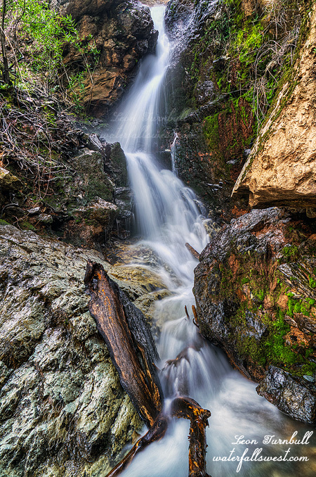
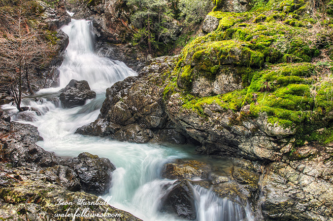
I decided to go to Colfax and back to Stevens Creek Falls. I had been wanting to go back here because I still needed a good photo of the lower section of this falls. And I still do. It is an easy hike, and I made good time to the waterfall viewpoint. The creek was flowing more than I have ever seen it before, as I suspected it would be. I took some photos of the waterfall, then continued on to the creek crossing. Umm … nope. The trail crosses the creek at the brink of the lower falls. Under normal circumstances, ie. whenever I have been here before, it is no trouble to cross the creek. It was extremely dangerous to cross today. There was absolutely no possible way to cross. Unless you wanted to slide off the waterfall.

I tried to go down to the bottom on this side of the creek, but I could not get down all the way to the bottom, it was too sketchy, and I could not find any viewpoints. All I did find down there was poison oak. I did not find any ticks, however. Whenever I have been here before, I have always seen ticks. All this winter, I have only seen one tick in total. The last few years, they have been out months before now. Maybe they all died in the floods. One can only hope.

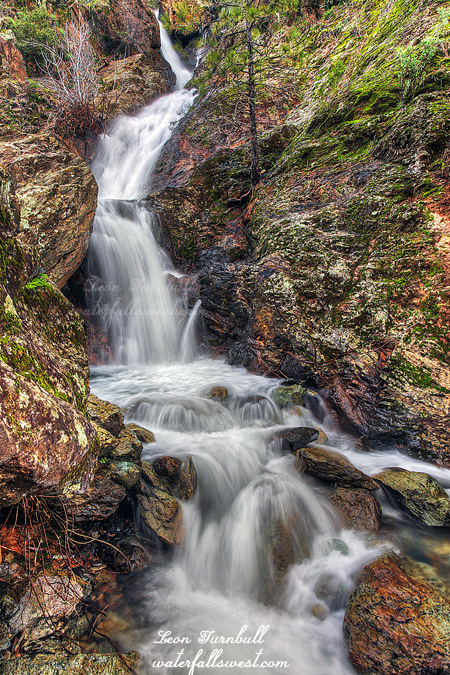
After trying to get to the bottom, I went up to the upper section, through all the poison oak, and found a pretty nice viewpoint of this section (shown above). I never braved going through the prickly brush and oak before to get to this spot, but today I did. It was very sweet. As for the bottom section, it occurred to me after I got home that I actually perhaps could have gotten down to it. I was not thinking clearly, and this other possible route did not even occur to me until after I got home. Argh. Now I’m going to have to go back. Someday.

No Comments

NEED MORE OOMPH

It was kind of a lame weekend for me, no new waterfalls to report. You can’t win them all. The hike I really wanted to do was all snowed in. It was only about 5000 ft. in elevation, but the road had too much snow to continue. With this ridiculously warm month, I was surprised I could not drive up this road at least partially. Anyone want to buy me a snowmobile? I could have used one this weekend. I did not have a very great backup plan. I finally gave up all hope and went to Traverse Creek Falls.

I didn’t really have much desire to go back to Traverse Creek Falls again, but well I was in the area, and had nothing better to do. It is an easy hike, but there are some steep parts. Someone had cut the rope on the first descent. Fortunately, it is not the worst of the steep sections and a rope is not really needed (if you are careful, which of course I was). The second rope at the brink of the falls is still there. Good thing because it is much more treacherous there.

The waterfall was in Double Mode, but just barely. It is almost back to Single Mode after a month of no rain. I expected it to be in Double, but was hoping for a bit more oomph on that second segment. It looks like we may be getting some more of that much needed oomph in March. There is good news, rain is finally back in the forecast. El Nino may be making a comeback. Pray it is a big comeback. Anyhow, I think I got a somewhat different shot of the falls this time, and was standing in the middle of the cold creek to get it.

Whenever I am at Traverse Creek I always bring a garbage bag to pick up trash. In past years there has been a horrible problem here with idiots leaving behind their garbage, but the last couple times I have been here there has been very little to pick up. I was almost ready to declare Traverse Creek “problem” free. Not quite. This time around it seems we are back to square one. I picked up a whole bag of trash. Mostly beer cans, I guess, but a lot of other stuff as well, conveniently thrown into the bushes where all the poison oak is located. If I get poison oak from picking up trash … I will be very unhappy (to put it mildly). I also found a box for a mini cross bow, just left behind at the top of the falls. Really? If you are going to bring something like that on your hike, why wouldn’t you unpack it out of the box at your car? And leave the darn box at your car! If you don’t want to do that, then why can’t you take the box back with you? You packed it in, you can pack it out! Some people’s children. I did have a lovely morning.

No Comments

ALL GUNS BLAZING

    I have always wanted to visit Canyon Creek Falls when it is at crazy flow. All guns blazing. Off the charts bonkers. Check one off the bucket list now.

      On Friday the big Pineapple Express rolled on through northern California, whetting all our appetites (literally). We received 5.6 inches of rain in the Sierra foothills. Unfortunately, the snow levels were really high this time, so that means the snow was melting on top of the rain. That raises the river levels exponentially. On Friday night, the North Fork American River peaked at a whopping 20,000 cubic feet per second (in other words, a lot) – it was under 1000 before the rain started. When I woke up on Saturday, it was still at 19,000 but dropping fast. I scooted on up the hill as fast as allowed by the law, and arrived at the trailhead by sunrise.

        It is a fairly easy hike, but there are some steep parts. With the ground saturated and wet, it was very slippery and muddy. I fell one time, getting my clothes thoroughly mud baked. After that, I was extra careful on the steep parts. I did not want to put my back out again. Also, I did not want to slide right off a cliff. That would not be out of the question, if I was not paying attention. I paid attention.

          Arriving at the viewpoint … and WOW. This is the absolute best I have ever seen the Big Waterfall, which is 144 ft. high. The view of the North Fork American River was stunning, the river was roaring below me, unnamed waterfalls cascading down every mountain. It is difficult to know exactly what the river level was at because there is a delay from the time it takes for the water to reach the gauge at the North Fork Dam, but I believe it was in the range 16,000 to 18,000 cfs. Last time I was here, it was around 6000 to 7000 cfs, so that means Canyon Creek had about 2 to 3 times the flow as last time. Absolutely amazing. If you have never been to this viewpoint before, you need to add it onto your list too.

            So now … what about the rain and snow situation and El Nino? It is the end of January and we are halfway done with winter. After this latest storm we finished January at 122% of average rainfall. The snowpack is 117%of average for Central Sierra, 120% for the North, and 107% of average for the Southern Sierra. Folsom Lake is at 54% capacity (average for this time of year), Shasta is 52% and Oroville is 43% – and these will rise more this week from the rest of the rain runoff. So that is all good, right? Or is it?

              Certainly it is good when compared to the last four years. I’m not going to complain. However, everyone is talking about El Nino this and El Nino that, but what are the facts? The fact is we have only had 1 or 2 El Nino storms all this winter. Almost all the storms we have had have come from the Pacific Northwest. Not that it is a bad thing, but southern California has been very dry thus far and I certainly would have expected (and hoped) that by the end of January this super strong El Nino would have had a much bigger impact than it has, and we would have even more rain than we have had up to now. What about February? That nasty old ridge is building in this week, and the long range forecast is indicating that we are going to have a dry February, at least for the first couple of weeks. So even though we are above average for now, by the middle of February we will probably be back below average. They are already talking about releasing water from Folsom reservoir. That would be a huge mistake if they do that now. Bottom line … we need to keep praying for rain and an end to this ugly drought.


                3 Comments

                HIDDEN

                My hike on Saturday was a bust. If I had made it where I was hoping, it would have been glorious, but that darn canyon wracks my nerves every time.

                I had thought that if I could just climb up this certain ridge, *somewhere* deep within the American River canyon, after about a 600 ft. ascent, then I could easily get down the other side to where this *certain* waterfall was located. From the topo maps and GE it looked quite do-able. The worst part, it seemed, would be the ascent, and possibly quite cliffy, but definitely very steep with lots of poison oak. Well as it turned out the ascent was no problem, there was (surprisingly) even a trail to follow. There was just one sketchy section near the top, but I got past it to the top of the ridge. All right, I thought, I am actually going to make it. It will be a cakewalk from here. Then I looked down the other side. Nothing but cliff. It was much much cliffier on this other side, and no way was I getting down it in one piece. Ugh! Struck out again on this waterfall. Will I ever get to that one? Yes, I say, yes. But not today.

                Well, after that mess, I really did not want a complete shutout from the weekend, so I went on a second hike. This would be an easy one, Hidden Falls in Auburn. I have been to it before, but I was hoping for something a bit different, thinking perhaps I could get down to the bottom of it. I knew it was steep at the overlook, but obviously had forgotten just how steep it was. When I arrived, I realized there was no possibility of getting down to the bottom safely. I could almost do it, maybe, with a rope, and I think some have perhaps done it, but it just seemed a bit too cliffy and unsafe, so I settled for the usual photo, settling my tripod up right beside the poison oak. The creek actually had more water flowing than last time I was here, and I was quite surprised to see this much flow.

                What really bugged me, however, was the overlook here seems to have become somewhat of a garbage dump. A lot of people have just thrown their garbage down from the overlook, into places where it is impossible for anyone to go pick it up, and yet there is a trash can literally within a two minute walk of the overlook. What a$$holes. I hope those people get bitten by ticks and get lyme disease. Speaking of which, the ticks are definitely out now. I saw quite a few of the little buggers this weekend. So much for them dying off in the drought.

                Now onto your El Nino update: if you missed my post earlier this past week (and thanks Facebook, it seems most people did miss it), *unofficially* El Nino 2015-16 has become the largest El Nino in recorded history, surpassing 1997-98. It is not official because El Nino is measured in three month segments, so we will need to wait a couple months for the official results, but when it comes out you are going to see that this year’s El Nino is not just a little stronger than 98, but a heckuva lot stronger than 98. It still has not even peaked yet. It is a monster. But will that translate into rain/snow? Well that is up to God of course, because He is the one that brings the rain, not El Nino. But He did bring us a monster El Nino. The very few storms we have had thus far this year have not had anything to do with El Nino, however I have heard an unsubstantiated rumour that this may change in early December, and we will start seeing those much anticipated El Nino storms. Stay tuned for that.

                2 Comments

                GOOD TIMES

                Had an awesome little father daughter hike with Nekoda this weekend. Though for her, she probably thought it was a big hike, not a little one.

                After last weekend when I found a new waterfall but the creek was almost completely bone dry, I was a bit concerned about where to go this week. We still have not received enough rain here to get the waterfalls going yet.

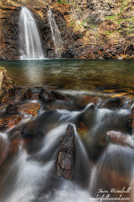
                American Canyon Creek Falls is one of those waterfalls that do not need a lot of water to look nice. It is very pretty even with only a little water flowing, and that makes it a great one to go to early in the waterfall season. Indeed, it is my go to waterfall in the early season, and one of my favorites of the little waterfalls in the area. It is incredibly gorgeous, tucked between the narrow rocks, and dumping into that incredible pool.

                It was 37 degrees when we started the hike, just a bit on the nippy side, but we warmed up quickly as we descended the hill. The hike down was uneventful. There was a decent amount of water in American Canyon Creek, not much, but it was not dry. Hoboken Creek (which flows into the main creek) was dry, however. I have never seen that creek dry before. I was also disappointed at not seeing any newts along the trail. You always see plenty of these little guys on this trail. I hope they did not die off because of the drought. I was *not* disappointed at not seeing any ticks, however. I would be quite happy if they died off from the drought.

                We got down to the falls, and crossed the creek in front of the waterfall. The rocks are very slippery and Nekoda’s boots have zero traction, so I was anxious that she not slip and fall into that big pool, but I managed to keep her from doing that. She sat down and waited patiently on the cold, wet rocks while I took my photos.

                She did quite well on the hike back up the mountain. She said she almost died but not quite (I think that means it was not an overly difficult hike). We got back to the car and I could not find my keys anywhere. I always make sure to put my keys and wallet in the top pouch of my backpack. They were not there. My wallet was in my back pocket. How the heck did it get there? I could not find the keys. The car door was also unlocked! I was absolutely certain that I had locked the car before we started. What the heck is wrong with me today?!?! The keys were not in the car, though. I carefully unpacked everything from my backpack. I found them inside the rain cover that I put over my backpack, so in other words they were on the outside of my backpack, inside the rain cover. I could have lost them on the hike so easily. Whew that was lucky. Thank you God for not letting this bozo lose his keys down in that canyon.

                No Comments