DAY 2. I BELIEVE IN MIRACLES
My plan for day 2 was not a good one. In fact, it was a very bad one, but I had no other choice. I really wanted to see Barker Creek Falls on this trip and I wanted to photograph it in good light. The problem is that it is in the sun until sunset at 8AM. That meant I had to be down at the falls at sunset, and that meant I had to setup camp near the waterfall. The problem is that there is no camping there. It is a very steep descent on a cliff down to the waterfall and you cannot get close to the creek either. On my way down to Rubicon Cascades the previous day I saw a spot somewhat near the waterfall. It was flat enough and there was water. It was just a pond, more of a swamp, but I definitely could get drinking water there. It seemed there were bugs also. It was just not a very nice place to camp. And if I camped here, I would have to get up super early the next day in the dark if I wanted to go photograph Miller Creek Falls. It was not ideal but it was the only option.
Back at the magical Rubicon, I was sleeping in. Well, according to my wife’s idea of sleeping in, it was definitely not sleeping in, but it was sleeping in for me. I would have slept a lot more but I had to get up to use the facilities. Once I’m up, I’m up, so I walked up to the waterfalls again and waited for the sun to make its way down into the canyon. Once that happened, the temperature warmed significantly. I enjoyed my breakfast and coffee, and took my time packing up. I really really really did not want to leave. It was such a glorious morning.
Eventually, I decided I should start my climb up out of the Rubicon River canyon and make my way back over to Barker Creek. I arrived there about noon.
There were quite a few clouds throughout the morning and the sun was in and out of them. A thought occurred to me. What if I could go down to Barker Creek Falls now, and hoping for the best, clouds would cover up the sun, and I would be able to get a good photo of the waterfall now, at noon. Then I could hike on to Miller Creek and camp there. It would be SO MUCH MORE pleasant to camp at Miller Creek. There were some big clouds in the distance now and heading this way towards the sun. If I hurried down there, I would not have to wait long. I prayed for the clouds to come.
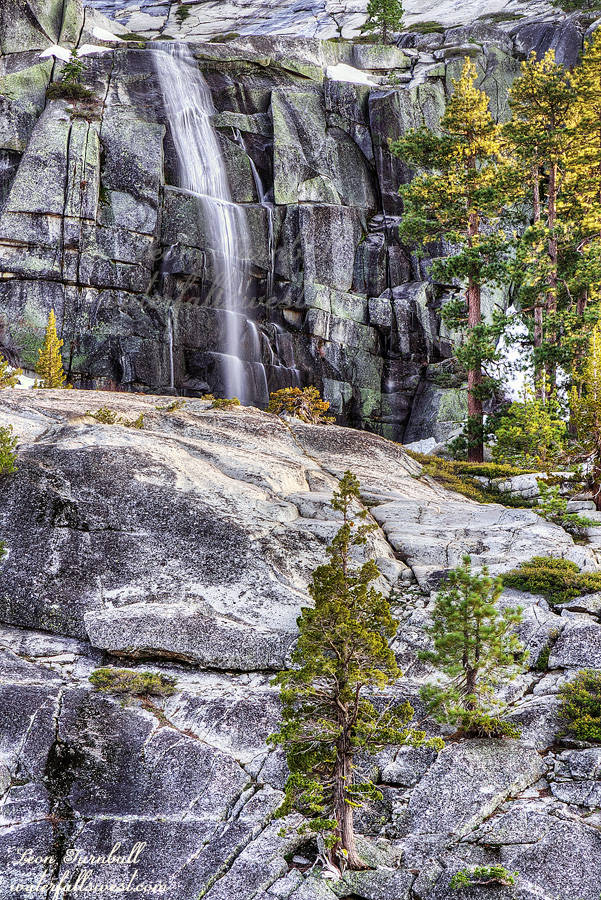
It was not very difficult to hike down to Barker Creek Falls but it is a big descent and once down there, you are standing on the cliff edge looking across at the waterfall. It was absolutely spectacular! This is a monster waterfall (270 ft. high) and it was flowing very strong, probably at peak flow for this year. What an amazing sight!
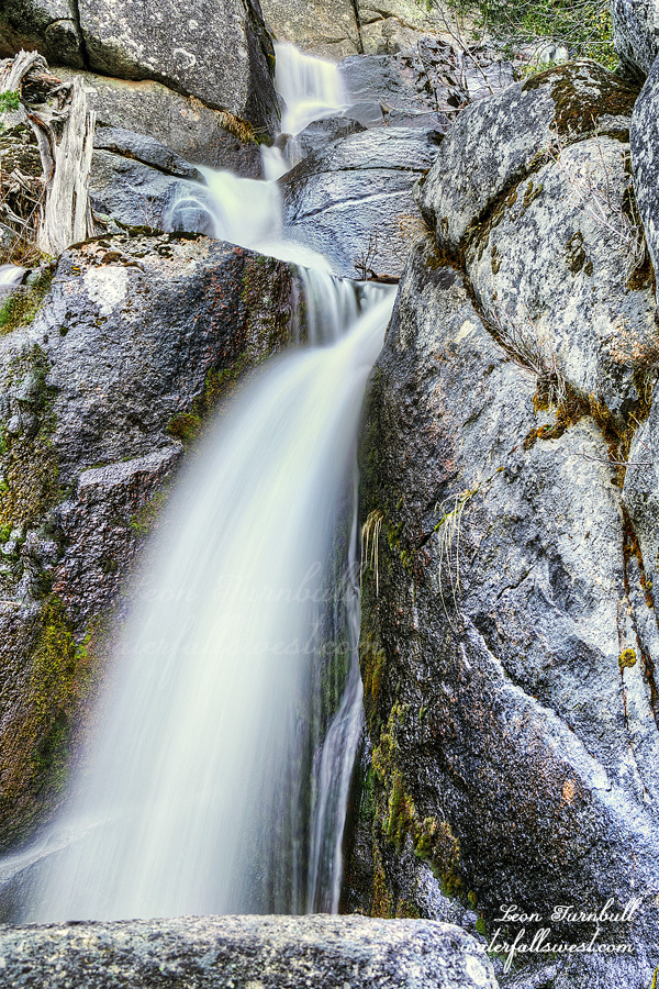
I setup my camera and waited. Those big clouds came as hoped for and I did not have to wait long. God provided for me. It was a miracle. Thank you! I was able to get a decent photo from multiple different angles. There is an upper section as well you cannot see from this spot but it is possible to get right up beside the upper section, which I did as well, and which is also amazing. Barker Creek Falls is a top tier waterfall and no one has even heard of it before. A new discovery by waterfallswest.
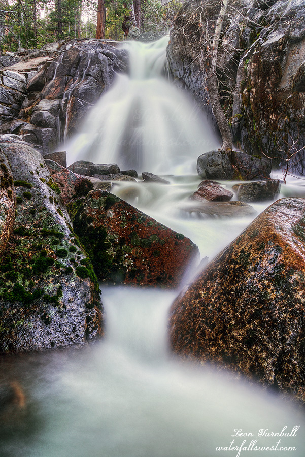
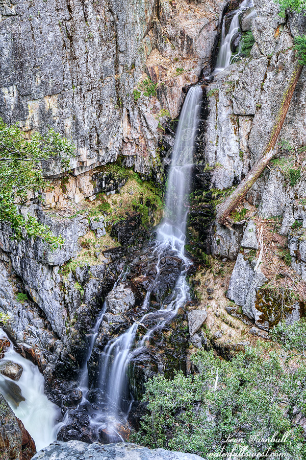
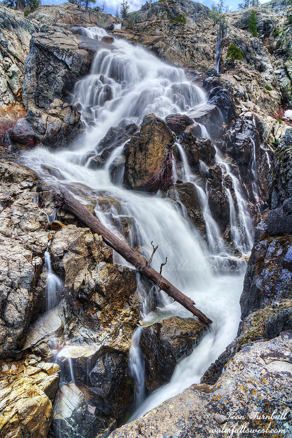
I got back to the place where I left my pack and after a rest, I continued on to Miller Creek. I arrived at Upper Miller Creek Falls and set up my camp by the waterfall. I had to wait a long time, almost to sunset, before I could photograph the falls. The clouds were all gone, and my camp was cold because it was all in shade, but the waterfall and other side of the creek was in sun. Crossing the creek to sit in the sun was NOT an option. Miller Creek was absolutely roaring. So I waited. In the cold. Then I went to bed. It was a fantastic day.