DAY 3. THE BIG GOODBYE
I slept much better the second night. It was warmer for sure, but also I always sleep better on the second night of camping. The first night I can never sleep well, no matter what, even if I am very tired. I woke up at 5:30am (sunrise), packed up, ate my breakfast, drank my coffee, and started the big hike up the mountain. Goodbye North Fork American River. Until next year.
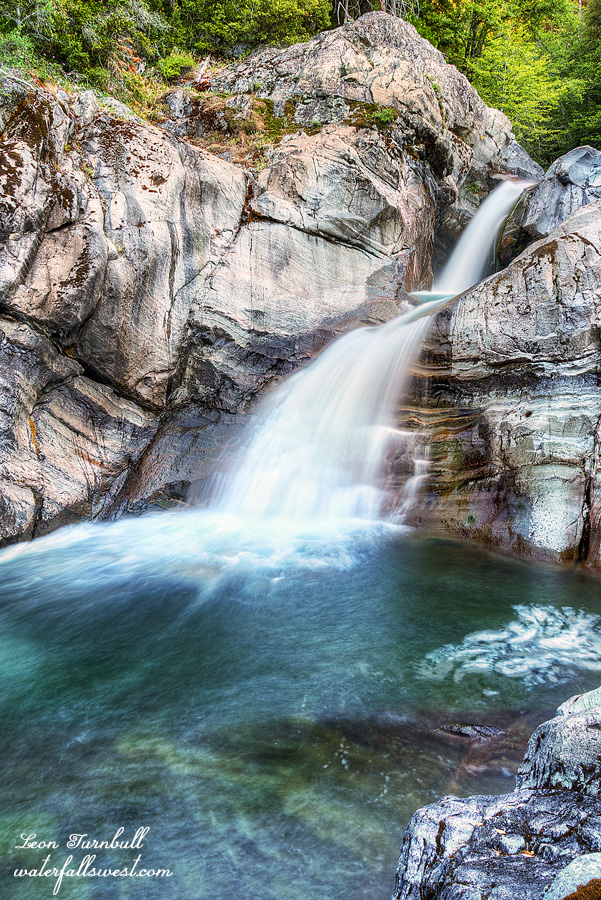
The hike starts out with a bang, the crossing of Big Granite Creek. I expected this crossing to be deadly cold first thing in the morning, but it wasn’t too bad at all. I took one more photo of the lower falls on the other side, then continued on up the hill.
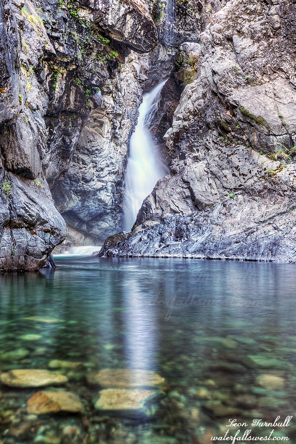
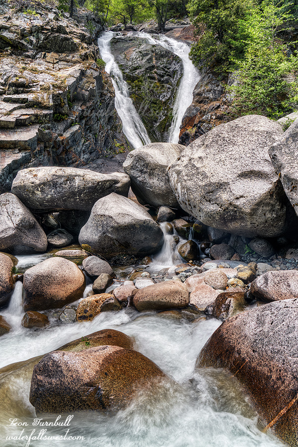
There is just one more waterfall to see along the way. Little Granite Creek drops 60 ft. into the confluence of Big Granite Creek. It is a very pretty thing, sort of shaped like a heart. I love you NFAR. (sorry, couldn’t resist saying that).
I was certain the mosquitoes would be horrendous once the temperature warmed up, but really, they were not bad at all. This was an answer to my prayer. It would have been a horrible hike if the mosquitoes were bad (the elevation gain is bad enough). There were a few strange spots where they seemed to be more prominent, but mostly they were non-existent, and I did not need to put on any bug spray.
I was carrying more weight than I should have been for the hike back up. That is because I picked up some trash down at the river. In particular, a pair of old water shoes that probably weighed 2 pounds. They were obviously there for years, yet no one else ever bothered to carry them out. It is always me that has to do it. Why is this? I’ve been thinking about this recently. It seems to me there is a small percentage of the hiking community that are the a$$holes, that trash places and don’t give a crap. These people will continue to trash and there is nothing anyone can do about it. I would not even call them part of the hiking community because they should not be allowed to hike. Then there is an equally small percentage that care deeply about the wilderness (like myself), and will always pick up trash as much as possible. There are not enough of these people. The rest of the hiking community, the vast majority, may not litter and may leave no trace themselves (hopefully), but they will not or do not want to be bothered to pick up other peoples’ trash. If you are in this group, I urge you to please consider this, and help to clean up our trails. I honestly believe that if EVERYONE picked up just 3 pieces of trash on every hike, then all our trails would be completely clean in less than one year. I posted an appeal recently to a very large hiking group to do just this, and I was thoroughly disappointed in the response. It was only that very small percentage that responded (who are already doing it to begin with). Everyone needs to help out. It is so easy. Just 3 pieces. Let’s do this, people!
Anyhow, back to my hike: It was a killer hike, obviously: 3500 ft. elevation gain. I made good time, about 1000 ft. per hour. The last 500 ft., however, were particularly grueling, I was just so darn tired. I made it back to my car at about noon, ate my lunch in the car, and drove home. It was an amazing two nights on the North Fork American River, my favorite river in the world.