DAY 1. FURY IN THE MIDDLE
I went up to Bassi Falls on Saturday morning. I did not get up early. I have been there many times before, and I have many good photos of Bassi Falls. Why would I go back to Bassi Falls? When the light would be very bad? The answer is: so I could get some video of the falls. I was not happy about the bad lighting, but I just did not want to get up at 3AM. So there.
Even though I was not super early, I was the first one to arrive at Bassi Falls. Bassi Creek is well past peak flow now, but it is still not crossable. An important point to note for later. It was not long before the hordes showed up. It was a Saturday. It was summer. I knew it would be busy at Bassi Falls, but I was not expecting all of this. By the time I left at 10AM, it was already super packed around the falls, and when I got back to the car, the parking lot was overflowed. Yikes! There was a time not long ago, when no one went to Bassi Falls, not even in summer. You needed a four wheel drive to get to the trailhead, so that was a big deterrent, plus no one knew about it. What happened? Is it because of Facebook/Instagram? I do not know. I do know it is extremely popular now. I was just talking to someone on Instagram who had a recent photo of Bassi Falls and they said they did not know the name of the waterfall and wanted to keep it secret. Secret? What is the point of that? That ship has long passed by, many years ago. Also, how can you come here (apparently, more than once) and not know the name of this waterfall? There are multiple signs saying “Bassi Falls”. You would have to be blind not to see them. And if you are blind, how could you see the waterfall?
It is also interesting to note (and I pondered this as I was sitting on the rocks by the waterfall), is that there is no trash at Bassi Falls. It is such a popular location, yet the lack of trash is very evident! This is an oddity! But it is a very happy oddity. Now having said that, as soon as I got up to leave, I immediately noticed two pieces of trash on the ground (which I picked up of course). Nonetheless, that is all I noticed. I did not look very hard, and I’m sure I could have found more if I did. Still, I was pretty happy to find extremely little garbage at Bassi Falls. In fact, it was so shocking that I was thinking I must be on a different planet.
My main plan for the weekend was to backpack to Middle Bassi Falls and camp there for the night. I was also hoping to find a brand new waterfall as well. I would not be going up to Middle Bassi the same way as I have done before. This was to be a new route, one that would put me on the correct side of the river (creek), in order to properly view and photograph the waterfall. The way I have gone in the past, you cannot view the falls very easily, and remember, the creek is still not crossable right now. I would not have to cross Bassi Creek with this new route, but is it even possible?
I just had my little car with me. The road is dirt and is really ok for cars, but there are many sharp rocks on the road, and I was really worried I would get a flat, which would be really bad way out here in the middle of nowhere. I parked two miles from the trailhead and walked the rest of the way. I saw zero people on this hike in these two days, except for one couple which I will mention below.
It is an extremely steep climb, gaining 1400 ft. of elevation. It is a huffer and a puffer. Once this is climbed, you need to drop off the road and down to Bassi Creek, losing 700 ft. of elevation. I was thinking this section could possibly be brushy and impossible to negotiate, but I mapped my route out on Google Earth, and thought I could do it. There was definitely a lot of brush and it would indeed be impossible if you do not do it correctly, but I did it correctly and there was not so much brush that I could not get through it. Really, it was not a problem at all. There were no trails. No human trails, that is. There were bear trails. I saw bear evidence (ie. Poop) even down at my campsite. It was not too fresh, but clearly bears (or bear) went down this way to get down to the creek (right beside where I had my tent setup). Lovely.
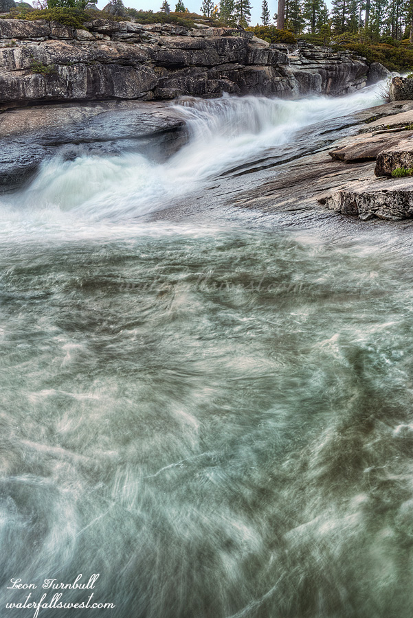
I found a perfect camping area at the top of Middle Bassi Falls. Well, not exactly perfect because it was not exactly flat, but it was good enough. There was a stiff breeze all afternoon and evening. I was not expecting this (according to the forecast), but it was extremely welcome, and it kept the mosquitoes completely away. I had a long wait until sunset. The falls would be in the sun right up until the end of the day. I tried to nap, laying down on the rocks, but there were a lot of ants and I constantly had to brush them off of me. At one point, I felt one on my leg and brushed it off, except it was not an ant. It was a bee! And it stung me! Ugh. Needless to say, I did not get any sleep.
I had some interesting visitors while I waited. There was a couple on the other side of the creek, who obviously came up the creek from the big waterfall downstream. I have done this before as well. It is extremely brushy going that route. Not recommended. I am sure that they wanted to cross Bassi Creek to get a better view of the middle falls. As I said above, you cannot see it very well from that side. It would certainly be foolish to attempt a crossing, however. They looked up and down the creek, but could not find a good way to cross it. I am sure they were wondering how the heck I got across the creek! Eventually, they gave up and went back down towards the big waterfall. I was all alone once more (just the way I like it). All the while this was happening I was giving the play by play to my wife (I had cell service here). Ha ha.
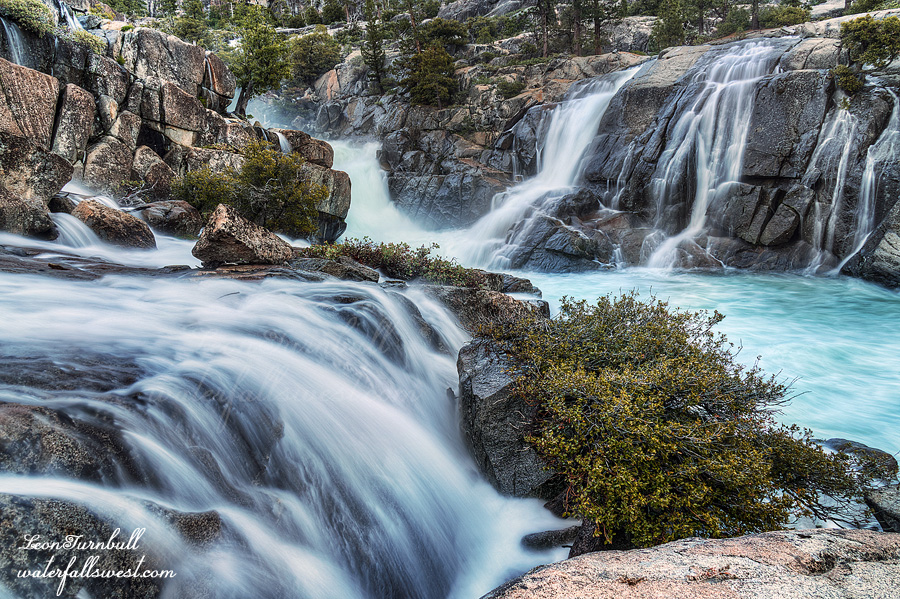
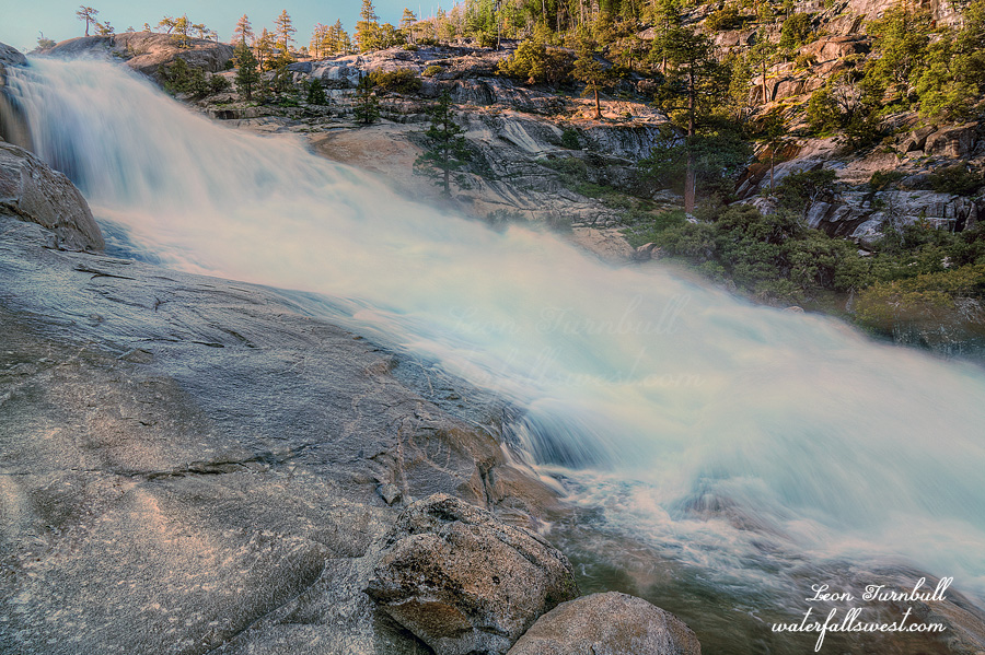
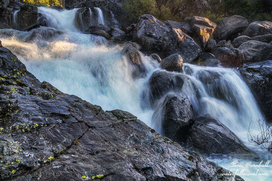
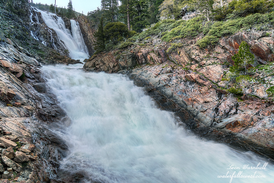
In the evening, the sun finally dipped below the mountains, and I went down to take my photographs. The middle falls is not very comparable to the huge waterfall downstream (it is only 28 ft. high), but the creek was rushing fast and furious down the granite rock, and it is a very exciting slide. It was a (surprisingly) cold night, but I slept fairly well. I would have to get up very early the next morning.