THE BLUES
I heard from a friend that the road to Blue Lakes was finally open as of this past week. I’ve always wanted to go there and never have. Until now.
I woke up while it was still dark and began packing up my tent and other belongings. As I mentioned in the last post, I forgot my headlamp. It is a bit tricky holding onto your iPhone light with one hand, while taking down and folding up your tent with the other hand. It was a one-handed tent folding extravaganza. Well, I managed to do it fairly quickly, and did not wake up any of the neighbor campers in the process. I drove down the hill and over to the Blue Lakes.
This was supposed to be a short and very easy two mile hike (one way). Of course it never works out that way for the Waterfall Madman, does it? At the first (lower) Blue Lake, I found that the road was blocked/closed. It was only blocked with a couple measly pylons that I could have easily driven around, but there was a closed sign there, and I was unsure why the road would be closed. It should be open but maybe there was a good reason it was blocked, such as snow on the road, giant mud pit ahead, road damage, etc. etc. I have never been here before, I did not know the ropes of the land so to speak, so I parked my car and walked. This would add 2.5 miles (one way) to my hike.
That is no big deal. However … now I had a sun issue. I had to be at the waterfall before the sun got onto it. By my calculations, it was now touch and go and I did not think I would make it in time. There was only one thing to do: run. On the downhill parts of the hike of course, not the uphill parts. I do not like to do this on my hikes, but I figured I had no choice. Much better to do this than to arrive at the waterfall too late and not be able to take a decent photo. So I ran and ran and ran, trying to make up just a little bit of time on the hike. Fifteen minutes or so was all I needed.
By the way, the Blue Lakes are incredibly beautiful – if I did not say so yet. The snow capped mountains in the background, and the blue colored lakes (yes, they are blue colored). Wow. A bald eagle soaring through the sky (yes indeed!). There were mosquitoes as well, the only negative thing I found there. There was snow on the trail as well, starting at 8200 ft. This created a conundrum. The trail follows a seasonal creek for awhile with steep banks. There were big unstable snow bridges on steep snowy slopes. I climbed high above the creek to get around this section. The route got much better after that, but it was very difficult to follow the trail proper with the snow cover. All of this slowed me down immensely. Could I still make it in time?
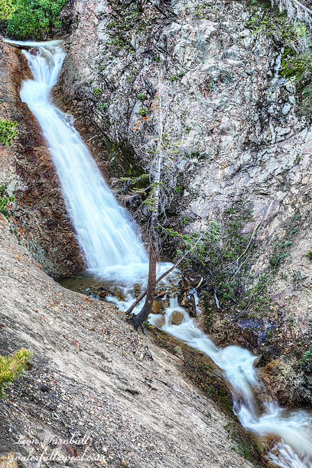
I arrived at the creek crossing. It was only a half mile from here to the falls, but I was late now. I could not jump or rock hop across this creek. I would be getting my feet wet for sure. However, to change out of my boots and into my water shoes would take precious time which I did not have. I walked straight across the creek in my boots. Two quick steps into the water. My feet were now wet but I did not care. I ran down the trail.
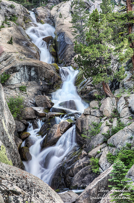
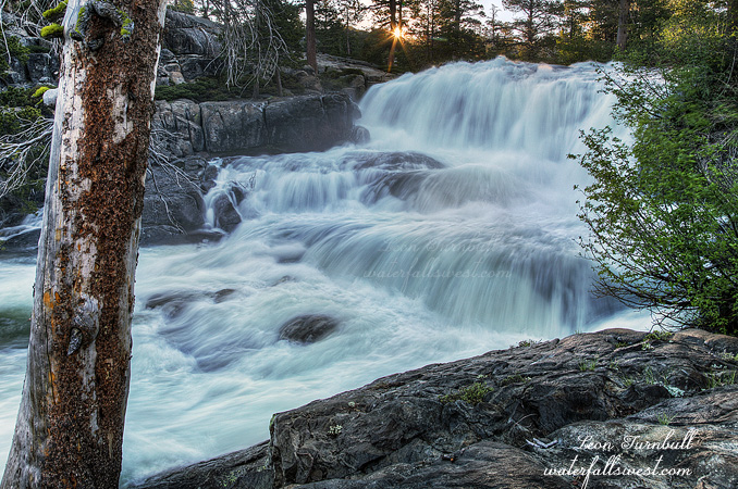
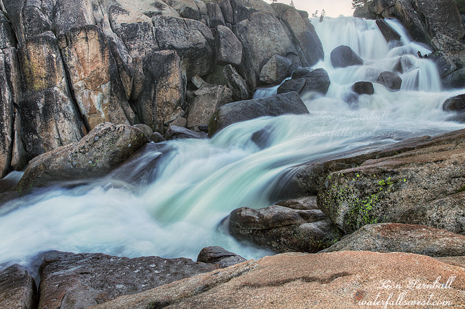
And promptly went right past the waterfall. You cannot see the falls from the trail, and it is difficult to know exactly where it is or where to go. I came down to the lower cascade, which is not terribly interesting, but I took a couple quick photos. Now I had to climb back up the hill to get to the main waterfall. I figured by now I would be too late, and the sun would be on the falls. I hoped, I prayed, I would not be too late. Thankfully, it was still in shade. Actually, I still had a lot of time to take my photos. Whew.
It is incredibly steep here. In order to see the waterfall you need to climb down the crumbly, near vertical slope. I did not have my rope. That was a mistake. This was dangerous stuff but I had to get a photo of this waterfall. Was it foolish to go down here with no rope? It was not ideal, but no, I was careful, very careful. I took some photos. Now I could relax.
On the way back, when I came back to the creek crossing, I saw, I glimpsed, a large brown animal running away as I approached the creek. What was that? Was that a bear? Was that a cougar? Or was that a deer? I did not see it clearly, and it could have been a cougar, but I think it must have been a deer. I hoped it was a deer. At least it was running the other direction.
I took my time hiking back to the lakes. No more running. Let’s enjoy the rest of this hike, shall we? When I got back to the lakes, I found many cars had now driven up the road. I guessed the road was now open officially, but in fact, I learned that they had driven right past those pylons that were blocking the road. I could have done this, had I known it was ok to do so. Oh well, it was a good hike. It was a beautiful hike.