WINTER MADNESS
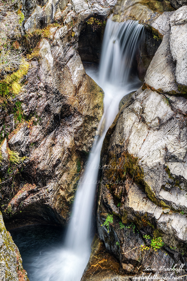
Bassi Falls in the spring? Very awesome. Bassi Falls in the winter? Not very good. What about Bassi Falls in the winter after a Pineapple Express with 11.5 inches of rain? I wondered what it would be like this last weekend after the storm. Would it be flowing as well as it does in the spring? Or perhaps even better than spring?
I was actually planning to go to Table Mountain in Oroville on this day but I was just so tired and I could not wake up. I slept in until 7:30am (for me that is incredibly late). I blame my kids. I stayed up with them on New Year’s Eve and the lack of sleep caught up with me two days later. So I slept in on the holiday Monday and did not feel like going to Oroville when I woke up. Instead, I thought about going to Bassi Falls in the afternoon. Heck, why not?
There were a lot of people on Ice House Rd, going up there to play in the snow, but no one was hiking to Bassi Falls. Nonetheless, there were a lot of tracks and the trail was well trodden down. I did not need my snow shoes as the snow was hard packed and easy to walk upon. It was quite icy, however, and I wondered if I should have brought my spikes. I especially thought it was going to be very icy at the falls (and it was).
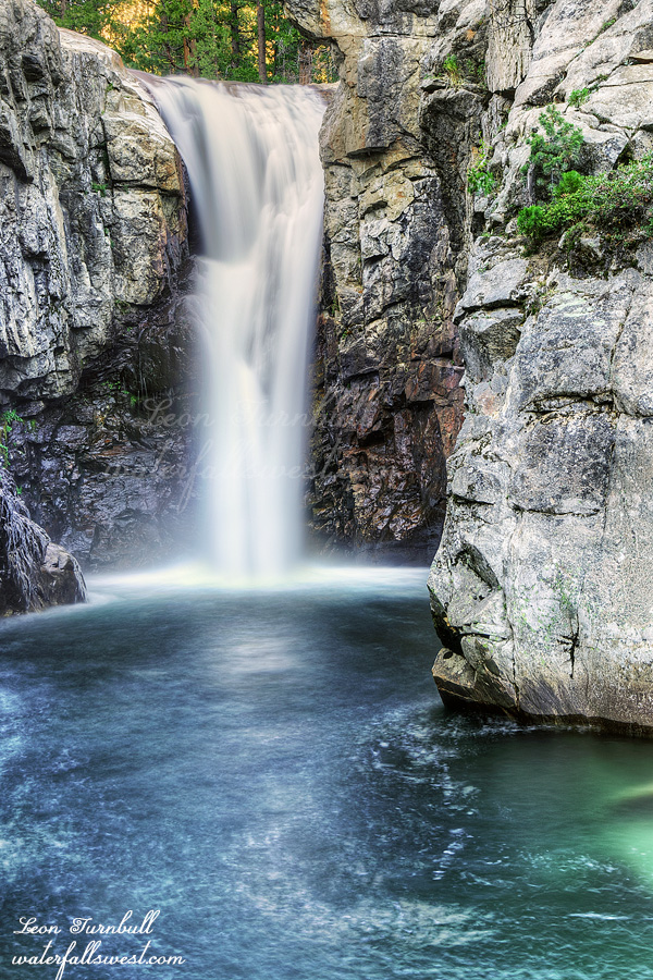
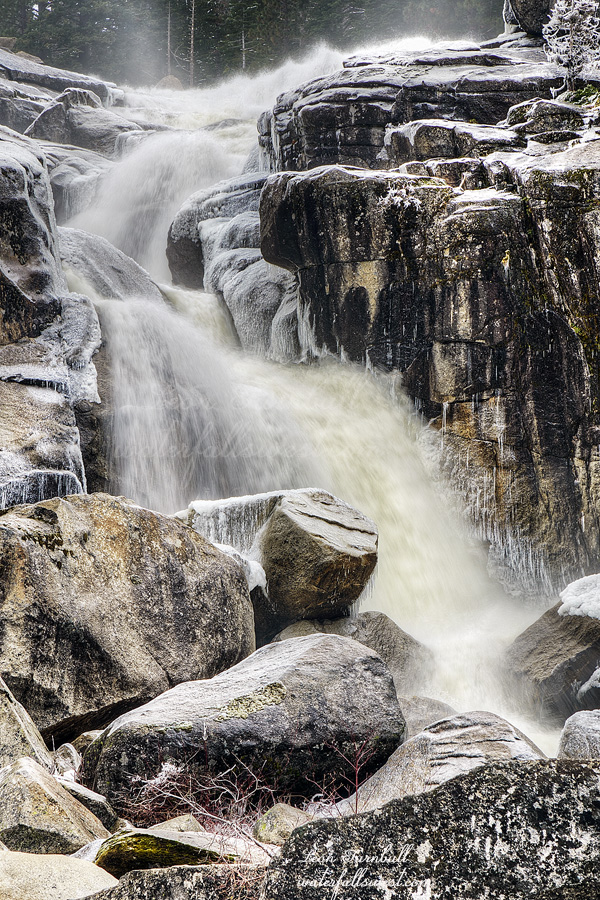
Bassi Falls was indeed spectacular and it was very much like spring flows. The ice around the waterfall was incredible and obviously not something you will see in the spring. To be honest I did not really think it would be flowing like this on Monday. This really made me wonder what it would have been like on Saturday in the rain. I imagine it would have been much tougher to get there but the water flows would have been out of this world (it would have had at about 10 times the flow on Saturday). Perhaps for the next Pineapple Express I will try this one.
By the way, to the assholes who left their graffiti all over the area this past summer, thanks so much for making Bassi Falls look like those southern California waterfalls that have ugly graffiti everywhere. Please leave your address below so I can personally thank you.
On the hike back to the car I did see a couple people. Apparently they only went to the lower falls and were on their way back already. Why would you hike all the way to the lower falls and not go to the big waterfall? I have seen that a lot. People only go to the lower falls and don’t even know there is a big waterfall just a short distance further. You people need to check out waterfallswest.com. It is a pretty good website, you know. Anyway, as I passed by this couple I definitely let them know they missed out on seeing an incredible waterfall. It was an awesome winter day in Eldorado National Forest.
No Comments