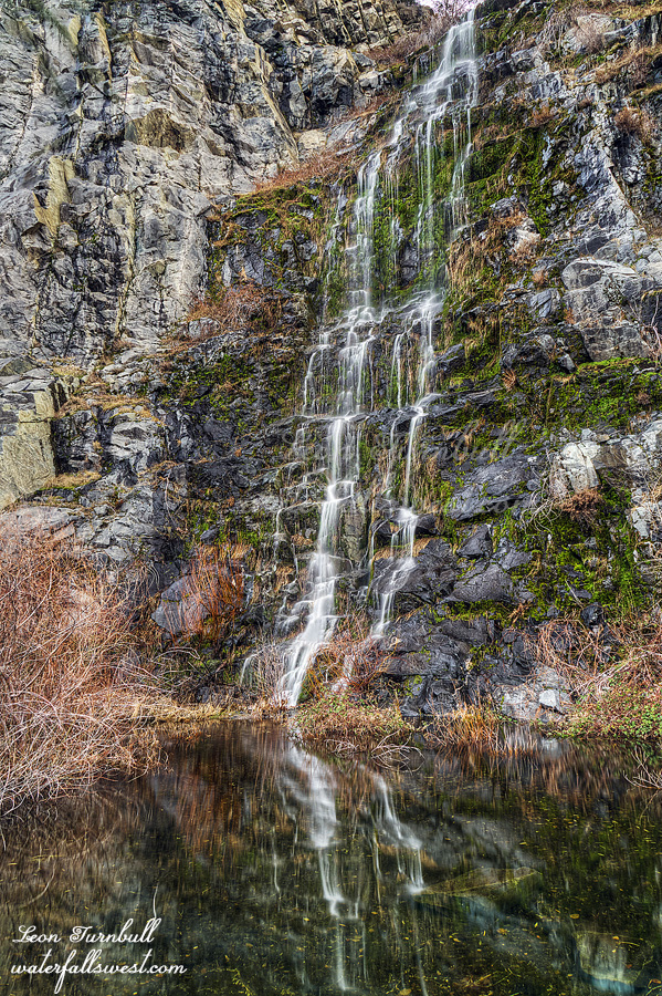
If I may be so bold, I would like to say something to all you Ventana Wilderness hikers: I think that many of you think you are very “hearty” and “tough” hikers, because you regularly hike through so much deadfall, heavy brush, swaths of ticks, and forests of poison oak. Granted, it is very tough, but that is my objection: It is not enjoyable! Ticks give you lyme disease. Poison oak gives you a horrible rash. If I was immune to poison oak, I would have no trouble bashing through it for 26 miles, as it covers over the entire trail for that distance. However, if I touch a single leaf, I will get the itch. I cannot afford to get that again this year. (already had a horrible case already). After two miles of going incredibly slowly, trying desperately to not touch any of it, I decided enough was enough, and I turned around to go to a different trail. If it was just the ticks (and there were plenty), I could deal with it (-maybe-), but not the oak. I can not hike like this for 26 miles. As for the brush, I can do a good bush whack to find a waterfall, and I have done so many times, but that is not enjoyable or fun either. It is hard! And if the brush is laced with poison oak, I probably would not do it, even if there is a waterfall.
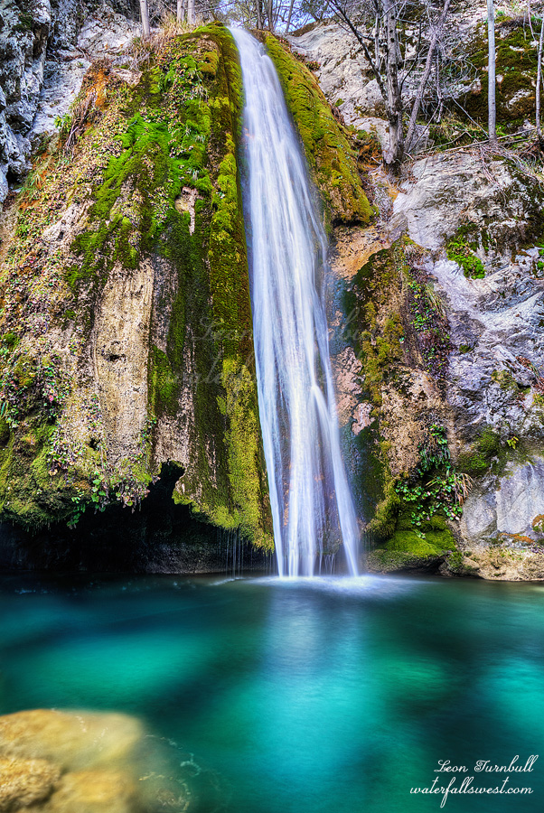
So there you go. Thus was my failed attempt in the Ventana Wilderness recently. At this point I am thinking I will never hike in Ventana again, even though there are plenty of more waterfalls to see there. Just say no to Ventana! I don’t know. Perhaps I will try again next year. This is a throwback to one successful attempt in Ventana from last year: Sugar Falls.
Posted in Northern CA, Waterfalls by leapin26: March 19, 2019
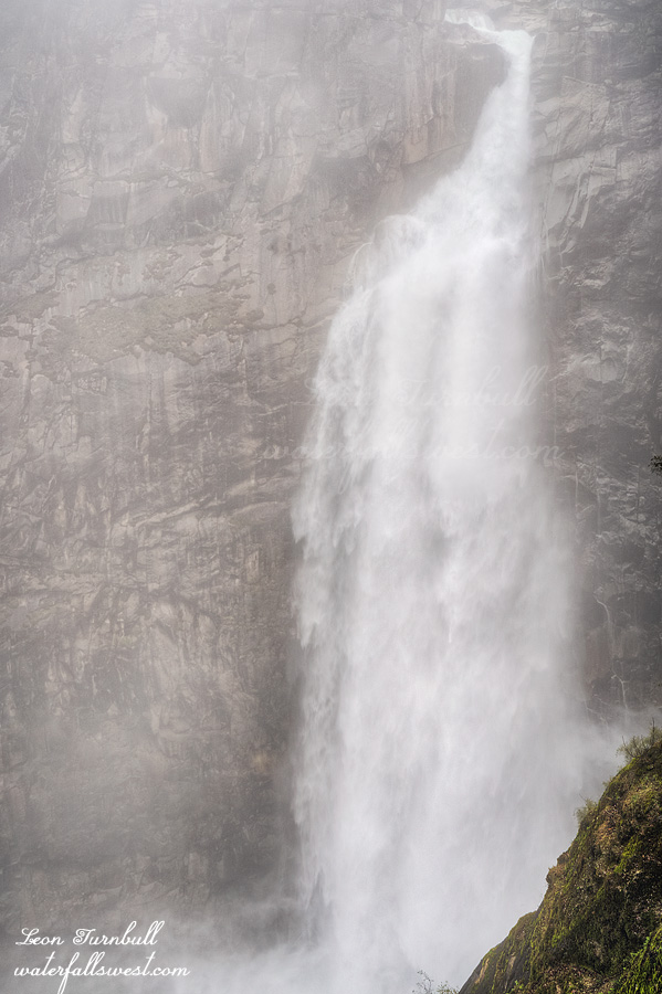
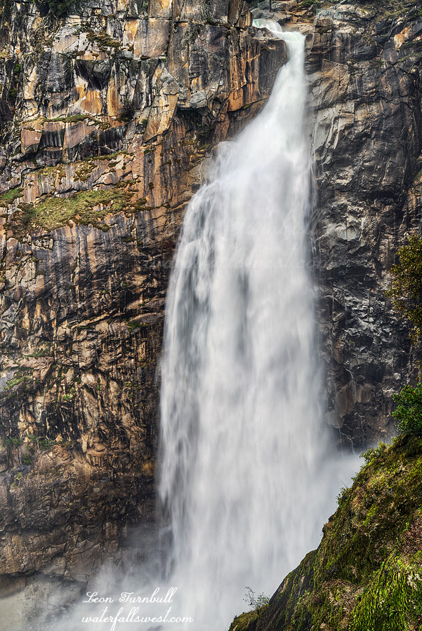
Every so often the mist from the waterfall would rise and cover the view, making it seem as if it was fogged in. Pretty darn cool.
Posted in Northern CA, Waterfalls by leapin26: February 24, 2019
As I drove up to Oroville (yet again), I debated to myself where I should hike. Should I go to Feather Falls (again)? Or should I go on a different hike to a new waterfall? I did want to go to Feather Falls. We had over 10 inches of rain in the past few days. Feather Falls would be a monster. I have seen it at full force before, but that was a long time ago, and also was before I had a good camera. I really wanted to go back there. However … I also wanted to do this other hike to find something new. It would be awesome as well for sure. I decided to go for the new waterfall. The decision was made. I continued on my journey to Oroville.
But alas, things do not always work out as planned, do they? When I got to the Feather Falls turnoff, I found snow on the road. This is very low elevation, and there is already snow here. For my planned hike, I would be at 1500 ft. higher than this. It was pretty clear to me that I would not be able to drive anywhere close to where I wanted to go, there would be way too much snow on the road, and it would be pointless to waste time trying to drive up there. I made the turnoff to Feather Falls.
Feather Falls is certainly no small consolation prize.
There were creeks flowing along the trail that are normally dry. Frey Creek was amazing. I’ve never seen so much water in that creek. I knew Feather Falls would be awesome. The anticipation was mounting but the hike seemed to take a lot longer than usual. I was not dawdling either. I began to wonder if Feather Falls would be just too much. There would be so much mist at the overlook, that I would not be able to take any photos at all. It was a pretty big concern, but it was unwarranted. There was no mistiness at the overlook, but there was a lot of mist on the waterfall. Feather Falls was a monster. A good monster. It was not what I would call “in flood”, though. The river had come down a lot in the last couple days. If I had been here two days earlier, the river would have had about twice the flow. Hard to believe but it would have been even more spectacular. Nonetheless, it was still incredible.
It really bugs me that there is always so much trash at Feather Falls. I just do not understand people. You want to come out in nature to see a beautiful waterfall, and then trash it? I picked up a lot that I saw along the trail, but there was just a ton of it thrown down in places that would be very dangerous or impossible to go pick up (particularly, at the overlook). Please people! If an empty can really is too heavy for you to carry back to your car, then at least leave it by the trail where someone else can pick it up for you. I do not want to take out your trash, and I should not have to take out your trash, but I will do it.
Anyhow, I spent about 1.5 hours at the falls, taking lots of photos and video, and enjoying the view. Then I headed back. I was surprised I did not see anyone else on the trail. I would think others would have the same idea as me, to see Feather Falls at monster flow. I almost made it all the way back to the trailhead, then I finally saw some other people just starting out their hike. There were just a couple cars in the parking lot. It was certainly a most special day at Feather Falls.
Posted in Northern CA, Waterfalls by leapin26: February 16, 2019
As of Feb. 1, here are your stats for the year thus far: Snow pack is 101% of average (northern CA), 103% (central Sierra),98% (southern Sierra). Rain is 96% of average (northern CA), 92% (central Sierra), 97% (southern Sierra). So as you can see, we are pretty darn average for the year so far. The good news is that February is starting out with a bang (the above stats do not include the storm that started on Feb. 1). I like being average. I have said it before. I wish we had average precipitation EVERY YEAR, instead of the huge ups and downs that we usually have in California. We will have to see how we end up at the end of this year with two more months to go in the winter. I am sure liking how February is starting off.
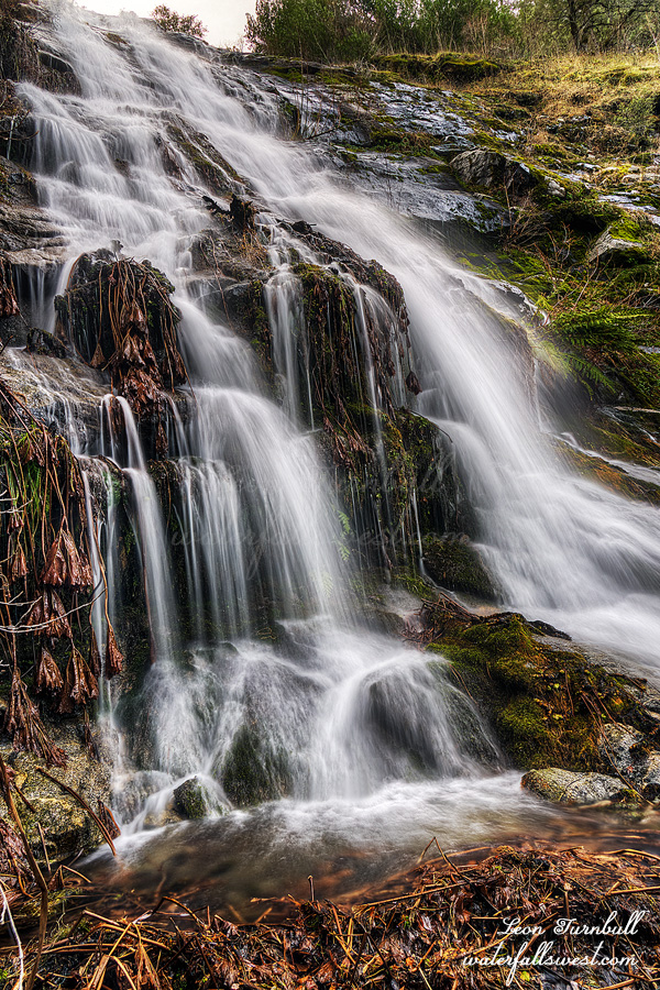
As for this photo, is it a pretty average photo of an average waterfall? This is Upper Merlin Falls, 53 ft. high. When I first went to Merlin Falls a couple years ago, I did not go to this upper Falls. Why not? It is not difficult! On that day, I totally wrenched my back on my first hike of the day. I could only BARELY hobble up to the lower falls (which is by the roadside). Going up to the upper falls was out of the question. Driving home that day was a nightmare. I am only now just getting back to this one. So many waterfalls to see, not enough time. Enjoy.
Posted in Northern CA, Waterfalls by leapin26: February 2, 2019
This is a new waterfall for me. Tobin Falls, 117 ft. high. It is a real beauty. At higher flows, it would be amazing. I found that the creeks on this side of the river were flowing quite a bit less than the other side, generally speaking. I think that is because there was no snow on the mountains on this side, and there was snow on the other side. Weird.
Anyway, to get to this one, you need to walk along the railroad tracks, which is always a bit unnerving, wherever you may be, but I saw no trains the entire morning. In the afternoon, I did see quite a few trains while I was hiking to Chambers Creek. Weird.
Posted in Northern CA, Waterfalls by leapin26: January 29, 2019
