I returned to Upper Bidwell Park in Chico. They received an additional 2 inches of rain in the past week (after the big storm the prior week) so I was sure the waterfalls here would still be flowing well.
As Journey and I hiked down the trail there were many little streams flowing along down beside the trail, sometimes in the middle of the trail. Other little creeks had very good flow. These are all normally dry. This was a great sign. Lovejoy Falls and Iron Canyon Falls would be roaring. Right?
We came to the Lovejoy Falls stream. It was pathetic. It was worse than when I was here before. What the heck? Why isn’t this creek flowing better? Indeed it should be very strong. Iron Canyon was the same way. It barely had any flow at all. It was all quite disappointing.
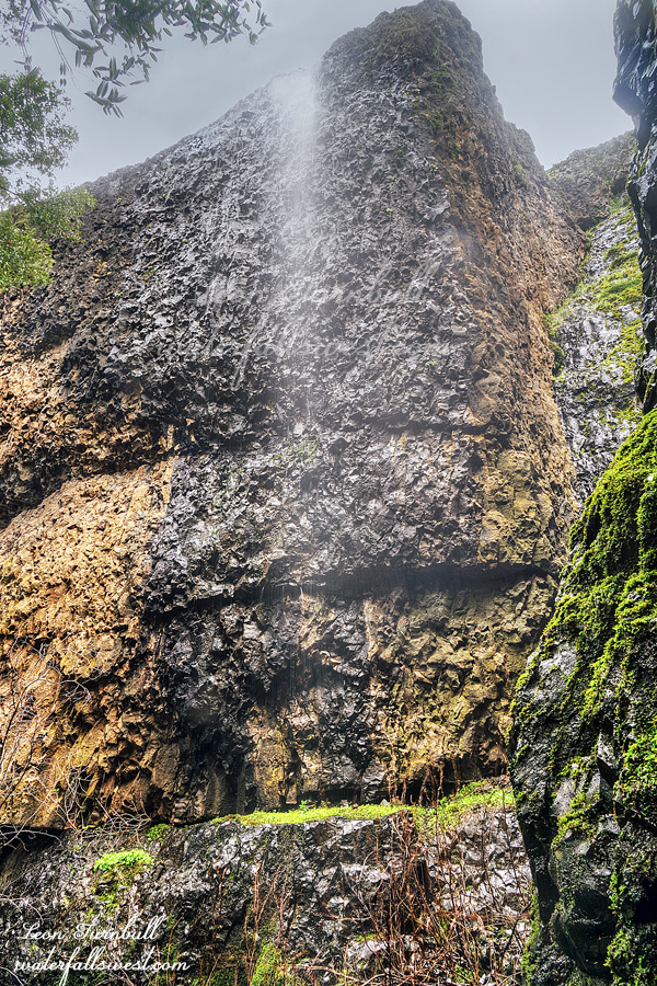
Iron Canyon Falls is 63 ft. high. I have not been to it before. There is a very interesting slot canyon you can go down to get to the bottom of it. I was not sure if Journey would be able to do it but a friend who has a dog said it was not a problem for his pooch. Indeed Journey had no trouble getting down the slot. I, on the other hand, did have a slight issue. There is a very narrow spot at the bottom and I got stuck trying to go through it. I had to take my backpack off then I was able to squeeze through, pulling my backpack down after me, with Journey following along behind. We made it. It is an incredibly cool spot. Even with the low flow there was a lot of spray from the falls and it was difficult to take photos. I can’t imagine taking photos down here at high flow (but a friend of mine has a great photo from the bottom – how did he manage?). Anyway, I will definitely be back here again when there is more water. Give me more more more.
We climbed back up the slot and over to Lovejoy Falls. Then we hiked back to the car and drove home. Even though the water flow was disappointing, it was still a gorgeous hike in Upper Bidwell Park.
After Christmas we drove to Canada to visit my family. It was somewhat sad for me because we would first be attending my mom’s memorial in Rossland. It was not a surprise that she passed but I do really miss her greatly. There were so many little things on the trip or places we went that made me think of her and miss her.
On the way we made a quick stop at Hedge Creek Falls. There has been a lot of rain in California this month but not much snow. As of Jan 1, the snow pack is in very bad shape: 45% of normal (north), 70% (central), 92% (south). Precipitation is well over 100% of normal throughout the state. However, we need the snow, not the rain. People will exclaim: global warming! If it is all due to global warming then explain why the snow pack was normal last year and the year before that. You can’t. Maybe it is just a bad year for snow in California. Hopefully we will get more snow in January, however. There was a lot of flooding because of the rain before Christmas. There was some legitimate bad flooding in southern California and some due to king tides in Marin county but others I don’t understand. Redding, for instance. They only got four inches of rain but had bad flooding. They were saying it was a 50 year storm. That is baloney. It was not a 50 year storm. 4 inches of rain is not that much. Plenty of times in recent years they had 4 inches of rain (and no flooding). I can tell you the dates if you want me to. On our own street there was a little flooding because leaves were blocking the drains and the city did not clear them out before the storm. They knew the storm was coming but they did not bother to clear the drains.
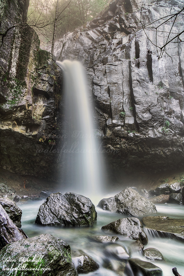
Hedge Creek Falls was roaring. There were cascades falling above the waterfall and down into the top of the falls. I think I have just seen that once before and I had the same issue then. How to photograph it? I could not figure it out. There is no decent angle to photograph the waterfall with the above cascades so I just photographed the main drop from the other side. It was wet and misty going behind the falls. Journey did not want to get wet! She went as far up on the inside of the cave as she could to avoid getting wet. She is so funny. It was a nice and quick stop at Hedge Creek Falls before we continued our journey to Canada.
A few weeks back my wife shared me a map of the current location of one of the wolf packs in northern California. The map seemed to show them very close to Lower Deer Creek Falls in Lassen National Forest. I said to her, this will be a great hike for Journey and myself to go see the wolves. She said, no way! I said, why not? I would love to see wolves in the wild.
Fast forward to Black Friday when our family was up north for Thanksgiving. On the way home I thought this hike would be a good one for myself on Journey. It is sort of on the way. Of course I knew the wolves would probably be 100 miles away by now. But hey, you never know. It is a good little hike and Journey has not done it before. The last time I did it was in 2012 with my previous dog Kaya.
It was another very cold morning, about 28 degrees. We stopped at the upper Deer Creek Falls first, took a quick photo and then drove down to the Lower Deer Creek Falls parking.
According to the national forest website this trail is currently closed due to the 2024 Park Fire. However, that fire never even touched this area so there is absolutely no reason the trail should be closed. I thought it would be worth taking a chance on it. I was right and it was perfectly fine. There were no signs at the trailhead indicating a closure and the trail itself was in perfect shape.
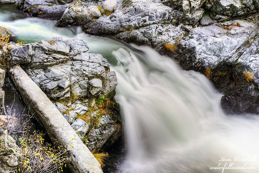
Lower Deer Creek Falls is only 10 feet high. It is a cute little thing but not exactly a magnificent waterfall; the trail, however, is a beautiful one following Deer Creek the whole way. It is really a great hike and not difficult. The trail continues past the waterfall and Journey made it very clear she wanted to keep going. Daddy, however, did not want to go any further. We took our photos and then went back. Sorry, Journey. Next time, perhaps, we will go a lot further.
Sadly, we did not see any wolves. The only wildlife we saw was a squirrel that made a fantastic leap of about 6 or 7 feet from one tree to another. All the while Journey watching it closely and hoping it would not make it. It was another beautiful and brisk morning in Lassen National Forest.
The last adventure for my week long vacation. I had two ideas for a hike with Journey. Both of them I was unsure if she would be able to do, but I thought Lower Battle Creek Falls would be the most likely one she could do out of the two of them.
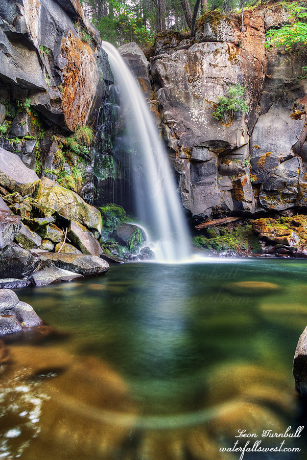
We arrived at the trailhead. It was still dark. It is an easy hike to the top of the waterfall. From there, it is quite dicey. It is a very steep descent down to the bottom with some treacherous sections. You do not want to fall. Can Journey really do this? I figured that if I could get down myself without a rope then she could probably do it. If I need a rope then that is something she probably could not do. That seems just about right. There actually is an old rope here to help you down but I did not need it or use it. And she did it! I was very proud that she made it. She did so well. She had a snack at the bottom while I took photos. Lower Battle Creek Falls is 32 feet high and still flowing nicely in late September.
As an aside, can you please explain to me how hiking through the forest is a fire hazard? If I walk too fast it will create a spark and start a fire? Utterly ridiculous. I am probably not making sense to you, but if you have been to this waterfall you might know what I am talking about. I can’t really say any more.
We climbed back up the hill and hiked back to the car. It was a very lovely morning in Lassen National Forest.
I usually take a week off work in the Fall and do one big backpacking trip. This year, I took a week because we were planning to go to Canada to see my mom one last time. Unfortunately she passed before we could leave. We will go up there later for the memorial but I did not cancel my vacation. I could still do a big backpacking trip but the weather was not very co-operative this year so I decided to do a couple small trips instead. The first one I did with Journey to Canyon Creek Falls. The second I would do by myself and go back to Mt. Shasta.
I knew there was no water up there so I would carry all the water I would need. I had 5.5 liters. I did not weigh my pack but I think it was around 45 pounds. It was agonizingly heavy. If water was not an issue Journey could have done this hike but if she came with me this time I would have to carry all her stuff and water for her as well and I would be over 60 pounds for certain. Definitely best that she stay home this time. 5.5 liters was not quite enough. I drank more than I thought going up to the waterfall viewpoint because it was quite difficult so I did not have enough for coffee in the morning. Well, I thought I could survive without coffee. It would be a close thing.
I camped at a huge wide open flat area with a view of Mt. Shasta. It was a very nice sandy spot which of course I had all to myself. There were a lot of wasps buzzing around. A huge amount of them. They did not really bother me much but the buzzing was constant all afternoon. Quite a few flies also. I set up camp, ate my dinner, and relaxed. In the evening, I went up to the waterfall viewpoint.
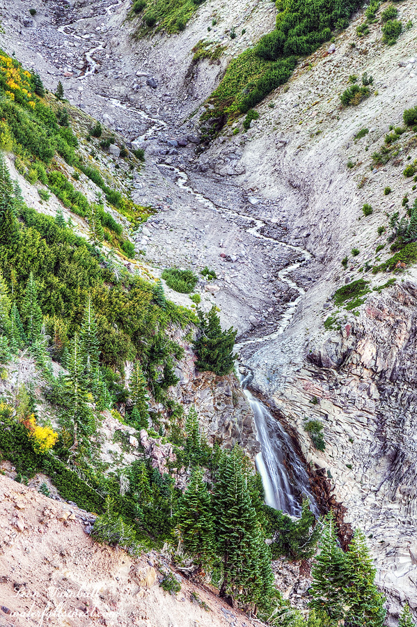
It was easy until the end at which point there was a 450 ft. climb off trail. It was a steep slog. There seemed to be a path and I think this is a climber’s route but one that is not very commonly used. I made it up to my planned viewpoint of Mud Creek Canyon Falls. It was disappointing. Very disappointing. I studied this spot on Google Earth for many hours and determined that from here I would be able to see the entire waterfall. As long as I could get close enough to the cliff edge. That was the only thing I was worried about. The cliff edge was indeed unstable and I was very careful but getting a view from the edge was not an issue. There were trees blocking the view down at the waterfall and also a ridge that was not showing on Google Earth. GE you are a bad liar. I could see probably 3/4 of the waterfall but not the bottom of it. It was not supposed to be like this. I guess my photo is not really all that horrible but in my mind I was expecting (and wanting) a lot more. I retreated back to camp.
I slept quite well but my tent zipper broke. I have already had it fixed once before so I think it is time for a new tent. Too bad I cannot afford one. It is a good thing the wasps went away at night otherwise I would have had them all in my tent which would not have been very fun. I got up for a nice sunrise view of Mt. Shasta, packed up, ate my breakfast (sans coffee) and hiked back down. It was an interesting and quick trip into the Mt. Shasta Wilderness.