Obsessed with Table Mountain
On Thursday I returned yet again to Table Mountain in Oroville. This was my fourth time there this winter. I really am obsessed with the place this year, so it seems. I just love it there. The terrain and landscape is so amazing. And there are so many waterfalls there.
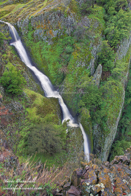
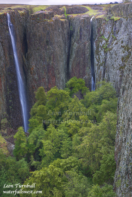
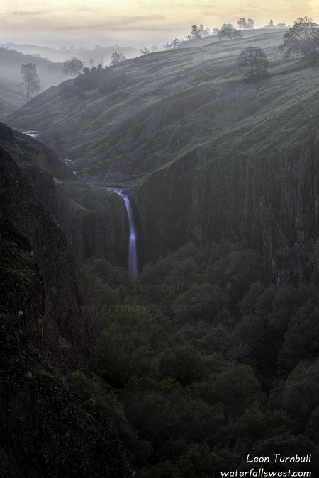
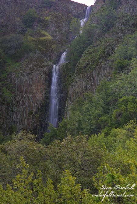
This time my goal was to go back to Ranch Falls. I wanted to try to get down and see the lower plunge of the waterfall. From the last time I was here, I figured the best way to do this would be on the south side of the creek (opposite of where I viewed the falls last time). I arrived at the cliffs on the south side of the creek at the top of the falls looking for a way down. Along the edge of the cliff is a fence (supposedly there to make sure the cows don’t take a big plunge off the cliff?). I was able to get around at the end of the fence, being very careful, as one missed step could prove rather disastrous, then I walked back along the fence looking for a way down. I had to walk further than I anticipated, but I got to a less steep spot that proved promising and worked my way down. There was actually a trail leading down, and I’m sure it wasn’t a cow trail (unless they are more dexterous at getting around fences than I had thought), so obviously people had been down this way before. There was also a lot of … you guessed it … poison oak. As I worked my way down and back towards the waterfall below the cliff, I saw a rock ledge that looked promising for a view of the waterfall. The trail seemed to go right to it as well. I climbed up on the ledge and worked my way back to the far end, as far as possible to get the best view of the waterfall. About 10 more feet would have been perfect, but then I would be flying in mid air. So this is our view of the lower section of Ranch Falls. I measured the entire waterfall to be 157 ft. high. From this side, I could see no way to get any closer to the falls. The trail ended as far as I could see, and it was far too brushy to continue. But as I looked across the canyon, it seemed that it actually might be possible to get down much closer to the falls on the other side, though it might be a bit on the steep side. Time for a fifth trip back to Table Mountain?
Unfortunately this last storm did not drop too much rain. I estimated the flow in the falls about half as much as when I had been here a couple weeks ago. Ranch Falls was still flowing quite nice but Coon was just trickling. On the plus side, the wildflowers on Table Mountain were just starting to come out. Another month, I think, and they will be spectacular.
More info on Ranch Falls:
http://www.waterfallswest.com/waterfall.php?id=952