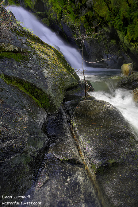
If at first you don’t succeed …

… then try again. If you fail a second time, then try a third. Let’s just hope you don’t strike out.
I was working on two strikes before I finally reached this fabulous cascade on Deer Creek off Ice House Rd. It sure wasn’t easy getting to this new found waterfall, but I did it. And that definitely made me a happy camper.
But I almost didn’t make it. Indeed, I wasn’t really in much of a hiking mood today, certainly not for a killer 5 hour hike. I actually got a decent night’s sleep (for once). I woke up at 3AM ready to go and made the long drive up Ice House Rd.
I was trying to first shoot sunrise at Loon Lake. The forecast was calling for increasing cloudiness for the morning. I was really hoping for some fantastic sunrise clouds over the lake. Not a cloud in the sky. What the hey? It was supposed to be overcast by 8AM, and rain later in the day. I was bummed. That is probably what put me in a sour non-hiking type of mood.
Nonetheless, after a quick stop at the lake (I didn’t even wait around for the sunrise), I started off on my hike anyway. I was trying to find a new waterfall on Deer Creek. Now I consider myself a pretty darn good route finder. With my excellent GPS, I can find and follow anything (if it exists, that is). According to the topo maps, there is an old trail that follows Deer Creek down to the Rubicon Trail. Well, I could not find it. There may have been a trail at one time long ago, but it is no more. I was wandering through the forest looking high and low for any hint of a trail. Nothing. I had my GPS but I was still worried I might get lost in the forest. My GPS is excellent under tree cover, but if I lost a signal, I could be in trouble. Eventually, I turned back, realizing that there was no trail. Strike one.
But there was an old logging road, so I decided to follow it down and see where it went. It led down to the creek, then seemed to continue up the creek (instead of going down to where the waterfall would be). No good following the logging road. Strike two.
But on the way back, I did find a trail. This was actually a secondary trail on the topo map going down to Deer Creek. By this time, I was ready to quit, especially for not being in much of a hiking mood. Nonetheless, I followed it down. It was overgrown, but it was clear enough to follow. The trail did not follow the correct contour as indicated on the USGS topo maps. It led down to a logging road, then stopped. Possibly the same logging road as I was following earlier. This time the logging road did continue down Deer Creek, so I followed it down. I soon realized it was going to continue on down right to the waterfall. Sweet. Now the only question was whether I could actually get down to the falls or not.
As I approached the vicinity of the waterfall, I had to get off the road, and do some scrambling down to the falls. It was steep. It was cliffy as well. I was still not in a hiking mood. But I was deep into the hike and if I came all this way down, there was no way I was not going to do everything possible to get to the waterfall. I did find a route down to the bottom of the waterfall. It was really a fabulous cascade, which I measured to be 99 ft. high. The only problem was that there was no good view of the falls from the bottom. There was a ton of fallen logs, trees, and brush in the way. Not to mention, by this time the sun was shining right on the falls. What happened to those overcast skies by 8AM? I could not get any closer due to the cliffs. I took a quick snap, then started back up the hill. However, I decided to try again, going back down to the falls, around the cliff section, and closer to the top of the waterfall. From there, I was able to make my way down to the creek again, this time right close to the base of the falls. It was still difficult to take a photo from there, but I did manage to get this somewhat decent shot of the bottom 25 ft. section of the waterfall. Time to head back up the long difficult trail back to the car. But now I was in a great mood.
4 Comments