Silver Fork

I’ve been wondering for a few years now about the Silver Fork American River. Specifically, wondering if there are any waterfalls on it. I had not heard of any. But surely, I thought, there *must* be a waterfall on this river. Not a big one, I knew, but there must be a small one, a decent one, somewhere on this river.
I studied the topo maps. Studied them some more. I came up with a possible location. It even looked like there was a trail leading right to it. Sweet.
Well fast forward to a Friday evening in late July. I was in a certain mood. An exploring mood. But not for any difficult exploring. I wanted to get out of the house, get up in the mountains, away from the heat of the city. But I didn’t want a difficult hike, just an easy one, but not too easy. Well, where could I possibly go for that? Then a light bulb clicked. How about the Silver Fork? Seemed like a great idea. That river would be still flowing decent. It is not too far from my house, and the hike should not be too difficult. Perfect. And off I went.
I drove up the Silver Fork Road at Kyburz. I found that it was paved the whole way. That was sure nice. I didn’t want to have to wash my vehicle again so soon. I arrived at the trailhead, and I was surprised to find there was a campsite here. I didn’t know there was one here, and I didn’t know where the trailhead was, so I wandered through the campsite in search of the trail. Eventually I found it, and it would have been easier to find if I went the correct way, but oh well.
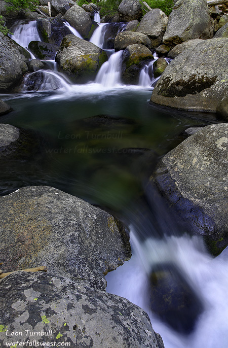
Once on the trail, things were easy. The trail leads up to where Caples Creek flows into the Silver Fork, then crosses Caples Creek on a bridge, and leads back to the Silver Fork. Both Caples Creek and the Silver Fork had pretty good flow. I arrived at the spot where I thought there would be a waterfall, and yay, lo and behold, there was one.
But I was quite early, the sun was still shining down into the canyon, and I felt like doing more hiking. So I continued on up the trail for another couple miles. The trail was mostly flat the entire distance, so it was a good hike and not too difficult. Just what the doctor ordered. I realized that I could have hiked all the way to Silver Lake. It would not have been all that far to the lake, but it was a bit far for me on this day, so I turned around well before getting to the lake. On the way back, I heard a totally obscene and outrageous noise coming up the trail interrupting my beautiful, pleasant hike. It was someone on a motorcycle coming towards me. I got out of the way, but this really irritated me because motor vehicles are not allowed on this trail. There are plenty of places where people can ride their motorcycles and not chew up nice hiking trails. Argh.
Anyway, I arrived back at the waterfall. As you can see from this photo, it does not look like much of a waterfall. I measured it to be 23 feet high. The problem with this waterfall is that it needs a lot of water flowing in the river to make it look good. There are so many boulders in the river, when the flow is lower in the summer, it just doesn’t look so good. But in the spring, when the flow is high, I think this waterfall would be rockin. I definitely plan to be back here next spring. Though I won’t be able to stand in the middle of the river to take photos in the spring, so that might make things more interesting.

August 30th, 2010 at 2:04 pm
Downstream quite a ways from the campground/bridge is a waterfall around 20′ high. It has a big cascading mess above it. In the kayak realm it’s nicknamed “bruised balls falls” because it has a shallow landing that people have hit and well….
August 30th, 2010 at 5:13 pm
Thanks Darin