DANGER, WILL ROBINSON!
The first day after Christmas we went up on the ski hill. Red Mountain is the best ski hill anywhere. Am I biased? Maybe. My children do not ski much, because it is so expensive down in California. Shame on me, I do not like to ski is much as I used to. I have skied at all the Lake Tahoe resorts, and they are good hills there, but it is so expensive and such a long drive to Tahoe. Frankly, nowadays I prefer to hike and not ski. It is much cheaper, and more fulfilling also. However, when I am back in my hometown I do ski (since my mom pays for it). So although my kids are not expert skiers, they do really well when they do go. My daughter and son both got up on the top of Red Mountain for the first time, and there are no easy runs from the top of that lift. They did great. We did have one funny incident when we went to the very top (Granite Mtn), with my daughter Nekoda and niece Hannah. As we were about to get off the lift, Hannah’s board got caught and she did a faceplant. Right in front of me. I could see this whole thing unfolding in slow motion. I could not get off or I would have sliced her head open stepping on her, so I waited for her to get out of my way, then I realized there was no more ramp for me to get off on, and the lift was turning to go back downhill, so I just jumped. It was about 10 ft, and I slammed into a pole, but fortunately the snow was soft. The ski patrol guy came over. He first asked me if I was ok (so nice of him to be so concerned for me), then he harangued me about how I should be getting off the lift properly, as if I was a stupid beginner who does not know how to get off a chair lift. Yeah ok, Mr. Expert, in case you did not notice, I would have killed my niece if I had tried to get off. Thank you very much. At least my sister was thankful I did not severely injure her daughter. I’m sure Hannah was grateful also.
On the second day, the day that Carrie Fisher died, he went to see Rogue One in the theater. I still remember clearly the day in 1977 my family took us to see Star Wars. I was nine. Now 39 years later, I take my family back to the very same theater to see this movie. It seemed rather appropriate.
On the third day, we were supposed to go skiing again however some members of our family, not to name any names, did not want to go up. So I grabbed my things and headed down the hill to Beaver Falls.
It is an interesting hike in the winter along the railroad tracks. And fun. There was about 2 feet of snow on the ground, and they do not clear the tracks in the winter, so the snow shoes were a definite necessity.
In the beginning, you go past some houses. One raging dog maniac was barking his head off at me, and wagging his tail at the same time. Trying to get at me if he could (to lick me to death?). His two dog companions, however, were howling ridiculously. It sounded as if they were both being slowly eaten alive by some sort of large animal. I’m not kidding. It was pathetic.
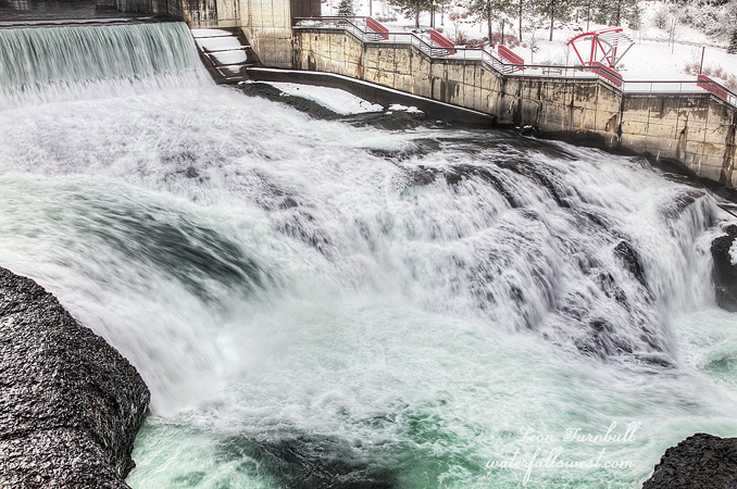
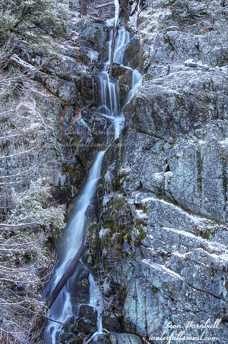
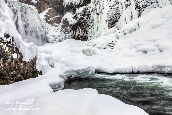
Along the way, I saw some tracks that must’ve been coyote. It looked like the coyote was jumping down the trail because the tracks were huge, almost like a bear. Then I came across fresh deer tracks and I followed the deer trail all the way to the falls and right down to the bottom. It was not hard getting to the bottom, but once down things got downright dangerous. The water level was very high for this time of year, and I could not follow along the creek bed as I normally would.
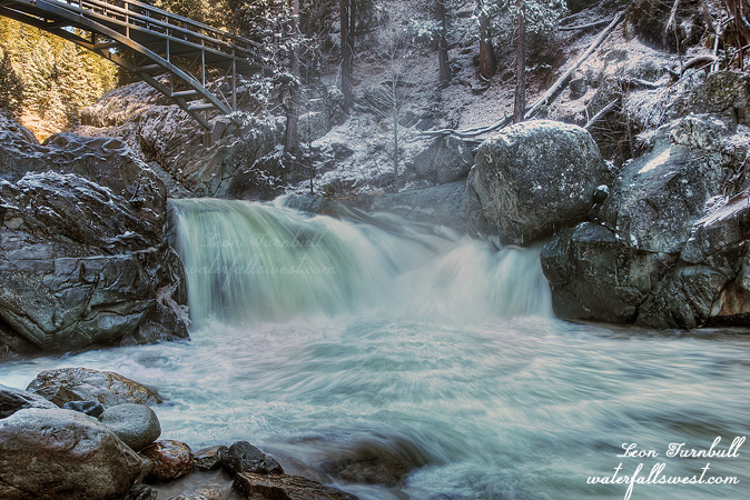
I had to ditch the snowshoes, then climb up a cliff and along the cliff before I could get back down to creek level. Once down, I had to work my way out on the ice towards the creek edge in order to see the waterfall around the corner. The raging creek was flowing right under my feet as I stood on the shaky ice. It was a bit freaky and I did not, I could not go any further up towards the falls, and I certainly did not want to get out any closer to the edge of the creek for fear of dropping through the ice. If my wife is reading this, then I will say I was perfectly safe where I was standing to take this shot, and I made sure the ice was very secure under my feet. Ok, honey? Anyway, it was incredibly beautiful down there. My first snowshoe hike of the season.
No Comments