MILLER TIME

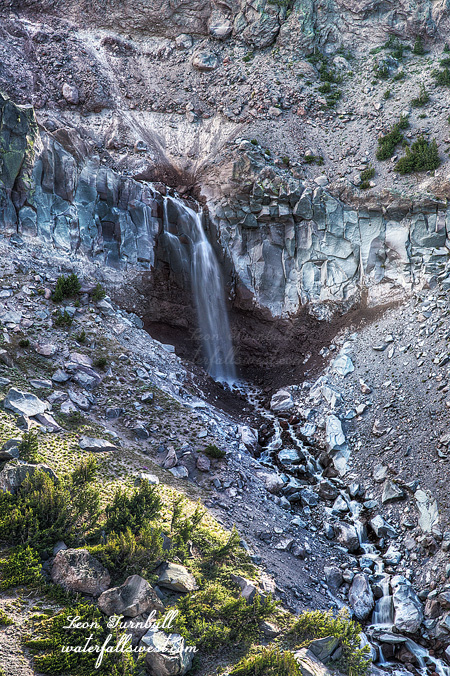
Out for a stroll this weekend, and I was up at 3AM. Ouch. I arrived at the trailhead at 5:30AM. This is the world famous and extremely popular Rubicon Trail. The parking lot was jam pack full with cars and trailers. Ouch. I expected there to be people and jeeps on the trail, but not this many. It is summertime. I had actually wanted to come on this hike much earlier in the spring, but this was the first chance I had this year. It was time to go see Miller Creek Falls. It was Miller Time. I managed to squeeze my SUV into one of the only remaining spaces.

Well hopefully I would not see any jeeps on the trail. Yeah right. Going into the waterfall, indeed I did not see anyone, but coming back? Hmph. As for the weather, it was a cool and very pleasant 37 degrees. A nice start to the day, but it would warm up quickly, and with the warmth would come nightmarish mosquitoes. I was hoping to at least get to the waterfall before the mosquitoes came out to play. I did not quite make it.

Along the way, I pass 4 alpine lakes. If lakes can be ugly (can they be ugly?) then these ones were ugly. Well, the third one was quite nice, but the others were just completely covered with vegetation, like a big bog. They were not very scenic. But anyway, I continued on. I could see the creek had quite a bit of water, which was a good sign, as I was not sure how well the falls would still be flowing since it is already summer. Now I just had to get down there before the sun. If I stopped at all, the skeeters were over me. Needless  to say I only stopped the one time.

It was a pretty easy hike until I got to the top of the waterfall. From there I could see nothing but cliff. How would I get down? I hummed and hawed, I was running out of time, I just decided to go for it. But carefully go for it, of course. No need to jump off the cliff. There was a perfect little ledge that took me right to the bottom of the waterfall. If it were not there, I don’t think it would be possible to get to the falls. Thank you ledge. Or rather, thank you God for putting it there. 

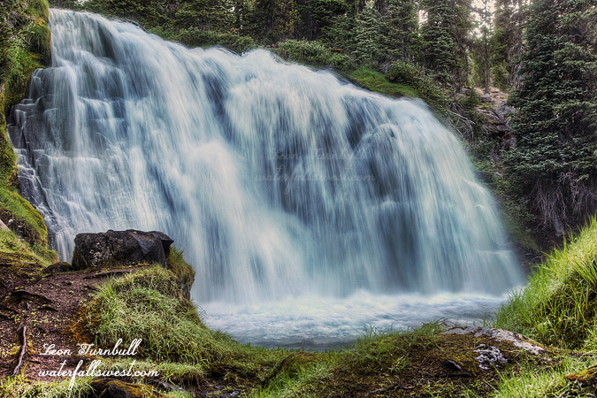
Miller Creek Falls is gorgeous, 54 feet high in total. And there was even more than this one. It is a very awesome little creek and I will be back here someday to explore it fully.

I lathered up in Skeeter juice for the hike back. Unfortunately, I did see quite a few jeeps coming up the trail. The first one was a Ranger, and he asked me where I was coming from. I believe he thought I was backpacking somewhere. I was wearing my big camera pack of course, and many people have mistaken it for a backpack. This Ranger will not be the last to do that. But if I was backpacking, then I would need a permit and I think that’s what he was wondering about. Actually, I did not know if I was in the wilderness or not at this point, and if so would I need a permit even for day hiking? I’ve been asked for them before when hiking in the Desolation Wilderness. I told him I was just on a day hike and down at the waterfall, all the while swatting the mosquitoes away from my face (he made me stop in a mosquito zone in order to talk to me). He let me go quickly, perhaps because he felt sorry for me, standing there swatting mosquitoes. I do wonder though if he even knew there was a waterfall down there.

After that I saw about 10,000 more jeeps and OHVs. I wondered where they all had parked, because the lot really was completely full when I had gotten there this morning. I hoped no one had blocked me in, keeping me stuck there all weekend. How nice would that be. By the time I got back to the car, I was thoroughly annoyed with them all for sure. For each one, I had to get off the road, stop and wait for them to pass, give them a polite wave with one hand, swatting mosquitoes with the other. I guess that is what you get for hiking on the single most popular jeep trail in the summertime, and on the weekend. Shame on me.

No Comments

BUMMED

After work on Friday I took my son Jadon up the hill to go on an evening hike. It is rare he wants to go with me. I always ask him, and he almost always says no. I strongly suspect it is because I usually get up at bloody awful hours of the morning to go hiking. This time I would be going in the evening, and he said yes. Coincidence? Probably not.

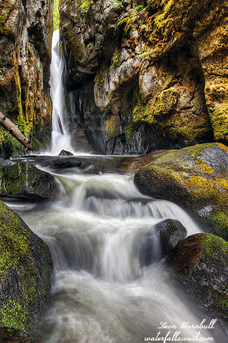
Traffic was awful but we arrived at Squaw Valley Resort and started the hike in good time, however I underestimated just how long this hike would take, and I also grossly misjudged the off-trail section we would be doing. Off-trail section? There is no off-trail section, it is a fine, completely all on-trail hike up to Shirley Lake. Right? You forget who you are dealing with here. Well it was mostly on-trail, and although there are many indistinct parts, it is mostly marked and easy enough to follow, but it is still a tough uphill climb to the lake. There is a small waterfall along the trail that everybody stops and takes pictures of. I knew about this one of course. There is also a second small waterfall above it that I did not know about. It is difficult to get down to it and photograph it, and that is probably why I had not seen photos of it. Nonetheless I was able to get down to it without too much difficulty, but Jadon elected to stay up on the trail, safe and sound. Good choice. Nonetheless, I managed to avoid falling off the scary rock overlook.

Besides these two falls, there are two other bigger waterfalls in the area and this was my major reason to come on this hike, and this is why I was so bummed. The first one is off-trail. It looked so easy on Google Earth, but it turned out to be very brushy, much too brushy, with a difficult creek crossing as well. We tried, and maybe if I was by myself I would have tried to smash through that brush and cross the creek, but it was just really difficult. Because of all the off-trail shenanigans, it was 7PM by the time we got up to Shirley Lake. We had to go back down. As it is, we barely made it back to the car before dark, there is no way we could have continued to the second big waterfall. So yes, I got to see a couple small waterfalls I had not seen before, and Jadon and I had a fun time hiking together, but I was definitely bummed that I could not get to either of the big waterfalls. I will certainly be  back again someday to attempt to smash through that brush.

No Comments

LOST !

I got up super early for this one: one last hike on the Memorial Day long weekend. Way too early indeed. 3AM early.

The trouble with this hike is, and it’s why I have not done it before, is that the sun gets on the waterfalls very early and it is a very long hike to get to them, which makes it almost impossible to get to them in good light. However, I found a better way. I just was not sure if I could do it this early in the season, but good news: there was no snow on the road and I could drive all the way to the new trailhead. This might actually work after all.

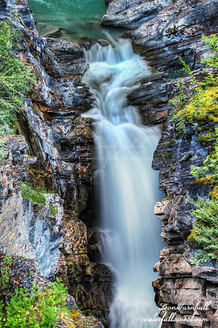
Indeed, it turned out to be a very easy hike to the waterfall. Only 1.5 miles instead of 5.5 miles. That’s a darn good shaving. Very little elevation gain, and only a little bit of cross country hiking was involved, nothing too difficult. I got to the falls in good time and it was flowing great. It is 41 feet high and it is a beauty.

In case you are wondering, I purposely made a longer exposure of this waterfall than usual. Some people do not like the silky waterfall look with longer exposures, and that is perfectly fine, and I agree that in some cases it is better to use a shorter exposure. Mostly, though, only with powerful waterfalls, not with smaller waterfalls. I am adamant about this. A short exposure with smaller waterfalls like this one will make the falls look choppy and uninteresting. Be a better photographer. A longer exposure will give the image a very artistic feel, and that is what I was trying for with this shot. I think I succeeded.

I decided not to go down to the bottom of the falls, as the view from up above is stellar anyway, but also I wanted to try to get to the upper Falls in good light. I figured I could go to the bottom afterwards if it was still in shade when I got back down to it. However, finding the upper Falls was troublesome to say the least. It is not in the place where it is supposed to be, in fact there is no waterfall at all where it is marked on all the maps. Did it even exist? No wonder I’ve never seen any photos of it. I had to do some serious off-trail exploring through the snow, but eventually I found the upper falls and it’s a nice one as well. Photo is coming later.

By the time I found it, I figured the lower Falls would be in the sun so I decided to go back a different route thinking it would be much much easier. Big mistake. It was not only harder, but I got lost. Not really, but I definitely would’ve been seriously lost and likely still out there if I did not have a GPS.

The first trouble was that snow, which covered most of the trail. The second trouble was that the actual trail did not precisely follow the USGS topo maps. Despite the snow cover, I was able to follow the trail fairly closely and even if I missed part of it I always found it again quickly. Until …. I came to a big Meadow and swamp, where I lost the trail completely and there was no finding it again. The trail supposedly went right through the middle of the swamp, but who knows if it really did or not. Not wanting to go back, I just hiked along the Meadow to the end. It was not so easy to do but I made it to the end of the meadow, where I found the trail again. And just in time. The trail proper took off in a different direction down a gully on the other side of the ridge. Well all right, it will be a cakewalk from here, right? Nope. At the bottom of this little gully there was another swampy area. And I lost the trail again! This time was much worse. I got completely turned around from where I was supposed to be heading. However, all I had to do was just follow my trusty GPS and it led me in the right direction and back onto the trail proper. No problem. The rest of the hike was indeed a cakewalk.

I have been thinking a lot lately about that guy and his dog who got lost hiking in the Sierra Nevada. In addition, there was some other person who got lost out east on the Appalachian trail and died, within a mile of the trail. But I don’t really get it. There is no excuse for getting lost in the wilderness if you are properly prepared. These people did not have a GPS. Why would you not have a GPS? Or at least a Compass and know how to use it? If you do not have a GPS, you can download maps onto your phone (even if there is no cell coverage), and you can buy solar powered chargers for your cell phone, right? So there is no reason at all for getting lost. I always take my GPS, with extra charged batteries, plus I have downloaded Maps onto my phone for emergency backup situations, and a SPOT device for real emergencies. So there you have it. Be prepared, don’t die. That’s a good philosophy. Am I right?

http://waterfallswest.com/waterfall.php?id=lower-canyon-creek-falls-926

2 Comments

ONE WITH THE BEARS

I arrived at Shasta in the afternoon and ready to start my hike. Soon after I started, I encountered snow. Snow patches at first but then solid steady snow at 6300 feet. I would be gaining 1500 feet in elevation, which is hard enough as it is, but with most of that through snow it would be more difficult. I was not expecting much snow at all until about 7000 ft, so this was a big surprise, and at some spots I was hiking through 7-8 ft of snow under my feet! No joke.

But it was fun! The snow was very solid and I was not sinking through, and even though it was very warm out, the snow was not melting much, if at all. I was not a little worried the waterfall would still be snow covered, and not flowing at all. I followed many bear tracks up through the snow. I was one with the Bears. It is funny that I have seen so many bear tracks this year, but I’ve never seen the bear that goes along with them. Just as well, I suppose. The snow is what made the hiking fun and it was easy enough to get all the way up to the creek on logging roads (easy is relative when you have to gain 1500 ft. however). Once at the creek I just had to climb up the steep snowbank for a little, and I would be at the waterfall. Easier said than done. This last part was definitely a bit treacherous, but I made it up close enough for a decent view of the 45 foot high falls. No one has previously documented this waterfall before, and it is quite a pretty one. I had to wait, as expected, for the sun to go behind the ridge. It took quite a while, so I ate my dinner, sat in the cold snow, froze my bum off, and waited and waited and waited. I still did not get all the sun out of my frame but I think this shot is quite decent.

It was easier to hike down the mountain of course, but it was still tiring. It is not so fun when you are tired. I think I saw some new bear tracks that were not there on the way up, I am pretty sure, but the bear was not anywhere to be seen as usual.

After this, my plan was to camp out somewhere around Mount Shasta, deep in the woods, all by myself. This was in order to do an early morning hike somewhere else. However, the hike I wanted to do was not going to work. That creek was completely dry. This was mind-boggling to me. All the other creeks on Shasta are running with decent snow melt, why is this one dry? I had to come up with a plan B and that was to hike to Ash Creek Falls next morning, which is not something I wanted to do again, but I had no better options. I did do the hike to Ash Creek Falls in the morning, but I did not take any photos because it took longer than expected and it was in the sun when I got there. It was still a good hike. It involved a lot more snow hiking too. By the end of it all, I was doggone tired.

http://waterfallswest.com/waterfall.php?id=upper-squaw-valley-creek-falls-shasta-2037

No Comments

ROCKY ROAD

Well I did have a big big hike planned this past weekend. It was going to be glorious. However, on Friday, we got over a foot of new snow along the I-80 summit precisely where I was planning to go. That is fantastic, especially in May, but I did not think I would be able to drive through all that new snow on roads that had not been plowed. I could not think of anywhere else I would want to go. So I gave up and slept in. (it was easier to give up than you might think – haha).

The next day I felt that I needed to do “something”, “anything”, nothing too hard, but at least “something”. I came up with the idea of going back to Rocky Canyon. I was pretty sure there was another waterfall on this creek, and with it getting some good spring flow now, I knew it was time to go back to it.

It is a steep climb up the mountain. If you don’t know where you are going, you get to go through brush as well. I went through brush. (on the way back down, I found the proper route – no brush- much better, but you do have to walk  a bit more along the crazy highway). I took photos of the lower falls. The last time I was here, my camera broke when I got to the falls. All I could take was a crappy iPhone photo. This time I got a better photo, but it is still a tough one to shoot. The terrain is very steep.

I continued up the mountain. One thousand feet up. Straight up. It is not a hike for pussy foots. I finally came to the upper falls, which I could see, but I screwed up. I tried to get down to the bottom but it is very steep, and very brushy, and even using my rope to help me get down, I could find no decent view of the cascade. What a wasted effort. Then it started to hail, and hail a lot. I packed up and got back up to the trail, where I put on my rain jacket. I was good now, and ready to go back down to the car with no decent shots. But the hail stopped, and I thought maybe I should try going further up the trail and see if there might be any more waterfalls up there. I am glad I did!

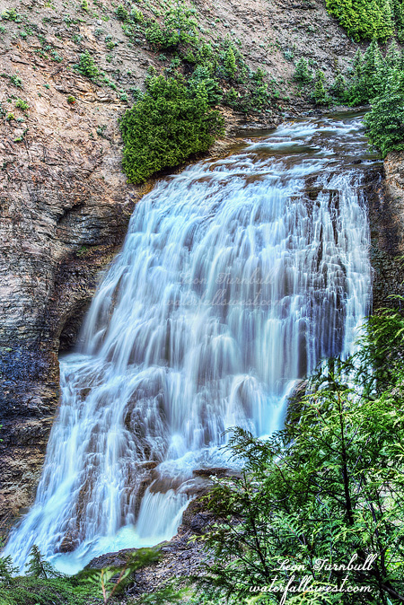
I found a very easy path over to the top of the falls, no steep terrain, and a clear view and shot right in front of this magnificent 49 ft. high drop. It was pretty much perfect. It was well worth the quick trip up from the valley, and the short but steep hike up to the falls. By the time I got back down to the car, it was snowing, and snowing  hard. I love that kind of weather!

No Comments