BULL-LONEY
I managed to get most of the gang up at 5AM to go to this waterfall. My daughter, my mother, my brother-in-law Lynal, and even my niece Hannah. I was surprised they all wanted to come.
This is a very easy waterfall to get to, right beside the road. It is a bit surprising that they had not been here before since they live so close to it. If I lived here, I would be going to this one and all the others in the area at least once a year. But my family? Why have they not been to any of these great waterfalls so close to them? I have failed them. Sigh.
Along the way, we saw a bear and an elk. Elk are as common in Cranbrook as deer are in most other places. The bear was cool. I find it interesting that my daughter saw zero bears in Alaska, but did see one in Canada. Canada wins! Canada also wins in hockey. Just saying.
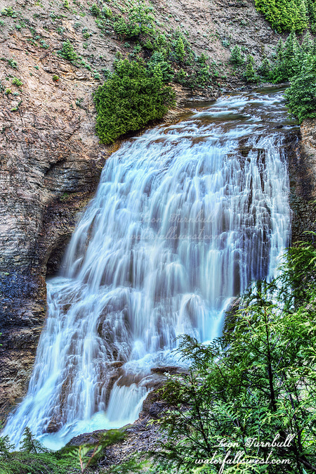
Bull River is dam controlled, but I knew that they were currently releasing water from the dam. However, the website said the current flow was 1200 ft.³ per second and this is definitely not 1200. It seems more like about half that amount, or less. The rest of it must be going into the powerhouse. Oh well. At least it is flowing decently well.
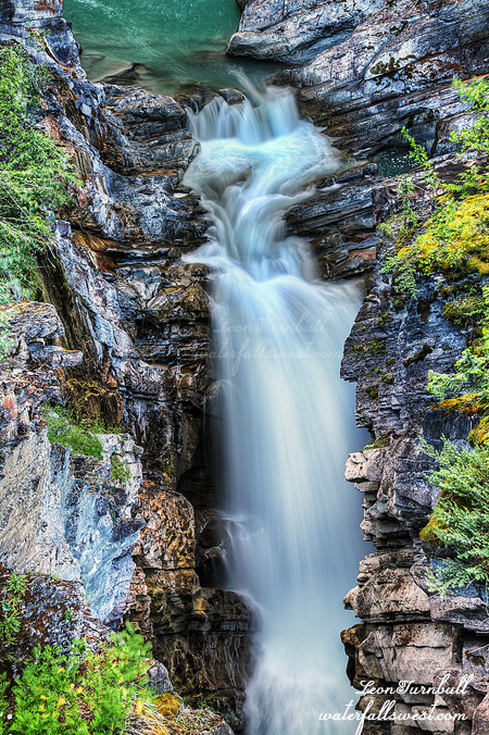
The waterfall is right under the bridge pretty much, so that makes it a bit difficult to see. You can get right to the cliff edge, but no you can’t. It is very treacherous here, and although I inched my way out to the edge of the cliff, as close as I possibly dared to go, I still cannot see the bottom of the waterfall. From the bridge, however, I climbed up on the railing, and I was able to see the entire waterfall and take a photo of it. From this extreme angle, it makes the waterfall seem much smaller than it really is. It is actually 44 ft. high. That is your guaranteed measurement, and if you are in the area, why not come to see it? Don’t wait for 10 years to see it, like my family did. Sigh.
2 Comments