TO YOSEMITE
It was not one of my best days in Yosemite. Too much sun, non existent waterfalls, long hikes, blisters, no sleep. In fact, out of all the times I have been there I would have to rank it right near the bottom. But hey this is Yosemite, right? Even the bottom dwellers are good days at Yosemite. And so it was.
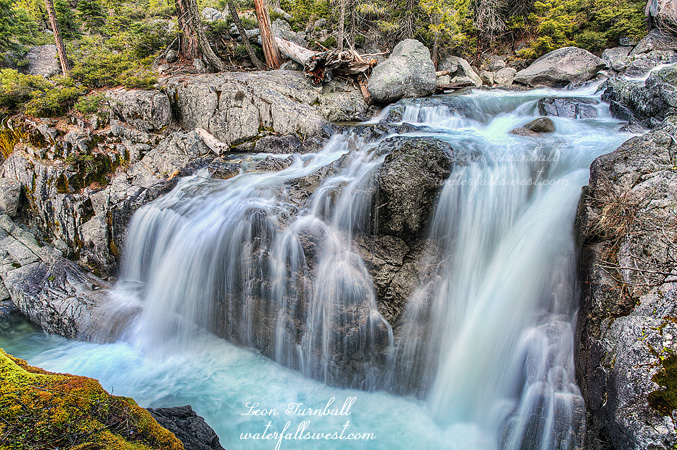
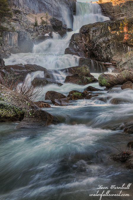
I left work early on Friday afternoon. Traffic was a nightmare. This can’t be good when it takes longer to drive to Yosemite than ever before. I wanted to try to hit three new waterfalls outside the park in the evening, so I couldn’t arrive too late or I would not have time. It is good that I left work earlier than I was initially planning to leave but I struck out big time on the waterfalls anyway. The first one was completely dry. Well, I was not expecting much from that one anyway. Move on. The second one, the one I really wanted to see, I could not get to. Access was all on private property. I tried to find a way around the private property, driving on rough dirt roads, getting my SUV all scratched up from the brush, but I could not find any way over to the waterfall. At least none that would not get me arrested. I tried the third waterfall. I found an old road leading up beside the creek, then I bushwhacked my way down to the creek when I got near the waterfall. There was an old old trail, overgrown, but at least it made things seem promising. When I got down to the creek, however, guess what? No waterfall. Nada. I was in the precise location that it was marked on the USGS topo maps, but nothing was there. Strike three. So what could I do? I drove back down the mountain to the great place I found last year, at the confluence of the south and middle forks of the Tuolumne River. I arrived there at sunset, barely enough time to take a few photos. It was enough to salvage the evening.
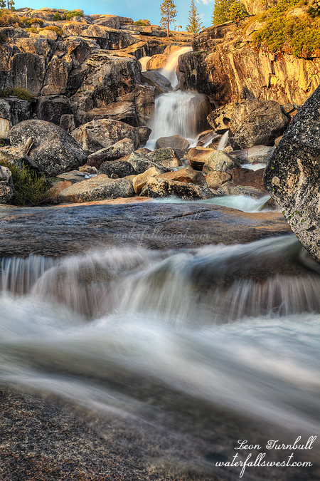
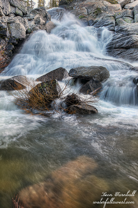
After very little sleep in my vehicle, I got up not so bright, way too early, and very coffee-less, to drive up Tioga Pass to Tuolumne Meadows. I did this big and very awesome hike down to Waterwheel Falls last year. This year, I was not going all the way down there again. I just wanted to take the very short hike down to the one waterfall I missed last year because I was too tired on that hike. It was just a short 6.5 mile hike. One way. Oh I forgot I have to hike back as well. That makes 13 miles. Maybe it’s not such a short hike, after all. But at least it’s not 19 miles or whatever the heck it was last year. Now according to my fine calculations, I had plenty of time to do this hike. I wanted to photograph Tuolumne Falls, White Cascade, and the new waterfall (Lower Glen Aulin Falls) in good light. White Cascade should be out of the sun until 9AM, and the new waterfall should be good until 10AM. Something did not seem right about that but my calculations must be right. I am never wrong. When I arrived down at Tuolumne Falls, it was still in shade, but just barely. I took my photo, then hurried down to White Cascade. It was already in the sun. How could this be? It was only 7:30AM. I trudged sulkily on down the trail for another mile thinking I should at least get to the new waterfall in good light with plenty of time to spare. Not so. It was already in full sun as well. It looked as though it would have been in sun shortly past sunrise as well, not even close to 10AM as I calculated. What went wrong? I am always usually spot on with my calculations. I do not know what I did, but the truth is I would not even have gone on this hike if I knew I had no chance of getting to this new waterfall in good light.
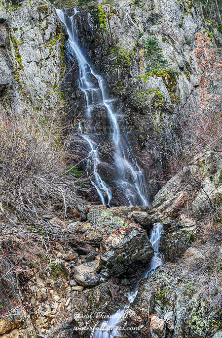
Well, it’s not like it is not a great hike though, and at least I got to one of the waterfalls in decent light. Last year I was here at the end of May, and so this year the river was flowing a bit stronger. Not a lot stronger. Just a little bit stronger. I was hoping the “rain” we had on Thursday would push the flow up quite a bit, as I would sure love to see these waterfalls flowing at full tilt, but it seems Yosemite got nothing from that system at all. Bummer. Well, there is always next year. I think it’ll have to be on a cloudy day next time though, so I can get some better photographs.
On the hike back up I saw quite a few people coming down the trail, including one group of backpackers that lost a couple in their party. They ran back up the trails looking for the couple, but to no avail. They were good and lost. I am really not sure how you could get so lost on this trail. There are signs at all the trail junctions, and it is pretty clear which way to go (ie. just follow the river downstream – and don’t go IN the river). They asked me to keep a lookout for the couple, but I saw no one on my way back. All I saw were deer. No bears, no coyotes. I do hope they found them eventually. I got my blistered feet and sunburned face (did I mention that I forgot my hat) back to the car around 1PM, ate my lunch, and 3 bananas (which my wife told me would prevent me from getting cramps – and it worked – thanks hun!), then made the long slow drive back home. Fell into bed at 7PM and slept right through to morning, which is a good thing because I had to get up for the early church service to play drums. It was a very good day in Yosemite. But I need to go back again.