Big Sur

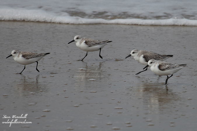
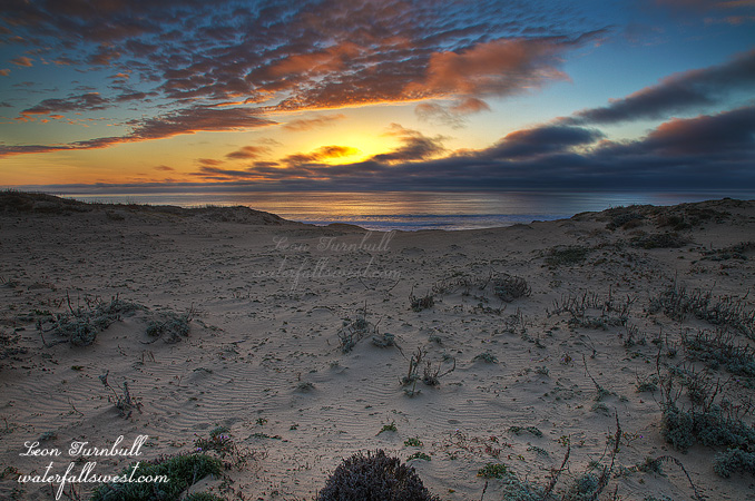
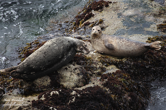
We are just back from spending the week at the coast, in the Monterey area. It will be my last vacation for awhile as I am starting a new job next week, and we had a great time. The weather was good. We saw plenty of wildlife. We had plenty of beach time. And we saw a few waterfalls as well.

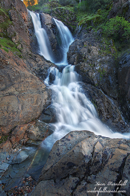
We took one day and drove down the Big Sur coastline to go waterfall hunting. The weather report had indicated it was going to be a cloudy morning, and I was thus hoping to see quite a few waterfalls in good lighting conditions. I got the family up very bright and early, and it was overcast in Monterey. A very good sign. But by the time we got down to Big Sur, the clouds had broken up. I could see that it was going to be a very sunny day along the coast, and I would not be able to see all the waterfalls I wanted to see. In fact, I figured I would only get to about one before the sun started wreaking havoc on my waterfall photos. The first stop was Limekiln State Park, but the gate was closed (it did not open until 8AM). Doh. Next stop, Salmon Creek Falls. Salmon Creek Falls is a spectacular 90 ft. drop and the creek was flowing very strongly. Too strongly, in fact, to get right up to the base of the falls. We tried to get as far as possible up to the falls, and we had fun rock hopping up the creek, but we could not get even near the waterfall. I then tried on the other side of the creek, and actually found a spectacular viewpoint overlooking the waterfall right in front of it. I was pleased and I figured it would be the only waterfall I saw in good lighting conditions that day (not so, however).

This is also the first waterfall I got to shoot with my new camera. I purchased the Canon 5D Mark II just in time for our trip to the coast. I have been wanting to purchase this camera for about 6 months as my old 5D has been on life support all this time, but without a job I was holding out on getting it. Now I was finally able to get it, and I am very happy with the purchase thus far. Salmon Creek Falls was a very good first waterfall tryout for the new camera.

More info on Salmon Creek Falls:
http://waterfallswest.com/waterfall.php?id=289

2 Comments

Burma

After my trek to Ranch Falls, I really wanted to try to get to one more in the area. Unfortunately, the sun was not co-operating. Although it was supposed to be cloudy with showers all day, the sun had come out. There were still clouds in the area, and they were moving in and out from in front of the sun, so I decided I may as well do the hike anyway and hope for the best. It was a 6 mile round trip to this other waterfall, so I decided to bike it instead of hike it.

I packed my camera and tripod onto the back of my bike and started out around Lake Oroville (Thermalito Pool). It was a very easy bike ride along a mostly flat (and quite muddy) dirt road. The biggest obstacles were the cows. They come right down onto the road and it is treacherous getting past them. I am kidding about the treacherous part. But I did have to pass by within a few feet of them because there was no where they could go to get out of the way. Cows make me nervous. My wife laughs at me about this, but when you are surrounded by big beasts and then they all start coming towards you, I wonder what evil they are plotting. I am kidding again. They are obviously very used to seeing bikers and hikers along here, and they are just very curious.

Anyway, I finally arrived at the creek inlet to the lake after 30 minutes of getting through the bovine obstacle course. The waterfall is a bit upstream, so I had to stash my bike and walk up the rest of the way. It is not a big waterfall, just 22 ft. high, but  it is nice little one, and very easy (in other words, no deadly dropoffs for once). It is called Burma Falls (or Bermuda Falls). But as I said, the sun was not co-operating. I got my camera ready, setup in the middle of the stream, and waited. And I waited. Fortunately, the stream was not too cold to stand in. I was waiting for the clouds to cover up the sun, so I could get a decent shot. They did not ever do that completely, but this one shot turned out all right. Interestingly enough, on my bike ride back to the car, most of the cows had all moved off the road. There were just two left on the obstacle course.

More info on Burma Falls:

http://waterfallswest.com/waterfall.php?id=960

No Comments

Obsessed with Table Mountain

On Thursday I returned yet again to Table Mountain in Oroville. This was my fourth time there this winter. I really am obsessed with the place this year, so it seems. I just love it there. The terrain and landscape is so amazing. And there are so many waterfalls there.

This time my goal was to go back to Ranch Falls. I wanted to try to get down and see the lower plunge of the waterfall. From the last time I was here, I figured the best way to do this would be on the south side of the creek (opposite of where I viewed the falls last time). I arrived at the cliffs on the south side of the creek at the top of the falls looking for a way down. Along the edge of the cliff is a fence (supposedly there to make sure the cows don’t take a big plunge off the cliff?). I was able to get around at the end of the fence, being very careful, as one missed step could prove rather disastrous, then I walked back along the fence looking for a way down. I had to walk further than I anticipated, but I got to a less steep spot that proved promising and worked my way down. There was actually a trail leading down, and I’m sure it wasn’t a cow trail (unless they are more dexterous at getting around fences than I had thought), so obviously people had been down this way before. There was also a lot of … you guessed it … poison oak. As I worked my way down and back towards the waterfall below the cliff, I saw a rock ledge that looked promising for a view of the waterfall. The trail seemed to go right to it as well. I climbed up on the ledge and worked my way back to the far end, as far as possible to get the best view of the waterfall. About 10 more feet would have been perfect, but then I would be flying in mid air. So this is our view of the lower section of Ranch Falls. I measured the entire waterfall to be 157 ft. high. From this side, I could see no way to get any closer to the falls. The trail ended as far as I could see, and it was far too brushy to continue. But as I looked across the canyon, it seemed that it actually might be possible to get down much closer to the falls on the other side, though it might be a bit on the steep side. Time for a fifth trip back to Table Mountain?

Unfortunately this last storm did not drop too much rain. I estimated the flow in the falls about half as much as when I had been here a couple weeks ago. Ranch Falls was still flowing quite nice but Coon was just trickling. On the plus side, the wildflowers on Table Mountain were just starting to come out. Another month, I think, and they will be spectacular.

More info on Ranch Falls:
http://www.waterfallswest.com/waterfall.php?id=952

5 Comments

Ranch Falls

I really like this shot. It is a super crazy angle, looking down upon Ranch Falls (aka Long Falls). From this freaky viewpoint, you can see the top 74 ft. high cascade section of the falls, and then where it starts a big plunge of another 70 ft. or so. The bottom plunge is not possible to see from here, though I did try. There is a rock outcrop here with deathly dropoffs on either side of it. There is also a small tree that you need to crawl under the branches to get up to the end of the precipice and view the falls. Did I mention that it was super windy when I was here? and extremely cold. My hands were freezing as I stood here taking my pictures. I suppose I should have left my gloves on, but sometimes it is hard to photograph with gloves on.

Anyway, I think it might be possible to get down to the bottom of Ranch Falls and see that lower plunge, but probably better to do it on the other side of the creek. Though not straight across, because as you can see it is very cliffy on the other side, but I think there is a way. And I’ll be back here to try it. It is a really cool waterfall (when it is flowing).

By the way, I have good news. After being out of work for 9 months and taking last summer off and spending most of my waking hours seeking out new waterfalls, I finally have a new job. So the bad thing is I won’t be able to go out hiking as much, but I do need to feed my family I guess, so I am grateful to God that I will be employed again. We are planning to take one final vacation fling next week as I don’t start for the new job for a couple weeks. I am thinking Big Sur. 🙂

More info on Ranch Falls here:
http://waterfallswest.com/waterfall.php?id=952

No Comments

Trail Blazer

Well we were supposed to get snow Friday night in the Sacramento area. I was expecting (not really) to wake up to a winter wonderland Saturday morning in Folsom. It would have been nice. But I did anticipate that Auburn would have a nice dumping Friday night. It did snow there on Friday morning I guess, but they were supposed to get more Friday night and that did not happen. When I arrived in Auburn first thing Saturday morning, all the snow was gone. I was hoping to get some snowy shots down at the Confluence, of the No Hands Bridge along the river, and I was also planning to go to the Black Hole of Calcutta Falls, hoping for some snow there as well. With no snow, the No Hands Bridge was out of the question. I considered going to the waterfall, but I already have a good shot of that one, so I nixed that idea. Time to implement Plan B.

Plan B turned out to be an ideal choice. And a fantastic adventurous one as well. My idea was to try to get to a waterfall on Clipper Creek, about 1.5 miles upriver from the Confluence. I did not really think I would be able to make it. I was certain there was no trail, that it would be too brushy, too tick infested, too poison oak infested, and worst of all, much too cliffy to get up that far. But hey, I am always up for an adventure and a mad scramble through brush and poison oak. There certainly was a lot of poison oak. I knew that, and I anticipated that, but that was the least of my worries, so I thought. When I tried this route last year, I got turned back by ticks. In the spring, this whole area is infested with the buggers. I have said it many times, I can handle the poison oak, but I cannot handle the ticks. But I figured this was a good time to go, with the recent cold weather, perhaps they would not be lurking about. And I was right again about this. I only had to pluck a single one of the little beasts off me today.

As for the rest of it, I was pretty much completely wrong. And that made me ecstatic. What I mean is that there was indeed a trail to follow. And it went from the Confluence all the way up to Clipper Creek and beyond (likely, all the way to Lake Clementine). It was an old trail, and certainly overgrown, but hey, it was a trail. No bushwhacking through thick brush and along steep cliffs. That was my next worry, as I knew there were steep cliffs on this side of the river. But the trail seemed to bypass these cliffy sections quite perfectly. There were no dangerous sections along the trail at all. It was certainly not an easy hike, that is for sure. But it was definitely an adventurous one, and one that I will do again for certain.

As for the waterfall, well it was a dandy. It was smaller than I expected. The topo maps seem to indicate a waterfall in the neighborhood of 60 ft. or so, and I measured this one to be 27 ft. high. I was a bit surprised at that, as it seemed quite a bit bigger than that, but hey, 27 ft. is not shabby, and it definitely was worth the effort to get to this one. As Arnold says, I’ll be back.

http://www.waterfallswest.com/waterfall.php?id=628

No Comments