TWO
Hike Number Two of my vacation.
So I’m back home from my Christmas vacation. I go back to work on Monday. Eck. My goal for this vacation was to have six “successful” hikes. By “successful”, I mean that I actually find waterfalls on the hike. Well, I only had five successful hikes. Plus four unsuccessful ones. I am a bit disappointed because I really thought that I should have been able to get to some of those other waterfalls. On three of them the problem was just way too much brush which I could not pound my way through. (I was not expecting so much of the stuff).
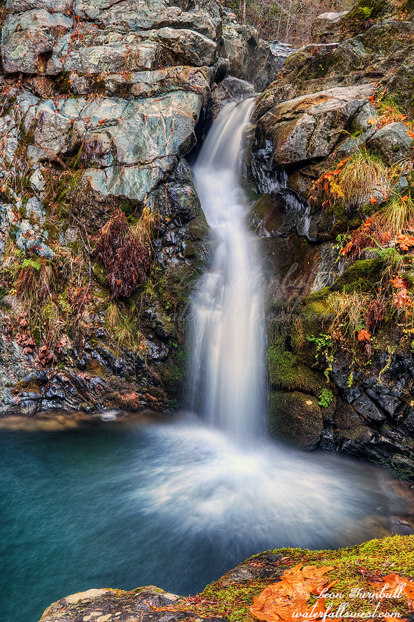
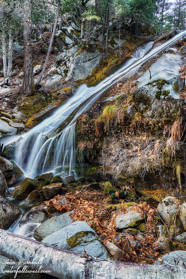
I did see many waterfalls (some of the hikes had multiple falls), and that includes three new waterfalls. The first was Lower Cherokee Creek Falls (last post). The one shown above is the second of the new waterfalls: Upper Camp Creek Falls, 62 ft. high. This is a brand new discovery by waterfallswest.
I forgot how awful the Camp Creek road is. It is extremely narrow and steep and there are zero turnouts. If anyone is coming down the road you are dead. (and it’s not uncommon because there are workers from the powerhouse often coming down the road in their big trucks). It was late when I got to the Camp Creek bridge. I wanted to hike from there to the upper Falls, although driving the road would have been possible as well. I chose to hike it.
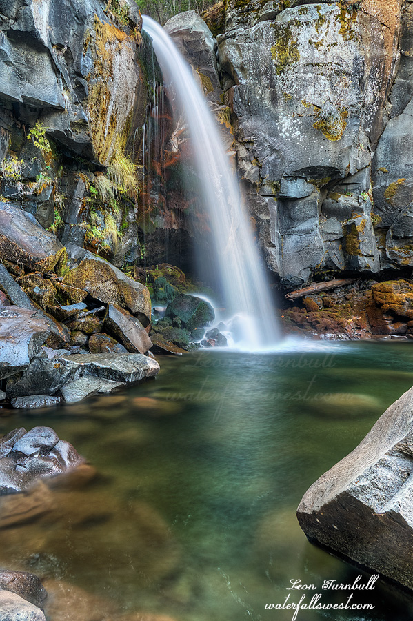
It actually wasn’t too difficult (for once) to get down to the waterfall. It was steep but not too bad. The problem was that there is no good angle to photograph the falls. I did my best. It is a beautiful slide, but you can’t get any angle in front of it. After photographing, I climbed back up to the road and literally ran back down the hill to Camp Creek bridge. I had no time and it was almost dark but I really wanted to go to the middle Falls at least (the third “new one”). At the bottom of the middle Falls is where they drain the water from the creek into the powerhouse. What this means is that you cannot get in front of the waterfall to photograph it. In other words, there is not any good angle to photograph this one either. I did not have time to explore so I took a quick shot and got out of there. It was dark when I got back to the car. It was a lovely afternoon in Plumas National Forest.