RAIN RAIN DON’T GO AWAY
Rain rain don’t go away. Stick around for a few more months and days! After a much too long dry spell, we finally have our first winter storm of the season. On Thanksgiving Day! Praise the Lord. I will have more to say about the rain at the end of the month. In the meantime, I was looking forward to going hiking on Thanksgiving Day in the rain.
Our family dinner was on Wednesday night (get it in early, right?) so I was free on Thanksgiving Day to go out. Thursday looks much better than Friday for weather, and I also have a big hike planned on Saturday. So for Thursday, I wanted something close by. It did not matter what, or if I had been there before. But there was only an inch of rain on Wednesday, so nothing would be flowing yet. Normally, in this situation, I would pick my yearly go to waterfall: American Canyon Creek Falls, but I did not really feel like going to that one this year. I decided to go up to East Fork Falls.
It was raining pretty good when I arrived at the trailhead. I was hoping it would let up by the time I got down to the river. There was supposed to be a bit of a break, but that never happened. It basically rained the entire hike, though it did let up briefly now and again.
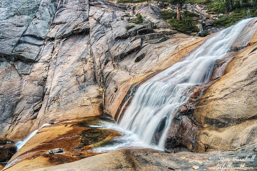
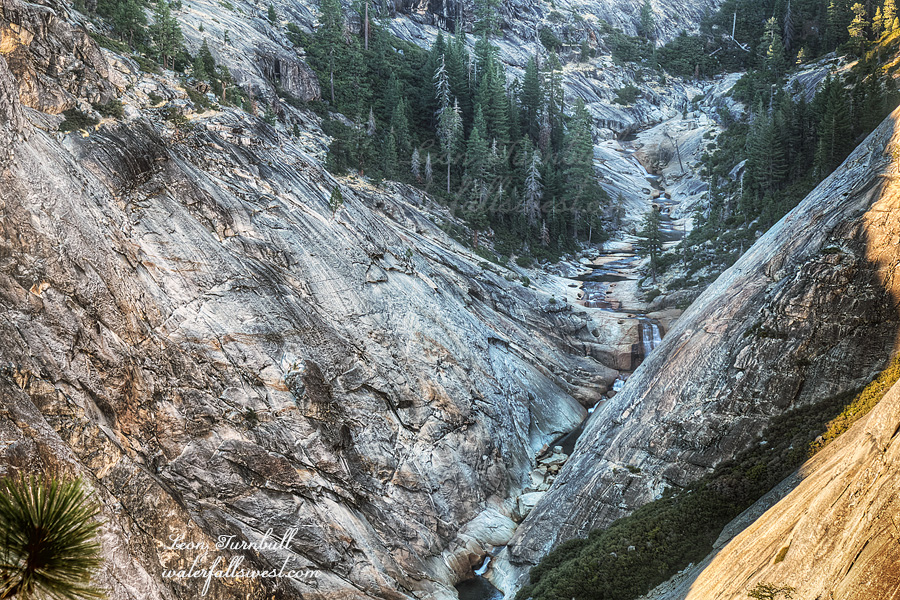
Even though there was only an inch of rain thus far, the river was much higher than I expected it to be. It seemed to be crossable, but quite deep. In order to get up to the falls, you have to cross the river, and wade up to the waterfall. I anticipated this part to be very tricky in the higher water. It was much lower when I was here before (and not raining).
All the way down, I kept thinking I should turn back and do a hike somewhere else. Yet I kept going, and finally arrived down at the river soaking wet, and still raining hard. Now maybe I should give up. I did not want to wade up to the river in the rain, or try and take photographs in the rain. Nonetheless, I put on my water shoes and started up the river.
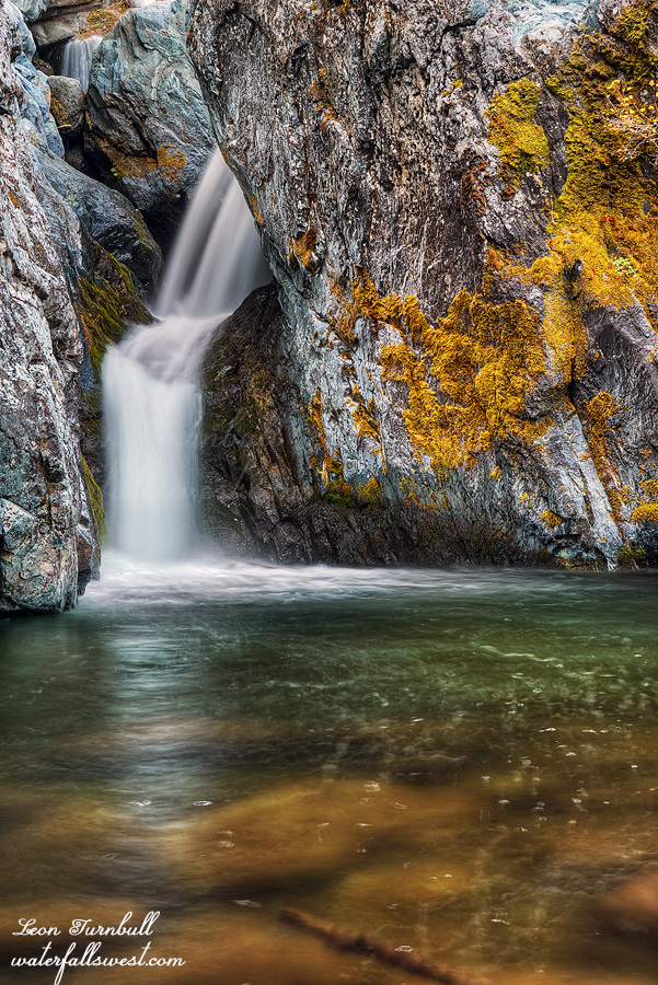
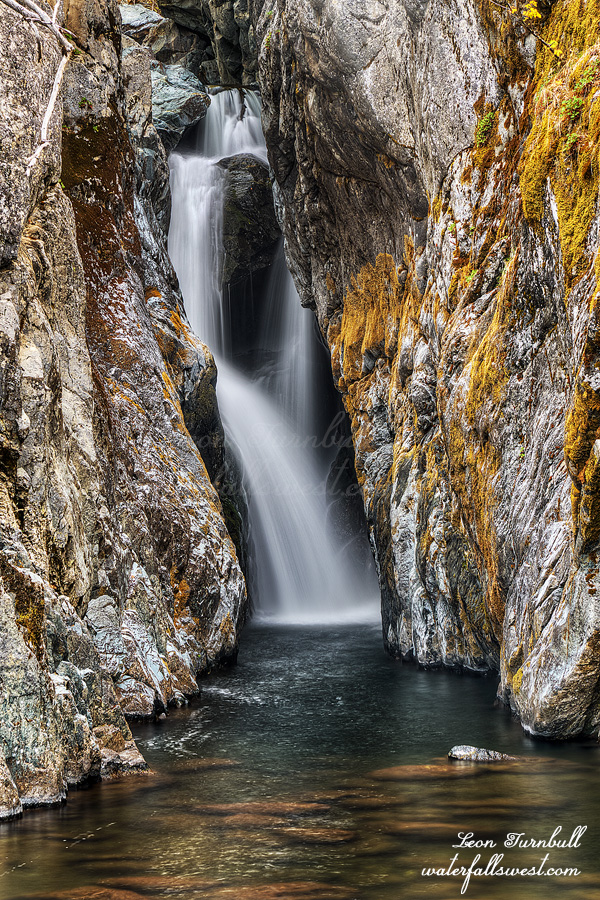
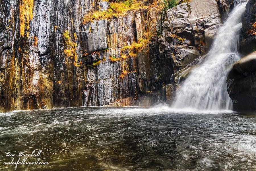
There is a little baby waterfall you have to get up and over. Last time, I just climbed right up beside it, but today it seemed a little too strong to do that, so I had to climb up and around on the hillside, which was quite tricky with dangerous dropoffs, and the ground (of course) was wet and slick. I used my rope for safety. I got back down to the river above the little falls, then crossed over to the other side, and started up river to the waterfall. It was quite deep in places, but I made it. The last section requires wading through a deep pool and then climbing up (or jumping up) on a rock to finally view the waterfall. It is an amazing and very special place, and the falls were rockin strong. It was spectacular. I’m not happy with my photos, it is very difficult to photograph in the rain, and I was not properly prepared, which I should have been, but it is my first rainy hike of the season, so that is my excuse.
Anyhow, I would have liked to stay here much longer, but right after taking photos, the rain really started to come down. I still had to cross back over the river, and down that difficult slope, and then back up the mountain and through all the wet brush. It was time to get out of there. Once back up to the road, I did not mind hiking in the rain. Bring it on. It is just a bit too wet and uncomfortable when you are in the brush and off trail. I was a wet sloppy dog by the time I got back to the car. It was a very fun and very wet hike on the first rainy day of the season.
No Comments