UP UP AND AWAY
I heard from someone that Whitney Creek was flowing as of last week, and flowing fairly well. I decided to make a return trip on the longish weekend (which was *not* a long weekend for me, since I had to work on Monday – but I still made the trip up north anyway). I drove out to the Mt. Shasta trailhead to sleep in the car so I could get a very early morning start, same as I did last year. I swear the road is getting worse every year. This is the third time I’ve been out here with my SUV, and I think it will be the last with this vehicle, even though I would really like to come out here again. Next year I will be bottoming out, I am certain. Indeed, I was worried all night about the drive back out the next day.
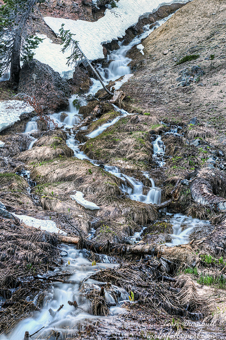
Bolam Creek at the trailhead was completely dry. What? I had checked out Whitney Creek at the highway, and it had decent flow. I figured Bolam would have a good flow as well, but not so. What does this mean? Figuring out Whitney Creek is a mystery long in the making. If Whitney Glacier is melting, then it is logical that Bolam Glacier would be melting also. My theory is that Whitney Glacier is not melting at the current time (ie. this month), and all the flow in Whitney Creek was coming from snow melt. Perhaps there was a little glacier melt in there as well. In the drought years, I do not think Whitney Creek had any substantial snow melt in the spring, but this year was a big snow year, and it makes sense that there would be a decent flow in the spring. The good news about all this is that all the flow (and more) that I saw down at the highway would be going over Whitney Falls, and none of it was from Bolam Creek (the two creeks join together before the highway).
Another interesting tidbit about Whitney Creek: I recently saw a couple photos from 2013 and 2017 of the creek (from the highway) and they were drastically different. In 2013, there was no bank along the creek bed, and now there is a fairly steep bank. What does this mean? It seems to me that there must have been an event in the last four years on Whitney or Bolam Glacier that went completely unknown and which created this bank (such as the event on Mud Creek Glacier a couple years ago – which did not go undetected). The normally very small flows on Whitney Creek (especially during the drought) could not have created such a bank along the creek. What do you think? I find stuff like this very fascinating.
Anyway, more good news. There were no mosquitoes at the trailhead. I expected quite a lot, actually, but there were none at Lassen, and none here at Shasta. No complaints about that. It was a very warm night in the car, about 50 degrees. Despite the warmth, and despite me being worried about driving that awful road the next day, I still managed to sleep fairly well. I got up in the dark and began my hike up to Whitney Falls and beyond at 5AM.
I debated about just hiking straight up the dry Bolam Creek. Would that be easier than taking the trail? I thought about it, it would be a shorter distance, but in the end decided to take the trail. The creek bed looked very rocky, and I thought it would be slow going. I’m pretty sure that was a good decision. I did decide to hike up the creek bed between the 2nd and 3rd creek crossings (which is a short distance). That section was not too difficult, except I did take a header and almost smashed my head onto some rocks when I fell. I got my arms up just in time to arrest my fall. I cut my pinky finger but I am not a baseball player, so it was not something that was going to stop me from continuing the hike (see my previous blog post regarding pinky fingers).
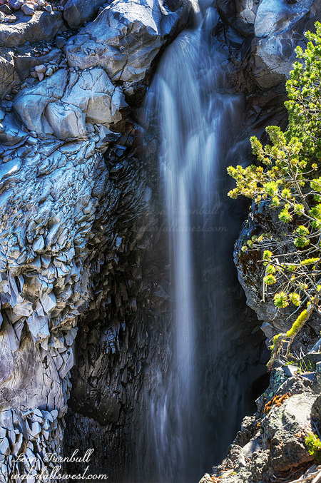
Whitney Falls was flowing pretty well, and I got there just a bit past sunrise. It was definitely much better than when I was here last year. I was very pleased. I brought my big lens up to the viewpoint, and I took a number of photos. But quickly. I still had a big hike to do. There were mosquitoes at the Whitney Falls viewpoint. Not many, but a few. What the hey? There are none down at the trailhead, but some up here? I was not be expecting any of the buggers up here.
My goal was to continue up Whitney Creek into the upper reaches of the canyon. It would be a tough climb, and I did not want to bring my big, heavy and expensive lens up there. My back would not be happy if I carried it up. What should I do? Surely, no one was coming around to Whitney Falls today. I decided to leave it in the bushes along with my jacket which I did not need any longer. I would retrieve them on the way back down. Leaving a $1000 lens out in the middle of the wilderness. How smart is that? I didn’t think the bears would want it. It would not taste very good.
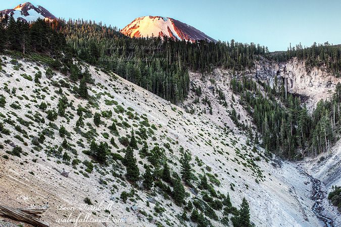
The trail up the canyon follows an old road, which is no longer a road, and it is highly overgrown with brush. Nonetheless, it is a trail. People obviously hike up here, there are rock cairns and occasional ribbons showing the way. I was a bit surprised to see any human markings up here, in fact I thought I would be battling through thick brush the entire way up. Then I realized that this is one route that climbers take to the summit of Mt. Shasta. It is not one of the usual routes up to the top, but I guess it is still used occasionally. About half way up, however, I lost the rock cairns. I made my way back over towards Whitney Creek, thinking it would be much easier up that way if I got over to the lava rocks along the creek (yes, Mt. Shasta is an old volcano, if you did not realize that). Bad choice. The lava rocks consisted of huge boulders, and some of them were loose, and if you fell on any of them, it would be a seriously catastrophic issue. It was dangerous to walk on this stuff. The mosquitoes seemed to like the lava rock also. I got off the lava as soon as I could, but now I had to battle thick brush all the way up to the Middle Falls. I really thought this section of the hike would be fairly easy, but it was extremely difficult. I battled onwards and upwards. Finally I made it up to the Middle Falls (pictured here).
Initially, I was thinking it would be fun to camp up here at this spot, and I had considered it. In the end, I decided to just do a day hike in the morning. I’m glad I decided that. The hike up to this point was just too incredibly difficult. To see the Middle Falls, you need to cross the creek above the waterfall to the other side. It was a bit difficult to jump across the creek, but I found a spot where I could do it without getting my feet wet. I could hear constant rumbling in the creek, as the creek carried hundreds of small stones downstream, and occasionally bigger ones. I went to the brink of the falls, and I could see the stones tumbling off the waterfall. You certainly would not want to be standing under the waterfall at the bottom. Not that you could get down to the bottom anyway. I thought I’d be able to get a good view of the falls from the other side, but there were literally no views to be had except for one looking down at the falls from the brink, standing right at the edge of the cliff. I could not see the bottom of the falls from here, and unfortunately the sun was already on the top of the waterfall. I was on time and I should have been early enough for photographing the falls. Clearly, I miscalculated somehow. Darn it.
I still wanted to get to the Upper Falls. Hopefully, I would have enough time for that, but considering how difficult it was getting up to the Middle Falls, I had my doubts. I jumped back across the creek, then continued up the canyon. All of a sudden, the trail was much easier. The rock cairns were back, and I was on a regular trail again. The rest of the way to the Upper Falls was quite easy. So where did the actual trail go from the Middle Falls on down? On the way back down, I tried to take a different route, but it was just as difficult, if not more so, and I lost the rock cairns on my way down as well. I could not find where the actual trail went to, and I sure did look for it. It would make this hike much easier for next time if I could figure this out, it is such a difficult hike scrambling through all the brush. The good news however: my knee was completely fine. I had no troubles with it at all, and considering how strenuous the hike was, that is saying something. The Madman is back in business now (I hoped).
There was no snow the entire hike up to the Upper Falls at 7900 ft. At Lassen, I had complete snow cover at 7200 ft. There were not even any lingering snow patches here on Shasta. That is, until I got to the Upper Falls, where I found one big ice patch completely covering the face of the waterfall. Ugh! You could not even see hardly any of the waterfall. I walked up to it (which was difficult) to see if I could see any part of the falls flowing underneath the ice patch, but nothing doing. The second thing I was bummed about was the lower part of the cascade. It was only 10 ft. high, but if you look at Google Earth, it seems to be at least 30 ft. high. I would have been completely happy if even the lower part was that high. So basically, the Upper Falls was a whitewash. I did take some photos regardless, and relaxed for awhile. Going back down would be easier, except for that awful brushy section. It was getting hot now, also, so that would make the hike down longer and more tiring.
I almost got back to the main trail where I was hiding my big lens, when I heard something extremely odd. People! A big group of hikers were coming up the mountain, and not on the main trail to Whitney Falls, they were coming up the canyon above Whitney Falls. I asked them where they were going. They said, Whitney Falls. I said, you are going the wrong way (trying to be helpful). They said, no they are going up to the ridge above the falls and coming down to the waterfall that way. I said, ok then, have fun. Now …. I’m not going to say too much about that, you can hike wherever you want to hike, but that is a strange way to go to Whitney Falls. You won’t get any better views of the waterfall up that way, and it is very brushy, and not to mention it is hot. I would not want to hike that route myself. Anyhow, I found my lens undisturbed in the bushes. This big group walked right past it, did they not even see it? Not that they would have taken it, but it surely would have provoked a lot of curiosity had they seen it. It is not something that one normally sees in the wilderness.
I got back to the car. I was hot and tired. I still had to drive all the way home and work the next day. I did sleep very well that night back in my bed.