| Della Falls | Very Strenuous |


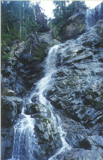
Image 1 of 1; Click arrow to scroll or click image to enlarge Lower cascade of Della Falls
×
|
Location: Strathcona Provincial Park, Great Central Lake, Port Alberni region Stream: Della Creek Alternate Names:
Height: 1444 ft. (440.2 m) |
Della Falls will always have a special place in my heart. It is where I proposed to my wonderful wife, Tara. It is also the tallest waterfall in Canada. It is incredibly pretty, falling from Della Lake above in three cascades. And it is a super experience just getting to the falls. Located in Strathcona Park on Vancouver Island, you need to take a boat across Great Central Lake near Port Alberni, just to get to the trailhead. Then it is a full days hike to get to the base of the falls, where you camp and enjoy the scenery. It is a pretty difficult hike, uphill most of the way. And the trail is rocky, which is hard on the old feet. We went in early September, and the falls were still quite pretty. But they would be much more spectacular in late June or early July, though you may have to battle the mosquitoes getting to the falls. In May, there will probably still be too much snow on the trail, depending on the year.
Other hikes. Once you reach the base of Della Falls, there a couple optional hikes you can do on the following day. There is a hike to the top of the falls, which we understand to be quite difficult and potentially slippery and dangerous. There is also a hike up to Love Lake, which is a difficult 2 hour hike (~ 35 switchbacks), but it offers good views of Della Falls and Della Lake. Love Lake itself is a jewel, and you will likely have it all to yourself.
Other Falls. The topographic maps show a route (not a trail) leading from Della Falls along Drinkwater Creek, to Bedwell Lake. There is a waterfall along Drinkwater Creek, one at Little Jim Lake, and Doran Falls at K2 Creek (past Bedwell Lake). If anyone has been along this route and has more information about the trail and falls (what are they like), we would be very interested in hearing from you.
Get Google Maps directions to trailhead
Zoom out on map to see all nearby waterfalls:
Other waterfalls nearby:
| Vancouver Island | Waterfalls Home Page |
 Home
Home  Info
Info  Contact
  Alpha Index
  Region Map
  Links
Links  Search
  Newsletter
  Blog
Blog  Gallery
  Account
  Logout
 Photographs and content may not be used in any form without prior permission.
All rights reserved.


