|
|
Moderate |

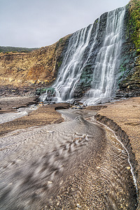
Image 1 of 6; Click arrow to scroll or click image to enlarge |
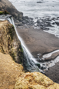
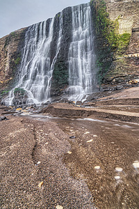
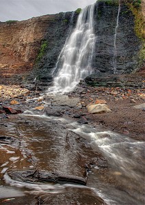
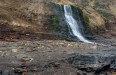
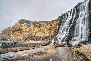
Location: Pt. Reyes National Seashore, near Bolinas, Marin County Stream: Alamere Creek Alternate Names: Height: ~40 ft. Access:   Distance: 8.6 miles (RT) Elevation: 250 ft. (+400 ft., -500 ft.) Season: Dec-May Form:  Lat/Long:37.95419, -122.78298 Directions:Take Hwy #101 to San Rafael, and take the Sir Francis Drake Blvd. exit. Drive 20 miles to Olema, then drive south on Hwy #1 for 9.1 miles to Bolinas Rd. (unsigned). Turn right and drive 1.8 miles to Mesa Rd. Turn right and drive 4.7 miles to Palomarin trailhead. |


6 Miles NW Bolinas CA (Elev. 531 ft)
TonightMostly clear, with a low around 44. Northwest wind around 7 mph.
Saturday
Increasing clouds, with a high near 53. North wind 5 to 8 mph becoming west in the afternoon.
Saturday Night
A 50 percent chance of rain after 11pm. Cloudy, with a steady temperature around 49. Light and variable wind becoming south southeast 5 to 7 mph after midnight. New precipitation amounts of less than a tenth of an inch possible.
Sunday
Rain, mainly before 11am. High near 54. Southeast wind 10 to 16 mph, with gusts as high as 31 mph. Chance of precipitation is 90%. New precipitation amounts between a tenth and quarter of an inch possible.
Sunday Night
Rain likely, mainly after 11pm. Mostly cloudy, with a low around 51. Southwest wind 9 to 11 mph, with gusts as high as 23 mph. Chance of precipitation is 60%. New precipitation amounts of less than a tenth of an inch possible.
Monday
Rain, mainly before 11am. High near 53. Chance of precipitation is 80%. New precipitation amounts between a tenth and quarter of an inch possible.
Monday Night
A 30 percent chance of rain. Mostly cloudy, with a low around 45.
Tuesday
A chance of rain. Partly sunny, with a high near 52.
Tuesday Night
A chance of rain. Mostly cloudy, with a low around 46.
Wednesday
A chance of rain, mainly before 11am. Partly sunny, with a high near 54.
Wednesday Night
A chance of rain. Mostly cloudy, with a low around 46.
Thursday
A chance of rain. Partly sunny, with a high near 54.
Thursday Night
A chance of rain. Mostly cloudy, with a low around 46.
| Upper Alamere Falls | 0.01 miles | |
| Bass Falls | 1.19 miles | |
| South Bass Falls | 1.23 miles | |
| Palomarin Falls | 1.93 miles | |
| Phantom Falls | 1.94 miles | |
| North Phantom Falls | 2.22 miles | |
| Horsetail Falls | 2.43 miles | |
| Arroyo Hondo Falls | 3.15 miles | |
| Surprise Falls | 3.27 miles | |
| RCA Beach Falls | 3.56 miles | |
| Kelham Creek Falls | 3.56 miles | |
| Bolinas Point Falls | 4.54 miles | |
| Stairstep Falls | 6.44 miles | |
| Big Carson Falls | 6.70 miles | |
| Morses Gulch Falls | 6.71 miles | |
| Carson Falls | 7.43 miles | |
| Cataract Falls | 7.98 miles | |
| South Fork San Anselmo Creek Falls | 8.35 miles | |
| Upper Cascade Falls | 8.40 miles | |
| White Hill Falls | 8.54 miles | |
| Cascade Falls | 8.77 miles | |
| West Fork Lagunitas Creek Falls | 9.81 miles | |
| Steep Ravine Falls | 9.84 miles | |
| Loma Alta Falls | 9.98 miles |
| San Francisco Bay | Waterfalls Home Page |
Alamere Falls
5.0 out of 1 reviews