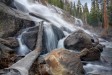
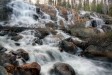
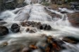
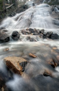
| Minaret Falls | Easy |

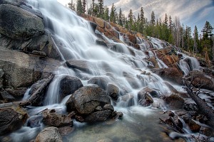
Image 1 of 5; Click arrow to scroll or click image to enlarge |
Location: Mammoth Lakes, Devils Postpile National Monument, Inyo National Forest, Madera County Stream: Minaret Creek Alternate Names: Height: ~250 ft. Access:   Distance: 2.6 miles (RT) Elevation: 7600 ft. (+100 ft.) Season: Jun-Sep Form:  Lat/Long:37.64058, -119.09140 Directions:From Mammoth Lakes, drive 13 miles on Hwy 203 to Devils Postpile Natl. Monument. Turn into the Devils Postpile (ranger station) area. There is a fee to enter the Monument. There is also a mandatory shuttle bus unless you are camping or are handicapped. |


6 Miles W Mammoth Lakes CA (Elev. 8071 ft)
This AfternoonIncreasing clouds, with a high near 41. Wind chill values as low as 31. South southwest wind around 5 mph, with gusts as high as 20 mph.
Tonight
Cloudy, then gradually becoming partly cloudy, with a low around 20. Wind chill values as low as 13. Southwest wind 5 to 10 mph, with gusts as high as 25 mph.
Sunday
Snow likely, mainly before 11am. Partly sunny, with a high near 37. Wind chill values as low as 11. Southwest wind around 10 mph, with gusts as high as 40 mph. Chance of precipitation is 60%. New snow accumulation of 1 to 2 inches possible.
Sunday Night
A 30 percent chance of snow, mainly after 11pm. Mostly cloudy, with a low around 22. Wind chill values as low as 11. Southwest wind 10 to 15 mph, with gusts as high as 45 mph. New snow accumulation of less than one inch possible.
Monday
Snow likely, mainly after 11am. Mostly cloudy, with a high near 33. South southwest wind around 15 mph, with gusts as high as 55 mph. Chance of precipitation is 70%. New snow accumulation of 3 to 5 inches possible.
Monday Night
Snow showers likely before 11pm, then a chance of snow after 11pm. Some thunder is also possible. Mostly cloudy, with a low around 12. West southwest wind 10 to 15 mph, with gusts as high as 55 mph. Chance of precipitation is 70%. New snow accumulation of 2 to 4 inches possible.
Tuesday
A 50 percent chance of snow, mainly after 11am. Partly sunny and cold, with a high near 28. Southwest wind around 10 mph, with gusts as high as 40 mph. New snow accumulation of around an inch possible.
Tuesday Night
A 40 percent chance of snow before 11pm. Mostly cloudy, with a low around 8. Southwest wind 5 to 10 mph, with gusts as high as 35 mph.
Wednesday
A 20 percent chance of snow after 11am. Partly sunny and cold, with a high near 32. West southwest wind around 5 mph, with gusts as high as 25 mph.
Wednesday Night
A 20 percent chance of snow. Mostly cloudy, with a low around 11. West southwest wind 5 to 10 mph, with gusts as high as 30 mph.
Thursday
A 30 percent chance of snow. Partly sunny, with a high near 34. Southwest wind 5 to 10 mph, with gusts as high as 30 mph.
Thursday Night
A 40 percent chance of snow. Mostly cloudy, with a low around 13. West northwest wind 5 to 10 mph, with gusts as high as 30 mph.
Friday
A 30 percent chance of snow. Partly sunny, with a high near 37. North northwest wind 5 to 10 mph, with gusts as high as 30 mph.
| High Sierra | Waterfalls Home Page |