BREAKING NECK BAD

As of March 1, we have a snowpack at 60% of average (northern CA), 67% (central Sierra), 64% (southern Sierra). Rain is at 89% (north), 77% (central), 72% (south). After two months of no rain we have gone from way above average to way below average and once again we are in desperate need of a miracle March. Please pray!
The plan this weekend was to return to Big Kimshew because I really wanted to attempt Frenchys Falls. I have been in this area before but it is 10 miles one way. You cannot drive in here any longer (which, by the way, is stupid and annoying – but that is a topic for another day). Last time I went here I biked in but I did not want to do that again. It is very tough! Plus, my bike is currently out of order. Twenty miles as a day hike is just a bit too much (I did think about it, however). Doing it as a 2 day backpacking trip would be quite do-able and not too difficult and I would have time to get to other waterfalls as well. Sounds like a plan, madman!
The entire hike is on dirt roads so it is a very boring hike. I tried to keep myself entertained by taking funny video clips (wait for the madman video!). There was not much snow on the roads but there was a little bit. I saw an inordinate amount of animal tracks in the snow. Deer, squirrel, rabbit, bear, and bobcat tracks. A lot of bobcat tracks. A huge amount of bobcat tracks! In this one particular spot there must have been 20 or 30 bobcat tracks all over the place. Maybe it was just one bobcat gone bonkers, or a lot of different cats, I don’t know, but I have never ever seen so many tracks in one place before. I was certain I was going to see one, there must be a lot of them around, but I never did. I also saw quite a bit of poop including bear and bobcat. The cats seem to do their thing on top of rocks in the middle of the road. Have you ever noticed this? They don’t leave it in the dirt, they leave it on top of rocks. Why do they do this? I think they need to learn some leave no trace principles.
I arrived at my intended campsite at around 2PM or so. Camping in this area is difficult. There is little water (a necessity for camping) and where there are creeks flowing there is not any camping. I had mapped out a couple potential campsites on Google Earth beforehand but when I arrived at these spots I found that these are NOT good camping locations at all! In fact it was impossible to camp at these spots. What do I do now? It is late and I did not want to go back on the road to find something so instead I continued forward on the road to where it crossed Breakneck Creek. I set up my tent right on the roadside beside the creek. It was not very scenic and probably the worst location I have ever camped but it was the only possible option! At least I had water and does it really matter what else? I am only going to sleep here for one night.
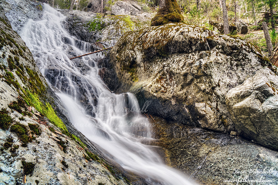
After eating dinner I went to try to find the waterfall on Breakneck Creek. The name of this creek is rather interesting. Indeed it is a bit ominous. It is a very steep descent (about 500 ft.). It is ominously steep. Surprisingly, however, I was able to get down to the waterfall. It is about 60 ft. high and is a very lovely cascade. Photographing it was a big challenge. I could not find any decent angle that I liked. There is another drop just below this but I could not get down to it because it was too cliffy and brushy. One out of two is not bad (so far). I returned to my beautiful campsite and went to bed.
I woke up early and packed up. The plan was to head down to Middle Big Kimshew Falls and Frenchys Falls. I have been to Middle Big Kimshew Falls seven years ago. A lot has changed in seven years. The road is now completely overgrown. Seven years ago it was perfectly fine. Now it is horrible and I came really close to turning around. (and I suppose I should have). Just when I was about to turn back it seemed to get a bit better. I thought that if I could get down to the ridge road it would be much easier. Umm, nope. When I finally got down to the ridge road it was much later than I hoped so I decided to skip Middle Big Kimshew Falls since I have been to it before and decided to focus on Frenchys. The ridge road was not better. It was worse. Far worse! The brush was essentially impenetrable and there were three landslides I had to cross over. What I should have done is turn back but then I would have to climb 1000 ft. back up to the main road. I did not want to do this so I pressed on. I was already very tired from all this bushwhacking. The road finally opened up by the time I reached the point where I needed to drop down to Frenchys. The planned route down did not work. I got about halfway and then got cliffed out. Once again it was too brushy and too cliffy to continue. I suppose it was not too surprising but I was disappointed that I had to retreat. At least I made it to one waterfall on this trip. One is better than none.
My planned route now was to continue on the ridge road back to the bridge over the West Branch Feather River making the hike a big loop. I certainly did not want to go back up the mountain through all that brush with a 1000 ft. ascent. This route “should” work. After all that brushy-ness earlier on the road I was a bit concerned but now the road has opened up and it should be fine for the rest of the way. If I had to retreat now I would be in huge trouble. I was well past the point of no return. I would not be able to get back to the car before dark if I had to do that and I had no food left to spend another night camping. (not to mention that I was extremely tired and also I had to work the next day). The road was perfect and easy hiking … until … I completely missed a turnoff. I walked almost a mile on the nice road past my supposed turnoff. But there was no turnoff! I surely would have seen it. This road I was walking on now was not on my map at all. I went back to where the supposed turnoff was and found a very old road that was completely overgrown. It was literally impassable. I was already well past the amount of bushwhacking I could do (or wanted to do) on a single day. I was not going to bushwhack down this old road for 3 miles. I could not retreat (as I already said). My biggest fear was realized for this trip. I sat down and thought about it. The other road that was not on my map was a good wide maintained road. It must go back to the main road eventually. It logically must go back! It might take a while but it must take me back to where I need to go. I decided to continue on the unmapped road. Indeed, it did take me back to the bridge and the main road. I don’t even think it was that much longer but I did lose a lot of time and added two miles or so to my hike. I ended up hiking 17 miles in total for the day. I finally got back to my car at 3PM. Of course I stopped at Jake’s in Oroville for a burger. It was an interesting trip into Lassen National Forest with one waterfall seen.
4 Comments


