When I discovered this waterfall on Wabena Creek in summer 2020 it went right to the top of my list for visiting this year. I knew it would be an incredible waterfall. If I could get to it…
The plan was to try to go there in the spring of this year but it just never worked out. I never had a chance to go. I guess it is going to have to be spring of 2022, I thought. However … it is December. We still do not have any snow. It did rain a lot in October. Would Wabena Creek be flowing now? It seemed a bit unlikely but perhaps worth a try anyway. I had a backup plan if I got all the way out there and found the creek was dry.
It was to be the last adventure for Gator. That is the name of our dark green SUV. It is a name that fits the beast perfectly and stuck for 17 years. It is time for her retirement now. I am glad I picked Foresthill for her final outing with me. It is without a doubt our favorite place to go. It is shocking that I can drive up there in December. I have never been able to do that before. As I drove the last 10 miles on the rough dirt road from Robinsons Flat I suppose I even got a little bit emotional. I’m strange. It was a good last drive for her. There was no snow, but there was mud, creek crossings, and steep sections to drive up. I did not put it in 4 wheel drive because she has been having trouble with that in her old age. It was not needed anyway. The only thing missing was a bear sighting. Ah well.
The first order of business was to go to the Far Upper falls. (next post). It is a quick jaunt from the road down to the creek. I could see that the creek was flowing decently. Perfect. This is going to be a great day. It was not difficult to get down to this waterfall, a pretty little 32 ft. drop.
Now I had to climb back up and traverse the ridge down to the big waterfall. Surprisingly there was a path. I think it must be a bear path. I don’t know of any humans that have ever been down here before. How would anyone even know about this waterfall? It has never been documented by anyone (before now). Not even the late Russell Towle made it here as far as I know (and he went everywhere). I am the last adventurer. The path seemed to abruptly end at a wall of thick brush or perhaps it went through it. Must be bear. Now I had to drop straight down to the creek. Would it be too cliffy? As I descended I came to a terrific viewpoint of the big waterfall and I took some photos from there. I was not sure if I’d be able to continue, getting down to the creek and then up to the falls. I definitely had to try. Getting all the way down to the creek was easy enough. No cliffs. No problem. I worked my way upstream to the falls and got blocked out by a mini waterfall but I was not to be outdone. I crossed the creek and climbed up above the cascade on the other side. That was the only obstacle. I made it!
Upper Wabena Creek Falls is absolutely magnificent. 143 ft. high. It is a monster. Being able to stand right at the bottom of this incredible waterfall is so utterly amazing. It was a very awesome day in Tahoe National Forest for the waterfall madman and Gator.
Posted in Northern Sierra, Waterfalls by leapin26: December 5, 2021

This is Lower West Fork Deep Creek Falls, 55 ft. high.
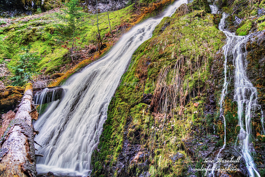
On my way down from the upper falls I came to the brink of a cliff. A big one. I was at the top of a waterfall which should not be here. The topo map does not indicate that there should be any steep drop here. Indeed according to the map the terrain should be pretty mellow. It was a huge surprise to find this waterfall here. I like surprises but how on earth am I going to get down? I crossed the creek at the top of the falls and traversed along the ridge away from the falls. There was actually a path. Was it human or bear? It led away from the cliff to a spot where I could get down easily enough but then it continued away from the waterfall. I had to get back to the waterfall to photograph it so I left the path and headed straight down to the bottom of the falls. This one reminded me a lot of Russian Gulch Falls on the California coast, complete with the log across the middle of it. It is another beauty.
Posted in Northern CA, Waterfalls by leapin26: December 1, 2021

BLACK FRIDAY. It is my favorite day of the entire year to go hiking. While everyone else is out pushing and shoving and trampling others to get their favorite expensive TV, you can find me out on the trail. Or in this case, off the trails. These days it is more popular for people to go hiking on Black Friday but I was doing it long before it was cool. Nonetheless, even on the best of days you won’t find anyone else on this particular trail. That is because there is no trail. In other words it was extremely difficult. But oh yah it was awesome.
I left the house at 5:30AM. There were a lot of cars out on the road already. That is normally not a surprise on Black Friday but in these COVID days perhaps it is a bit of surprise. None of them were going in my direction since I was heading out of the city and into the mountains.
The road to the trailhead is a bit interesting. I could not find it at first and in fact I thought there was no road at all anymore so I parked the car and started hiking. I finally found the actual road after a short walk so I went back to the car and tried to drive it. I got less than a mile and came to a huge mud pit. I did not want to drive through this and get stuck, so again parked the car and started walking. All that running around put me 45 minutes late starting my hike and added 9 miles round trip since I was now going to have to walk the road. I was prepared physically for the extra miles but not mentally. I was ready for a short difficult hike, not a long difficult hike. About half way along the road walk there was a huge landslide that had wiped out the road. Obviously I would not have been able to drive past this anyway. I suspect it has been there for years and they will never repair it. That also means the campground at the end of the road has been completely abandoned and not used anymore. It sure looked like it had been abandoned.
My biggest concern was that the creek would be completely dry. We had lots of rain in October but since then pretty much nada. I thought I would come to a dry creek after 4.5 miles of hiking and have to turn right around. Much to my surprise the creek had a very strong flow. The waterfalls would definitely be flowing nice. Now the next question is: can I even get to them?
There is no trail going up the creek. I came across occasional bear paths, or so it seemed, but essentially I had to scramble up beside the creek, crossing it numerous times to find the best path. It started out quite fun. Before long, the fun deteriorated into type 2 fun. Then type 3 fun. Then not fun at all. The route became more and more brushy. More and more difficult. More and more cliffy. More and more crazy.
I was almost at the first waterfall when I came to a complete dead end. There was no way to continue up the creek. Both sides of the creek were walled in by cliffs. There was no way around it. Somehow a friend of mine made it but I could not see how to do it. There was a big log to scramble over along the top of a cliff. It just seemed way too dangerous to me. I gave it a strong effort but I finally decided to turn back. By this time it was quite late and I was beat down tired. I had not really been planning to go to the second waterfall because of this, however, my route back took me interestingly close to the other waterfall. It was after 12PM but there was a good chance it was still in shade and perhaps it would not be so cliffy as the first one. It was certainly very brushy getting up to it but it was not cliffy. I made it. And it was absolutely gorgeous!
I reached the bottom of the falls, an incredible 163 ft. high cascade. The top part of the waterfall reminds me of Proxy Falls in Oregon. This is not Oregon folks. I was stunned. It was so beautiful. I don’t know of anyone that has been to this waterfall before. Hidden away deep in Shasta Trinity National Forest. No trail. Very difficult access. Type 4 not fun. And absolutely worth the effort to find it.
On the way back down I took a route straight down the creek back to the confluence thinking it should be easy enough (though perhaps not “fun”). Before long I had a big problem. I was cliffed out. There was another waterfall here and it was a big one. There should not be a waterfall here. How am I going to get around this? I certainly did not want to retreat up the mountain again and back down the route I took before. That would take forever. Fortunately I found a way around the cliff that was not too difficult and came to the bottom of this surprising waterfall. It was another beauty, this one 55 ft. high. (stay tuned for my next post)
It was almost dark by the time I got back to my car. I was essentially hiking from sunrise to sunset. I was beat tired. I was cramping. I was happy. It was another awesome Black Friday.
Posted in Northern CA, Waterfalls by leapin26: November 27, 2021

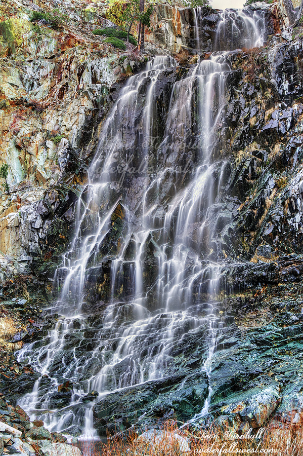
This is a bonus 20 ft. high waterfall I found on West Cherry Creek in between the other two falls. I had no idea this one was here. I was thinking there would be another good one above my camp; that one turned out to be nothing however this one is a pretty nice drop. In the past I have skipped waterfalls such as this one. It is just a minor falls and I do not have time to stop and photograph it. I was still a long way from camp and it was almost sunset. I have always regretted not stopping in the past. I will likely never be here again in my life. So now I always try to make the time to photograph these ones. Sometimes also when I am at a waterfall I get my shot and think I could get a different angle if I go over there but I don’t because I am out of time. I have a good shot of it, do I really need another one? Again, I always regret doing that so now I try to take the time to get that other shot if I can.
Thankfully this one was right by my path and easy to get up close to. I took a “couple” quick shots and hurried on back to my campsite.
Posted in Northern Sierra, Waterfalls by leapin26: November 20, 2021

I slept to the sound of the roaring waterfall. I would have slept better if I had brought electrolytes with me but I stupidly forgot. Nonetheless I still slept all right. It was supposed to be 38 degrees at night but I’m not sure it even got that cold.
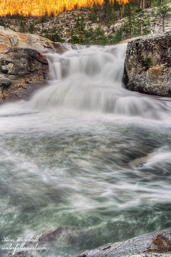
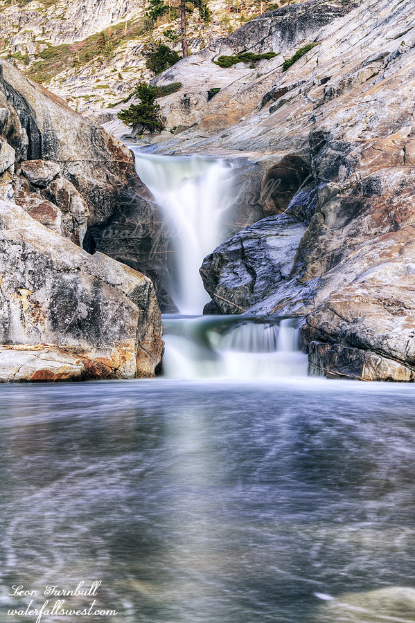
The flow of the creek was noticeably lower in the morning. The creek is very wide with multiple channels and I had to go to the very far channel to get my water (which I did not have to do the previous day). The waterfall still looked good even if the flow was a bit lower. I estimate it is 30 ft. high. The kayakers call it the Pothole and I don’t know that any of them have ever run it. I’m sure they would just slam into those rocks at the bottom if they tried (at least that is what it seems to me). The kayakers may not like it but I sure do. I took more photos, ate my breakfast, drank my coffee, packed up, and then headed up the hill at 8AM.
I quickly shedded my clothing once the sun came out. It was another very warm day. About halfway up I stopped to check out another cascade on the creek. (which I thought would be more impressive than it turned out to be). Continuing the tough climb up the ridge, I finally reached the top, then down the other side and eventually back up to the main trail. I arrived back at the car at about 11am. It took just as long to hike back as it did going in the previous day. There were no new tracks in the snow so that means no one else came up on Saturday.
I believe now I have seen all the waterfalls on West Cherry Creek. That does not mean I will never come back here again, it is such an amazing place, but I don’t really ever want to come back to this same trailhead because the road is so awful. I still have a couple waterfalls to see on the other branch (the main Cherry Creek) so perhaps I will be back to Emigrant Wilderness next spring. It was another glorious trip to my precious place in West Cherry Canyon.
Posted in Northern Sierra, Waterfalls by leapin26: November 17, 2021


