CARIBOU MADNESS

Backpacking trip #4 of the spring. One more to go before the waterfalls all dry up for this dismal year. This one did not turn out so successful. I made it to just two waterfalls, and only one good photo (this one). I had hoped for much more. Let me explain!

It was my 22nd wedding anniversary. My wife and I were in Red Bluff for the weekend at her mom’s house. We went out to lunch and then got some ice cream and went down to the river for a pleasant afternoon. In the evening I drove up north to the Trinity Alps Wilderness at the end of Coffee Creek Road.

I had read horror stories about this road and they all turned out to be fairly accurate (much to my chagrin). It is a very rough road littered with sharp rocks for the entire length of it. I tried my best to avoid getting a flat tire on these rocks (I have had that happen before on a similar road). 20 miles of slow driving at about 20mph. You do the math.

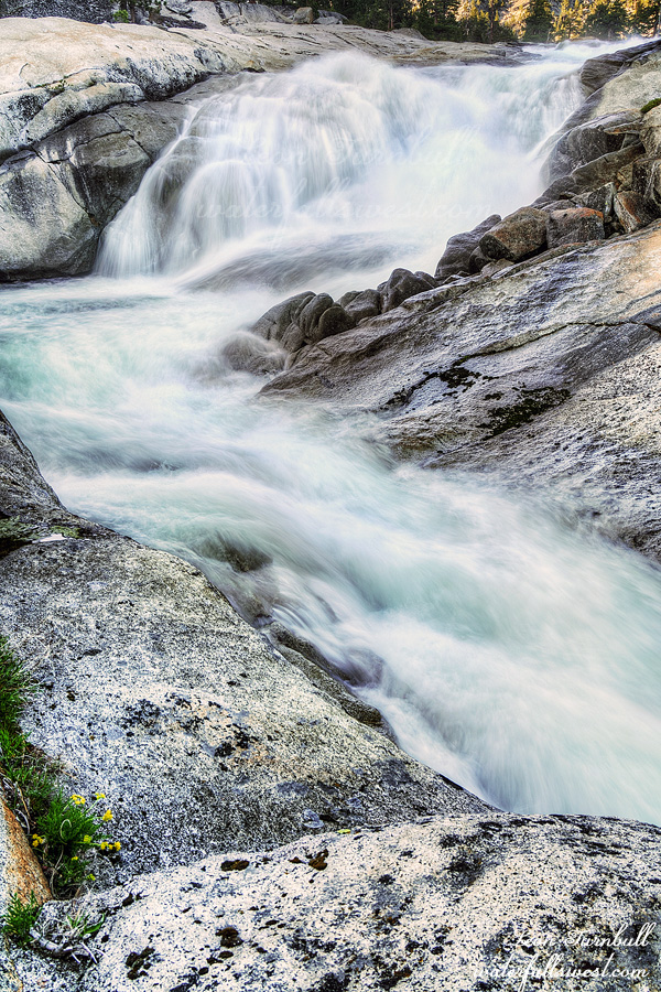
I finally reached the end of the road at the campground. There was still enough light so I went down to the first waterfall: South Fork Salmon River Falls (pictured here). It is about 60 ft. high so that is quite a bit bigger than I expected. It was a bit too steep to get all the way down to the river but I found a great viewpoint on a rock at the edge of the cliff. One waterfall in the bag. It was a great start to the trip.

I slept in my car at the trailhead. I slept in until 7:30! That is very late for me and a bit later than I wanted to sleep. Oh well, I guess I needed it. My plan was to hike up to Caribou Lakes and beyond. It did not exactly turn out that way.

There were an enormous number of deer at the trailhead (and also up at Caribou Lakes). They were all over the place, wandering around the campground, hanging out in the meadows, it was crazy. There were more deer here than I have seen in the last three years combined or more (no exaggeration).

There were also quite a few cars at the trailhead for Caribou Lakes. This was a surprise. This trail in the Trinity Alps has become rather popular in the last few years. Too popular. I think the Trinity Alps needs to start implementing quota on some trails (including this one) because they are becoming over used. Nonetheless, I was not expecting to see anyone this weekend because it is very early season. It was definitely not even possible to hike up to the lakes just two weeks ago so I was hitting this trail in the first one or two weeks of the season.

The trail is 9 miles long with 2000 ft. elevation gain. The grade is fairly gentle with no big steep sections. It is a steady climb the entire way. Nevertheless, it took a long time to hike up to the lakes and I was beat by the time I got there. I totally underestimated this hike. I had plans to continue past the lakes and down the other side. It did not matter anyway. There was still way too much snow on the other side and it was impassable. I knew there would be snow (and I brought my spikes) but it looked far too treacherous to attempt it. I did not have any energy to continue regardless.

There were two big groups camped at the lakes that I saw. One of them was camping in the spot where I had hoped to camp. Argh. Well, I found a different spot beside the outlet stream from Snowslide Lake opposite a pretty little waterfall dropping into the lake from the cliffs on the other side. Snowslide Lake is well named I suspect, it looked like there would be plenty of avalanches into the lake in the winter. My camping spot was away from the other groups and I did not see them at all for the rest of the day. The only bad thing is there was almost no shade. It was very hot in the sun. But it was very cold in the shade (what little shade there was). It was a tale of two extremes. I could not find a happy medium.

After dinner I hiked up to the Upper Caribou Lake. There was still plenty of snow up there, and still ice in the lake. It was incredibly gorgeous.

I had one more waterfall to see. There is a huge waterfall below Lower Caribou Lake. Getting down to it is a big problem because it is far below the lake. One thousand feet below the lake, to be precise. I was expecting that the descent would be extremely sketchy the whole way down. Actually, it was not too bad (a few tricky spots) but it took a full hour to get down. I made it all the way down to the precise spot where I had planned. There “should be” a terrific view of the waterfall from this spot. There “would be” a terrific view of the waterfall from this spot. EXCEPT for a bunch of trees beside the falls that were obscuring the view of it. ARGH! I would have been very happy if there was a clear view of the waterfall from here, however it was pretty much a wasted effort. I won’t be sharing the photo on this blog but it will be loaded on my website. There was no way to continue further to the bottom. It is just cliff and more cliff below me. Nothing more I could do but climb back up to the top and to my campsite.

The next morning I packed up and retreated down the mountain to my car. Along the way I had a cool sighting. There was a long traverse which I thought would make a good video clip so I setup my camera as I do and walked back along the traverse. As I was doing this a pine marten came down to my camera walking right in front of it as it was recording video. When he noticed me walking back up the trail he scooted up into the bushes above the trail. So cool! And I got it on video! Well anyway, it took a long time to hike the 9 miles down and I was exhausted by the end of it. It was a good and very tiring trip in the Trinity Alps Wilderness.


No Comments

THE REWARD

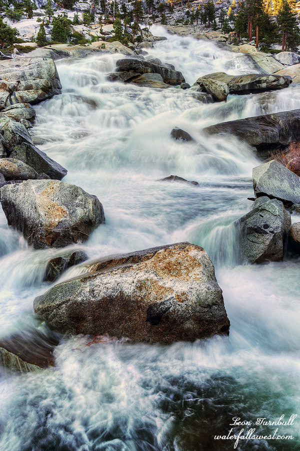
This photo is what I am calling Middle Falls Creek Falls, at the inlet to Lake Vernon.

I got up very early. I did not want to be hiking in the heat of the afternoon so I packed up, ate my breakfast and hit the trail. After a short 500 ft. climb, it is all downhill (3100 ft. down). I felt like I was almost running down the hill (I was walking very fast), but I was not making good progress. I wanted to be back at the car before 11am, but I was not going to make it by that time. This is dumb. I slowed down for the last section down to Hetch Hetchy Reservoir. It was hot now. Once I got down to the reservoir there were loads of people on the trail, all hiking to Wapama Falls. I saw a rattlesnake along here and a huge lizard. I don’t know what kind of lizard it was, but it was not one I’ve seen before. I tried to look up the species later but I could not figure it out. I made it to the car at 11:30AM. That’s not “too bad”, I guess.

I stopped at Pizza Factory in Groveland for a late lunch (the real reason why I wanted to be down the hill earlier). It is the first time since COVID started that I have gone out to eat in a restaurant after one of my hikes. There are a variety of reasons, some obvious, some not, but one of them being that certain towns (especially South Lake Tahoe and Mammoth Lakes) were telling people to stay away from their trails. Really, I am not allowed to hike on the “public” trails in your town and you don’t want me to spend money in your primarily tourist town? Then I won’t. Even after COVID is over. (spend money, that is – you are not stopping me from hiking in your town). I can’t imagine the restaurant owners approved of what their city leaders were saying. Anyway, before COVID I would occasionally go out to eat, especially after backpacking (not always). However, whenever I was in Yosemite, I ALWAYS stopped at Pizza Factory afterwards. I felt it was time to do this again. My reward after a long hard trek. Sweet.

No Comments

IMPOSSIBLE BURGER

At 3PM I started my second hike of the day, this time going to the inlet of Lake Vernon. There is a trail on that side of the lake which goes (almost) all the way to the inlet. The last little bit is slightly brushy but I did not find it too difficult to reach the inlet. There is a waterfall here but this is not the main one I wanted to see. For that, I had to climb up the canyon.

I was not sure if this was even going to be possible or not. Would it be too dangerous? If the granite was too slick and steep, I would be sliding off into the roaring creek, and be dead. From my study of Google Earth the route looked quite do-able, but there were a couple sections I was just not sure about. I began the climb.

It was very easy! The granite was not too steep and it was very open and easy going and a very beautiful hike. I was going to make it. Wait, not so fast madman. Guess what, I did not make it.

I was so close. I could partially see the big waterfall. I could not get to it. There was a WALL of manzanita brush in front of me. It was thick as molasses. It was not far but there was absolutely no possible way to get through the stuff. Believe me, I tried. I tried to go up and around it. Nope. I tried to go through it at the bottom. Nope. I had to give it up. This is horrible. I came all the way up here and was almost to the waterfall but I could not make it. It was so disappointing. What could I do? I sat down and ate my dinner. This gave me time to think. Maybe there is another way. I could not miss out on seeing this huge waterfall. There is a side channel going up beside the main branch of Falls Creek. There was water flowing down this drainage. It is overflow from the main creek. Maybe, just maybe, if I could get to it (through the brush), then maybe, just maybe, I could climb up the creek to the top it. I decided to give it a go. What did I have to lose? My life? The brushy part was short and I walked through it along the edge of the cliff. It was not quite as thick right along the cliff. It probably did not want to live right on death’s door. I made it through the brush. After that, I was able to get down to the creek at the bottom. Now I had to climb up the side channel. This is one of the stupider things I have done recently. The rocks were wet and slick. I had to crawl through a narrow slot in the rocks. A couple times I had to put my feet right in the water to climb up the cascade. How would I ever get down? But I did it! I made it to the top and I made it to the bottom of the huge waterfall. If there was any more water in the creek, I could not have done this. At very high flows it certainly would have been impossible (when I was here the Tuolumne River was flowing at about 1200 cfs – this is somewhat high, but it usually gets a lot higher in a normal year).

Has anyone ever been to this waterfall before? It seems unlikely. There is a trail at the top of it but I could see no possible way to get down from the top. It looked very cliffy. The other side of the creek looked better (no brush), but I don’t see how you could get to it without having to cross Falls Creek. Perhaps at low flow Falls Creek would be crossable and then it could be done but the way I did it seems very unlikely anyone has ever gone this way. That brush is insurmountable, and at higher flows, crawling up the side channel would be impossible for sure. Maybe someone has made it up here at lower flows. Perhaps.

Falls Creek Falls is a huge cascade, about 400 ft. high in total. I was standing right near the bottom of the main section of the falls. It was enormous and magnificent. I was so happy! I did not believe I had actually done it. Now I had to wait about 30 minutes for the sun to go behind the ridge, then I took my photos and went back down. Going down that creek drainage was easier than going up (it seemed), but I was very careful. I hiked back down all the way to the bottom and took photos of the lower falls. Then I hurried back the trail to my camp, arriving just before dark. I noticed a couple more backpacking groups had come up today, but they were all camped on the north side. So again, I had the entire south side to myself. Why was everyone camped on the north side of the lake? The camping is far better on the south side of the lake, it is a lot more brushy and a lot more buggy on the north side. Anyway, I had an absolutely fantastic day and saw all the waterfalls I wanted to see. I went to sleep a very happy boy.

2 Comments

PILGRIM’S PROGRESS

It was time for my annual pilgrimage to Yosemite National Park. I always try to go here at least once per year. And of course, I try to see new waterfalls while I am there as well.

Someone recently mentioned they were attempting to hike every trail in Yosemite National Park (about 800 miles). I thought that would be an enormous achievement if he completes it. I would not want to do that. However, I thought that maybe I would like to see EVERY waterfall in Yosemite. That would be an even greater monumental achievement than hiking every trail. It is probably impossible because some waterfalls are likely very inaccessible, and also I am getting old. I don’t have too many years left in me, I imagine. Thus far I have seen 70 waterfalls in Yosemite out of 139 that I have catalogued, so that is about 50 percent. Baby steps. If I just continue each year on my pilgrim’s progress, I will get a little bit closer to that goal.

This year I saw four new waterfalls and a couple of them I can’t imagine anyone has ever seen before. It was an incredible trip. The destination: Lake Vernon in Hetch Hetchy.

I way overestimated the time it would take to drive to Hetch Hetchy. Google Maps said it would take 3 ½ hours. It only took 2 ½ hours (I was not speeding!). I arrived at the gate at 7:30AM, 30 minutes before it opened. Ah well, so I waited. I was first in line.

I got my permit and I was on the trail by about 8:30AM or so. I have never hiked up towards Lake Vernon before. It is interesting because there is old pavement on this very steep trail to the top of Wapama Falls. At some point in the past they built this road and drove up here. I cannot imagine how you could drive up here (or why). It is interesting.

It is a steep climb. The total elevation gain is 3100 ft. to Lake Vernon in 11 miles. A couple speedy groups passed me. One group of three that was going to Lake Vernon and another supersonic hiker who was going I don’t know where. It took longer than anticipated and I did not arrive at Lake Vernon until 3PM, and by the time I setup my camp and ate dinner it was after 4PM, so I had no time to go to the first waterfall as originally planned. I would have to see all the waterfalls on the second day. I just relaxed at camp, strolled up to see the lake, and took it easy. The other group was on the other side of the lake so I had the entire south side all to myself (and it is a big lake). It was absolutely gorgeous.

I saw no bears at Lake Vernon. I was disappointed. This is supposed to be one of the hot spots in Yosemite for bears. Nada for me. I did see a falcon that was hanging out near my camp. I think its nest was nearby on the other side of the creek, so that was cool to see.

I slept very well. My campsite was right beside the roaring Falls Creek. There are many campsites at this lake, but I chose to camp by the creek instead of by the lake. I would rather listen to the sound of a rushing creek, than the quiet of the lake. That’s just me.

I got up very early, in the dark. It is two miles down to the Lower Falls Creek Falls and I suspected it would take two hours, but I was hoping for less. It took exactly two hours. It was much more difficult than I expected. At first it was very easy going, walking along the open granite rock. Then it became very difficult, climbing up and down cliffs, and through brush, and crossing difficult streams. It was a lot of work and when I finally got down to the waterfall, I could see it was already in the sun. Was I too late? Well, the lower part of the falls was in the sun but the upper (main) part was still in shade. I climbed up beside the waterfall (more hard work) and reached a ledge where I could see it and photograph it. Lower Falls Creek Falls is a magnificent waterfall, dashing through a narrow slot in the canyon in a few tiers. Awesome. One down, three to go.

I ate my breakfast at the falls and filled up with water, then made the long trek back to camp. I went a different way back up, hoping it would be easier, but it wasn’t. It took two hours going back. This is a tough one to see! Back at camp, I made my lunch and rested. I had four hours to recover before heading out on my next hike…

No Comments

DAY 3. NO WORDS

I did not sleep well. My tent was not on a perfectly flat spot and I kept sliding down on my pad. I just could not get comfortable.

I got up very early and packed up camp. I only had a 6 mile hike back down the hill to my car but first I wanted to see one more waterfall: Miller Creek Falls.

This is the one waterfall I had already been to. I don’t remember the trail being so overgrown and brushy before. I also don’t remember it being so darn treacherous to get down to it. It was all of the above and more. It was almost too treacherous and I thought about skipping it, but hey I did it before, I could do it again. Right?

I made it down to Miller Creek Falls and it was just as I remembered, but this time it was at high flow. It was spectacular but …

There is a Lower Miller Creek Falls as well. I do remember seeing it when I was last here but I did not go down to it because I did not have enough time. It looked even crazier to get down to it than the upper part. This time I wanted to make the attempt to get down to the lower falls. But how? It was very cliffy and very brushy. I found a route that looked possible. It was actually not too bad at all (much better than the upper part). I arrived in quick order down at the bottom of the lower falls and … WOWZERS …

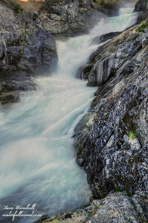
Lower Miller Creek Falls is …. Absolutely NO WORDS … it is just MAGNIFICENT. (I guess that is a word but still…). Of the nine waterfalls I saw on this trip I saved the best (by far) for last. What an amazing waterfall. It is not easy to photograph but I got some shots and then ate my breakfast down at the falls.

I still had to climb back up both the waterfalls and get back to camp where I left my pack. Then I had a 6 mile hike back down the Rubicon Trail to my car. There were a lot more jeeps that had come up the trail on Saturday and Sunday. The snow was now hard packed and easier to walk on. I wondered how the jeeps could even drive on this trail so early in the year with the soft melting snow. Wouldn’t they get stuck? What if the snow bridges collapsed under the weight of the vehicle? How did they manage to cross roaring Miller Creek and especially how would they cross the Rubicon River near the end of the trail? Anyway, back to my hike, even though the road was easier to walk on it seemed a lot more snow had melted and there were more obstacles than before. It was very slow going. My feet were now hurting quite a bit and I was limping down the trail. I had no problems with my feet on day 1 and day 2 (the hardest days), but now on day 3 (the easiest day) my feet were hurting. I arrived back at my car just after noon. It was an amazing top five backpacking trip into the Rubicon River in Eldorado National Forest.

2 Comments