DAY 2. THE BIG BOY

It was a very cold night. The temperature was supposed to be 39 degrees, but I suspect it was colder than that. I woke up early. I was planning to hike to Big Valley in the morning. I was hoping this would not be too difficult, but unfortunately it was worse. I thought it would be a simple walk along the river bed. Nope. It is only two miles. The first mile is great. There is a fantastic, easy to follow Forest Service trail. Then it just ends. Oh come on, Forest Service. Why would you end the trail here? After the trail ends, it becomes extremely brushy, extremely steep and extremely cliffy. I made a good attempt to get to Big Valley, scrambling for a couple hours along the dangerous cliffs, and through the extreme brush. Eventually, I ran out of time, and decided to go back. There is no point in going there if I cannot get good photos. Someday, I may try again.

When I got back to camp, it was noon. I was dead tired. There is no way I could hike back up the mountain, so I decided to stay the second night. There was one more waterfall I wanted to see in the evening, anyway. I hoped I could get to this one, but again, I was not sure.

I spent the afternoon at camp. I started a campfire to keep the mosquitoes at bay, I took a nap, and enjoyed the scenery. I saw an interesting thing on the other side of the river, high on the cliff, and barely seen in the far off distance. It was a cross. On the edge of a cliff. It was quite big, perhaps 50 to 100 ft. high. It was not anywhere near the trail on the other side, but right on the cliff. I thought it highly unlikely anyone could have put it there. My wife had various theories, ranging from rock climbers to Sasquatch to Aliens. Frankly, I think Sasquatch is probably most likely. Perhaps God put it there, just for me to see it. (apparently, it was put there by some people quite awhile ago – no idea why).

I saw a couple snakes. One was a garter snake in my camp. The second one freaked me out royally. I went to the river to get some water. As I bent down to scoop some up, I saw a snake swimming right for me, about a foot away. It was just a water snake, not a rattler, but boy did it scare me! I jumped two feet in the  air.

After dinner, I made the waterfall attempt. This requires multiple creek crossings of Big Granite Creek. Again, no possible way to do this any earlier in the year. The waterfall is hidden, tucked away in an incredible alcove with towering cliffs on each side. Access is blocked on both sides of the creek. The only way there is to cross the creek at the end of the waterfall pool, and at the top of a mini waterfall. The water was deep, and would have been up over my head I suspect, but there were big rocks in the creek to stand on. Just don’t slip off them, madman. After this little section, I had to continue across the top of the mini waterfall. Slowly and surely, but I made it. What an amazing location! The waterfall is drop dead gorgeous, about 60 ft. in height. The surrounding cliffs and pool are absolutely stunning. This is the Big Boy of the waterfalls at the confluence. I only know of one other person that has been here before. It is a hidden masterpiece.

After photographing the waterfall, I reluctantly went back to camp and to bed. It was a much warmer night.

No Comments

DAY 1. THE BIG GAME

Last year I attempted to get down to Big Granite Creek at the confluence with the North Fork American River and failed miserably. Four weeks ago I tried again, going down from Loch Leven Lakes, and failed miserably. (due to the trail being too brushy). Little did I know at the time, I would not have made it even if the trail was not brushy. This last weekend I tried it again, via a different route. And finally, success! Yet … I almost failed again.

I did not go up to Loch Leven Lakes, but started from a different point; it was a long and bumpy dirt road which seemed to take forever, but at least it was drivable. I finally made it to the trailhead. It was June 7 and the temperature was 31 degrees. There was snow in the forecast for the morning. Yes, you heard me correctly. It was cold, and yes it did indeed snow a little on my hike this morning. There was another couple going from here to Loch Leven at the same time (it was very early). We said our hellos and goodbyes, and then I was off and running in a different direction. It is a 3500 ft. descent in elevation down to the river. This is not for the faint of heart. This is the Big Game.

I missed the trail marker. I walked right by it and did not see it. (I only saw where I went wrong on my way back up). I have no idea how I could have missed it, as it was very obvious. The actual trail is right beside a clear cut area, which is what confused me. Nonetheless, I wandered around in the bush for a full hour trying to find the trail. I lost my blue foam sitting pad somewhere during the bushwhack. I was this close to giving up completely, and then I stumbled upon it. Salvation! What a relief. I really really did not want to have to turn around and go home.

Even though I finally found the trail, I was still very unsure how far I could go on it. I have heard it is overgrown and brushy, and on my attempt last year, that was my analysis also. Well, not so. The trail was in perfect condition the entire way down to the river. It is very steep, for certain. Otherwise, it was perfect. Again, I don’t know how I could have missed it on my trip last year. The trail is so obvious! I guess it is only obvious when you are on it. I saw a sign saying that the trail has been cleared by a motorized group. I do not know who or when, but I sincerely thank you, whoever has cleared this trail (it “should be” the Forest Service that maintains it). I honestly don’t know how anyone could ride a motor bike down this trail, however. It is so steep!

There are two crossings of Big Granite Creek. I expected them to be very easy, perhaps even rock-hoppable. Not so! In fact, the creek was just barely crossable. It was certainly do-able, but the water was up to my knees with a fairly strong pull. The second crossing down at the confluence was more difficult, and up to my thigh. The North Fork American River was flowing at about 380 cfs at the North Fork Dam. I think I could have crossed at a little bit more, perhaps 500, but probably not 600. Four weeks ago, it certainly would have been impossible, had I made it down this far. (so it’s a very good thing I could not find that trail four weeks ago).

There are no decent campsites on the east side of the creek at the confluence. That meant I had to cross Big Granite again. I was sort of expecting this, but was not sure. The reason the crossing at the confluence is more difficult is because Little Granite Creek joins up with Big Granite after the first crossing. On the west side, however, it is extremely rocky. I was definitely NOT expecting that. There was literally only one small spot to setup my tent. Well, it worked. It was 3PM. I setup camp, ate my dinner, and then set out to photograph the waterfall, which is found right at the confluence.

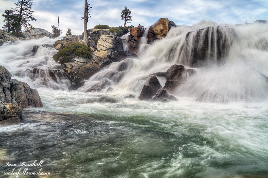
Big Granite Creek Falls is a beautiful 3 tiered waterfall, about 40 ft. high in total (only two tiers are shown in this photo – in case you are wondering – ha ha). I may have to rename it, however (story on that, tomorrow). In the evening, it started to rain. Thankfully, it did not rain too much and I had a very enjoyable evening.

But the best is yet to come … so stay tuned ….

1 Comment

DELUGE

It was a very rainy Saturday. I kinda wanted to do this hike, but not in the rain. I thought about going in the evening and camping by the falls. Even though it is a very easy day hike, I just kinda felt like doing this. Then my daughter said she would come with me, but she did not want to stay overnight. Well, all righty then. Let’s just do a day hike in the evening.

We drove through a couple deluges on the drive over in the late afternoon. Extremely heavy rain. Lightning. Thunder. Hail. Yeah, this should be fun. When we arrived at the trailhead, it was still raining. Thick clouds all around. But within 10 minutes, the rain stopped and the sun started to come out. This should be the end of the rain for the evening. The rest of the hike should be very pleasant. Well, not quite. We did encounter one more rain shower after that and a bit more hail, but mostly it was a lovely hike.

The last bit of the hike to get down to the waterfall is steep, and off-trail. The brush was thick. It was strange, though, because the brush seemed easy enough to walk on, but it was deep and that made it very tricky and potentially dangerous. Nekoda got halfway down, but did not want to continue all the way to the bottom. She decided to just wait for me on a rock. It was still a long way to the bottom, and I did not want to leave her up there by herself for too long, so I decided to not go all the way down either. I found a viewpoint from further up and tried to take photos from there. It was not bad, but would have been better from the bottom. This new discovery is 127 ft. high, a beautiful tiered cascade. I will have to come back sometime and get down to the creek level, before that brush gets really bad. It was a lovely rainy day hike in Eldorado National Forest.


No Comments

MY PRECIOUS

Two years ago I went into West Cherry Creek Canyon in Emigrant Wilderness with my son. We saw two spectacular waterfalls and had an amazing experience. I thought the canyon was one of the most stunning places I have ever seen, it was so beautiful: the waterfalls, the creek, the mountains, I was in complete awe (Jadon did not have the same emotional experience that I did). Last year, I went back to West Cherry Creek to a different location (without Jadon), and I saw three more amazing waterfalls, and again, I thought the canyon was absolutely breathtaking. This year, I wanted to return once more to West Cherry Creek to yet a different spot to see yet different waterfalls. Would I have the same emotional experience and go three for three in this amazing canyon? (spoiler alert: yes, I would)

It is a long drive to the trailhead. It was Memorial Day weekend. Traffic was surprisingly very light. Was this due to COVID-19? I’m not sure, but from what I’ve been reading, everyone is packing up all the open parks and trails now, and I expected everyone to be out and about somewhere on the long weekend. The last few miles to the trailhead are extremely rough, but I made it as far as possible and was stopped a mile from the official trailhead due to snow on the road. There was one other car here, perhaps some people backpacking down in the canyon?

It is a four mile hike to the waterfall (five, because I had to walk an extra mile), so it is easy enough to do as a day hike. But it is not an easy hike. There is an unofficial and unmarked trail to the creek. Many people use this trail to backpack to Hyatt Lake in the summer. Nonetheless, it is faint in many spots, I completely lost the trail more than once, and ended up having to bushwhack through the forest.

Finally, I emerged from the forest to get my first view of the West Cherry Canyon. Absolutely stunning! (no surprise to me). West Cherry Creek was flowing very strong off in the distance. The trail traverses down to the creek where backpackers cross it to go to Hyatt Lake, but it was not crossable today. The inflow to Cherry Lake was at 1000 cfs (West Cherry is about half that). There is no more trail from here, so I had to go cross country to the waterfall. This is a magnificent stretch of hiking as you walk along the granite rock beside the fast flowing creek. There were a couple difficult spots (brush, swamp, cliff, etc.), but mostly it was glorious. The last section involves climbing up a cliff (not hard), where as you come over the top, you are at the top of the waterfall with amazing views in all directions.

The waterfall is spectacular at high flow. What shall I name it? It is somewhat close to Middle West Cherry Falls, so I think I must name it Lower Middle West Cherry Falls. (I know, it is a crappy name). It probably deserves a better one. It is very wide and shoots off in two separate cascades, each about 40 ft. high. It was too wide to photograph with my camera lens, but I did the best I could. The lighting was good as I arrived at the bottom of the waterfall, and there are tons of angles and photographic opportunities. I took many many photos, much more than I normally do. I was in heaven.

There is a second falls here, and I wanted to go check it out as well. It was much harder to reach and involved climbing up and down a cliff. No easy feat, it was very difficult, and it took a long time. When I got down to the bottom, the light was crappy and I did not take any photos of the waterfall, but it is another spectacular cascade, and I think I will have to return here next year and perhaps camp here. Indeed, there was someone camping here at this second falls. I was a bit shocked to see anyone down here. It is way off the beaten path, and as I said, very difficult to get to. I was even more shocked when I saw him come out of his tent. He was stark naked. The temperature was chilly, only about 50 degrees or so. He was just hanging out (literally) beside his tent. He did not see me sitting by the waterfall. I think he did see me eventually and went back into his tent (thankfully!). No doubt he was as shocked to see me there, as I was to see him with all his bits hanging out. By the way, I think he was backpacking alone – I only saw one pair of hiking boots by the tent when I passed by – some people are a bit odd, I guess.

After he went back into his tent and after I had eaten some food, I packed up my stuff, got a load of fresh water from the river, and headed back up the mountain. I went back up a different route. It was not any easier. In fact, I think it was harder. Technically, it was a shorter route back to the main trail, but it took longer due to the difficulty. When I return next year, I’m not sure how I will come. Hopefully, there will not be any naked people camping at the waterfall. That’s about all I can say about that. I got back to the car and drove home. It was a very hard hike, and an absolutely awesome journey (again) into the West Cherry Creek Canyon of the Emigrant Wilderness.

No Comments

CLOUDY WITH A CHANCE OF MEATBALLS

I checked the weather forecast all week, every day, at least twice a day. Multiple different weather apps. Every single time on every single app it said it would be cloudy all day on Saturday. Right up until I went to bed on Friday night. This was the perfect forecast. I had a big hike planned on Saturday, and I did not want to get up at some stupid ridiculous hour to hike in order to make it to the planned destination on time and take photos in good lighting conditions. So I slept in a bit on Saturday. When I woke up I checked the forecast. What do you think it said? PARTLY CLOUDY. What the &*$#&*($%# ?? Are you kidding me ???

I almost went back to bed. However, I decided to drive up the hill anyway, in hopes that the conditions would be ok once I got up there. Nope. I arrived at the trailhead and it was sunny. It would be pointless to do this very difficult hike now. There was no possible way I could make it to the waterfalls in good light.  I drove all the way up here, though, and I did not want to just turn around and go back home, so I decided to do a different, easy hike, that I have done many times before: North Fork Falls. I have plenty of photos of it, but I have not made a video of it yet, so it seemed like a good plan.

Normally when I go to North Fork Falls, it is winter. It is far too treacherous in the winter to get all the way down to the river. In the spring, however, it is a different story. The last little bit is still quite dangerous, however, so I used my rope for safety. I made it down to the river without any incident. It is a slightly better point of view from river level. North Fork Falls is a very beautiful 27 ft. high waterfall. No one else was around at the falls or on the trail (though I did see people camping in the closed campground – somehow, I was not surprised). It was a lovely, quick and easy hike in the Tahoe National Forest.


No Comments