NORTHERN IRELAND. DAY 6 PART 2. IRISH PEEVES

There is one thing that perturbed me about all my hikes in Scotland and Northern Ireland: there was a lot of trash on the trail. I found that the trails had more litter than even in California. It would not surprise me if a lot of this trash was caused by Americans littering in foreign countries, and there may have been some of that, but I believe the vast majority of it was done by locals. I find this very upsetting and sad. Cranny Falls, for instance, which we went to next after Glenoe Falls, is mostly a locals trail, not a tourist trail, and there was a ton of trash on this trail. I always pick up trash when I am hiking as I hate seeing litter on trails (it is my number two pet peeve). My wife and I picked up more than our fair share of it, trying to clean up the trails in Scotland and Northern Ireland, but it got to the point where I was just sick and tired of it all. I think the Scottish and Irish hiking trails societies ought to be thanking us personally (if there is even such a group in those countries – ha ha).

We did find the people in Scotland and Northern Ireland to be very friendly. On our hike to Cranny Falls, my wife asked some locals about the berries she saw on some plants. Are they edible, she asked? No! they replied emphatically. That is poison ivy. Don’t eat that. We want you to enjoy your stay in our country!

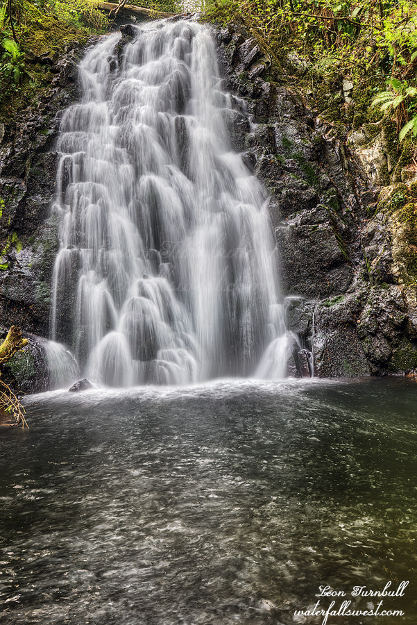
After Cranny Falls, our next stop was Glenariff Falls, where there are two beautiful waterfalls on a nice loop trail in Glenariff Forest Park, an upper falls – pictured here (60 ft.) and a lower falls (40 ft.). You have to pay for parking at this park, 5 pounds. It is worth the fee, but again, I found so much trash on these trails. If I am paying this much to go into the park, why aren’t they keeping the trails clean? Where is my money going to? Why can’t they keep their parks clean in Northern Ireland? I found this to be even more upsetting than the trail at Cranny Falls (where the parking was free).

My daughter took a wrong turn on the trail here, because she decided to go off the trail to take a “short cut”, and thus she missed the “waterfall sign” pointing the other direction. I was way behind (taking video) and did not see her, but my wife saw her go off the wrong way and yelled at me, so I grabbed my camera and ran after her. It took awhile to catch her, she was far up the trail. So much for that short cut. It was a fun hike, but not exactly easy. There is a long climb from the lower falls back up the car. By the time we got back to the car, the local cafe was closed because it was almost sunset, which is where I had hoped to eat dinner. We had to drive a bit, but we eventually found something better: a pizza place in some small town. Yum.

No Comments

NORTHERN IRELAND. DAY 6. IRISH WEDDING CRASHERS

On this day we explored the eastern side of Northern Ireland, going to the Dark Hedges, then Carrickfergus castle; both of these were fairly interesting places. The Dark Hedges are a grove of beech trees along the road. The road is closed to vehicle traffic, so people can just walk down the road amongst the trees. They were planted in 1775. Apparently the trees are haunted as well. Go figure. The Carrickfergus castle is a Norman castle built in 1177. It is in very good shape considering how old it is. Unfortunately, it was partly closed for renovations when we were there, but we still got a nice tour of it. It was definitely worth visiting. Some tourist came in and started complaining loudly because the castle was partly closed and they were still charging for the tour. Geez lady, give it a rest.

We followed up these locations with a few waterfalls of course.

Our first waterfall stop was Glenoe Falls, 40 ft. I have seen it spelled Gleno and Glenoe, so I have no idea which one is correct. I think Glenoe is good. This is a very easy and very short walk. My kids decided to go the hard way, however, using a big rope to climb up a very steep hill, which then just came back to the regular trail. Silly kids.

When we arrived, the falls was in the sun so I had to wait a bit for some clouds to cover it before I could take some decent photos. There were a few people playing in the water, but not in my way for taking photos. I did not have to wait too long for the sun. God was very gracious to me on this trip. I think I said that already.

We finished up at Glenoe Falls just in the knick of time. A very large group came down the trail to the waterfall. It was a wedding party. I’m not sure if they were having the wedding at the falls, or just taking wedding photos at the falls (it seemed a very large group for just wedding pictures – but maybe that’s the way they do it in Ireland). They took over the entire waterfall location very quickly, crashing our waterfall party in a heartbeat. Thankfully, I was all done taking my photos. Time to go on to the next one. Day 6 Part 2 coming soon…

No Comments

NORTHERN IRELAND. DAY 5. GAME OF FALLS

On Day 5 of our trip, we flew to Belfast in the morning and drove to Portrush, where we would be staying the next few days. I was not particularly impressed with Portrush. It is like a mini San Francisco, and our lodge was right in the middle of it. I do not really want to spend my  vacation in San Francisco. The traffic was a mess and there were far too many people. It was not very relaxing. Well, it is not like we would be spending too much time at the lodge. We had many sights to see.

There is so much to see in Scotland and Ireland, we only saw a small tiny drop in the bucket there. We only had 8 days in total for the three countries (Scotland, Northern Ireland, and Ireland). My wife is the one that really wanted to see Ireland. It has been on her bucket list forever. When her group decided to do this Europe trip, Ireland was not on the list. She was upset. How can she go all the way over there, and not see Ireland. She decided to extend the Europe vacation, and go to Ireland separately. This is why I went. I do not like tour groups, and I was not going to go to France and England in a big group to see things I do not want to see. I want to do my own thing (waterfalls is a big part of that, of course). So when she decided to go to Ireland separately, I said heck yes. We can spend time there by ourselves, doing the things we want to do and seeing the things we want to see (waterfalls is a big part of that, of course!). I would go over a bit earlier, so I can see Scotland as well, which was another country I really wanted to see. So that is what we did, and it was awesome.

We checked into our Air bnb lodge in downtown San Francisco, I mean Portrush. The lock on the door would not work. We could not figure it out whatsoever. Oh great. Now we would not be able to leave our stuff in the lodge while we were out and about. We had to call the owner (a $15 phone call), and he told us how to lock the door very simply. This may have been pretty obvious to Irish people, but to Americans, it is very un-intuitive how to lock the doors there. Why could they just not say how to do this in the instructions? It sure could have saved us that darn expensive phone call.

In the afternoon, we visited the Giants Causeway, Fair Head, Dunluce Castle, Kinbane Castle, Dunseverick Castle, and Dunseverick Falls. The Giants Causeway is a big huge tourist scam. It was apparently featured in one of the Harry Potter movies. We were told, thankfully, not to pay the huge entry fee, so we only had to pay 8 pounds for parking. It was a very busy place, and a busy walk down to it. Admittedly, it is a very interesting feature. We could not figure out if it was man made or natural, it looks like it could be either. Legend says it was built by the Irish giant, Finn MacCool, as a crossing to confront his Scottish rival. In fact, however, it is a natural volcanic formation. They have a bunch of attendants there, situated at various places, telling you not to climb here or there. It is a bit ridiculous, but if you fell you could be seriously hurt. There was just way too many people there for my liking.

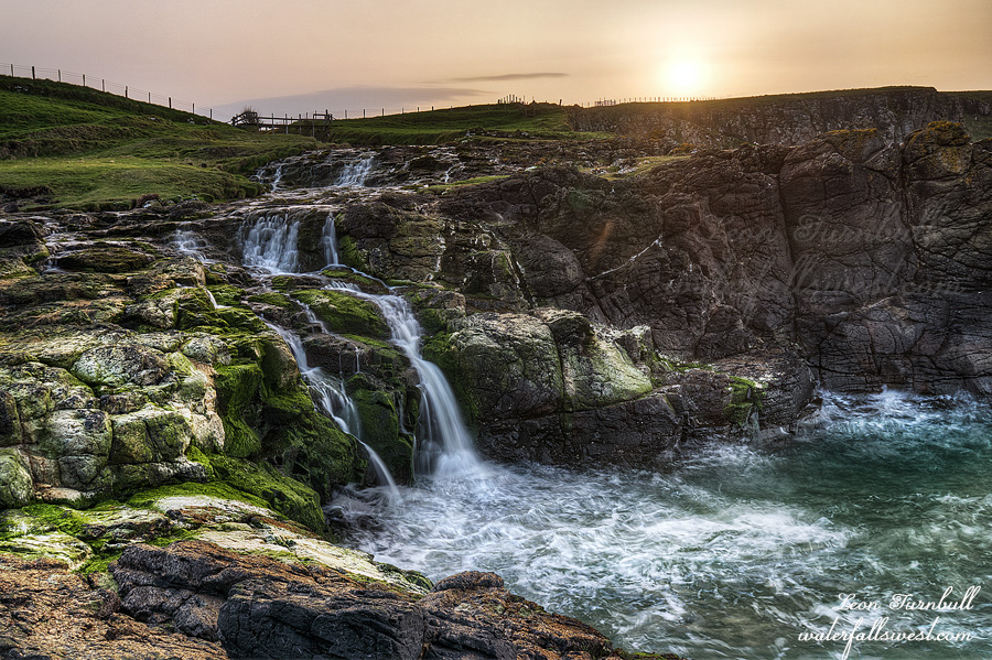
After this we visited some castles in the area. Kinbane Castle was our favorite, but apparently if you are familiar with Game of Thrones, then you know about Dunluce Castle. I do not know anything about Game of Thrones. What the heck is that? All I know about is the Game of Falls, and I know that Dunseverick Falls (pictured here) is a very pretty little waterfall, cascading into the ocean. We were here at sunset, and it was a gorgeous spot, with beautiful sunset lighting. This place was indeed very relaxing. We had it all to ourselves.

No Comments

DAY 2. THE LOST ONE

The next day I decided to pack up and hike back home. I was not exactly certain what I wanted to do, stay a second night, or hike back out? There were potential thunderstorms on the forecast for this day, and there was nothing else (no other hikes) I could do all day anyway, so I just decided to go home.

I got up very early and packed up my gear quickly. I wanted to be sure to photograph that upper falls in good light. It was only a half mile but still took over 30 minutes. That brush! I barely made it to the upper falls in time. I am calling this one Far Upper Big Granite Creek Falls. It is about 50 ft. high in two tiers. It is perhaps the lost one on this creek amidst the big waterfalls downstream, but it is a very cool and powerful waterfall. Yet another waterfall discovery by yours truly, the waterfall madman.

On that note, I have a comment to make. Other than Russell and Tom 13 years ago, I know of NO OTHER person that has ever been to the upper Big Granite Creek waterfalls. It is an extremely strenuous hike. There are many difficulties and many treacherous spots. I was almost certain no other person has ever been down there. And yet … there is a faint path along the creek, which I spotted occasionally from this far upper falls down to the big waterfalls. It is so faint it is basically non-existent. I assumed it was a bear trail. I was certain it had to be a bear trail. But as you get closer to the big waterfalls, it is more defined. The bears would not go down to these waterfalls (then again, maybe bears like waterfalls too). Seriously, it is obviously a human path down near the falls. This path was not made by two people 14 years ago. So who has been here? When were they there? Why have I not heard that anyone has else has ever been here? It is so faint, I wonder if it was made by people a long time ago, before Russell/Tom were there. It all just seemed very strange.

I made my breakfast at the upper falls, enjoying the moments with my coffee as the sun rose above the mountains to shine down on me and the waterfall. Then it was time to make the long, very difficult, 1900 ft. climb out of the canyon. When I finally got to the top, I could see the storm clouds starting to roll in. I was on an exposed ridge, and a thunderstorm was just behind me. I needed to get down off that ridge quick. Actually, the storm seemed to be going in the other direction. I had a tiny bit of rain fall on me, but nothing to write home about. Then …

My GPS died. To be more specific, my batteries died. I couldn’t believe it. Three sets of batteries should have been MORE than enough to last for 2 days. It wasn’t. Indeed, the last set of batteries only lasted about 3 hours even though they should have been fully charged. How could that have happened? Well, I was not on any trail or road. There was 10 feet of snow on the ground. I was lost … but … not exactly. I had a backup on my iPhone (Gaia GPS). With the Gaia map, I easily figured out which way to proceed and successfully found the way to my vehicle in short order. I have never needed to use it before, but if I did not have this backup, I would have been lost. There were no signs, no trails, no way to determine which way I needed to go. Honestly, I did not load the Gaia map on my phone before this hike, so I believe God was looking out for me here. This is a lesson learned (for me). Always make sure you have a good backup. This is critical for everyone, in my opinion. Remember that guy who got lost at Loch Leven Lakes a couple years ago and almost died? He not only did not have any backup system, he did not have a way to call for help either. Everyone needs to have a reliable navigation system (whatever it is) and a reliable backup. I can easily see (especially after this weekend), how someone can get lost in the wilderness. Even if you always hike on a trail, it is still possible to lose the trail and get turned around, but if there is snow or if you hike off trail, then it is doubly important. There is my two cents.

No Comments

DAY 1. THE BIG ONE

Before we move on to the Ireland part of my overseas trip, let’s take a break and go back to my favorite area in the world: The North Fork American River. I have not been idle since I got back from the U.K., and indeed will not be idle in the near future. This is the best time of the year in California. The snow is melting, the waterfalls are raging, and the mosquitoes are not out yet. Since it is a big snow year, you know I will be out there enjoying it. How about you? By the way I still have tons of Scotland waterfall photos to process as well!

I first heard about these big waterfalls on Big Granite Creek thirteen years ago. Yes, that is correct. Thirteen years ago I started planning (or thinking about) this trip. It took me that long to get there. It was one of the most grueling and strenuous hikes I have ever done, and I am already planning a return trip. It was so incredibly amazing.

In 2006, the late Russell Towle and waterfallswest friend the Gambolin Man (Tom McGuire) came here. Tom almost died (literally) crossing the creek at the top of the waterfalls. You can read about their adventure if you do an internet search. When they were here, the flow in the North Fork American was at about 1800 cfs at the North Fork Dam. This past weekend the flow was about 50% higher than that (around 2500 to 2800 cfs). My best guess estimate was that Big Granite Creek itself would have a flow of at least 200 cfs. I think in actuality that it was quite a bit higher than this (at least 300 cfs). You do the math. Crossing Big Granite Creek would be out of the question. And yet … to get here you MUST cross Big Granite Creek. Was I foolish or suicidal or both to try the hike this weekend?

My 13 year plan in the making was to *NOT* go the same route they did. Obviously, I could not go the same route they did. I was hiking earlier in the year because of a couple big reasons: I would like to see the waterfalls at a bit higher flow. Also, and more importantly, I thought that with snow still on the ground, it would be easier to hike because the route is so very brushy. There is no trail. With snow covering up the brush, it should be easier. In retrospect, I think I picked the most perfect time to go. If there was any more snow, I don’t think I would have made it. But that creek crossing!

There was 5-10 feet of snow on the ground when I began the hike, climbing up to about 6900 ft. in elevation. The snow was very hard packed. I did not need my snow shoes, yet I carried them up anyway. I anticipated needing them, and indeed I would need them. My pack was much heavier than usual for this hike. I was carrying about 8 pounds of extra gear that I would normally not carry, but I expected that I would need all this gear: snowshoes, water shoes for the creek crossing, rope, and extra food. I thought I was prepared enough, but should have brought more, and this is one of the reasons I want to go back.

When I got to the top of the mountain, you need to descend down the other side. It is a 1900 ft. drop in elevation down to the waterfalls. It is a very steep descent in some places. I came to the first steep part, and I realized I would need to put on my snow shoes. I should have had my micro spikes! I left my spikes at home, thinking snowshoes would be good enough, but spikes would have been better. However, on the return trip the next day the snow was much softer. Snowshoes were much better in that situation. I should have had both. I was very careful on this first section of the descent with my snowshoes. Plant one foot solidly in the snow at a time. I made it down the steep section. My snowshoes broke. Well, not exactly. The binding on one of the shoes was hanging on by a thread. If it broke off, I would be screwed enormously. Would it hang together until I got home the next day? (it did, thankfully).

I continued on. I came to the end of a little (still frozen) lake at which I needed to cross the outlet stream. There were steep snow dropoffs on both sides of the creek. It was with great difficulty and after much scouting, when I finally found a way across. On the other side, I needed to climb up the side of a steep cornice. This was very hairy. Again, spikes would have been better than snowshoes. I almost turned back at this point. Not because of the cornice or stream crossing, but because I knew things were about to get much worse. There were going to be two more very steep and probably cliffy descents, much worse than the first one (when I first put on the snowshoes). I was almost certain that it would be far too treacherous to go down these in my snowshoes. I decided to just continue on to the top of the cliffs, and see what it was like. And then….

The snow disappeared! Now that I was on the south side of the mountain, the snow was all melted. I was able to walk down the cliffy sections in my hiking boots. It is a good thing too, because I certainly would not have been able to go down if there was snow, but with no snow it was very easy. This was a huge blessing, and an unexpected one, because I thought there would still be a lot of snow at this point. I carried my snowshoes all the way to the bottom. It would have been nice to leave them at the top, but there was no good obvious place to do so, and I thought I still might need them further down. As I got to the bottom, I was still not confident I was going to make it all the way to the waterfalls. That creek crossing!

This is where I planned to cross Big Granite Creek. I was a few miles upstream of the big waterfalls, and somewhat near (but not precisely near) the creek source. I did not even get my feet wet! It was simple to just rock hop across the creek. Easy smeasy!

After crossing this creek way up near the source, my plan was to just follow it all the way down to the waterfalls. At first it was pretty easy. There was even snow down along the creek, and since it was hard packed it was easy (easier) to just walk on top of it. I had left my snowshoes at the creek crossing. I would not need them anymore. And then …

When I came to the first of the waterfalls, things became much more difficult. It became extremely brushy. I am not referring to the big waterfalls, but there are a couple others much further upstream. I knew about these waterfalls and I planned to photograph them – which I did (these are new discoveries, and were not seen by Towle/McGuire). It looked easy enough on Google Earth to get around them, however they were NOT easy to get around whatsoever. Once again, I almost turned around here. I could not figure out how to get by the waterfalls. It was just far too brushy, and I was also well past my physical limits. It is only a 6 mile hike one way. It took 8 hours to hike this 6 miles (each way). That is over 1 hour for each mile. It was grueling, and I was absolutely exhausted. I was going to just find a spot to camp along the creek somewhere (but it was so brushy, I did not even see any possible campsites).

So in fact, I actually did turn around and start heading back upstream to find a campsite. I took one last look back over my shoulder. Wait! Is that an opening through the brush? I may as well go check it out. It was an opening indeed. Right around this point, I saw two bears, the first two I have seen this year so far. They looked to be juveniles, perhaps brother and sister, and when they saw me they ran away from me, leading me on the path through that brush. Thank you, my friends. And they were my friends. All bears are my friends: I LOVE seeing bears in the wilderness. We were way high above the creek, but there was a good opening through all that brush. I then had to drop back down to the creek, away from the bears, and down to the bottom of the waterfalls, a couple hundred feet down. I got down, but still there was no place to make camp.

I continued downstream, looking for a campsite. It was still very brushy down here and difficult hiking. I finally found a decent place. There was not much room for the tent because it was very rocky, but it was a nice open area near the creek. It would do for me.

At 5PM, after dinner, I went downstream to see the big waterfalls. Big Granite Creek was absolutely raging, and as I knew, there would be no way to cross if I came the Towle/McGuire route. Now for the crazy part …

I came to the first big waterfall. I knew it was a dangerous and tricky descent to get down. This is why I brought my rope. If your name is Russell Towle, you may have no need of a silly rope, but for me, I always play it safe. I did not know if I would need the rope, but I did need it, and I did use it. I do not think I would have tried it without, but with a rope, it was not too horrible getting down.

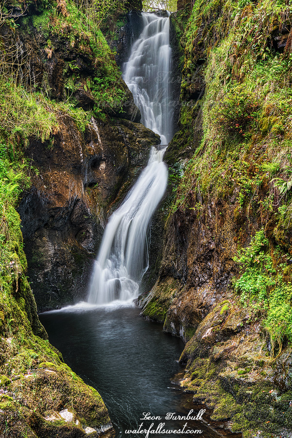
This first big drop on Big Granite Creek (shown here) is my favorite.  It is absolutely spectacular, about 150 ft. high, and just so incredibly powerful and magnificent. Below this, there are more big drops. I needed more rope to descend down the next sections. You can also see the tall and majestic West Snow Mountain Falls free falling into the main channel. It is an overpowering experience being at this location. You can see why I am already planning the return.
 

No Comments